
Seasonality
Summary
Limestone
The climbing village
Description
Orpierre is a convenient and popular destination with more than 600 routes from 3a to 8c. It features sectors ranging from single pitch to long routes, all safely equipped and within walking distance of the town & campsite. No month reaches 10 days with considerable perception. It's no wonder that Orpierre is ever-popular, even if some of the routes feel more than a little polished.
The town is a model for well-managed sport climbing areas: There are car parks and signs for climbers everywhere. The tracks & paths are maintained, well visible and good to walk. Routes are very well bolted, bolt density is higher near the ground and at difficult parts of a route, typical distance between 2 bolts is 1-3 meters, lower offs consist of at least 2 bolts interconnected via noteworthy solid chain, rock & metal are checked and maintained often. If routes start from a ledge or other exposed positions, belayers can secure themselfs at bolts or steel cables. Where stones are likely to fall, e.g. below a track or a coomb, nets made of steel ropes are installed.
While being a small village, you'll find an old town, a climbing shop, a climbers orientated gift & clothes shop, two restaurants, a mini-market and plenty of accomodations in Orpierre.
For mates or days neither feeling like climbing nor hanging around, there are signposted MTB trails, the beautiful & diverse landscape invites for moderate hikes as well as hikes with over 1000 elevation meters, and for bike tours into the surroundings. Sisteron is the next bigger city and worth a trip, not only because of the rock formations but also the old town and the citadel. Some sights are in between.
The topo paper guidebook Orpierre – Grimper dand les Pays du Buëch - Châteauneuf, Ventavon, Savournon, Sigottier, Buëch nord is published by FFME, produced by the local climbing club, and is available in the town. It's updated & extended every few years. Online shops tend to not reliably update the catalog/meta info but only the cover images, hence a listing extending the one at orpierre-escaladedurable.com by further editions and more infos:
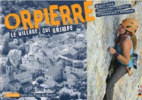
- Edition 2020, 26€, 280 pages, ISBN 978-2-9544-5752-9, cover shows 2 photos side by side with climber on the right. Maps and orienation photos have been considerably improved.
- Edition 2016, cover shows on the left a white text on red background, on the left a hand clipping a quickdraw
- Edition 2016, cover shows on the left a photo of a guy climbing, on the right an overview photo of the town below a red bar containing the "Orpierre".
- Edition 2013, 256 pages, EAN 9-782954-457505, cover with photo inside a sketched carabine
- Edition 2006, 160 pages, cover with full size photo showing climber on left
Access issues inherited from France
Some privately owned climbing areas may have restricted access. Check with https://www.ffme.fr/
Approach
Within Orpierre, town, restaurants, climbing crags, etc are just a short walk – there's no need to drive anywhere. All crags are very well sign-posted and finding them is mostly a matter of starting in the right place and following them.
Orpierre is located around 8 km west of the river Buëch which is accompanied by the street D 1075 connecting to Grenoble in the north and to Sisteron in the south.
Approach by car  is easy and comfortable. Streets are well maintained & secure. There are many parking possibilities.
Public transport to Orpierre itself consists of only a school bus, but...
- ...a pooled car ride may be found at blablacar.fr (it took over www.CoVoiturage.fr which is still signposted 10/2022 in the area)
- ...in Eyguians, the (
 stop44.34616, 5.77087) called Garde-Colombe - Eyguians Mairie is served by far distance buses, and for the last 8 km to Orpierre, you may walk, cycle, take a taxi or hitchhike – good chances someone gives you a lift because everyone knows about the missing public transport.
The far distance buses are operated by ZOU, called "Car LER" or "Ligne Express Regionale", clean and modern.
Route 31 connects Nice with Grenoble central station, drives 10/2022 twice a day but only the first drive towards Grenoble reaches Eyguians. It leaves around 11:45 (exact time differs by few minutes depending on the day) and to Grenoble, it takes 110 min and costs 18.50€.
Route 33 connects to Gap; TODO: Add more details.
stop44.34616, 5.77087) called Garde-Colombe - Eyguians Mairie is served by far distance buses, and for the last 8 km to Orpierre, you may walk, cycle, take a taxi or hitchhike – good chances someone gives you a lift because everyone knows about the missing public transport.
The far distance buses are operated by ZOU, called "Car LER" or "Ligne Express Regionale", clean and modern.
Route 31 connects Nice with Grenoble central station, drives 10/2022 twice a day but only the first drive towards Grenoble reaches Eyguians. It leaves around 11:45 (exact time differs by few minutes depending on the day) and to Grenoble, it takes 110 min and costs 18.50€.
Route 33 connects to Gap; TODO: Add more details. - ... the train
 from/to the north (Grenoble), the line "VIF" is temporarily shut down due to reconstruction works and shall serve Aspres-sur-Buëch again starting 12/2022. During works, for nothern desinations like Paris, Switzerland or Germany, it's quicker to first take the bus to Grenoble and from there take a train than to go by train south to Marseilles. TODO: Add details about connection between Aspres-sur-Buëch and Orpierre.
 - ... the train from/to south, there is a connection from Laragne to Marseille. Laragne is 13 km driving diatance, but by bike, the heavily used D 1075 is no fun – the 2.5 km detour via nearly unused D 330 is worth a consideration.
Where to stay
There are several gîtes in town and around.
The campsite is located a 7 min walk from downtown. It is big, has considerable infrastructure ranging from warm showers over washing machines to a swimming pool, offers spaces for tents, caravans and mobile homes, and rents huts and tents. The campsite is divided into the part Les Noyons with 2  and the part Les Princes d'Orange with 4 . Only the second one includes access to the swimming pool, only this rents huts & tents, and only this is opened in the cold part of the year.
Ethic inherited from France
Park where indicated, take care of the environment, buy the local guidebook when possible (this is one of the ways you can help local route setters), clean up your shoes before climbing, don't spray beta, be polite.
History
Orpierre's climbing history starts in 1983 when Dominique Jugy and Pierre-Yves Bochaton bolt the first modern routes. With the help of mayor Raymond Chauvet, they bet on sport climbing to bring new life to the village. Today, Orpierre is also known as "le village qui grimpe" ("the climbing village").
Tags
Plan your Trip
Did you know?
Did you know that you can create an account to record, track and share your climbing ascents? Thousands of climbers are already doing this.


Selected Guidebooks more Hide
Author(s): Collectiv
Date: 2020
Orpierre - ein Dorf hat sich dem Klettern verschrieben. Der Kletterführer beschreibt den 2020er Stand der Erschließungen an den umliegenden Wänden - 683 Seillängen! Im Sportkletterbereich 325 Einseillängen sowie 55 Mehrseillängenwege, in den sogenannten "ausgestatteten Abenteuersektoren" sind es 37 lange Wege mit 3 - 7 Längen.
ⓘ
Author(s): L. Girousse
Date: 2022
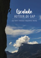
Many sport climbing routes and long multi-pitches - from Dévoluy to Champsaur to Buëch and Méouge, the south of the Hautes-Alpes offers a great variety of climbing areas in magnificent landscapes.
ⓘ
Author(s): Laurent Girousse
Date: 2022
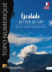
This bilingual English/French guidebook is the digital version of the guidebook Escalade autour de Gap. In addition to the Gap region, it covers the Dévoluy and the Champsaur massifs and, a little further north, the Valgaudemar massif and the Buëch valley. The guidebook presents more than twenty sport climbing sites, including the western part of Céüse, the world famous sport crag, but also many multi-pitch routes generally fully bolted and at moderate level. The content of the guidebook is detailed in the OmegaRoc app.
ⓘ
Accommodations nearby more Hide
Share this
Photos Browse all photos
/6f/6b/6f6babb63dbdfff5965e6ba6ef5627da5a420ebc)
Les Racines du ciel - IMG_7675.jpg
/cf/5c/cf5cd57782b855bd72afe58fc4a31011d3fef4ca)
/43/a1/43a10d2d9b8bf99aabeaa6500781d877b1a75d33)
Beat on ★★ N'oubliez jamais 8b - IMG_2872.jpeg

Les Racines du ciel - P1080278_v1.jpg
Fri 2 Jun
Check out what is happening in Orpierre.
Get a detailed insight with a timeline showing
- Ticks by climbers like you
- Discussions of the community
- Updates to the index by our users
- and many more things.
Login to see the timeline!