Seasonality
Summary
Description
This is definitely alpine granite, and as such you will encounter dirty cracks as well as loose and chossy sections. Those expecting clean Squamish-quality granite may be uncomfortable at times. However, those expecting and comfortable with alpine conditions will find a wealth of quality routes and unique terrain in a stellar setting. The views from the peak are spectacular.
Access issues
None. The area is frequented by recreationalists, with established hiking trails and relatively good flagging. Sufficient use keeps the major trails in useable condition.
Approach
Easy though long approach and longer descent. Park at the Zopkios brake check (washrooms available), then walk northeast along the highway until you can duck into the woods. Cross a boggy stream section (may be very muddy during spring run off or after heavy rains), then continue into the woods. Follow the trail system up until you reach a boulderfield. Crossing the boulderfield will bring you to the southeast face of Yak. The whole approach takes about 1 1/2 hours.
Alternatively, once you hit the boulderfield, skirt along it uphill and to the right, and follow a series of generally well-marked trails and slab sections which eventually lead around the back of Yak to the northeast face. A number of routes start there.
The descent trail from the peak follows a pretty obvious trail down from the top and along the northeast face, then links up with the aforementioned approach trail. Follow it back to the highway, then your vehicle.
Descent from the peak takes about 2 1/2 to 3 hours, and moves over some pretty awkward terrain. Be careful. In spring, the descent can be complicated by the presence of a hanging glacier in the saddle between the false and true peaks of Yak, so crampons and an ice axe may be helpful for the descent. By mid to late summer, the glacier has usually melted, greatly simplifying the descent.
Where to stay
Park at the Zopkios brake check. You can park all day and overnight for free.
Plan your Trip
Hello!
First time here?
theCrag.com is a free guide for rock climbing areas all over the world, collaboratively edited by keen rock climbers, boulderers and other nice folks.You can log all your routes, connect and chat with other climbers and much more...» go exploring, » learn more or » ask us a questionSelected Guidebooks more Hide
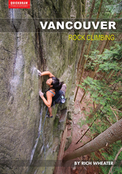
Author(s): Rich Wheater
Date: 2015
ISBN: 978-0-9877796-5-6
With 300 routes, 600 boulder problems and a handful of fine alpine objectives, Vancouver Rock Climbing provides comprehensive coverage of the diverse climbing scene around Vancouver, Canada.
- Provides detailed coverage of Howe Sound, Caulfeild Sea Cliffs, Cypress Falls Park, Cypress Mountain, Grouse Mountain, Lynn Valley and Deep Cove
- Includes full-color images and maps, descriptions of conditions and approach notes for each climbing area
- Each climb description tells you what gear to use, how many bolts there are, a difficulty rating, the pitch length and where to start and end
Accommodations nearby more Hide
Share this
Nearby Icons
| 5.10a | ★★★ Yak-Check |
Photos Browse all photos

★★★ Yak-Check 5.10a - Yak Peak Topo by Drew Brayshaw, from Markhor Peak
Get a detailed insight with a timeline showing
- Ticks by climbers like you
- Discussions of the community
- Updates to the index by our users
- and many more things.
Login to see the timeline!

