
A Crag Guide gives an extensive view of all sub areas and climbs at a point in the index. It shows a snapshot of the index heirachy, up to 300 climbs (or areas) on a single web page. It shows selected comments climbers have made on a recently submitted ascent.
At a minor crag level this should be suitable for printing and taking with you on a climbing trip as an adjunct to your guidebook.
This guide was generated anonymously. Login to show your logged ascents against each route.
Warning
Rock climbing is extremely dangerous and can result in serious injury or death. Users acting on any information directly or indirectly available from this site do so at their own risk.
This guide is compiled from a community of users and is presented without verification that the information is accurate or complete and is subject to system errors. By using this guide you acknowledge that the material described in this document is extremely dangerous, and that the content may be misleading or wrong. In particular there may be misdescriptions of routes, incorrectly drawn topo lines, incorrect difficulty ratings or incorrect or missing protection ratings. This includes both errors from the content and system errors.
Nobody has checked this particlular guide so you cannot rely on it's accuracy like you would a store bought guide.
You should not depend on any information gleaned from this guide for your personal safety.
You must keep this warning with the guide. For more information refer to our:
Usage policy
Contributors
Thanks to the following people who have contributed to this crag guide:
Christoph Rauch
Campbell Gome
Alma
cooky
Peter Zahn
Stefan
Charis
Jürgen Wolf
Adam Orcholski
GeorgD
The size of a person's name reflects their Crag Karma, which is their level of contribution. You can help contribute to your local crag by adding descriptions, photos, topos and more.
Table of contents
- 1.
Frankenjura Nord / Nördliche Frankenalb
13929 in Area
-
1.1.
Weißmain-Alb 1060 in Area
-
1.1.1.
Wattendorf 185 in Area
- 1.1.1.1. Alpenvereinswand 18 in Crag
- 1.1.1.2. Wattendorfer Wand 13 in Crag
- 1.1.1.3. Kemitzenstein 31 in Crag
- 1.1.1.4. Coburger Wand / Stachelbeerwand 4 in Crag
- 1.1.1.5. Falkenwand 5 in Crag
- 1.1.1.6. Juraeck 5 in Crag
- 1.1.1.7. Eichiger Felszwillinge 12 in Crag
- 1.1.1.8. Katzenbuckel 43 in Crag
- 1.1.1.9. Bindelwand 14 in Crag
- 1.1.1.10. Altenburgwand 14 in Crag
- 1.1.1.11. Eigerblock 16 in Crag
- 1.1.1.12. Lippert Gedenkwand 5 in Crag
- 1.1.1.13. Hohler Stein 5 in Crag
-
1.1.2.
Kleinziegenfeld 606 in Area
- 1.1.2.1. Altbabawand 30 in Crag
- 1.1.2.2. Rote Wand 51 in Crag
- 1.1.2.3. Hanfplantage 10 in Crag
- 1.1.2.4. Rolandfels 43 in Crag
- 1.1.2.5. Spitzenstein 7 in Crag
- 1.1.2.6. Ziegenfelder Wände / Klinge 42 in Crag
- 1.1.2.7. Leumer Gedenkwand 21 in Crag
- 1.1.2.8. Lichtenfelser Dach 13 in Crag
- 1.1.2.9. Geierwand 22 in Crag
- 1.1.2.10. Roter Mönch 27 in Crag
- 1.1.2.11. Diebesloch 22 in Crag
- 1.1.2.12. Hammerschmiedturm 19 in Crag
- 1.1.2.13. Toni Schmid Gedenkwand / Altes Schloss 18 in Crag
- 1.1.2.14. Bauernschmitt Gedenkwand / Altes Schloss 17 in Crag
- 1.1.2.15. Holzgauer Wand / Altes Schloss 63 in Crag
- 1.1.2.16. Hüttenriss 10 in Crag
- 1.1.2.17. Uhustein / Emporwand 7 in Crag
- 1.1.2.18. Weihersmühler Wand / Untere Wand 26 in Crag
- 1.1.2.19. Aquarium 14 in Crag
- 1.1.2.20. Luisenwand 15 in Crag
- 1.1.2.21. Mosenberger Wände 32 in Crag
- 1.1.2.22. Suttenstein 17 in Crag
- 1.1.2.23. Hohe Wand 13 in Crag
- 1.1.2.24. Hexenkessel 17 in Crag
- 1.1.2.25. Buchauer Wände 6 in Crag
- 1.1.2.26. Kleinziegenfelder Wacht 4 in Crag
- 1.1.2.27. Waßmannwand / Wassermannwand 5 in Crag
- 1.1.2.28. Teufelwand 15 in Crag
- 1.1.2.29. Waßmannsmühler Wand / Silbermond 9 in Crag
- 1.1.2.30. Schammendorfer Wand 11 in Crag
-
1.1.3.
Bärental 62 in Area
- 1.1.3.1. Großer Juraturm 14 in Crag
- 1.1.3.2. Bärentalwächter 14 in Crag
- 1.1.3.3. Felsentor 5 in Crag
- 1.1.3.4. Kraftriss 2 in Crag
- 1.1.3.5. Diagonalweg-Massiv 5 in Crag
- 1.1.3.6. Wunkendorfer Eck 11 in Crag
- 1.1.3.7. Krassacher Türme 8 in Crag
- 1.1.3.8. Neudorfer Wand 3 in Crag
-
1.1.4.
Zillertal 48 in Area
- 1.1.4.1. Efeuwand 5 in Crag
- 1.1.4.2. Höhlenwand 6 in Crag
- 1.1.4.3. Niestener Wand 19 in Crag
- 1.1.4.4. Regenwand 5 in Crag
- 1.1.4.5. Sonnenwand 13 in Crag
-
1.1.5.
Burglesau 95 in Area
- 1.1.5.1. Burglesauer Wand und Vortürme 47 in Crag
- 1.1.5.2. Stephansturm & Dreitorspitze 18 in Crag
- 1.1.5.3. Winterseite 30 in Crag
-
1.1.6.
Stübig 44 in Area
- 1.1.6.1. Großer Stübiger Turm 28 in Crag
- 1.1.6.2. Kleiner Stübiger Turm 16 in Crag
- 1.1.7. Staffelfels / Staffelberg 20 in Crag
-
1.1.1.
Wattendorf 185 in Area
-
1.2.
Fränkische Schweiz / "Fränkische" 8624 in Area
-
1.2.1.
Würgau 123 in Crag
- 1.2.1.1. Würgauer Nadel 3 in Crag
- 1.2.1.2. Bamberger Turm 5 in Crag
- 1.2.1.3. Würgauer Wand 6 in Crag
- 1.2.1.4. Fermeda 3 in Crag
- 1.2.1.5. Gewitterriss 3 in Crag
- 1.2.1.6. Kreuzstein 6 in Crag
- 1.2.1.7. Bayreuther Wand 9 in Crag
- 1.2.1.8. Nürnberger Turm 15 in Crag
- 1.2.1.9. Bayerl Gedenkwand 4 in Crag
- 1.2.1.10. Dolomit 7 in Crag
- 1.2.1.11. Edelweißwand 9 in Crag
- 1.2.1.12. Fiechtlwand 20 in Crag
- 1.2.1.13. Frankenwand 13 in Crag
- 1.2.1.14. Kariöser Zahn 2 in Cliff
- 1.2.1.15. Wacholderspitze 12 in Cliff
- 1.2.1.16. Würgauer Wändchen 6 in Cliff
-
1.2.2.
Paradiestal 94 in Region
- 1.2.2.1. Wüstenstein 33 in Crag
- 1.2.2.2. Vorderer Paradiestalwächter 10 in Crag
- 1.2.2.3. Nasenlöcherturm 7 in Crag
- 1.2.2.4. Dachstein 4 in Crag
- 1.2.2.5. Gelbe Wand / Silberwand 16 in Crag
- 1.2.2.6. Paradieswand 9 in Crag
- 1.2.2.7. Bamberger Wand 3 in Crag
- 1.2.2.8. Zigeunerstube 5 in Crag
- 1.2.2.9. Langenstein / Hinterer Paradiestalwächter 7 in Crag
-
1.2.3.
Oberes Wiesenttal 292 in Area
- 1.2.3.1. Hintere Steinfelder Wand 5 in Crag
- 1.2.3.2. Steinfelder Turm 20 in Crag
- 1.2.3.3. Steinfelder Wand 20 in Crag
- 1.2.3.4. Steinfelder Wändchen 24 in Crag
- 1.2.3.5. Treunitzer Wand 14 in Crag
- 1.2.3.6. Hintere Treunitzer Wand / Treunitzer Pfeiler Nebenmassiv / Freiheitsfels 10 in Crag
- 1.2.3.7. Treunitzer Pfeiler 3 in Crag
- 1.2.3.8. Torstein 15 in Crag
- 1.2.3.9. Tritzmann Gedenkwand 7 in Crag
- 1.2.3.10. Treunitzer Kletterblöcke 7 in Crag
- 1.2.3.11. Treunitzer Klettergarten 54 in Crag
- 1.2.3.12. DTC / Double Trouble Company 23 in Crag
- 1.2.3.13. Kuhkirchner Wand 21 in Crag
- 1.2.3.14. Schallmauer 8 in Crag
- 1.2.3.15. Venushügel 4 in Crag
- 1.2.3.16. Freienfels 14 in Crag
- 1.2.3.17. Eiserne Jungfrau 26 in Crag
- 1.2.3.18. Neidensteiner Wand 17 in Crag
-
1.2.4.
Krögelstein 98 in Area
- 1.2.4.1. Dohlenstein 13 in Crag
- 1.2.4.2. Kaiserbachtaler Riesenüberhang 6 in Crag
- 1.2.4.3. Kainachtaler Torbogen 5 in Crag
- 1.2.4.4. Kainachtaler Pfeiler 4 in Crag
- 1.2.4.5. Kainachtaler Block 8 in Crag
- 1.2.4.6. Teufelslöcherwände 9 in Crag
- 1.2.4.7. Säukirchner Turm 10 in Crag
- 1.2.4.8. Hochburg des Terrors 2 in Crag
- 1.2.4.9. Kuhleutner Turm 10 in Crag
- 1.2.4.10. Kuhleutner Wand 13 in Crag
- 1.2.4.11. Eherbacher Wand 16 in Crag
- 1.2.4.12. Talschlussturm / Lautertaler Turm 2 in Area
-
1.2.5.
Schirradorf 15 in Area
- 1.2.5.1. Schirradorfer Block 6 in Crag
- 1.2.5.2. Wetterspitze 7 in Crag
- 1.2.5.3. Schwalbenstein 2 in Crag
-
1.2.6.
Tiefenellern 79 in Area
- 1.2.6.1. Gügel 12 in Crag
- 1.2.6.2. Eulenwand / Eulenstein 28 in Crag
- 1.2.6.3. Schlosswand 8 in Crag
- 1.2.6.4. Fundgrube 11 in Crag
- 1.2.6.5. Herzogenreuther Wand 13 in Crag
- 1.2.6.6. Herzogenreuther Findling / Neudorfer Wand 7 in Crag
-
1.2.7.
Frankendorf / Frankendorfer Klettergarten 136 in Area
- 1.2.7.1. Kreuzerwand / Kreutzerwand / Kalkofen 18 in Crag
- 1.2.7.2. Annastein 16 in Crag
- 1.2.7.3. Allgäuer Wand / Bamberger Riss 6 in Crag
- 1.2.7.4. Annasteinseite 40 in Crag
- 1.2.7.5. Dragonerwand 17 in Crag
- 1.2.7.6. Landrichterseite 39 in Crag
-
1.2.8.
Leinleitertal 304 in Area
- 1.2.8.1. Burggrub 95 in Crag
- 1.2.8.2. Heiligenstadt 64 in Crag
- 1.2.8.3. Veilbronn 145 in Crag
-
1.2.9.
Aufseßtal 112 in Area
- 1.2.9.1. Neppwand 14 in Crag
- 1.2.9.2. Werner Brösel Gedenkwand 6 in Crag
- 1.2.9.3. Berglerturm 7 in Crag
- 1.2.9.4. Anderland 5 in Crag
- 1.2.9.5. Aufseßtal Südwand 18 in Cliff
- 1.2.9.6. Höllenstein / Aufseßtaler Höllenstein 18 in Crag
- 1.2.9.7. Willy Merkl Gedenkwand 1 in Crag
- 1.2.9.8. Neuhauser Wand / Taschnerfels 28 in Crag
- 1.2.9.9. Neuhauser Turm / Himmelsstäuberer 2 in Crag
- 1.2.9.10. Purzelstein 13 in Crag
-
1.2.10.
Ailsbachtal 428 in Area
- 1.2.10.1. Wagnerfels 38 in Crag
- 1.2.10.2. Schweigelstein 11 in Crag
- 1.2.10.3. Aussiedlerstein 7 in Crag
- 1.2.10.4. Hungenberger Wand 10 in Crag
- 1.2.10.5. Alter Freund 9 in Crag
- 1.2.10.6. Unterailsfelder Wand 20 in Crag
- 1.2.10.7. Moschendorfer Wand 22 in Crag
- 1.2.10.8. Steinerne Welt 30 in Crag
- 1.2.10.9. Powereck 19 in Crag
- 1.2.10.10. Wackelstein 8 in Crag
- 1.2.10.11. Schlupflochfels 18 in Crag
- 1.2.10.12. Gangster's Paradise 7 in Crag
- 1.2.10.13. Ailsbachtaler Turm 18 in Crag
- 1.2.10.14. Zamonien 7 in Crag
- 1.2.10.15. Fuchsbau 5 in Crag
- 1.2.10.16. Rennerfelsen / Applauskurvenwand 28 in Crag
- 1.2.10.17. Schneiderloch 11 in Crag
- 1.2.10.18. Rabenstein / Burg Rabenstein 43 in Crag
- 1.2.10.19. Rabensteinwächter 7 in Crag
- 1.2.10.20. Catch me Wandl 1 in Crag
- 1.2.10.21. Witchcraft / Neumühle 8 in Crag
- 1.2.10.22. Einstein 12 in Crag
- 1.2.10.23. Boy's Tempel 0 in Boulder
- 1.2.10.24. Zauppenberger Wand 10 in Crag
- 1.2.10.25. Heldwand 17 in Crag
- 1.2.10.26. Hulk-Blöcke 0 in Crag
- 1.2.10.27. Schweinsmühler Wand 10 in Crag
- 1.2.10.28. Hardcore-Wändchen 12 in Crag
- 1.2.10.29. Rötliches Massiv / Bugfels / Pornowand 9 in Crag
- 1.2.10.30. Strand 11 in Crag
- 1.2.10.31. Tick-Tack-Wand / Sandkasten 20 in Crag
-
1.2.11.
Nankendorf / Plankenfels 242 in Area
- 1.2.11.1. Lochbergwand 7 in Crag
- 1.2.11.2. Nankendorfer Block 15 in Crag
- 1.2.11.3. Roter Turm 2 in Crag
- 1.2.11.4. Loreleyblock / Ponderosa 25 in Crag
- 1.2.11.5. Loreley 6 in Crag
- 1.2.11.6. Geckofels 7 in Crag
- 1.2.11.7. Freudenhaus / Aalkorber Wände 32 in Crag
- 1.2.11.8. Hinterzimmer 7 in Cliff
- 1.2.11.9. Mader Gedenkwand 12 in Crag
- 1.2.11.10. Rupertuswand 24 in Crag
- 1.2.11.11. Spaßwand 10 in Crag
- 1.2.11.12. Frankenstüble 16 in Crag
- 1.2.11.13. Truppachwand 9 in Crag
- 1.2.11.14. Plankenfelser Schlossturm 19 in Crag
- 1.2.11.15. Oberer Sonnwendstein 12 in Crag
- 1.2.11.16. Plankenstein 29 in Crag
- 1.2.11.17. Lochauer Wand 10 in Crag
-
1.2.12.
Engelhardsberg 121 in Area
- 1.2.12.1. Kammer 56 in Crag
- 1.2.12.2. Quackenschloss 11 in Cliff
- 1.2.12.3. Leygoff Gedenkwand 4 in Crag
- 1.2.12.4. Räuberburg 17 in Crag
- 1.2.12.5. Moritzer Turm 14 in Crag
- 1.2.12.6. Brüderwand 4 in Crag
- 1.2.12.7. Schwesternwand 3 in Crag
- 1.2.12.8. Stille Aussicht / Rhinozeros 6 in Crag
- 1.2.12.9. Schlagerturm / Scheibe 4 in Crag
-
1.2.13.
Mittleres Wiesenttal / mid Wiesent valley 1017 in Area
- 1.2.13.1. Wiesentturm 4 in Crag
- 1.2.13.2. Aschenbrennerwand / Aschenbrenner Gedenkwand 5 in Crag
- 1.2.13.3. Walter Schnell Gedenkwand 3 in Crag
- 1.2.13.4. Wiesentfelsen / Wiesentwand 16 in Crag
- 1.2.13.5. Bohrinsel 6 in Crag
- 1.2.13.6. Frankenzirkus 11 in Crag
- 1.2.13.7. Höhlenstein 11 in Crag
- 1.2.13.8. Schottertaler Turm 8 in Crag
- 1.2.13.9. Schottertaler Wand 9 in Crag
- 1.2.13.10. Kathedrale / Felsendom 18 in Crag
- 1.2.13.11. Affentheater 27 in Crag
- 1.2.13.12. Karwendelturm / Wiesentstein 6 in Crag
- 1.2.13.13. Wiesentblick / Johnny Cash Wand 9 in Crag
- 1.2.13.14. Kalte Wand 36 in Crag
- 1.2.13.15. Gelber Turm 11 in Crag
- 1.2.13.16. Magdalenenwand 6 in Crag
- 1.2.13.17. Wintergarten 10 in Crag
- 1.2.13.18. Wolkensteiner Wand 24 in Crag
- 1.2.13.19. Schiefer Tod 17 in Crag
- 1.2.13.20. Schottersmühler Wand 28 in Crag
- 1.2.13.21. Abendleite 9 in Crag
- 1.2.13.22. Schottertaler Querung 7 in Crag
- 1.2.13.23. Jubiläumswand 34 in Crag
- 1.2.13.24. Morgenleite 35 in Crag
- 1.2.13.25. Mittagsleite 9 in Crag
- 1.2.13.26. Altersheim 8 in Crag
- 1.2.13.27. Riesenburg 15 in Crag
- 1.2.13.28. Obere Riesenburgwand 3 in Crag
- 1.2.13.29. Altherrnwand / Altherrenwand 5 in Crag
- 1.2.13.30. Moosiger Turm 1 in Cliff
- 1.2.13.31. Grünbauer Gedenkwand 13 in Crag
- 1.2.13.32. Dohlenwand 10 in Crag
- 1.2.13.33. Galawand 9 in Crag
- 1.2.13.34. Kajakwand 5 in Crag
- 1.2.13.35. Sieghardtsfelsen 9 in Cliff
- 1.2.13.36. Sonnwendwände 64 in Crag
- 1.2.13.37. Blechfass 11 in Crag
- 1.2.13.38. Megalumania 13 in Crag
- 1.2.13.39. Eigerwand 2 in Crag
- 1.2.13.40. Bischofsberg 8 in Crag
- 1.2.13.41. Leykauf Gedenkwand 21 in Crag
- 1.2.13.42. Schwarze Wand 31 in Crag
- 1.2.13.43. Bandstein 28 in Crag
- 1.2.13.44. Zwergenschloss 48 in Crag
- 1.2.13.45. Hacke Gedenkwand 10 in Crag
- 1.2.13.46. Peterswandl 3 in Crag
- 1.2.13.47. Alitzstein 5 in Crag
- 1.2.13.48. Fischer-Schneider Gedenkwand 7 in Crag
- 1.2.13.49. Schrollwand 13 in Crag
- 1.2.13.50. Bayreuther Riss 17 in Crag
- 1.2.13.51. Treusteiner Wand 15 in Crag
- 1.2.13.52. Rabenecker Wand 24 in Crag
- 1.2.13.53. Mariandlwand 2 in Crag
- 1.2.13.54. Headwall 4 in Crag
- 1.2.13.55. Große Dooser Welle 10 in Crag
- 1.2.13.56. Dooser Wand 22 in Crag
- 1.2.13.57. Jungfernriss 22 in Crag
- 1.2.13.58. Schrumpelrisse 7 in Crag
- 1.2.13.59. Kleine Dooser Welle 6 in Crag
- 1.2.13.60. Gockerlwand 11 in Crag
- 1.2.13.61. Enigma 20 in Crag
- 1.2.13.62. Pulverfass 7 in Crag
- 1.2.13.63. Freistein 6 in Crag
- 1.2.13.64. Moby Dick 11 in Crag
- 1.2.13.65. Steinpilz 10 in Crag
- 1.2.13.66. Kindergarten / Krötenstein 10 in Crag
- 1.2.13.67. Waischenfelder Turm 21 in Crag
- 1.2.13.68. Schlumpfendorf 31 in Crag
- 1.2.13.69. Waldnaabtaler Turm 1 in Crag
- 1.2.13.70. Harry Potter Wand 20 in Crag
- 1.2.13.71. Clubbwall 11 in Crag
- 1.2.13.72. Terrarium 8 in Crag
- 1.2.13.73. Zellblock / Gummizelle 6 in Crag
- 1.2.13.74. Andeltodrom 14 in Crag
-
1.2.14.
Unteres Wiesenttal / lower Wiesent valley 708 in Area
- 1.2.14.1. Ebermannstadt 56 in Area
- 1.2.14.2. Muggendorf 78 in Area
- 1.2.14.3. Burggaillenreuth 161 in Area
- 1.2.14.4. Streitberg 191 in Area
- 1.2.14.5. Sachsenmühle 222 in Area
-
1.2.15.
Unteres Püttlachtal / lower Püttlach valley 668 in Area
- 1.2.15.1. Universum 34 in Crag
- 1.2.15.2. Paralleluniversum 7 in Crag
- 1.2.15.3. Ballast der Republik 3 in Cliff
- 1.2.15.4. Bärenschluchtwände 80 in Crag
- 1.2.15.5. Ringlerwand 43 in Crag
- 1.2.15.6. Püttlacher Turm / Püttlachtaler Turm 2 in Crag
- 1.2.15.7. Trockauer Wand 37 in Crag
- 1.2.15.8. Weidener Wand 27 in Crag
- 1.2.15.9. Erinnerungswand 16 in Crag
- 1.2.15.10. Püttlachkamin 17 in Crag
- 1.2.15.11. Teufelskrallenturm 6 in Crag
- 1.2.15.12. Frankenjoggerturm 7 in Crag
- 1.2.15.13. Piazwand 9 in Crag
- 1.2.15.14. Püttlacher Wand / Püttlachtaler Wand 41 in Crag
- 1.2.15.15. Püttlachnadel 1 in Crag
- 1.2.15.16. Schlossbergwände 8 in Crag
- 1.2.15.17. Mäusewand 2 in Crag
- 1.2.15.18. Toni Rockstroh Gedenkwand 7 in Crag
- 1.2.15.19. Tüchersfelder Campingplatzwand 14 in Crag
- 1.2.15.20. Tüchersfelder Wand 14 in Crag
- 1.2.15.21. Christinenwand 12 in Crag
- 1.2.15.22. Intensivstation 137 in Crag
- 1.2.15.23. Bröggerla 8 in Crag
- 1.2.15.24. Wallfahrt 2 in Crag
- 1.2.15.25. Schonunger Wand 10 in Crag
- 1.2.15.26. Dornröschenwand 29 in Crag
- 1.2.15.27. Märchenwand 7 in Crag
- 1.2.15.28. Planetarium 13 in Crag
- 1.2.15.29. Das Weiße Haus 0 in Crag
- 1.2.15.30. Amerikanische Botschaft 14 in Crag
- 1.2.15.31. Eliade 9 in Crag
- 1.2.15.32. Rammstein 4 in Crag
- 1.2.15.33. Geißleinwand / Geissleinwand 27 in Crag
- 1.2.15.34. Fuchsenstein 6 in Crag
- 1.2.15.35. Lummerland 15 in Crag
-
1.2.16.
Pottenstein 333 in Area
- 1.2.16.1. Schwarzes Riff 27 in Crag
- 1.2.16.2. Kleine Pottensteiner Wand / Venga-Wand 6 in Crag
- 1.2.16.3. Totentaler Wand 7 in Crag
- 1.2.16.4. Jules-Verne-Massiv / Jules-Verne-Wand 8 in Crag
- 1.2.16.5. Neue Heimat 13 in Crag
- 1.2.16.6. Schöfflblock 2 in Crag
- 1.2.16.7. Schwalbenloch 0 in Crag
- 1.2.16.8. Mariengrotte 1 in Crag
- 1.2.16.9. Marientaler Wand 55 in Crag
- 1.2.16.10. Dohlenloch 9 in Crag
- 1.2.16.11. Pottensteiner Wand 10 in Crag
- 1.2.16.12. Brotzeitwand 8 in Crag
- 1.2.16.13. Soul Kitchen 8 in Crag
- 1.2.16.14. Trautner Gedenkwand 24 in Crag
- 1.2.16.15. Zum Waldcafé / Trautner Nebenfels 6 in Crag
- 1.2.16.16. Streichelzoo 3 in Crag
- 1.2.16.17. Emil Riedl Gedenkwand 20 in Crag
- 1.2.16.18. Adamsfels 8 in Crag
- 1.2.16.19. Predigtstuhl 4 in Crag
- 1.2.16.20. Trierer Wand 17 in Crag
- 1.2.16.21. Glawe-Wand 9 in Crag
- 1.2.16.22. Laurins Burg 14 in Area
- 1.2.16.23. Püttlachturm / Katzenkopf / Knochen 7 in Crag
- 1.2.16.24. Bleisteinwand 24 in Crag
- 1.2.16.25. Deppentempel 7 in Crag
- 1.2.16.26. Hohe Nase 17 in Crag
- 1.2.16.27. Hätzerkirche 10 in Cliff
- 1.2.16.28. Hauensteiner Wand 4 in Crag
- 1.2.16.29. Tiwall / Waldtempel links / Hasenloch 5 in Cliff
-
1.2.17.
Weihersbachtal 215 in Area
- 1.2.17.1. Solarium 9 in Crag
- 1.2.17.2. UFA-Palast 6 in Crag
- 1.2.17.3. Zerplatztes Alien 6 in Crag
- 1.2.17.4. Zwergenhöhle 5 in Crag
- 1.2.17.5. Edelsteine 30 in Crag
- 1.2.17.6. Bronner Brummer 3 in Crag
- 1.2.17.7. Winterleite 4 in Crag
- 1.2.17.8. Orakel 9 in Crag
- 1.2.17.9. Teufelwand 5 in Crag
- 1.2.17.10. Schüttersmühler Wand 6 in Crag
- 1.2.17.11. Dromedar 26 in Crag
- 1.2.17.12. Weiherbacher Männchen / Docke 0 in Crag
- 1.2.17.13. Amphitheater 27 in Crag
- 1.2.17.14. Amphitheater Nebenmassiv 2 in Cliff
- 1.2.17.15. Entenstein / Terminatordach 5 in Boulder
- 1.2.17.16. Terra Australis 66 in Crag
- 1.2.17.17. Lindigsbühler Wand / Hollenberger Wand 6 in Crag
-
1.2.18.
Walberla / Ehrenbachtal 57 in Area
- 1.2.18.1. Rodenstein 49 in Crag
- 1.2.18.2. Leutenbacher Kreuzfelsen 8 in Crag
-
1.2.19.
Unteres Trubachtal 805 in Area
- 1.2.19.1. Wichsenstein / Wannbach 273 in Area
- 1.2.19.2. Zaunsbachtal 46 in Area
- 1.2.19.3. Schlehenmühle 121 in Area
- 1.2.19.4. Mostviel - Affalterthal 118 in Area
- 1.2.19.5. Egloffstein 133 in Area
- 1.2.19.6. Todsfelder Tal 114 in Area
-
1.2.20.
Großenoher Tal 94 in Area
- 1.2.20.1. Rechte Dörnhofer Wände 17 in Crag
- 1.2.20.2. Linke Dörnhofer Wand 6 in Crag
- 1.2.20.3. Großenoher Wand 22 in Crag
- 1.2.20.4. Hohe Geisel 9 in Crag
- 1.2.20.5. Höfleser Wand und Turm 13 in Crag
- 1.2.20.6. Waldmannspitze 7 in Crag
- 1.2.20.7. Kurfürst 5 in Crag
- 1.2.20.8. Drei Zinnen 15 in Crag
-
1.2.21.
Obertrubach / Oberes Trubachtal / Sorg / Affalterthal 591 in Area
- 1.2.21.1. Herzwand 5 in Crag
- 1.2.21.2. Pitztaler Wand / Pitztaler Klettergarten 8 in Crag
- 1.2.21.3. Kascholong 13 in Crag
- 1.2.21.4. Eldorado 13 in Crag
- 1.2.21.5. Dachlwand 14 in Crag
- 1.2.21.6. Schlöttermühler Wände / Blechsteine 9 in Crag
- 1.2.21.7. Bleisteine 21 in Crag
- 1.2.21.8. Rumpelkammer 5 in Cliff
- 1.2.21.9. Auenland 6 in Sector
- 1.2.21.10. Schlötterturm / Blechsteindaumen / Herbstwand 8 in Crag
- 1.2.21.11. Ziegelmühler Wand 2 in Crag
- 1.2.21.12. Prodigywand 1 in Cliff
- 1.2.21.13. Zauberberg 11 in Crag
- 1.2.21.14. Richard-Wagner-Fels 24 in Crag
- 1.2.21.15. Reichelsmühler Wand 16 in Crag
- 1.2.21.16. Hartelstein 27 in Crag
- 1.2.21.17. Wolfsberger Wand 10 in Crag
- 1.2.21.18. Neudorf / Höllenstein 57 in Crag
- 1.2.21.19. Nonne 11 in Crag
- 1.2.21.20. Kleiner Mönch 7 in Crag
- 1.2.21.21. Topfstein 9 in Crag
- 1.2.21.22. Großer Mönch 16 in Crag
- 1.2.21.23. Sargträgerwand 4 in Crag
- 1.2.21.24. Rudi Mehl Gedenk-Block 6 in Crag
- 1.2.21.25. Haselstaudener Wände 26 in Crag
- 1.2.21.26. Fürther Turm 7 in Crag
- 1.2.21.27. Wetterstein / Wittmannsnadel 6 in Crag
- 1.2.21.28. Wolfsberger Nadel 4 in Crag
- 1.2.21.29. Wolfsberger Block 10 in Crag
- 1.2.21.30. Wolfsberger Grotte / Nasser Stein 13 in Crag
- 1.2.21.31. Zehnerstein / Wolfsberger Felsentor 42 in Crag
- 1.2.21.32. Wolfsberger Burgfelsen / Ruine Wolfsberg 12 in Crag
- 1.2.21.33. Endorama 10 in Crag
- 1.2.21.34. Saufels 13 in Crag
- 1.2.21.35. Hohle Kirche / Burggrafenstein / Burggraf 8 in Crag
- 1.2.21.36. Golem 10 in Crag
- 1.2.21.37. Rondell 9 in Boulder
- 1.2.21.38. Nagelstudio 6 in Crag
- 1.2.21.39. Klagemauer 25 in Crag
- 1.2.21.40. Signalstein 8 in Crag
- 1.2.21.41. Duplo 10 in Crag
- 1.2.21.42. Kleiner Turm / Sorgenkind 7 in Crag
- 1.2.21.43. Grüne Hölle 41 in Crag
- 1.2.21.44. Fuchsstein 21 in Crag
-
1.2.22.
Gößweinstein 430 in Area
- 1.2.22.1. Obere Gößweinsteiner Wände 45 in Crag
- 1.2.22.2. Untere Gößweinsteiner Wände 10 in Crag
- 1.2.22.3. Martinswand 29 in Crag
- 1.2.22.4. Schwalbenstein / Handschuhfels 10 in Crag
- 1.2.22.5. Napoleon 25 in Crag
- 1.2.22.6. Emporwand 13 in Crag
- 1.2.22.7. Fehensteine 17 in Crag
- 1.2.22.8. Eibenwände 77 in Crag
- 1.2.22.9. Wickenstein 6 in Crag
- 1.2.22.10. Gernerfels 5 in Crag
- 1.2.22.11. Bärenstein 5 in Crag
- 1.2.22.12. Im Bärenkäfig 10 in Crag
- 1.2.22.13. Bärensteinwände 27 in Crag
- 1.2.22.14. Breitenberg Südwand / Breitenberger Südwand 18 in Crag
- 1.2.22.15. Fellner Dolinenwand 9 in Crag
- 1.2.22.16. Breitenberger Nordwand / Breitenberg Nordwand 12 in Crag
- 1.2.22.17. Breitenberg Parkplatzwand / Nice Guy Wändchen 2 in Crag
- 1.2.22.18. Oma Eichler Wand 5 in Crag
- 1.2.22.19. Kesselpfeiler 3 in Crag
- 1.2.22.20. Tanzboden 10 in Crag
- 1.2.22.21. Aussichtsfels am Breitenberg 6 in Crag
- 1.2.22.22. Silvesterfels 4 in Crag
- 1.2.22.23. Freibadwand 15 in Crag
- 1.2.22.24. Lustige Zaubererwand / Zaubererwände 15 in Crag
- 1.2.22.25. Lustige Wand 8 in Crag
- 1.2.22.26. Vogeltränke 3 in Crag
- 1.2.22.27. Frankenwohnheim / Frankenwohnanlage 12 in Crag
- 1.2.22.28. Zaubererturm 5 in Crag
- 1.2.22.29. Elfenwelt 24 in Crag
-
1.2.23.
Allersdorf / Stadelhofen 304 in Area
- 1.2.23.1. Allersdorfer Turm 0 in Crag
- 1.2.23.2. Allersdorfer Wand 8 in Crag
- 1.2.23.3. Daggi Wöhrl Gedenkwand 15 in Crag
- 1.2.23.4. Fritz Fertinger Gedenkwand / Fertinger Gedenkwand 8 in Crag
- 1.2.23.5. Föhrenstein 33 in Crag
- 1.2.23.6. Östliche Förstelsteinkette 50 in Crag
- 1.2.23.7. Frauenstein 6 in Crag
- 1.2.23.8. Herbstwand 6 in Crag
- 1.2.23.9. Vordere Stadelhofener Wände 9 in Cliff
- 1.2.23.10. Hintere Stadelhofener Wände 23 in Crag
- 1.2.23.11. Heidepfeiler / Haidestein 5 in Area
- 1.2.23.12. Stadelhofener Dunkelkammer 24 in Crag
- 1.2.23.13. Lindenstein / Rabenleite 38 in Crag
- 1.2.23.14. Prügeldorfer Turm 8 in Crag
- 1.2.23.15. Parkplatzwandl 1 in Crag
- 1.2.23.16. Preßknockwände 36 in Crag
- 1.2.23.17. Prügeldorfer Wand 6 in Crag
- 1.2.23.18. Wappenwände 14 in Crag
- 1.2.23.19. Wappenwand Nebenfels 4 in Crag
- 1.2.23.20. Wasserstein 10 in Crag
-
1.2.24.
Graisch, Leienfels, Bärnfels 357 in Area
- 1.2.24.1. Graischer Bleisteinwände 86 in Crag
- 1.2.24.2. Graischer Nadel 7 in Crag
- 1.2.24.3. Graischenstein 40 in Crag
- 1.2.24.4. Leienfelser Türmchen / Dönerbude 6 in Crag
- 1.2.24.5. Leienfelser Pfeiler 14 in Crag
- 1.2.24.6. Leienfelser Block / Leienstein 16 in Crag
- 1.2.24.7. Ruine Leienfels 19 in Crag
- 1.2.24.8. Linke Reibertsbergwand 7 in Crag
- 1.2.24.9. Rechte Reibertsbergwand 12 in Crag
- 1.2.24.10. Ganz rechte Reibertsbergwand / Hintere Reibertsbergwand / Reibertsbergwand Kinderkessel 16 in Crag
- 1.2.24.11. Gräfenberger Turm 6 in Crag
- 1.2.24.12. Schda Schdum / Bärnfels Wände 63 in Crag
- 1.2.24.13. Soranger Wand 32 in Crag
- 1.2.24.14. Wolfstein 33 in Crag
-
1.2.25.
Betzenstein-Stierberg-Leupoldstein 457 in Area
- 1.2.25.1. Betzensteiner Sportkletterwand 45 in Crag
- 1.2.25.2. Parkplatzwand / Betzensteiner Parkplatzwand 8 in Crag
- 1.2.25.3. Dreistaffelfels 91 in Crag
- 1.2.25.4. Leupoldsteiner Wand 73 in Crag
- 1.2.25.5. Münchser Wand 45 in Crag
- 1.2.25.6. Münchser Türmchen 8 in Sector
- 1.2.25.7. Stierberger Wand / Stierberger Schloßbergwand 11 in Crag
- 1.2.25.8. Stierberger Nordwand 15 in Crag
- 1.2.25.9. Langer Berg Wand / Steingarten 45 in Crag
- 1.2.25.10. Stierberger Gemsenwand 50 in Crag
- 1.2.25.11. Hetzendorfer Wand / Teufelsküche 29 in Crag
- 1.2.25.12. Hetzendorfer Felsengnom 2 in Crag
- 1.2.25.13. Wasserkröte 10 in Crag
- 1.2.25.14. Vergessene Welt 4 in Crag
- 1.2.25.15. Kleiner Wasserstein 21 in Crag
-
1.2.26.
Hiltpoltstein / Reipertsgesee 301 in Area
- 1.2.26.1. Hexenküche 109 in Crag
- 1.2.26.2. Almoser Wand 15 in Crag
- 1.2.26.3. Bitzenberg / Bitzenstein 8 in Crag
- 1.2.26.4. Ochsenbrand 39 in Crag
- 1.2.26.5. Stumpfelestein 27 in Crag
- 1.2.26.6. Ittlinger Wand 18 in Crag
- 1.2.26.7. Ittlinger Fels / Ittlinger Wand-Nebenmassiv 17 in Crag
- 1.2.26.8. Hühnersteinwand 27 in Crag
- 1.2.26.9. Hühnerstein 17 in Crag
- 1.2.26.10. Reipertsgeseer Wand / Langenbergwand 11 in Crag
- 1.2.26.11. Strahlenfels 13 in Crag
-
1.2.27.
Spies / Schermshöhe 243 in Area
- 1.2.27.1. Hohe Reute 51 in Cliff
- 1.2.27.2. Spieser Wand 15 in Crag
- 1.2.27.3. Leonhardsturm 10 in Crag
- 1.2.27.4. Vogler Gedenkwand 9 in Crag
- 1.2.27.5. Kanzelwand 10 in Crag
- 1.2.27.6. Spieser Felsen 9 in Crag
- 1.2.27.7. Hunger Wand 3 in Crag
- 1.2.27.8. Ruine Riegelstein / Riegelsteiner Schlossbergwand 40 in Crag
- 1.2.27.9. Schiepfenstein 20 in Crag
- 1.2.27.10. Eibgrat Nordwand 13 in Crag
- 1.2.27.11. Bärleinhuter / Eibgrat Südwand 22 in Crag
- 1.2.27.12. Schimmelecke 10 in Crag
- 1.2.27.13. Devils Garden 3 in Crag
- 1.2.27.14. Naifertaler Klettergarten 21 in Crag
- 1.2.27.15. Wintersteiner Wand 7 in Crag
-
1.2.1.
Würgau 123 in Crag
-
1.3.
Hersbrucker Schweiz / Hersbrucker Alb 3719 in Area
-
1.3.1.
Oberes Pegnitz- und Flembachtal 177 in Area
- 1.3.1.1. Welle 12 in Crag
- 1.3.1.2. Weidlwanger Wand 15 in Crag
- 1.3.1.3. Hainbronner Pfeiler 11 in Crag
- 1.3.1.4. Wachbergfelsen 44 in Crag
- 1.3.1.5. Geheimaktion 23 in Crag
- 1.3.1.6. Flemtalpilz 5 in Area
- 1.3.1.7. Flemtalwächter 7 in Crag
- 1.3.1.8. Hüttenwand 2 in Crag
- 1.3.1.9. Flemtalwand / Kluppfelsen 7 in Crag
- 1.3.1.10. Großer Lochstein 4 in Crag
- 1.3.1.11. Felsenländl / Felsenländl 5 in Crag
- 1.3.1.12. Lochbergwände / Luxer 42 in Crag
- 1.3.1.13. Beilensteiner Felsen 0 in Crag
-
1.3.2.
Neuhaus 58 in Area
- 1.3.2.1. Weißenstein 51 in Crag
- 1.3.2.2. Gambrinus / Langenstein 7 in Crag
-
1.3.3.
Hartenstein 230 in Area
- 1.3.3.1. Hainkirche 7 in Crag
- 1.3.3.2. Piccolino 5 in Crag
- 1.3.3.3. Gotthardskirche 16 in Crag
- 1.3.3.4. Zimmerbergwände 61 in Crag
- 1.3.3.5. Hirtenstreich 20 in Crag
- 1.3.3.6. Hartensteiner Wand 41 in Crag
- 1.3.3.7. Rabensberger Wand 8 in Crag
- 1.3.3.8. Grünreuther Wand 25 in Crag
- 1.3.3.9. Stadeltenne 31 in Crag
- 1.3.3.10. Neue Stadeltenne 12 in Crag
- 1.3.3.11. Schwatzhammer 4 in Crag
-
1.3.4.
Bärnhof 140 in Area
- 1.3.4.1. Sulzfels & Wächter 12 in Crag
- 1.3.4.2. Stefansturm Nebenfels 3 in Cliff
- 1.3.4.3. Stefansturm 21 in Crag
- 1.3.4.4. Waldschänke 5 in Crag
- 1.3.4.5. Vöderreuther Wand 24 in Crag
- 1.3.4.6. Katzenlöcher 42 in Crag
- 1.3.4.7. Däumling 8 in Crag
- 1.3.4.8. Brändelstein 10 in Crag
- 1.3.4.9. Ewige Jagdgründe 11 in Crag
- 1.3.4.10. Sonnenuhr / Schelmbachstein 4 in Crag
-
1.3.5.
Königstein 417 in Area
- 1.3.5.1. Weiße Hülle 20 in Crag
- 1.3.5.2. Aussiedlerhof / Eremit 12 in Crag
- 1.3.5.3. Locher Fels / 100 und 1 29 in Crag
- 1.3.5.4. Teufelsstuhl 23 in Crag
- 1.3.5.5. Schafberg 0 in Crag
- 1.3.5.6. Steinbergpilz 4 in Crag
- 1.3.5.7. Kühlochfels 90 in Crag
- 1.3.5.8. Thorstein 15 in Crag
- 1.3.5.9. Steinberg 145 in Crag
- 1.3.5.10. Nussbergwand 7 in Crag
- 1.3.5.11. Sutzer Berg 11 in Crag
- 1.3.5.12. Gewitterstein 9 in Crag
- 1.3.5.13. Breitenstein 23 in Crag
- 1.3.5.14. Rosengarten 10 in Crag
- 1.3.5.15. Eschenfelder Wändchen 4 in Crag
- 1.3.5.16. Riglashofer Wand / Riglashofer Turm 10 in Crag
- 1.3.5.17. Zur Liegenschaft 5 in Crag
-
1.3.6.
Mittleres Pegnitztal 301 in Area
- 1.3.6.1. Pavian / and Enzendorfer Nadel 18 in Crag
- 1.3.6.2. Student 22 in Crag
- 1.3.6.3. Weißer Grat 5 in Crag
- 1.3.6.4. Freudenmauer 13 in Crag
- 1.3.6.5. Rupprechtwand 4 in Crag
- 1.3.6.6. Ankatalwand 39 in Crag
- 1.3.6.7. Ankatalturm / Big Mushroom 4 in Cliff
- 1.3.6.8. Ochsenstein 10 in Crag
- 1.3.6.9. Brückenwand 9 in Crag
- 1.3.6.10. Emporwand 19 in Crag
- 1.3.6.11. Roter Fels 50 in Crag
- 1.3.6.12. Zsigmondy Gedenkwand 16 in Crag
- 1.3.6.13. Immer-Höher-Turm 9 in Crag
- 1.3.6.14. Löwenstein 5 in Crag
- 1.3.6.15. Hängender Stein 21 in Crag
- 1.3.6.16. Mühlwand / Beach 27 in Crag
- 1.3.6.17. Veldener Turm 6 in Crag
- 1.3.6.18. Veldener Wand 24 in Crag
-
1.3.7.
Unteres Pegnitztal 186 in Area
- 1.3.7.1. Zankelstein 19 in Crag
- 1.3.7.2. Riffler 38 in Crag
- 1.3.7.3. Düsselbacher Wand 26 in Crag
- 1.3.7.4. Hohlleitenfels 11 in Crag
- 1.3.7.5. Langenstein 16 in Crag
- 1.3.7.6. Kleine Wacht 38 in Crag
- 1.3.7.7. Große Wacht 19 in Crag
- 1.3.7.8. Schmerzzentrum 6 in Crag
- 1.3.7.9. Sieglitzberger Nadel 9 in Crag
- 1.3.7.10. Artelshofener Wand 4 in Crag
-
1.3.8.
Krottenseer Forst 541 in Area
- 1.3.8.1. Weißingkuppe 0 in Crag
- 1.3.8.2. Vogelherdgrotte 14 in Crag
- 1.3.8.3. Ape-Index Grotte 7 in Crag
- 1.3.8.4. Vierte Dimension 18 in Crag
- 1.3.8.5. Steinerne Stadt 93 in Crag
- 1.3.8.6. Krottenseer Turm 21 in Crag
- 1.3.8.7. Maximilianswand 80 in Crag
- 1.3.8.8. Erdenkäuferwand 5 in Crag
- 1.3.8.9. ZZ-Top Grotte 19 in Crag
- 1.3.8.10. Pölze 7 in Crag
- 1.3.8.11. Wolfsfalle 7 in Crag
- 1.3.8.12. Bladerunnerwand 15 in Crag
- 1.3.8.13. Projektwand 10 in Crag
- 1.3.8.14. Bastelstube 6 in Crag
- 1.3.8.15. Folterkammer 37 in Crag
- 1.3.8.16. Formula Uno 8 in Crag
- 1.3.8.17. Geheimbund 27 in Crag
- 1.3.8.18. Kanzelstein / Kanzelturm / Kanzelfels 35 in Crag
- 1.3.8.19. Mosquito Rock / Moskito Rock 12 in Crag
- 1.3.8.20. Rabenfels 16 in Crag
- 1.3.8.21. Rote Kante 28 in Crag
- 1.3.8.22. Sackdillinger Felsen 25 in Crag
- 1.3.8.23. Stoneage 20 in Crag
- 1.3.8.24. Into the Wild / Bergfreispitze 31 in Crag
-
1.3.9.
Plech 110 in Area
- 1.3.9.1. Plecher Wand 31 in Crag
- 1.3.9.2. Plecher Turm 11 in Crag
- 1.3.9.3. Gerhardsfels / Mungowand / Plecher Wand Nebenmassiv 5 in Area
- 1.3.9.4. Schöne Aussicht 12 in Crag
- 1.3.9.5. Plecher Klippen 30 in Crag
- 1.3.9.6. Pfingstwände / Strüthofer Wände 17 in Crag
- 1.3.9.7. Rufenberg 4 in Crag
-
1.3.10.
Hirschbach 442 in Area
- 1.3.10.1. Klausener Wand 18 in Crag
- 1.3.10.2. Habichtstein / Habichtfels / Habichtfeld 41 in Crag
- 1.3.10.3. Mittelbergwand 55 in Crag
- 1.3.10.4. Castellwand 55 in Crag
- 1.3.10.5. Kurt Albert Gedenkwand 20 in Crag
- 1.3.10.6. Norisbrettl 54 in Crag
- 1.3.10.7. Sprungstein 26 in Crag
- 1.3.10.8. Neue Fischbrunner Wand 12 in Crag
- 1.3.10.9. Neutrale Zone 10 in Crag
- 1.3.10.10. Schattenwand 5 in Crag
- 1.3.10.11. Todesstern 7 in Crag
- 1.3.10.12. Schlaraffenland 139 in Crag
- 1.3.10.13. Norissteig 0 in Feature
-
1.3.11.
Schwarzer Brand / Neutras 293 in Area
- 1.3.11.1. Hohenbergturm 6 in Crag
- 1.3.11.2. Schwarzbrennerei 25 in Crag
- 1.3.11.3. Gemeindefels 6 in Crag
- 1.3.11.4. Starenfels 21 in Crag
- 1.3.11.5. Bodenbergwand 12 in Crag
- 1.3.11.6. Weiße Wand 51 in Crag
- 1.3.11.7. Röthenbacher Turm 5 in Crag
- 1.3.11.8. Röthenbacher Wand 18 in Crag
- 1.3.11.9. Drachenhöhle 7 in Crag
- 1.3.11.10. Drachenburg 13 in Crag
- 1.3.11.11. Nischenwand 12 in Crag
- 1.3.11.12. Köhlerwand 5 in Crag
- 1.3.11.13. Lug ins Land 13 in Crag
- 1.3.11.14. Steiler Zahn & Schwanzflosse / Schwanzflosse / Steiler Zahn 4 in Crag
- 1.3.11.15. Petrus / Hutzelwand 7 in Crag
- 1.3.11.16. Sepp Bader Gedenkwand 6 in Crag
- 1.3.11.17. Prellstein 18 in Crag
- 1.3.11.18. Annaturm und Annawand 8 in Crag
- 1.3.11.19. Himmelsfels (Toni Schmid Gedenkwand) 6 in Crag
- 1.3.11.20. Hauseck 6 in Crag
- 1.3.11.21. Hauseckenwand 6 in Crag
- 1.3.11.22. Münchner Wand 7 in Crag
- 1.3.11.23. Wichtelfels 4 in Crag
- 1.3.11.24. Schmidtstadter Wand / Rohrbergwand 9 in Crag
- 1.3.11.25. Höhenglücksteig 5 in Cliff
- 1.3.11.26. Kinder-Klettersteig 1 in Cliff
- 1.3.11.27. Heuchlinger Wand / Gehrestalwächter 12 in Area
-
1.3.12.
Sittenbachtal 129 in Area
- 1.3.12.1. Gäherstein / Traumschiff 10 in Crag
- 1.3.12.2. Bolzenstein / Hohensteiner Kletterblock 16 in Crag
- 1.3.12.3. Rabenstein 20 in Crag
- 1.3.12.4. Algersdorfer Schattenwand 7 in Crag
- 1.3.12.5. Algersdorfer Wand 23 in Crag
- 1.3.12.6. Algersdorfer Pfeiler 5 in Crag
- 1.3.12.7. Grauer Fels 13 in Crag
- 1.3.12.8. Illafelder Wand / Illafels 12 in Crag
- 1.3.12.9. Geierstein 10 in Crag
- 1.3.12.10. Stöppacher Wand / Waldjuwel 13 in Area
-
1.3.13.
Schnaittach 50 in Area
- 1.3.13.1. Enzenstein 14 in Crag
- 1.3.13.2. Glatzenstein 34 in Crag
- 1.3.13.3. Kersbacher Turm / Champagnerpfropf 2 in Crag
-
1.3.14.
Förrenbachtal 133 in Area
- 1.3.14.1. Hohler Fels 23 in Crag
- 1.3.14.2. Gmabrocken 14 in Crag
- 1.3.14.3. Happurger Wand 15 in Crag
- 1.3.14.4. Kanzelfels 9 in Crag
- 1.3.14.5. Gotzenberger Wand und Turm 35 in Crag
- 1.3.14.6. Kirchtalwände / Kirchthalwände 37 in Crag
-
1.3.15.
Lehenhammertal 176 in Area
- 1.3.15.1. Sieben Brüder / Nübluri-Wand 20 in Crag
- 1.3.15.2. Etzelwanger Wand 20 in Crag
- 1.3.15.3. Lehenhammerwände 18 in Crag
- 1.3.15.4. Neidstallwand 9 in Crag
- 1.3.15.5. Hammertalwand 28 in Crag
- 1.3.15.6. Riesturm 13 in Crag
- 1.3.15.7. Lehenstein 5 in Crag
- 1.3.15.8. Oeder Fels 3 in Crag
- 1.3.15.9. Oeder Wand / Oeder Turm 11 in Crag
- 1.3.15.10. Brosinnadel 6 in Crag
- 1.3.15.11. Oeder Schlucht 17 in Crag
- 1.3.15.12. Rupprechtstein 6 in Crag
- 1.3.15.13. Dohlenwand 20 in Crag
- 1.3.15.14. Sulzbacher Wand 0 in Crag
-
1.3.16.
Haunritz 83 in Area
- 1.3.16.1. Haunritzer Wirtsfelsen 6 in Crag
- 1.3.16.2. Alter Fritz 19 in Crag
- 1.3.16.3. Haunritzer Wand 22 in Crag
- 1.3.16.4. Märchenland 11 in Crag
- 1.3.16.5. Kuhfels 5 in Crag
- 1.3.16.6. Naturfreundefels 13 in Crag
- 1.3.16.7. Junger Fritz 7 in Crag
-
1.3.17.
Lichtenegg 123 in Area
- 1.3.17.1. Lichtenegger Wand 14 in Crag
- 1.3.17.2. Steinerne Krone 13 in Crag
- 1.3.17.3. Hoher Fels 10 in Crag
- 1.3.17.4. Türkenfels 38 in Crag
- 1.3.17.5. Nonnhofer Hochfels 10 in Crag
- 1.3.17.6. Nonnhofer Höhlenwand 3 in Crag
- 1.3.17.7. Birkenfels 9 in Crag
- 1.3.17.8. Ammerrieder Fels 10 in Crag
- 1.3.17.9. Kalbsfels 3 in Crag
- 1.3.17.10. Siebenschläferwand 13 in Area
-
1.3.18.
Neukirchen 130 in Area
- 1.3.18.1. Hartenfels 41 in Crag
- 1.3.18.2. Grundfels 19 in Crag
- 1.3.18.3. Buchenstein 25 in Crag
- 1.3.18.4. Flinzbergwand 10 in Crag
- 1.3.18.5. Gaisheimer Wand 14 in Crag
- 1.3.18.6. Gockelfels 3 in Crag
- 1.3.18.7. Henastoa 18 in Crag
-
1.3.1.
Oberes Pegnitz- und Flembachtal 177 in Area
-
1.4.
Indoor / Kletter- und Boulderhallen 48 in Artificial
- 1.4.1. Kletterkatakomben Eckersdorf 0 in Gym
- 1.4.2. Boulderhalle Zugzwang Auerbach 0 in Gym
- 1.4.3. Fight Club (Betzenstein) 0 in Gym
-
1.4.4.
Magnesia Forchheim / Magnesia 29 in Gym
- 1.4.4.1. Frankenjura 0 in Sector
- 1.4.4.2. Kalymnos 2 in Sector
- 1.4.4.3. Fontainebleau 0 in Sector
- 1.4.4.4. Margalet 5 in Sector
- 1.4.4.5. Ceüse 6 in Sector
- 1.4.4.6. Arco 7 in Sector
- 1.4.4.7. Finale 6 in Sector
- 1.4.4.8. Yosemite 1 in Sector
- 1.4.4.9. Eldorado 2 in Sector
- 1.4.5. Kletterhalle Hersbruck 19 in Gym
- 1.4.6. Blockhelden - Boulderhalle Bamberg 0 in Gym
- 1.4.7. Blockhelden Erlangen / Boulderhalle Dechsendorf 0 in Gym
- 1.4.8. Steinbock Fürth/Zirndorf 0 in Gym
- 1.4.9. DAV Amberg 0 in Gym
- 1.4.10. DAV Neumarkt 0 in Gym
- 1.4.11. DAV Sulzbach-Rosenberg 0 in Gym
-
1.5.
Amberger Gebiet / Oberpfälzer Alb 388 in Area
-
1.5.1.
Schwend / Illschwang 151 in Crag
- 1.5.1.1. Bettelmannsfels 20 in Crag
- 1.5.1.2. Gumpenwand 10 in Crag
- 1.5.1.3. Hagfels 15 in Crag
- 1.5.1.4. Kalmusfels / Zuckerhut 41 in Crag
- 1.5.1.5. Osterlochwände 35 in Crag
- 1.5.1.6. Kalvarienwand 11 in Crag
- 1.5.1.7. Schwender Wand 16 in Crag
- 1.5.1.8. Buschenberg 3 in Crag
-
1.5.2.
Breitenbrunner Wände 53 in Crag
- 1.5.2.1. Torbogenwand 4 in Sector
- 1.5.2.2. Bouldereck 2 in Sector
- 1.5.2.3. Bauchwand 6 in Sector
- 1.5.2.4. Krakenwand 11 in Sector
- 1.5.2.5. Rotwand 8 in Sector
- 1.5.2.6. Schildwand 8 in Sector
- 1.5.2.7. Boulderwand 0 in Sector
- 1.5.2.8. Rudi Hoch Gedenkwand 5 in Sector
- 1.5.2.9. Endwand 9 in Sector
- 1.5.3. Ammerthaler Wand / Rote Wand 26 in Crag
- 1.5.4. Schlampenland 32 in Crag
-
1.5.5.
Lauterachtal / Kastl 126 in Crag
- 1.5.5.1. Lauterachfelsen 20 in Crag
- 1.5.5.2. Brennesselwand 13 in Crag
- 1.5.5.3. Rote Wand 5 in Crag
- 1.5.5.4. Happy-Hippo-Wand 8 in Crag
- 1.5.5.5. Dachlwand 13 in Crag
- 1.5.5.6. Welzenbach Gedenkwand 12 in Crag
- 1.5.5.7. Kleine Wand 8 in Crag
- 1.5.5.8. Ransbacher Block 11 in Crag
- 1.5.5.9. Lauterachstube 12 in Crag
- 1.5.5.10. Flügelwand 9 in Crag
- 1.5.5.11. Hummellöcher 15 in Crag
- 1.5.5.12. "Kastl Dorfwand" 0 in Crag
-
1.5.1.
Schwend / Illschwang 151 in Crag
-
1.6.
Neumarkter Gebiet 90 in Area
- 1.6.1. Krähentischwand 9 in Crag
- 1.6.2. Oberrieder Turm 6 in Crag
- 1.6.3. Hackenhofen 5 in Crag
-
1.6.4.
Rudenshofen 11 in Area
- 1.6.4.1. Grasberg 11 in Area
- 1.6.5. Buchenberg 26 in Cliff
-
1.6.6.
Schwammerlwände 23 in Crag
- 1.6.6.1. Linke Wand 13 in Sector
- 1.6.6.2. Mittlere Wand 5 in Sector
- 1.6.6.3. Rechte Wand 5 in Sector
- 1.6.7. Grenzstein 10 in Crag
-
1.1.
Weißmain-Alb 1060 in Area
- 2. Index by grade
1. Frankenjura Nord 13,929 routes in Area
- Summary:
-
Mostly Sport climbing
Lat / Long: 49.590220, 11.481022
- Zone 1: NO climbing
- Zone 2: climbing on existing routes
- Zone 3: new routes possible
- R3 to Hersbruck, Neuhaus and Pegnitz
- R4 to Amberg via Hersbruck, Etzelwang
- S1 to Hartmannshof via Hersbruck
- R21 Gräfenberg
- R2/S1 to Bamberg voa Forchheim
- R22 from Forchheim to Ebermannstadt
- The limestone is soft – please clean your shoes from dirt in order to avoid polished handholds and steps.
- Don't toprope directly through bolts – use your own material.
- Clean chalk and tickmarks with a brush.
- Don't leave toilet paper.
- Pick up rubbish.
- No unnecessary noise.
- No camp fire and bivvy.
- Park considerately (tractor should be able to pass also at the weekend).
- Smoking in the forests is forbidden from March 1 until October 31 by law.
- No publishing of boulder blocks.
- 1905 the group "Rifflerbuben" climb the last tower ("Bolzenstein").
- 1960 Oskar Bühler invented the "Bühlerhaken" – father of glue-in bolts
- 1974 definition of "redpoint" by Kurt Albert † and friends
- 1991 "Action Directe" by Wolfgang Güllich † – first UIAA 11 route
summary
The biggest sport climbing area in Germany.
description
Limestone – not very sharp. Good Variety and often with pockets.
Mostly single pitch sport climbing, but not always well-protected. Nuts and slings can be very useful.
access issues
Seasonal closures for protected birds. See here: Closed crags
Additional information: IG Klettern closure list
Zoning concept
Please respect signs and zoning.
approach
The Frankenjura covers a big area; it depends where you want to climb and where you want to have your "base camp". The main city Nürnberg in the south west offers airport and railway connections to many crags. Public transport: VGN is your only option.
These are the important railway connections for this area:
Then you have to change to bus or bicycle. The valley of the Pegnitz, for example, can be reached by using the R3.
Some areas, however, are poorly connected with public transport (not much has happened since the middle ages). Most people have a car to travel around.
where to stay
Camping
The website of the Tourismuszentrale Fränkische Schweiz lists all camp grounds.
ethic
history
1.1. Weißmain-Alb 1,060 routes in Area
- Summary:
-
Mostly Sport climbing
Lat / Long: 50.055844, 11.139386
description
Ziegenfelder Alb und Staffelsteiner Alb
1.1.1. Wattendorf 185 routes in Area
- Summary:
-
Mostly Sport climbing
Lat / Long: 50.050642, 11.114387
1.1.1.1. Alpenvereinswand 18 routes in Crag
- Summary:
-
Mostly Sport climbing
Lat / Long: 50.027098, 11.109019
approach
GPS: 11.10914, 50.02706
1.1.1.2. Wattendorfer Wand 13 routes in Crag
- Summary:
-
Sport climbing, Trad climbing and other styles
Lat / Long: 50.032045, 11.118702
approach
GPS: 11.11880, 50.03214
1.1.1.3. Kemitzenstein 31 routes in Crag
- Summary:
-
All Sport climbing
Lat / Long: 50.050893, 11.109795
approach
GPS: 11.10993, 50.05082
1.1.1.4. Coburger Wand 4 routes in Crag
- Summary:
-
All Sport climbing
Lat / Long: 50.027296, 11.109533
approach
GPS: 11.10960, 50.02733
1.1.1.5. Falkenwand 5 routes in Crag
- Summary:
-
All Sport climbing
Lat / Long: 50.027605, 11.113926
approach
GPS: 11.11392, 50.02760
1.1.1.6. Juraeck 5 routes in Crag
- Summary:
-
All Sport climbing
Lat / Long: 50.029922, 11.114495
approach
GPS: 11.11447, 50.02996
1.1.1.7. Eichiger Felszwillinge 12 routes in Crag
- Summary:
-
Mostly Sport climbing
Lat / Long: 50.057192, 11.157201
approach
GPS: 11.15727, 50.05727
1.1.1.8. Katzenbuckel 43 routes in Crag
- Summary:
-
Mostly Sport climbing
Lat / Long: 50.021677, 11.064709
1.1.1.9. Bindelwand 14 routes in Crag
- Summary:
-
All Sport climbing
Lat / Long: 50.024540, 11.096008
summary
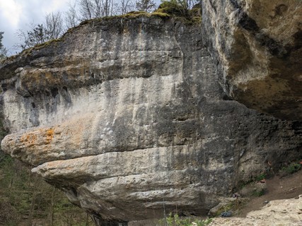
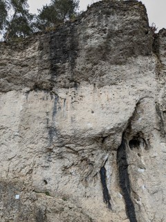
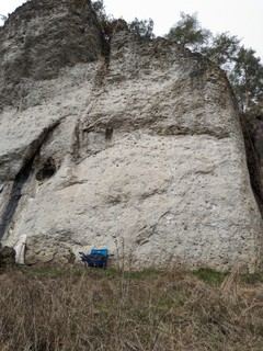
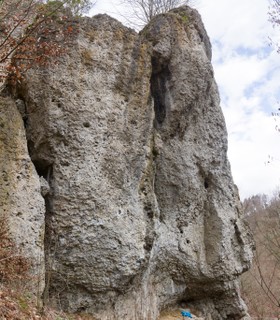
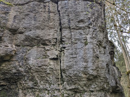
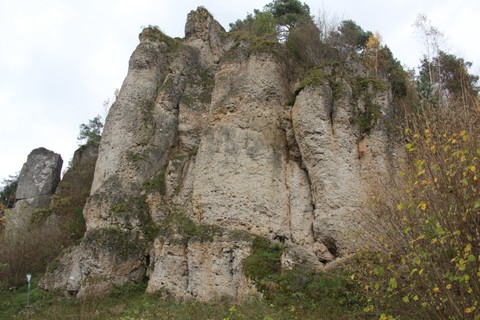
A lonely rock in the forest with a decent selection of routes from 4+ to 7-.
description
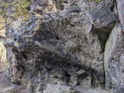
The rock quality varies a lot, so wearing a helmet is recommended. Also, even though the routes have been re-equipped, there are still some larger distances between bolts, so have some mobile protection ready. Take care to not place nuts behind one of the many loose blocks, though!
approach
Drive from Roßdach towards Wattendorf; park on the left 100 m after you leave Roßdach. Walk across the street and follow an overgrown path to the left along the forest. Before the path widens and enters the forest, there is another small track leading right. Follow this one: it turns left into the forest and up the hill after a few meters, and leads directly to the crag.
history
In 1932, Hans Kraus from the German Alpine Club (section Bamberg) made the first ascent of the "Bindelweg", which used to be a long traverse through the wall, in remembrance of Dr. Karl Bindel, director of the club section between 1895 and 1908.
1.1.1.10. Altenburgwand 14 routes in Crag
- Summary:
-
Mostly Sport climbing
Lat / Long: 50.023118, 11.063695
approach
GPS: 11.06366, 50.02303
1.1.1.11. Eigerblock 16 routes in Crag
- Summary:
-
Mostly Sport climbing
Lat / Long: 50.033032, 11.091384
approach
GPS: 11.09138, 50.03320
/90/72/90722fe0b1a6de79137d3b5a3c43b5ed6e2338dc) /e3/43/e3435d2d66f6935ee13f1c68d6be00cbb43850bb) /3d/26/3d265c0d052cdda4eba939cc76db54ab87094ad1)  /11/41/1141a255f7be92ff1707b72fc963e5ec44317d10) |
1.1.1.12. Lippert Gedenkwand 5 routes in Crag
- Summary:
-
All Sport climbing
Lat / Long: 50.026752, 11.110665
approach
GPS: 11.11070, 50.02679
1.1.1.13. Hohler Stein 5 routes in Crag
- Summary:
-
Sport climbing, Bouldering and Trad climbing
Lat / Long: 50.061111, 11.104753
description
approach
Von Bad Staffelstein nach Schwabtal, in Schwabtal links abbiegen in Richtung Kurklinik. Am Ortsausgang der Straße weiter Bergauf folgen bis nach ca 4 Km links ein Parkplatz erscheint. Hier parken. Nun links über die Wiese und ebenerdig in einer Minute zum Fels.
1.1.2. Kleinziegenfeld 606 routes in Area
- Summary:
-
Mostly Sport climbing
Lat / Long: 50.038706, 11.209704
1.1.2.1. Altbabawand 30 routes in Crag
- Summary:
-
Mostly Sport climbing
Lat / Long: 50.029480, 11.203260
approach
GPS: 11.20308, 50.02955
1.1.2.2. Rote Wand 51 routes in Crag
- Summary:
-
Mostly Sport climbing
Lat / Long: 50.030010, 11.203532
description
approach
Walk on bridge over river.
1.1.2.3. Hanfplantage 10 routes in Crag
- Summary:
-
All Sport climbing
Lat / Long: 50.030941, 11.202662
approach
GPS: 11.20250, 50.03107
1.1.2.4. Rolandfels 43 routes in Crag
- Summary:
-
Mostly Sport climbing
Lat / Long: 50.031396, 11.202742
summary
Sun in winter from 12:00 to 15:00.
approach
GPS:
1.1.2.5. Spitzenstein 7 routes in Crag
- Summary:
-
Mostly Sport climbing
Lat / Long: 50.015368, 11.212453
approach
GPS: 11.21245, 50.01544
1.1.2.6. Ziegenfelder Wände 42 routes in Crag
- Summary:
-
Mostly Sport climbing
Lat / Long: 50.025198, 11.194334
approach
GPS: 11.19420, 50.02513
   |
1.1.2.7. Leumer Gedenkwand 21 routes in Crag
- Summary:
-
All Sport climbing
Lat / Long: 50.025047, 11.196148
approach
GPS: 11.19615, 50.02501
1.1.2.8. Lichtenfelser Dach 13 routes in Crag
- Summary:
-
All Sport climbing
Lat / Long: 50.024654, 11.194441
approach
GPS: 11.19445, 50.02466
1.1.2.9. Geierwand 22 routes in Crag
- Summary:
-
All Sport climbing
Lat / Long: 50.028467, 11.190243
approach
GPS: 11.19040, 50.02831
    |
1.1.2.10. Roter Mönch 27 routes in Crag
- Summary:
-
Mostly Sport climbing
Lat / Long: 50.030335, 11.201036
description
approach
GPS: 11.20109, 50.03058
1.1.2.11. Diebesloch 22 routes in Crag
- Summary:
-
All Sport climbing
Lat / Long: 50.031054, 11.201146
approach
GPS: 11.20140, 50.03115
        |
1.1.2.12. Hammerschmiedturm 19 routes in Crag
- Summary:
-
Mostly Sport climbing
Lat / Long: 50.033054, 11.201744
summary
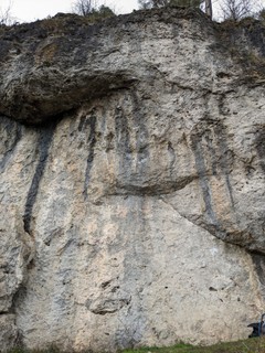
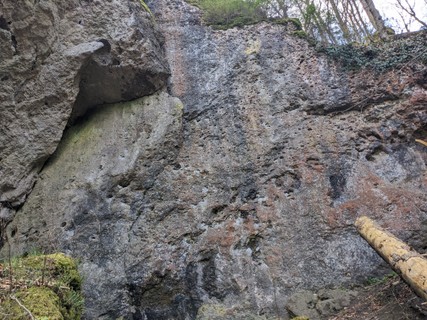
Big wall facing south to east, with a good selection of routes from adventurous to pure sport in overall decent rock quality.
description
Most of the routes have been reequipped over the years, some classics have been straightened. Some worthwhile additions from the first decade of the new millenium round up the experience. Mostly wall climbing on larger holds in the intermediate grades, steeper and with some smaller stuff as the difficulty rises.
access issues
This crag is closed from February 1 until June 30. An active closure is indicated by a warning and 'closed' tag here on the site; when in doubt, signs put up at the crag have precedence!
Dieser Fels ist von 1. Februar bis 30. Juni gesperrt. Eine aktive Sperrung wird auf dieser Seite durch eine Warnung und ein 'gesperrt'-Tag markiert; im Zweifelsfall haben die örtlich aufgehängten Schilder Vorrang!
approach
Coordinates:
1.1.2.13. Toni Schmid Gedenkwand 18 routes in Crag
- Summary:
-
Mostly Sport climbing
Lat / Long: 50.034619, 11.202965
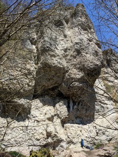
description
The Toni Schmid Gedenkwand is also known as “Altes Schloß” and is located in the northern Frankenjura. The rock consists of limestone and has a southeast orientation. The wall is up to 20 meters high and dries quickly. The wall mainly offers athletic wall climbing with crimps, holes and cracks.
approach
GPS: 11.20293, 50.03466
    |
1.1.2.14. Bauernschmitt Gedenkwand 17 routes in Crag
- Summary:
-
Mostly Sport climbing
Lat / Long: 50.034492, 11.203534
access issues
Parts of this crag are usually closed from February 1 until June 30. An active closure is indicated by a warning and 'closed' tag here on the site; when in doubt, signs put up at the crag have precedence!
Teile dieses Felsens sind üblicherweise von 1. Februar bis 30. Juni gesperrt. Eine aktive Sperrung wird auf dieser Seite durch eine Warnung und ein 'gesperrt'-Tag markiert; im Zweifelsfall haben die örtlich aufgehängten Schilder Vorrang!
approach
GPS: 11.20351, 50.03438
 |
1.1.2.15. Holzgauer Wand 63 routes in Crag
- Summary:
-
All Sport climbing
Lat / Long: 50.035012, 11.203648
access issues
Parts of this crag are usually closed from February 1 until June 30. An active closure is indicated by a warning and 'closed' tag here on the site; when in doubt, signs put up at the crag have precedence!
Teile dieses Felsens sind üblicherweise von 1. Februar bis 30. Juni gesperrt. Eine aktive Sperrung wird auf dieser Seite durch eine Warnung und ein 'gesperrt'-Tag markiert; im Zweifelsfall haben die örtlich aufgehängten Schilder Vorrang!
1.1.2.16. Hüttenriss 10 routes in Crag
- Summary:
-
All Sport climbing
Lat / Long: 50.024866, 11.195534
approach
GPS: 11.19563, 50.02493
1.1.2.17. Uhustein 7 routes in Crag
- Summary:
-
Sport climbing and Trad climbing
Lat / Long: 50.045066, 11.230302
access issues
This crag is closed from February 1 until June 30. An active closure is indicated by a warning and 'closed' tag here on the site; when in doubt, signs put up at the crag have precedence!
Dieser Fels ist von 1. Februar bis 30. Juni gesperrt. Eine aktive Sperrung wird auf dieser Seite durch eine Warnung und ein 'gesperrt'-Tag markiert; im Zweifelsfall haben die örtlich aufgehängten Schilder Vorrang!
approach
GPS: 11.23016, 50.04500
1.1.2.18. Weihersmühler Wand 26 routes in Crag
- Summary:
-
Mostly Sport climbing
Lat / Long: 50.042945, 11.219213
approach
GPS: 11.21868, 50.04321
      |
1.1.2.19. Aquarium 14 routes in Crag
- Summary:
-
Mostly Sport climbing
Lat / Long: 50.027751, 11.189944
approach
GPS: 11.18996, 50.02774
   |
1.1.2.20. Luisenwand 15 routes in Crag
- Summary:
-
Mostly Sport climbing
Lat / Long: 50.035755, 11.203365
approach
GPS:
1.1.2.21. Mosenberger Wände 32 routes in Crag
- Summary:
-
Mostly Sport climbing
Lat / Long: 50.051556, 11.196346
description
approach
GPS: 11.19629, 50.05178
1.1.2.22. Suttenstein 17 routes in Crag
- Summary:
-
Mostly Sport climbing
Lat / Long: 50.044968, 11.223381
description
approach
GPS: 11.22314, 50.04500
1.1.2.23. Hohe Wand 13 routes in Crag
- Summary:
-
Mostly Sport climbing
Lat / Long: 50.045553, 11.223386
access issues
This crag is closed from February 1 until June 30. An active closure is indicated by a warning and 'closed' tag here on the site; when in doubt, signs put up at the crag have precedence!
Dieser Fels ist von 1. Februar bis 30. Juni gesperrt. Eine aktive Sperrung wird auf dieser Seite durch eine Warnung und ein 'gesperrt'-Tag markiert; im Zweifelsfall haben die örtlich aufgehängten Schilder Vorrang!
approach
GPS:
1.1.2.24. Hexenkessel 17 routes in Crag
- Summary:
-
All Sport climbing
Lat / Long: 50.044116, 11.230629
approach
GPS: 11.23056, 50.04429
1.1.2.25. Buchauer Wände 6 routes in Crag
- Summary:
-
All Sport climbing
Lat / Long: 50.044869, 11.232441
approach
GPS: 11.23199, 50.04462
1.1.2.26. Kleinziegenfelder Wacht 4 routes in Crag
- Summary:
-
Sport climbing and Aid climbing
Lat / Long: 50.048428, 11.230677
approach
GPS: 11.23034, 50.04851
1.1.2.27. Waßmannwand 5 routes in Crag
- Summary:
-
All Sport climbing
Lat / Long: 50.055945, 11.227152
approach
GPS: 11.22725, 50.05602
1.1.2.28. Teufelwand 15 routes in Crag
- Summary:
-
All Sport climbing
Lat / Long: 50.048763, 11.228508
approach
GPS: 11.22855, 50.04886
1.1.2.29. Waßmannsmühler Wand 9 routes in Crag
- Summary:
-
Mostly Sport climbing
Lat / Long: 50.049142, 11.229279
approach
GPS: 11.22949, 50.04889
1.1.2.30. Schammendorfer Wand 11 routes in Crag
- Summary:
-
All Sport climbing
Lat / Long: 50.056469, 11.225943
summary
Sunny crag high on the hill. Easy routes, but loose rock and sometimes long runouts.
description
Nice winter spot if you can deal with the choss. Both climber and belayer should wear a helmet.
approach
  |
1.1.3. Bärental 62 routes in Area
- Summary:
-
Mostly Sport climbing
Lat / Long: 50.056174, 11.256816
description
1.1.3.1. Großer Juraturm 14 routes in Crag
- Summary:
-
Sport climbing, Trad climbing and Aid climbing
Lat / Long: 50.051941, 11.259839
approach
When entering Wunkendorf from the north, go left in the first turn, then left again at a little square with a cross, then park sensibly at the end of the village.
From the parking, walk north for a few meters, then just before a little picnic place with another cross, walk through the bushes on the right, then walk east along the edge of the forest. You can see the tower after a minute. It is best to make a big right turn to descend to the base.
Coordinates:
1.1.3.2. Bärentalwächter 14 routes in Crag
- Summary:
-
Mostly Sport climbing
Lat / Long: 50.052782, 11.261275
approach
GPS: 11.26093, 50.05281
1.1.3.3. Felsentor 5 routes in Crag
- Summary:
-
All Sport climbing
Lat / Long: 50.053160, 11.261261
approach
GPS: 11.26113, 50.05327
1.1.3.4. Kraftriss 2 routes in Crag
- Summary:
-
All Sport climbing
Lat / Long: 50.053538, 11.261214
approach
GPS: 11.26128, 50.05357
1.1.3.5. Diagonalweg-Massiv 5 routes in Crag
- Summary:
-
All Sport climbing
Lat / Long: 50.053790, 11.261007
summary
Small south face next to Wunkendorfer Eck.
access issues
This crag is usually closed from January 1 until July 31. An active closure is indicated by a warning and 'closed' tag here on the site; when in doubt, signs put up at the crag have precedence!
Dieser Fels ist üblicherweise von 1. Januar bis 31. Juli gesperrt. Eine aktive Sperrung wird auf dieser Seite durch eine Warnung und ein 'gesperrt'-Tag markiert; im Zweifelsfall haben die örtlich aufgehängten Schilder Vorrang!
approach
GPS: 11.26061, 50.05382
1.1.3.6. Wunkendorfer Eck 11 routes in Crag
- Summary:
-
Mostly Sport climbing
Lat / Long: 50.053830, 11.260623
summary
South and west face with a roof over the left part. Brittle rock but some worthwhile routes.
access issues
This crag is usually closed from January 1 until July 31. An active closure is indicated by a warning and 'closed' tag here on the site; when in doubt, signs put up at the crag have precedence!
Dieser Fels ist üblicherweise von 1. Januar bis 31. Juli gesperrt. Eine aktive Sperrung wird auf dieser Seite durch eine Warnung und ein 'gesperrt'-Tag markiert; im Zweifelsfall haben die örtlich aufgehängten Schilder Vorrang!
approach
GPS: 11.26039, 50.05386
1.1.3.7. Krassacher Türme 8 routes in Crag
- Summary:
-
All Sport climbing
Lat / Long: 50.054551, 11.260686
approach
GPS: 11.26055, 50.05472
1.1.3.8. Neudorfer Wand 3 routes in Crag
- Summary:
-
All Sport climbing
Lat / Long: 50.063555, 11.258005
1.1.4. Zillertal 48 routes in Area
- Summary:
-
Sport climbing, Trad climbing and Aid climbing
Lat / Long: 50.071485, 11.275763
1.1.4.1. Efeuwand 5 routes in Crag
- Summary:
-
All Sport climbing
Lat / Long: 50.072740, 11.270624
approach
GPS: 11.27065, 50.07260
1.1.4.2. Höhlenwand 6 routes in Crag
- Summary:
-
Mostly Sport climbing
Lat / Long: 50.072720, 11.271329
approach
GPS: 11.27131, 50.07263
1.1.4.3. Niestener Wand 19 routes in Crag
- Summary:
-
All Trad climbing
Lat / Long: 50.072139, 11.267553
approach
GPS: 11.26727, 50.07231
1.1.4.4. Regenwand 5 routes in Crag
- Summary:
-
Sport climbing and Aid climbing
Lat / Long: 50.071667, 11.264346
approach
GPS: 11.26456, 50.07157
/09/bb/09bb2950af76a74414083be9b42b7cbc25ceb6a6) |
1.1.4.5. Sonnenwand 13 routes in Crag
- Summary:
-
All Sport climbing
Lat / Long: 50.071949, 11.266518
summary
South face with routes in the intermediate range. The rock is extremely brittle in many places, better wear a helmet. Quite a few routes don't have a bolted anchor.
approach
GPS: 11.26655, 50.07193
1.1.5. Burglesau 95 routes in Area
- Summary:
-
Mostly Sport climbing
Lat / Long: 49.995344, 11.084757
1.1.5.1. Burglesauer Wand und Vortürme 47 routes in Crag
- Summary:
-
Mostly Sport climbing
Lat / Long: 49.999316, 11.087614
summary
Sunny climbing area with mostly vertical and slabby routes in very smooth (often polished) rock. Crack climbing and wall climbing on slopers and a few edges. Very few pockets.
description
A crag with a long climbing tradition, which shows in the polish as well as the grades, which are pretty stiff. The rock is typical for the area around Bamberg, that is to say mostly technical climbing on round features.
approach
Drive through Burglesau and exit to the east. Follow the narrow street past a little fountain to a marked hiker's parking lot (see coordinates below). From there, walk back a few meters and turn right (sign "Bergwacht"). After 300 meters, the crag is up the hill on your right.
Coordinates:
1.1.5.2. Stephansturm & Dreitorspitze 18 routes in Crag
- Summary:
-
Mostly Sport climbing
Lat / Long: 49.999463, 11.084552
approach
GPS: 11.08443, 49.99944
1.1.5.3. Winterseite 30 routes in Crag
- Summary:
-
Mostly Sport climbing
Lat / Long: 49.992037, 11.083903
approach
Disclaimer: there is a sign that actually forbids using this street, but on the other hand, there is an officially marked hiker's parking lot up the hill. If you don't want to risk driving up there, park in Burglesau.
Drive into Burglesau. After the bus stop, turn right onto a narrow street that leads south past some fields and up the hill in sharp turns. After 1.5 km, you reach a marked hiker's parking lot.
Walk up the street for a few meters. In the next sharp right turn, a forest road turns left into the forest. Follow this for around 300 meters to a visible fork. Turn left to reach the crag in a few hundred meters.
1.1.6. Stübig 44 routes in Area
- Summary:
-
Mostly Sport climbing
Lat / Long: 50.010081, 11.080009
1.1.6.1. Großer Stübiger Turm 28 routes in Crag
- Summary:
-
Mostly Sport climbing
Lat / Long: 50.008919, 11.082008
access issues
This crag is usually closed from January 1 until July 31. An active closure is indicated by a warning and 'closed' tag here on the site; when in doubt, signs put up at the crag have precedence!
Dieser Fels ist üblicherweise von 1. Januar bis 31. Juli gesperrt. Eine aktive Sperrung wird auf dieser Seite durch eine Warnung und ein 'gesperrt'-Tag markiert; im Zweifelsfall haben die örtlich aufgehängten Schilder Vorrang!
approach
GPS: 11.08170, 50.00889
1.1.6.2. Kleiner Stübiger Turm 16 routes in Crag
- Summary:
-
Mostly Sport climbing
Lat / Long: 50.008537, 11.081849
approach
GPS: 11.08163, 50.00857
1.1.7. Staffelfels 20 routes in Crag
- Summary:
-
All Sport climbing
Lat / Long: 50.092757, 11.023388
description
approach
GPS: 11.02323, 50.09284
| Route | Grade | Style | Selected ascents | |||
|---|---|---|---|---|---|---|
| 1 | ★★ Lichtenfelser Weg | 6 | 22m, 5 | |||
| 2 | Baby Cacke Walk | 7- | ||||
| 3 | Nordkante | 7+ | ||||
| 4 | Nordkante, Direktausstieg | 6 | ||||
| 5 | Hans Walschleb Gedenkweg | 4+ | ||||
| 6 | Volker Wirth Gedenkweg | 7- | ||||
| 7 | Höhlen-Direttissima | 7+ | ||||
| 8 | Neustadter Weg | 4 | ||||
| 9 | Unnamed 1 | ? | ||||
| 10 | Unvollendete | 9- | ||||
| 11 | ★★★ Klausenweg | 8- | ||||
| 12 | ★ Klausenweg, rechter Ausstieg | 6+ | ||||
| 13 | Querkeles-Quergang | 6- | ||||
| 14 | ★ Dreierweg | 3 | ||||
| 15 | Kamin bergseits | 5 | ||||
| 16 | Wand am Turm | 4 | ||||
| 17 | Talkante | 3 | ||||
| 18 | Kamin talseits | 3 | ||||
| 19 | Räuschlesweg | 8- | ||||
| 20 | Die Unbenannte | 4+ | ||||
1.2. Fränkische Schweiz 8,624 routes in Area
- Summary:
-
Mostly Sport climbing
Lat / Long: 49.828768, 11.309690
description
1.2.1. Würgau 123 routes in Crag
- Summary:
-
Mostly Sport climbing
Lat / Long: 49.980489, 11.099432
description
approach
Drive from Würgau heading Steinfeld/Hollfeld. Park here ( 49.978783, 11.09775) at the side of the road.
1.2.1.1. Würgauer Nadel 3 routes in Crag
- Summary:
-
All Sport climbing
Lat / Long: 49.980277, 11.098759
approach
GPS: 11.09869, 49.98027
1.2.1.2. Bamberger Turm 5 routes in Crag
- Summary:
-
All Sport climbing
Lat / Long: 49.980582, 11.098672
approach
GPS: 11.09880, 49.98049
1.2.1.3. Würgauer Wand 6 routes in Crag
- Summary:
-
All Sport climbing
Lat / Long: 49.980543, 11.098903
approach
GPS: 11.09880, 49.98049
1.2.1.4. Fermeda 3 routes in Crag
- Summary:
-
Sport climbing and Trad climbing
Lat / Long: 49.980597, 11.099178
1.2.1.5. Gewitterriss 3 routes in Crag
- Summary:
-
All Sport climbing
Lat / Long: 49.980696, 11.099135
approach
GPS: 11.09895, 49.98062
1.2.1.6. Kreuzstein 6 routes in Crag
- Summary:
-
All Sport climbing
Lat / Long: 49.980964, 11.099235
1.2.1.7. Bayreuther Wand 9 routes in Crag
- Summary:
-
Mostly Sport climbing
Lat / Long: 49.981083, 11.099187
approach
GPS: 11.09884, 49.98107
1.2.1.8. Nürnberger Turm 15 routes in Crag
- Summary:
-
Sport climbing and Trad climbing
Lat / Long: 49.981097, 11.098977
approach
GPS: 11.09884, 49.98107
1.2.1.9. Bayerl Gedenkwand 4 routes in Crag
- Summary:
-
All Sport climbing
Lat / Long: 49.981303, 11.099141
1.2.1.10. Dolomit 7 routes in Crag
- Summary:
-
All Sport climbing
Lat / Long: 49.981402, 11.098850
1.2.1.11. Edelweißwand 9 routes in Crag
- Summary:
-
All Sport climbing
Lat / Long: 49.981792, 11.099233
1.2.1.12. Fiechtlwand 20 routes in Crag
- Summary:
-
All Sport climbing
Lat / Long: 49.982019, 11.099166
approach
GPS: 11.09904, 49.98206
1.2.1.13. Frankenwand 13 routes in Crag
- Summary:
-
Mostly Sport climbing
Lat / Long: 49.982410, 11.099006
approach
GPS: 11.09866, 49.98247
1.2.1.14. Kariöser Zahn 2 routes in Cliff
- Summary:
-
All Sport climbing
Lat / Long: 49.982938, 11.098782
approach
GPS: 11.09875, 49.98290
1.2.1.15. Wacholderspitze 12 routes in Cliff
- Summary:
-
All Sport climbing
Lat / Long: 49.978091, 11.101277
approach
/a3/06/a3068e324e6abfeb9e46c11e9ba81068f21f188e) |
1.2.1.16. Würgauer Wändchen 6 routes in Cliff
- Summary:
-
All Sport climbing
Lat / Long: 49.977491, 11.102066
approach
1.2.2. Paradiestal 94 routes in Region
- Summary:
-
Mostly Sport climbing
Lat / Long: 49.986063, 11.186984
1.2.2.1. Wüstenstein 33 routes in Crag
- Summary:
-
Mostly Sport climbing
Lat / Long: 49.989799, 11.187964
summary
Impressive west and north-west face with lots of classics in the 9th grade.
description
The largest crag in the "Paradiestal" is truly a paradise for climbers who dabble in the UIAA 9 range. Classics like Jerry Moffat's "Schwarze Wand" and Wolfgang Güllich's "Sahara" and "Fata Morgana" are surrounded by some more quality routes in or around that grade. For the extreme hardmovers, "Nosegrind" offers a supreme line with a hard boulder over a striking prow. By now, also some lines in the 8th grade have been established, which end below the big roof in the west face.
access issues
Please do not drive into the valley. Use the hiker's parking lot at the northern end.
approach
From Steinfeld, drive towards Wölkendorf. Shortly after passing beneath the autobahn, there is a hiker's parking lot on the right.
Now just follow the path through the "Paradiestal" (east, pass beneath the autobahn again, then turn right into the valley at the fork) for about 1.5 km, until you can see the large crag on your left, slightly north of a little fork.
GPS: 11.18745, 49.98975
1.2.2.2. Vorderer Paradiestalwächter 10 routes in Crag
- Summary:
-
All Sport climbing
Lat / Long: 49.974541, 11.193904
approach
GPS: 11.19403, 49.97459
1.2.2.3. Nasenlöcherturm 7 routes in Crag
- Summary:
-
Sport climbing and Trad climbing
Lat / Long: 49.977055, 11.196172
approach
GPS: 11.19584, 49.97699
1.2.2.4. Dachstein 4 routes in Crag
- Summary:
-
All Sport climbing
Lat / Long: 49.977880, 11.192299
approach
GPS: 11.19230, 49.97791
1.2.2.5. Gelbe Wand 16 routes in Crag
- Summary:
-
Mostly Sport climbing
Lat / Long: 49.979063, 11.190016
approach
GPS: 11.18979, 49.97915
1.2.2.6. Paradieswand 9 routes in Crag
- Summary:
-
All Sport climbing
Lat / Long: 49.979233, 11.190935
description
A small crag recently rebolted and an alternative to "Gelbe Wand". A little bit dirty and not the top crag in this area.
access issues
Zone 3, which means no restrictions.
approach
60m after "Gelbe Wand" on the right hand side.
/88/7f/887f8d80c87da20cd35edcfe2d2c1591713b702c) |
1.2.2.7. Bamberger Wand 3 routes in Crag
- Summary:
-
All Sport climbing
Lat / Long: 49.979820, 11.190857
approach
GPS: 11.19080, 49.97983
1.2.2.8. Zigeunerstube 5 routes in Crag
- Summary:
-
All Sport climbing
Lat / Long: 49.989174, 11.187158
approach
GPS: 11.18708, 49.98917
1.2.2.9. Langenstein 7 routes in Crag
- Summary:
-
All Sport climbing
Lat / Long: 49.996967, 11.181176
summary
Leider aufgrund der sehr nahen Autobahn sehr laut. Trotzdem kann sich ein Besuch in der Abendsonne lohnen.
approach
GPS: 11.18102, 49.99710
1.2.3. Oberes Wiesenttal 292 routes in Area
- Summary:
-
Mostly Sport climbing
Lat / Long: 49.966016, 11.201597
where to stay
1.2.3.1. Hintere Steinfelder Wand 5 routes in Crag
- Summary:
-
Sport climbing and Trad climbing
Lat / Long: 49.981802, 11.147274
1.2.3.2. Steinfelder Turm 20 routes in Crag
- Summary:
-
All Sport climbing
Lat / Long: 49.981702, 11.146966
summary
High quality pocketed routes in a good grade range on the tower contrast with slabby routes with tiny crimps and cracks on the wall behind it.
access issues
This crag is usually closed from January 1 until July 31. An active closure is indicated by a warning and 'closed' tag here on the site; when in doubt, signs put up at the crag have precedence!
Dieser Fels ist üblicherweise von 1. Januar bis 31. Juli gesperrt. Eine aktive Sperrung wird auf dieser Seite durch eine Warnung und ein 'gesperrt'-Tag markiert; im Zweifelsfall haben die örtlich aufgehängten Schilder Vorrang!
approach
GPS: 11.14713, 49.98163
 |
1.2.3.3. Steinfelder Wand 20 routes in Crag
- Summary:
-
Sport climbing and Trad climbing
Lat / Long: 49.981555, 11.146672
access issues
This crag is usually closed from January 1 until July 31. An active closure is indicated by a warning and 'closed' tag here on the site; when in doubt, signs put up at the crag have precedence!
Dieser Fels ist üblicherweise von 1. Januar bis 31. Juli gesperrt. Eine aktive Sperrung wird auf dieser Seite durch eine Warnung und ein 'gesperrt'-Tag markiert; im Zweifelsfall haben die örtlich aufgehängten Schilder Vorrang!
approach
From Steinfeld, drive west towards Würgau/A70. After just 500 meters, turn right into a forest road with ample parking space. The crag is just a few meters down the forest road.
GPS: 11.14713, 49.98163
 |
1.2.3.4. Steinfelder Wändchen 24 routes in Crag
- Summary:
-
Mostly Sport climbing
Lat / Long: 49.978809, 11.151755
approach
GPS: 11.15168,49.97882
 |
1.2.3.5. Treunitzer Wand 14 routes in Crag
- Summary:
-
All Sport climbing
Lat / Long: 49.970525, 11.188376
description
Einige speckige Stellen, denn der Fels ist aus guten Gründen häufiger besucht: 50m vom Parkplatz (Camping verboten). Ebener Stand. 5m neben dem Fels münden zwei kleine Karstquellen in die Wiesent. Dahinter große Wiese. 2 Höhlen ca 50m rechts/nördlich vom Kletterbereich. Wochenends viele Passanten/Wanderer.
approach
GPS: 11.18854, 49.97018
1.2.3.6. Hintere Treunitzer Wand 10 routes in Crag
- Summary:
-
All Sport climbing
Lat / Long: 49.969003, 11.190166
summary
Abandoned wall directly by the footpath.
All but 3 Routes unclimbable due to removed bolts and botanical obstacles.
approach
GPS: 11.19038, 49.96894
1.2.3.7. Treunitzer Pfeiler 3 routes in Crag
- Summary:
-
All Sport climbing
Lat / Long: 49.968963, 11.190804
approach
GPS: 11.19079, 49.96899
1.2.3.8. Torstein 15 routes in Crag
- Summary:
-
All Sport climbing
Lat / Long: 49.968759, 11.191788
description
Small crag divided into two towers with routes ranging from 3+ to 8-, opened mainly by Karl Thon and Jürgen Kremer between 2009 and 2011. Notable are the three "trilogies" of routes, "Rockys bunte Welt", "Kekseklauer und Wandfußzottel" and "Der Himmel sucht ne gute Nase -- Scheiß Himmel -- Irgendetwas fehlt".
approach
GPS: 11.19173, 49.96878
/99/0b/990bfea02232b41657231fc274950057e520eaae) /ad/f3/adf3e182e9792b316941b1a2e1aa52453164f056) /5e/50/5e507ae08daf03ea416b616665cf3755eea81f00) /26/b3/26b374f52b950554a3ae3b2fb4feeca37704b091) /5c/2d/5c2d47c2368fc07714e32135e1fb72ffb36a27b4) 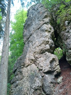 |
1.2.3.9. Tritzmann Gedenkwand 7 routes in Crag
- Summary:
-
All Sport climbing
Lat / Long: 49.962259, 11.203806
approach
GPS: 11.20387, 49.96230
1.2.3.10. Treunitzer Kletterblöcke 7 routes in Crag
- Summary:
-
All Sport climbing
Lat / Long: 49.960621, 11.206482
description
1.2.3.11. Treunitzer Klettergarten 54 routes in Crag
- Summary:
-
Mostly Sport climbing
Lat / Long: 49.959131, 11.208879
approach
(49.959571, 11.207765) Follow the street 30m east and an obvious path up to the crag ( 49.959179, 11.208816) in <1min.
 /44/42/4442f2a60906116b2b6da4f982f1acc3be89c6e6)    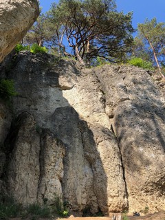  |
1.2.3.12. DTC 23 routes in Crag
- Summary:
-
Sport climbing and Bouldering
Lat / Long: 49.959057, 11.226196
approach
GPS: 11.22620, 49.95895
 |
1.2.3.13. Kuhkirchner Wand 21 routes in Crag
- Summary:
-
Mostly Sport climbing
Lat / Long: 49.958939, 11.239681
approach
GPS: 11.23947, 49.95860
1.2.3.14. Schallmauer 8 routes in Crag
- Summary:
-
Sport climbing, Bouldering and Trad climbing
Lat / Long: 49.960247, 11.243056
1.2.3.15. Venushügel 4 routes in Crag
- Summary:
-
All Sport climbing
Lat / Long: 49.958839, 11.248630
1.2.3.16. Freienfels 14 routes in Crag
- Summary:
-
All Sport climbing
Lat / Long: 49.959874, 11.251686
1.2.3.17. Eiserne Jungfrau 26 routes in Crag
- Summary:
-
All Sport climbing
Lat / Long: 49.958677, 11.254882
- Avoid unnecessary noise
- Remove any trash
- Please don't bivvy at the crag
- Consider financially supporting via the donation box on the right side of the sector
summary
Beautiful cliff on the bank of the Wiesent
description
The cliff was discovered and is being leased by Matthias Stöcker.
To help ensure continued access
approach
Park along the B22 in Freienfels. (49.959878, 11.253768)
Do not park on the property of Hellas Busreisen!
where to stay
There is a campground at the other end of the village: http://waldmuehle.net
/a8/04/a804bc8844978f5cb1d005739f87cd8891341157) /54/ce/54cefb7179532ef7a68dad4d0104ccd35a0a4684) |
1.2.3.18. Neidensteiner Wand 17 routes in Crag
- Summary:
-
Mostly Sport climbing
Lat / Long: 49.952993, 11.263030
summary
Short routes (max 12m), pockety on the right hand side.
approach
Park at the grass roundabout. Not on the riverhand side or the bus stop!
(49.95283, 11.27069)
/c5/92/c592c7c66ff0a32316400d488de49b99eac4978a) |
1.2.4. Krögelstein 98 routes in Area
- Summary:
-
Mostly Sport climbing
Lat / Long: 49.978036, 11.269572
1.2.4.1. Dohlenstein 13 routes in Crag
- Summary:
-
Mostly Sport climbing
Lat / Long: 49.971739, 11.275512
approach
GPS: 11.27554, 49.97188
1.2.4.2. Kaiserbachtaler Riesenüberhang 6 routes in Crag
- Summary:
-
All Sport climbing
Lat / Long: 49.971369, 11.275428
1.2.4.3. Kainachtaler Torbogen 5 routes in Crag
- Summary:
-
All Sport climbing
Lat / Long: 49.971713, 11.274110
approach
GPS: 11.27415, 49.97174
1.2.4.4. Kainachtaler Pfeiler 4 routes in Crag
- Summary:
-
Bouldering and Sport climbing
Lat / Long: 49.969665, 11.276704
1.2.4.5. Kainachtaler Block 8 routes in Crag
- Summary:
-
All Sport climbing
Lat / Long: 49.961408, 11.286637
approach
GPS: 11.28670, 49.96136
1.2.4.6. Teufelslöcherwände 9 routes in Crag
- Summary:
-
All Sport climbing
Lat / Long: 49.972267, 11.255195
description
Zwei schöne Wände in einem kleinen Trockental mit perfektem Fels.
approach
From the motorway A70, take the exit number 20 (Stadelhofen) and drive south in the direction of Hollfeld. Pass through Wotzendorf and Eichenhüll. 2 km after Eichenhüll, there is a crossing with a dirt road. Park here (on the left side). Follow the dirt road east until you reach the small streamless valley. Turn left onto a small path and you will see the crag on the opposite side of the valley after a few minutes.
GPS: 11.25493, 49.97187
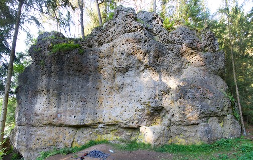  |
1.2.4.7. Säukirchner Turm 10 routes in Crag
- Summary:
-
Mostly Sport climbing
Lat / Long: 49.982122, 11.276397
summary
Free-standing tower in an idyllic valley with great routes in fantastic rock in the south face.
description
Also known as "Säukerng" among the locals due to the small cave beneath it which was supposedly used to hide pigs ("Säue") in former times, the rock tower offers sunny climbs in the intermediate grades in the south face. The rock quality is perfect for the most part. There are also two routes in the shady backside, but they are climbed much less often and are therefore slightly vegetated. The most common way to get to the summit is via "Direkte Bergseite".
access issues
This crag is usually temporally closed from January 1 until July 31. An active closure is indicated by a warning and 'closed' tag here on the site; when in doubt, signs put up at the crag have precedence!
Dieser Fels ist üblicherweise von 1. Januar bis 31. Juli gesperrt. Eine aktive Sperrung wird auf dieser Seite durch eine Warnung und ein 'gesperrt'-Tag markiert; im Zweifelsfall haben die örtlich aufgehängten Schilder Vorrang!
approach
GPS: 11.27633, 49.98215
 |
1.2.4.8. Hochburg des Terrors 2 routes in Crag
- Summary:
-
All Sport climbing
Lat / Long: 49.986429, 11.272929
approach
GPS: 11.27246, 49.98636
1.2.4.9. Kuhleutner Turm 10 routes in Crag
- Summary:
-
All Sport climbing
Lat / Long: 49.990687, 11.274720
access issues
This crag is usually closed from February 1 until June 30. An active closure is indicated by a warning and 'closed' tag here on the site; when in doubt, signs put up at the crag have precedence!
Dieser Fels ist üblicherweise von 1. Februar bis 30. Juni gesperrt. Eine aktive Sperrung wird auf dieser Seite durch eine Warnung und ein 'gesperrt'-Tag markiert; im Zweifelsfall haben die örtlich aufgehängten Schilder Vorrang!
1.2.4.10. Kuhleutner Wand 13 routes in Crag
- Summary:
-
All Sport climbing
Lat / Long: 49.991071, 11.274849
summary
Good face climbing on a sunny west face.
access issues
This crag is usually closed from February 1 until June 30. An active closure is indicated by a warning and 'closed' tag here on the site; when in doubt, signs put up at the crag have precedence!
Dieser Fels ist üblicherweise von 1. Februar bis 30. Juni gesperrt. Eine aktive Sperrung wird auf dieser Seite durch eine Warnung und ein 'gesperrt'-Tag markiert; im Zweifelsfall haben die örtlich aufgehängten Schilder Vorrang!
approach
GPS: 11.27482, 49.99112
1.2.4.11. Eherbacher Wand 16 routes in Crag
- Summary:
-
All Sport climbing
Lat / Long: 49.998675, 11.269343
description
Mainly overhanging, on good pockets and jugs. Stays dry in the rain, although often seeps in the bottom part.
approach
GPS: 11.26937, 49.99871
1.2.4.12. Talschlussturm 2 routes in Area
- Summary:
-
All Sport climbing
Lat / Long: 49.998661, 11.268257
summary
Small tower with two routes 100m next to Eherbacher Wand.
1.2.5. Schirradorf 15 routes in Area
- Summary:
-
All Sport climbing
Lat / Long: 50.003359, 11.304984
1.2.5.1. Schirradorfer Block 6 routes in Crag
- Summary:
-
Lat / Long: 50.005165, 11.310386
approach
GPS: 11.31028, 50.00502
1.2.5.2. Wetterspitze 7 routes in Crag
- Summary:
-
Lat / Long: 50.002418, 11.305795
approach
GPS: 11.30581, 50.00241
1.2.5.3. Schwalbenstein 2 routes in Crag
- Summary:
-
Lat / Long: 50.005656, 11.304916
approach
GPS: 11.30420, 50.00570
1.2.6. Tiefenellern 79 routes in Area
- Summary:
-
Mostly Sport climbing
Lat / Long: 49.930908, 11.085066
1.2.6.1. Gügel 12 routes in Crag
- Summary:
-
Mostly Sport climbing
Lat / Long: 49.950604, 11.066768
1.2.6.2. Eulenwand 28 routes in Crag
- Summary:
-
All Sport climbing
Lat / Long: 49.921458, 11.083084
approach
GPS: 11.08290, 49.92139
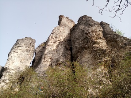 |
1.2.6.3. Schlosswand 8 routes in Crag
- Summary:
-
Mostly Sport climbing
Lat / Long: 49.920717, 11.083318
approach
GPS: 11.08326, 49.92074
  |
1.2.6.4. Fundgrube 11 routes in Crag
- Summary:
-
Mostly Sport climbing
Lat / Long: 49.913411, 11.081586
approach
GPS: 11.08135, 49.91358
1.2.6.5. Herzogenreuther Wand 13 routes in Crag
- Summary:
-
All Sport climbing
Lat / Long: 49.913495, 11.086285
summary
Small crag with very compact rock in the overhanging east face and slightly more blocky terrain in the south face. Good climbing in the higher grades.
approach
Please park you car on the side of the road or a parking bay nearby and walk the dirt road down to the forest. Don't park in the field.
Der Bauer hat darum gebeten dass die Kletterer in Zukunft bitte an der Straße bzw. in Parkbuchen parken sollen, da seine Wiese ansonsten finaziellen Schaden nehmen würde.
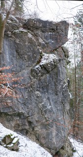  |
1.2.6.6. Herzogenreuther Findling 7 routes in Crag
- Summary:
-
All Sport climbing
Lat / Long: 49.913193, 11.086632
summary
Small crag with a few easy routes. Only some routes have anchors. You can thread large tunnels at the top (or walk off).
approach
(49.915028, 11.089111). Make sure to leave enough room for the farmer. Follow the path leading down left into the woods. Herzogenreuther Findling is at the left (49°54'47.6"N 11°05'12.0"E), Herzogenreuther Wand at the right.
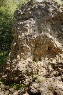 |
1.2.7. Frankendorf 136 routes in Area
- Summary:
-
Mostly Sport climbing
Lat / Long: 49.835962, 11.075250
1.2.7.1. Kreuzerwand 18 routes in Crag
- Summary:
-
Sport climbing and Trad climbing
Lat / Long: 49.837337, 11.070540
approach
GPS: 11.07067, 49.83740
   |
1.2.7.2. Annastein 16 routes in Crag
- Summary:
-
Mostly Sport climbing
Lat / Long: 49.840940, 11.071378
approach
GPS: 11.07132, 49.84105
    |
1.2.7.3. Allgäuer Wand 6 routes in Crag
- Summary:
-
Sport climbing, Aid climbing and Trad climbing
Lat / Long: 49.840411, 11.068520
access issues
This crag is usually closed from January 1 until July 31. An active closure is indicated by a warning and 'closed' tag here on the site; when in doubt, signs put up at the crag have precedence!
Dieser Fels ist üblicherweise von 1. Januar bis 31. Juli gesperrt. Eine aktive Sperrung wird auf dieser Seite durch eine Warnung und ein 'gesperrt'-Tag markiert; im Zweifelsfall haben die örtlich aufgehängten Schilder Vorrang!
approach
GPS: 11.06864, 49.84039
1.2.7.4. Annasteinseite 40 routes in Crag
- Summary:
-
Mostly Sport climbing
Lat / Long: 49.841281, 11.070501
access issues
This crag is usually closed from January 1 until July 31. An active closure is indicated by a warning and 'closed' tag here on the site; when in doubt, signs put up at the crag have precedence!
Dieser Fels ist üblicherweise von 1. Januar bis 31. Juli gesperrt. Eine aktive Sperrung wird auf dieser Seite durch eine Warnung und ein 'gesperrt'-Tag markiert; im Zweifelsfall haben die örtlich aufgehängten Schilder Vorrang!
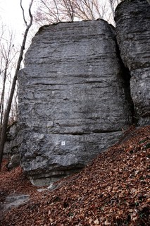 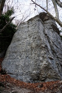 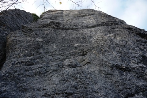 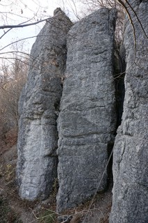 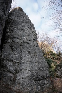 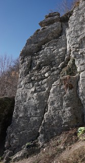 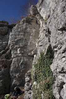 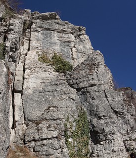 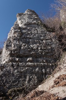 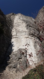 |
1.2.7.5. Dragonerwand 17 routes in Crag
- Summary:
-
Mostly Sport climbing
Lat / Long: 49.837846, 11.069688
approach
GPS: 11.06962, 49.83798
1.2.7.6. Landrichterseite 39 routes in Crag
- Summary:
-
Mostly Sport climbing
Lat / Long: 49.839687, 11.081674
summary
A fine crag in a bright beech forest, with lots of good routes in smooth rock.
description
This south-west facing crag has the best rock quality and routes of the crags around Frankendorf. In summer, the beech forest provides some shade, but the upper parts of the wall are fully in the sun, which makes it a good autumn and winter crag. The rock is very smooth, typical for the areas around Bamberg; there are basically no pockets, the climbing is mostly on roundish holds, slopers, and cracks.
approach
In Frankendorf, turn into a small road called "Bergweg", which leaves the village to the east. Follow the winding road uphill to a crossing (there is a large crucifix on your right). Park here.
Follow the forest road that branches off in northern direction from the crossing for 450 meters. Here, a slightly smaller dirt road branches off to the left. Follow it until – shortly after you've entered the forest – you see a tree nursery with a fence around. Walk left along the fence. After a few meters, you should see a little picnic area with a table and benches. Walk past it on the right, and you should be able to spot a steep gulley, which you descend to the foot of the crag.
GPS: 11.08087, 49.83998
1.2.8. Leinleitertal 304 routes in Area
- Summary:
-
Mostly Sport climbing
Lat / Long: 49.864519, 11.168573
1.2.8.1. Burggrub 95 routes in Crag
- Summary:
-
Mostly Sport climbing
Lat / Long: 49.869677, 11.137188
1.2.8.2. Heiligenstadt 64 routes in Crag
- Summary:
-
Mostly Sport climbing
Lat / Long: 49.874479, 11.176077
1.2.8.3. Veilbronn 145 routes in Crag
- Summary:
-
Mostly Sport climbing
Lat / Long: 49.841988, 11.197634
1.2.9. Aufseßtal 112 routes in Area
- Summary:
-
Mostly Sport climbing
Lat / Long: 49.884102, 11.243806
1.2.9.1. Neppwand 14 routes in Crag
- Summary:
-
All Sport climbing
Lat / Long: 49.814602, 11.294021
approach
Park in Doos. Take the hiking trail into the "Aufseßtal" (towards Kuchenmühle) past the café of the therapy center. A few meters after the last building, a path branches off to the right (sign: Gösseldorf). Follow that path uphill for about 300 meters and the crag will be on your right.
GPS: 11.29405, 49.81466
1.2.9.2. Werner Brösel Gedenkwand 6 routes in Crag
- Summary:
-
All Sport climbing
Lat / Long: 49.815446, 11.294026
approach
Park in Doos. Take the hiking trail into the "Aufseßtal" (towards Kuchenmühle) past the café of the therapy center. A few meters after the last building, a path branches off to the right (sign: Gösseldorf). Follow that path uphill for about 400 meters and the crag will be directly next to the path.
GPS: 11.29406, 49.81545
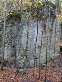 |
1.2.9.3. Berglerturm 7 routes in Crag
- Summary:
-
Sport climbing and Trad climbing
Lat / Long: 49.816035, 11.293486
approach
GPS: 11.29349, 49.81630
1.2.9.4. Anderland 5 routes in Crag
- Summary:
-
All Sport climbing
Lat / Long: 49.816340, 11.290891
approach
GPS: 11.29064, 49.81597
1.2.9.5. Aufseßtal Südwand 18 routes in Cliff
- Summary:
-
Mostly Sport climbing
Lat / Long: 49.816826, 11.288734
description
Cliff with easier and mid-grade routes in the idyllic Aufseß-valley. The base is shaded by the trees, while the left routes get some sun in their upper parts.
approach
From Doos, follow the desigated footpathto Kuchenmühle for approx. 900 m. The cliff is visible uphill in the wood just opposite a chunk of bigger boulders left of the path. GPS: 11.28874, 49.81689
    |
1.2.9.6. Höllenstein 18 routes in Crag
- Summary:
-
All Sport climbing
Lat / Long: 49.818146, 11.286870
summary
High west face, shady throughout the year due to the spruce forest; the routes all have an alpine touch, the rock quality varies a lot, wearing a helmet is recommended.
approach
Park in Doos and walk north on the hiking trail that leads past the therapy centre (yellow cross on white). After about 1 km (300 m after passing the prominent south face "Anderland"), the crag is on your right.
GPS: 11.28681, 49.81821
1.2.9.7. Willy Merkl Gedenkwand 1 route in Crag
- Summary:
-
All Aid climbing
Lat / Long: 49.852511, 11.257732
1.2.9.8. Neuhauser Wand 28 routes in Crag
- Summary:
-
All Sport climbing
Lat / Long: 49.910682, 11.225162
approach
GPS: 11.22509, 49.91064
 /b6/a7/b6a7b28552cd64ca889244799d160f78fb484778) |
1.2.9.9. Neuhauser Turm 2 routes in Crag
- Summary:
-
All Trad climbing
Lat / Long: 49.906866, 11.223811
summary
Slim needle directly above the village Neuhaus.
description
A little rock tower mostly visited by tourists and hikers. Two easy routes lead up to the summit. Careful, the rock is sometimes brittle and there are only a few old pegs. No anchor except for the old weathervane on the summit!
access issues
This crag is temporally closed from January 1 until July 31. An active closure is indicated by a warning and 'closed' tag here on the site; when in doubt, signs put up at the crag have precedence!
Dieser Fels ist üblicherweise von 1. Januar bis 31. Juli gesperrt. Eine aktive Sperrung wird auf dieser Seite durch eine Warnung und ein 'gesperrt'-Tag markiert; im Zweifelsfall haben die örtlich aufgehängten Schilder Vorrang!
approach
Park at the cemetery in Neuhaus. You can already see the summit from there. Walk along the eastern edge of the cemetery and follow the sign towards "Himmelsstäuberer".
1.2.9.10. Purzelstein 13 routes in Crag
- Summary:
-
Mostly Sport climbing
Lat / Long: 49.929007, 11.216730
access issues
No climbing on Sunday and on holidays!
The crag is currently fenced in (electric fence, herding goats). Please ring the doorbell of the house in front of the crag and kindly ask if it's ok to climb. The owners aren't opposed to people climbing there, so please don't make them regret it.
  |
1.2.10. Ailsbachtal 428 routes in Area
- Summary:
-
Mostly Sport climbing
Lat / Long: 49.813037, 11.357270
1.2.10.1. Wagnerfels 38 routes in Crag
- Summary:
-
Mostly Sport climbing
Lat / Long: 49.785264, 11.330973
description
This crag has 3 major sectors which offer something for everyone, from easy 6+ to steep 10-.
access issues
Parts of this crag are usually closed from January 1 until July 31. An active closure is indicated by a warning and 'closed' tag here on the site; when in doubt, signs put up at the crag have precedence!
Teile dieses Felsens sind üblicherweise von 1. Januar bis 31. Juli gesperrt. Eine aktive Sperrung wird auf dieser Seite durch eine Warnung und ein 'gesperrt'-Tag markiert; im Zweifelsfall haben die örtlich aufgehängten Schilder Vorrang!
approach
From Gößweinstein to Behringersmühle, left onto B470 and immediately right into Ailsbachtal. After about 600m, there is a dirt track on the left, park here. Follow the track back for 50m and you will find a path leading rightwards along the hillside (sign); follow this for about 200m until you reach some steps. A small trail leads sharp left to the visible crag.
/4c/ba/4cba90610acdcd7fc693232decefcbf5cfa55bce) /8c/79/8c797e27eca120efdddd4e4c1705487f84479ae7)  |
1.2.10.2. Schweigelstein 11 routes in Crag
- Summary:
-
Mostly Sport climbing
Lat / Long: 49.787283, 11.331659
approach
GPS: 11.33159, 49.78727
1.2.10.3. Aussiedlerstein 7 routes in Crag
- Summary:
-
Mostly Sport climbing
Lat / Long: 49.787477, 11.331662
approach
GPS: 11.33176, 49.78746
1.2.10.4. Hungenberger Wand 10 routes in Crag
- Summary:
-
All Sport climbing
Lat / Long: 49.801848, 11.344226
access issues
Please leave the crag 2 hours before sunset.
approach
GPS:
1.2.10.5. Alter Freund 9 routes in Crag
- Summary:
-
Mostly Sport climbing
Lat / Long: 49.802196, 11.344152
access issues
Please leave the crag 2 hours before sunset.
approach
GPS: 11.34452, 49.80204
 |
1.2.10.6. Unterailsfelder Wand 20 routes in Crag
- Summary:
-
Mostly Sport climbing
Lat / Long: 49.804443, 11.343653
approach
1.2.10.7. Moschendorfer Wand 22 routes in Crag
- Summary:
-
All Sport climbing
Lat / Long: 49.796371, 11.328776
approach
GPS: 11.32881, 49.79637
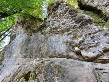 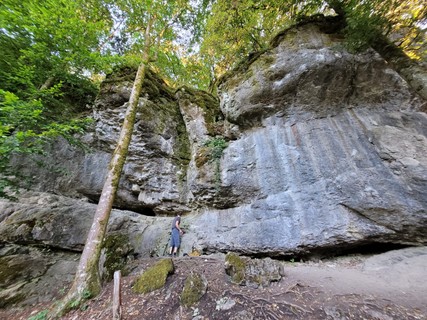  |
1.2.10.8. Steinerne Welt 30 routes in Crag
- Summary:
-
All Sport climbing
Lat / Long: 49.802588, 11.334213
approach
GPS: 11.33417, 49.80269
1.2.10.9. Powereck 19 routes in Crag
- Summary:
-
Bouldering, Sport climbing and Trad climbing
Lat / Long: 49.811393, 11.365242
approach
GPS: 11.36545, 49.81112
1.2.10.10. Wackelstein 8 routes in Crag
- Summary:
-
All Sport climbing
Lat / Long: 49.818191, 11.363450
approach
GPS: 11.36343, 49.81819
1.2.10.11. Schlupflochfels 18 routes in Crag
- Summary:
-
Mostly Sport climbing
Lat / Long: 49.816421, 11.364256
approach
GPS: 11.36487, 49.81641
1.2.10.12. Gangster's Paradise 7 routes in Crag
- Summary:
-
All Sport climbing
Lat / Long: 49.816901, 11.363667
approach
GPS: 11.36365, 49.81707
1.2.10.13. Ailsbachtaler Turm 18 routes in Crag
- Summary:
-
Sport climbing, Bouldering and Trad climbing
Lat / Long: 49.810600, 11.360970
summary
Great crag for anyone who wants to get their fingers on quality 7a's.
access issues
dont park in the field across the street!
approach
drive up the Ailsbachtal past Oberailsfeld. after a few hundred meters is a turnoff to the right towars Pottenstein. take this and park on your left. Walk back towars Oberailsfeld and you will find a path leading up to the tower in less than 2 minuntes. GPS: 11.36098, 49.81062
where to stay
Held Bräu in Oberailsfeld is known for great Beer, but the food is mostly canned and there is no vegetarian option
/99/45/99455cc5275aa81ddeec59fb8d35f7b43562bbb8) /cb/5d/cb5d6ccfa0dc3c9d383f52fa818543454307bf6b) 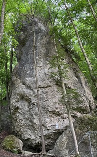 |
1.2.10.14. Zamonien 7 routes in Crag
- Summary:
-
All Sport climbing
Lat / Long: 49.815395, 11.365124
1.2.10.15. Fuchsbau 5 routes in Crag
- Summary:
-
All Sport climbing
Lat / Long: 49.815541, 11.365650
approach
GPS: 11.36564, 49.81556
1.2.10.16. Rennerfelsen 28 routes in Crag
- Summary:
-
Mostly Sport climbing
Lat / Long: 49.818715, 11.364581
approach
GPS: 11.36461, 49.81874
1.2.10.17. Schneiderloch 11 routes in Crag
- Summary:
-
All Sport climbing
Lat / Long: 49.820609, 11.370318
approach
GPS: 11.37155, 49.82054
1.2.10.18. Rabenstein 43 routes in Crag
- Summary:
-
Mostly Sport climbing
Lat / Long: 49.821763, 11.370969
summary
Large crag directly beneath a medieval castle. Lots of good routes in the upper grades. The high south-west face gets sun until the evening. The east face is shady in the afternoon.
approach
Drive from Behringersmühle towards Kirchahorn. 2.5 km after Oberailsfeld, there is a parking bay on the left directly below the castle (watch out for oncoming cars when turning!). At the east end of the parking, a footpath leads up the hill; follow it for only a few meters and then turn right onto a steep path with a fixed rope that leads directly to the base of the cliff.
GPS: 11.37114, 49.82167
1.2.10.19. Rabensteinwächter 7 routes in Crag
- Summary:
-
All Sport climbing
Lat / Long: 49.821589, 11.371115
summary
Little tower directly below Rabenstein castle.
description
Short, vertical routes with small holds in the north- and east face. One of the hardest summits (in terms of free climbing) in the Frankenjura.
access issues
Park in the big bay below Rabenstein castle. A footpath with some fixed ropes leads directly up to the foot of the "Burg Rabenstein" crag. The "Rabensteinwächter" is at the east end of the wall.
history
The earliest known ascent (maybe even the first ascent) is by Peter Nüssel (TC Edelweiß Fürth) in 1922.
1.2.10.20. Catch me Wandl 1 route in Crag
- Summary:
-
All Sport climbing
Lat / Long: 49.824489, 11.374315
approach
GPS: 11.37415, 49.82451
1.2.10.21. Witchcraft 8 routes in Crag
- Summary:
-
All Sport climbing
Lat / Long: 49.823368, 11.373692
approach
GPS: 11.37369, 49.82336
1.2.10.22. Einstein 12 routes in Crag
- Summary:
-
All Sport climbing
Lat / Long: 49.827952, 11.377253
approach
GPS:
1.2.10.23. Boy's Tempel 0 routes in Boulder
approach
GPS: 11.37724, 49.82600
1.2.10.24. Zauppenberger Wand 10 routes in Crag
- Summary:
-
All Sport climbing
Lat / Long: 49.826080, 11.378692
approach
GPS: 11.37874, 49.82613
1.2.10.25. Heldwand 17 routes in Crag
- Summary:
-
Mostly Sport climbing
Lat / Long: 49.827241, 11.380282
summary
Slightly overhanging wall with lots of pumpy, juggy routes.
access issues
This crag is closed from January 1 until July 15. An active closure is indicated by a warning and 'closed' tag here on the site; when in doubt, signs put up at the crag have precedence!
Dieser Fels ist von 1. Januar bis 15. Juli gesperrt. Eine aktive Sperrung wird auf dieser Seite durch eine Warnung und ein 'gesperrt'-Tag markiert; im Zweifelsfall haben die örtlich aufgehängten Schilder Vorrang!
approach
There is a parking lot directly after the turnoff towards Zauppenberg, in the Ailsbach valley halfway between Oberailsfeld and Kirchahorn. The crag is directly east of the parking lot.
GPS: 11.38042, 49.82735
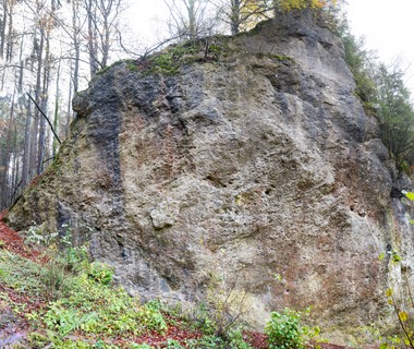 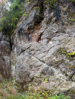 |
1.2.10.26. Hulk-Blöcke 0 routes in Crag
approach
GPS: 11.38208, 49.82755
1.2.10.27. Schweinsmühler Wand 10 routes in Crag
- Summary:
-
All Sport climbing
Lat / Long: 49.826239, 11.383180
approach
GPS: 11.38337, 49.82648
1.2.10.28. Hardcore-Wändchen 12 routes in Crag
- Summary:
-
Bouldering and Sport climbing
Lat / Long: 49.819109, 11.367599
approach
GPS:
1.2.10.29. Rötliches Massiv 9 routes in Crag
- Summary:
-
All Sport climbing
Lat / Long: 49.819886, 11.367928
approach
GPS: 11.36709, 49.82005
1.2.10.30. Strand 11 routes in Crag
- Summary:
-
All Bouldering
Lat / Long: 49.813316, 11.359391
description
Oberailsfelder Boulderblock
1.2.10.31. Tick-Tack-Wand 20 routes in Crag
- Summary:
-
All Sport climbing
Lat / Long: 49.820625, 11.367406
1.2.11. Nankendorf 242 routes in Area
- Summary:
-
Mostly Sport climbing
Lat / Long: 49.890599, 11.347643
1.2.11.1. Lochbergwand 7 routes in Crag
- Summary:
-
All Sport climbing
Lat / Long: 49.862433, 11.335040
1.2.11.2. Nankendorfer Block 15 routes in Crag
- Summary:
-
Mostly Sport climbing
Lat / Long: 49.866328, 11.339262
summary
Big chunk of rock with a massive roof in the left part, which keeps the routes below it dry in the rain.
approach
Drive from Waischenfeld towards Nankendorf. When you drive through you will see an obvious big Block at the end of the village on the right. That's it! GPS: 11.33915, 49.86641
 |
1.2.11.3. Roter Turm 2 routes in Crag
- Summary:
-
All Trad climbing
Lat / Long: 49.871360, 11.338137
summary
Nice tower at the roadside, collector's item.
1.2.11.4. Loreleyblock 25 routes in Crag
- Summary:
-
Mostly Sport climbing
Lat / Long: 49.874116, 11.340094
summary
Free-standing tower with good routes in the north face.
description
Die Ponderosa wurde 2003 von Jörg Zeidelhack und Mike Sauter erschlossen. Erstbegangen wurde der Block, der ursprünglich „Loreleyblock“ hieß, aber bereits vor 1931. 🤓 Jörg Perwitzschky hat den Block 2023 saniert und in Rücksprache mit der IG Klettern weitere Linien, sowie Haken ergänzt. Insgesamt warten jetzt 24 Routen zwischen 6 und 9- auf euch. Mehr Infos: https://ig-klettern.org/?p=27543
Known for decades as "Loreleyblock" and hardly ever visited, this crag was reimagined as "Ponderosa" at the beginning of the 21st century.
approach
Drive from Nankendorf towards Plankenfels. After about 1 km, in a big right turn, there is space for parking on the left.
Walk alongside the road towards Nankendorf for 100 m, then cross the street and walk up a steep path to the base of the tower.
Coordinates:
1.2.11.5. Loreley 6 routes in Crag
- Summary:
-
All Sport climbing
Lat / Long: 49.874394, 11.340335
approach
GPS: 11.34026, 49.87445
1.2.11.6. Geckofels 7 routes in Crag
- Summary:
-
All Sport climbing
Lat / Long: 49.875165, 11.336911
access issues
This crag is closed from January 1 until July 15. An active closure is indicated by a warning and 'closed' tag here on the site; when in doubt, signs put up at the crag have precedence!
Dieser Fels ist von 1. Januar bis 15. Juli gesperrt. Eine aktive Sperrung wird auf dieser Seite durch eine Warnung und ein 'gesperrt'-Tag markiert; im Zweifelsfall haben die örtlich aufgehängten Schilder Vorrang!
approach
GPS: 11.33677, 49.87519
1.2.11.7. Freudenhaus 32 routes in Crag
- Summary:
-
Mostly Sport climbing
Lat / Long: 49.875646, 11.338185
access issues
Parts of this crag are closed from January 1 until July 31. An active closure is indicated by a warning and 'closed' tag here on the site; when in doubt, signs put up at the crag have precedence!
Teile dieses Felsens sind von 1. Januar bis 31. Juli gesperrt. Eine aktive Sperrung wird auf dieser Seite durch eine Warnung und ein 'gesperrt'-Tag markiert; im Zweifelsfall haben die örtlich aufgehängten Schilder Vorrang!
approach
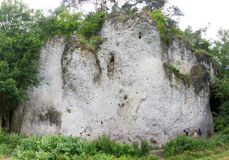 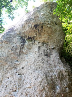 |
1.2.11.8. Hinterzimmer 7 routes in Cliff
- Summary:
-
All Sport climbing
Lat / Long: 49.876055, 11.338437
1.2.11.9. Mader Gedenkwand 12 routes in Crag
- Summary:
-
Mostly Sport climbing
Lat / Long: 49.876349, 11.337393
summary
Impressively overhanging wall with good pocket climbs.
description
With "Stalingrad", "Eisbär" and "Zock", this steeply overhanging crag offers some very nice routes in the 9th grade. In the left part of the wall, some even harder routes lead up the blank-looking overhang, whereas the right part awaits with the delicate, balancy arête "Tempo 60" and the beautiful pocket climb "Metas Welt".
approach
Drive from Nankendorf towards Plankenfels. After a big left turn, there is a large parking bay on the left.
Walk on towards Plankenfels along the street and cross the river Wiesent on your left. Directly after the bridge, a broad hiking path leads back south along the Wiesent. After 300 meters, you will see "Frankenstüble" up the hill. Continue for another 150 meters, past the base of "Rupertuswand". The crag will be directly above the path, with a small trail leading up to it (keep left to avoid a high step).
1.2.11.10. Rupertuswand 24 routes in Crag
- Summary:
-
Mostly Sport climbing
Lat / Long: 49.876537, 11.336660
summary
Shady north face split into two parts, the left of which has seen a renaissance with a handful of new intermediate routes. Harder routes in black rock in the right part.
approach
Drive from Nankendorf towards Plankenfels. After a big left turn, there is a large parking bay on the left.
Walk on towards Plankenfels along the street and cross the river Wiesent on your left. Directly after the bridge, a broad hiking path leads back south along the Wiesent. After 300 meters, you will see "Frankenstüble" up the hill. Continue for another 100 meters. The right part of the crag will be directly above you with a small trail leading up to it. The left part is best reached via "Mader Gedenkwand": continue on for 50 meters on the dirt road and walk up a small path, passing beneath the foot of "Mader Gedenkwand".
GPS: 11.33658, 49.87669
1.2.11.11. Spaßwand 10 routes in Crag
- Summary:
-
Mostly Sport climbing
Lat / Long: 49.876369, 11.335477
approach
GPS: 11.33555, 49.87642
1.2.11.12. Frankenstüble 16 routes in Crag
- Summary:
-
All Sport climbing
Lat / Long: 49.876843, 11.334853
approach
GPS: 11.33511, 49.87671
 |
1.2.11.13. Truppachwand 9 routes in Crag
- Summary:
-
All Sport climbing
Lat / Long: 49.879132, 11.336839
/37/bd/37bd5b38152cb539a1b423e6707a119c02bb8f8d) |
1.2.11.14. Plankenfelser Schlossturm 19 routes in Crag
- Summary:
-
All Sport climbing
Lat / Long: 49.885255, 11.332852
approach
From Nankendorf only a few km North, you will find Plankenfels, park in the village near the Gasthof, but please respect their property, it gets quite crowded especially on weekends. to the right of the Gathof is a street called Schlossanger, here you head down to the littlle Schloss, (a restored old castletower) in front of it you will find a path leading down to the bottom of the crag. GPS: 11.33274, 49.88516
1.2.11.15. Oberer Sonnwendstein 12 routes in Crag
- Summary:
-
Sport climbing and Trad climbing
Lat / Long: 49.893474, 11.344433
approach
GPS: 11.34454, 49.89354
1.2.11.16. Plankenstein 29 routes in Crag
- Summary:
-
Mostly Sport climbing
Lat / Long: 49.893605, 11.343940
approach
GPS: 11.34390, 49.89357
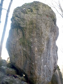 |
1.2.11.17. Lochauer Wand 10 routes in Crag
- Summary:
-
All Sport climbing
Lat / Long: 49.909224, 11.346406
access issues
This crag is usually closed from January 1 until July 31. An active closure is indicated by a warning and 'closed' tag here on the site; when in doubt, signs put up at the crag have precedence!
Dieser Fels ist üblicherweise von 1. Januar bis 31. Juli gesperrt. Eine aktive Sperrung wird auf dieser Seite durch eine Warnung und ein 'gesperrt'-Tag markiert; im Zweifelsfall haben die örtlich aufgehängten Schilder Vorrang!
1.2.12. Engelhardsberg 121 routes in Area
- Summary:
-
Mostly Sport climbing
Lat / Long: 49.787589, 11.300005
| Route | Grade | Style | Selected ascents | |||||
|---|---|---|---|---|---|---|---|---|
BoulderThis section lists boulders in this area without giving an exact location to stay in line with the Boulder Appell. Please do not locate these boulders until further notice. | ||||||||
| 11 | Toya Sit | 8B | ||||||
| 12 |
Semper Fi
Located directyl next to Toya Sit. | 8B | ||||||
1.2.12.1. Kammer 56 routes in Crag
- Summary:
-
Mostly Sport climbing
Lat / Long: 49.792963, 11.283212
approach
Park near the bus station (49.797191, 11.29304) in Engelhardsberg. Walk 100m north and turn left on a track with a green bar. Crag GPS: (49.79262, 11.28349)
1.2.12.2. Quackenschloss 11 routes in Cliff
- Summary:
-
Mostly Sport climbing
Lat / Long: 49.789453, 11.287915
description
Shady routes at a cliff with a small grotte. The routes all start at the north side. The base is quite blocky and overgrown. Apart from the first two routes, the climbs can be found in the central north wall and at the western buttress (R1-R4), which is best accessed from below and west.
approach
GPS: 11.28724, 49.78965
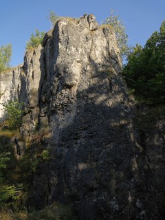 |
1.2.12.3. Leygoff Gedenkwand 4 routes in Crag
- Summary:
-
All Sport climbing
Lat / Long: 49.785894, 11.298310
approach
GPS: 11.29870, 49.78635
1.2.12.4. Räuberburg 17 routes in Crag
- Summary:
-
Mostly Sport climbing
Lat / Long: 49.781807, 11.309606
summary
Nicely set in the forest with a nearby campsite.
description
A shorter crag that will suit beginners with someone to lead some of the climbs. It's near the campsite in Moritz and it will get a fair bit of use from the people staying there.
access issues
Please don't park inside the village.
approach
Between Behringersmühle and Engelhardsberg; drive from Behringersm. towards Waischenfeld. After 800 m, there is a turn off to the left towards Engelhardsberg. Up this for about 1 km, then left towards Moritz. Park before the village on the right.
Walk up the main road through the village; after a square-like crossing, follow the hiking trail marked with a vertical red bar on white background. You will pass between two sheds and arrive in the forest. The crag is on your right after a few meters.
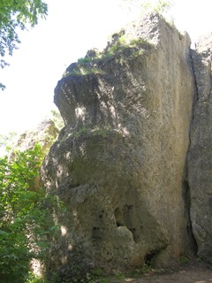 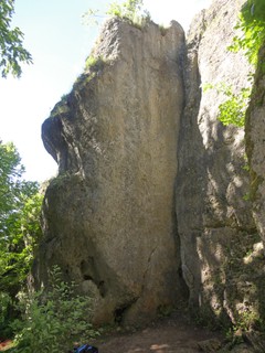   |
1.2.12.5. Moritzer Turm 14 routes in Crag
- Summary:
-
Mostly Sport climbing
Lat / Long: 49.781892, 11.310099
summary
Impressive free standing tower with fantastic face climbs.
access issues
Near a few houses and the owners are sort of sick of the amount of climbers here, so please be quiet and don't stay until midnight. Also take care with walking and avoid walking through the fields.Observe the new rules: https://ig-klettern.org/2021/04/probleme-am-moritzer-turm
approach
Between Behringersmühle and Engelhardsberg; drive from Behringersm. towards Waischenfeld. After 800 m, there is a turn off to the left towards Engelhardsberg. Up this for about 1 km, then left towards Moritz. Park before the village on the right. You can see the crag already.
Walk up the main road through the village; after a square-like crossing, follow the hiking trail marked with a vertical red bar on white background. You will pass between two sheds and arrive in the forest. Follow the trail for about 150 m, passing the crag "Räuberburg" on your right, then leave the path to the right, down the hill, and walk back along the rocks until you reach the crag.
1.2.12.6. Brüderwand 4 routes in Crag
- Summary:
-
Sport climbing and Trad climbing
Lat / Long: 49.777551, 11.307650
approach
GPS: 11.30761, 49.77757
1.2.12.7. Schwesternwand 3 routes in Crag
- Summary:
-
Sport climbing and Trad climbing
Lat / Long: 49.777641, 11.307792
approach
GPS: 11.30779, 49.77762
1.2.12.8. Stille Aussicht / Rhinozeros 6 routes in Crag
- Summary:
-
All Sport climbing
Lat / Long: 49.777812, 11.308023
approach
GPS: 11.30813, 49.77776
1.2.12.9. Schlagerturm / Scheibe 4 routes in Crag
- Summary:
-
All Sport climbing
Lat / Long: 49.776998, 11.308857
approach
GPS: 11.30821, 49.77700 (Schlagerturm)
1.2.13. Mittleres Wiesenttal 1,017 routes in Area
- Summary:
-
Mostly Sport climbing
Lat / Long: 49.821351, 11.327853
description
from Waischenfeld to Behringermühle
1.2.13.1. Wiesentturm 4 routes in Crag
- Summary:
-
Sport climbing and Trad climbing
Lat / Long: 49.780760, 11.327324
approach
GPS: 11.32718, 49.78075
1.2.13.2. Aschenbrennerwand 5 routes in Crag
- Summary:
-
All Sport climbing
Lat / Long: 49.781427, 11.326505
approach
GPS: 11.32627, 49.78148
1.2.13.3. Walter Schnell Gedenkwand 3 routes in Crag
- Summary:
-
All Sport climbing
Lat / Long: 49.782139, 11.326499
summary
A relatively narrow pillar with only three routes: a classic crack in the middle, between a nice slab climb on the left and a slightly adventurous line on the right.
approach
Park in Behringersmühle. In the center, slightly north of the little gas station, follow "Wiesentweg" westward. About 200 meters after the last house, a hiking trail leads uphill (signs towards Wagnerfelsen/Wiesentfelsen). Follow this trail for a short while, up to the base of a little rock tower. Turn right onto a hardly visible track that leads to the crag in a few meters.
GPS: 11.32582, 49.78221
1.2.13.4. Wiesentfelsen 16 routes in Crag
- Summary:
-
Mostly Sport climbing
Lat / Long: 49.782997, 11.326358
approach
GPS: 11.32615, 49.78305
1.2.13.5. Bohrinsel 6 routes in Crag
- Summary:
-
All Sport climbing
Lat / Long: 49.787528, 11.321013
approach
like Frankenzirkus, GPS: 11.32098, 49.78756
1.2.13.6. Frankenzirkus 11 routes in Crag
- Summary:
-
Mostly Sport climbing
Lat / Long: 49.788069, 11.320705
approach
GPS: 11.32087, 49.78790
1.2.13.7. Höhlenstein 11 routes in Crag
- Summary:
-
All Sport climbing
Lat / Long: 49.789564, 11.316219
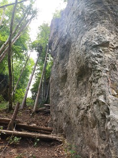 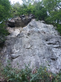 |
1.2.13.8. Schottertaler Turm 8 routes in Crag
- Summary:
-
Sport climbing and Trad climbing
Lat / Long: 49.791300, 11.318964
approach
GPS: 11.31905, 49.79131
1.2.13.9. Schottertaler Wand 9 routes in Crag
- Summary:
-
Mostly Sport climbing
Lat / Long: 49.791785, 11.319231
approach
GPS: 11.31918, 49.79172
1.2.13.10. Kathedrale 18 routes in Crag
- Summary:
-
All Sport climbing
Lat / Long: 49.793788, 11.318164
summary
Impressive cave-like crag; very chossy in most places.
approach
GPS: 11.31808, 49.79370
1.2.13.11. Affentheater 27 routes in Crag
- Summary:
-
All Sport climbing
Lat / Long: 49.793091, 11.315563
description
Some craglets spread in the forest, nice and shady and due to the close road not quite as popular as other crags in this valley.
approach
Drive from Behringersmühle (Gößweinstein) towards Waischenfeld. After about 2.3km, there is a circular shaped parking spot on your right. Walk upriver and after 50m follow a dirt road uphill for 100m. Here, the track turns into a path which leads in a few meters to the first routes.
GPS: 11.31596, 49.79313
   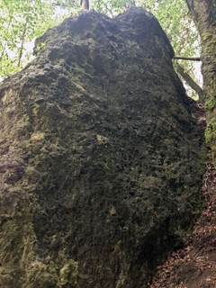   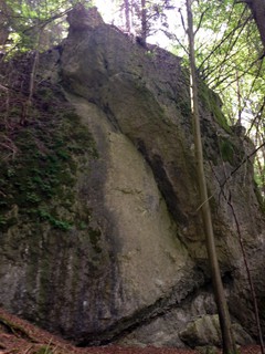 |
1.2.13.12. Karwendelturm 6 routes in Crag
- Summary:
-
All Sport climbing
Lat / Long: 49.792821, 11.319751
approach
GPS: 11.31938, 49.79278
1.2.13.13. Wiesentblick 9 routes in Crag
- Summary:
-
Mostly Sport climbing
Lat / Long: 49.793900, 11.319253
approach
GPS: 11.31918, 49.79384
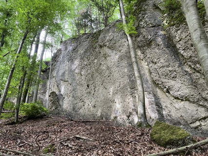 |
1.2.13.14. Kalte Wand 36 routes in Crag
- Summary:
-
Mostly Sport climbing
Lat / Long: 49.798062, 11.308767
description
"Kalte Wand" means "cold wall". And it's really a good place for hot summer.
approach
(49.799032, 11.306773) at the gravel stripe behind the restaurant "Schottermühle". Don't park at the parking of the restaurant. Follow the road for 100m east until after the wall a short steep path (hangeling rope) leads you in 2min upt to the main crag (49.798004, 11.308784).
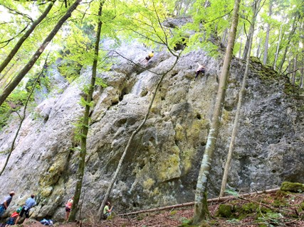 |
1.2.13.15. Gelber Turm 11 routes in Crag
- Summary:
-
Sport climbing and Trad climbing
Lat / Long: 49.798851, 11.309988
summary
High tower with yellow rock; it is worthwhile paying it a visit just to climb the classic south face ("Direkte Talseite").
access issues
This crag is usually closed from February 1 until June 30. An active closure is indicated by a warning and 'closed' tag here on the site; when in doubt, signs put up at the crag have precedence!
Dieser Fels ist üblicherweise von 1. Februar bis 30. Juni gesperrt. Eine aktive Sperrung wird auf dieser Seite durch eine Warnung und ein 'gesperrt'-Tag markiert; im Zweifelsfall haben die örtlich aufgehängten Schilder Vorrang!
approach
GPS: 11.30990, 49.79894
1.2.13.16. Magdalenenwand 6 routes in Crag
- Summary:
-
All Sport climbing
Lat / Long: 49.799159, 11.311177
approach
GPS: 11.31112, 49.79910
1.2.13.17. Wintergarten 10 routes in Crag
- Summary:
-
Mostly Sport climbing
Lat / Long: 49.799298, 11.309204
summary
Two little walls with a handful of routes in the 6th and 7th grade UIAA. Sunny in winter.
description
Small crag with two walls established by Eric Barnert, Ludwig Veith, Jo Fischer and Thorsten Schröder in 2001. The left wall features three pocket climbs with an overhang in the upper part, whereas the right wall has a little bulge at the start, followed by vertical climbing.
approach
Park at Schottersmühle, then cross the wooden bridge and turn slightly right and walk up to the lonely house, in front of which a marked hiking path leads up the hill. Follow this for about 100 meters; you can already see the crag to the right above you. A faint track leads to the base of the crag (you will arrive from above and left, don't try to go up directly).
GPS: 11.30927, 49.79927
1.2.13.18. Wolkensteiner Wand 24 routes in Crag
- Summary:
-
Mostly Sport climbing
Lat / Long: 49.800627, 11.302227
access issues
This crag is usually closed from January 1 until July 31. An active closure is indicated by a warning and 'closed' tag here on the site; when in doubt, signs put up at the crag have precedence!
Dieser Fels ist üblicherweise von 1. Januar bis 31. Juli gesperrt. Eine aktive Sperrung wird auf dieser Seite durch eine Warnung und ein 'gesperrt'-Tag markiert; im Zweifelsfall haben die örtlich aufgehängten Schilder Vorrang!
approach
Von Doos in Richtung Behringersmühle fahren. Nach 1,4 km befindet sich auf der rechten Seite eine kleine Parkbucht, direkt gegenüber eines kleinen Haus auf der anderen Seite des Flusses. Vom rechten Ende der Bucht führt ein Waldweg bergauf. Nach ca. 150 m führt rechts ein kleiner Weg zum Fuß des Felsens.
Drive from Doos towards Behringersmühle. After 1.4 km, there is a small parking bay on your right, directly opposite a lonely house on the other side of the river. From the right end of the bay, a forest road leads uphill. Keep straight for about 150 meters, where a small track on the right leads to the foot of the crag.
GPS: 11.30198, 49.80098
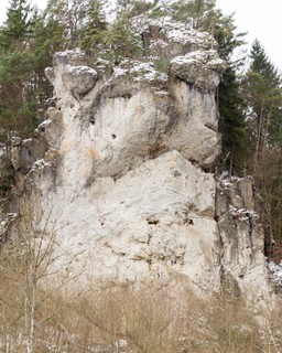 |
1.2.13.19. Schiefer Tod 17 routes in Crag
- Summary:
-
Mostly Sport climbing
Lat / Long: 49.802013, 11.299929
summary
This north-east face has the most to offer for climbers looking for routes in the 9th grade UIAA and above. Don't miss the easier classic namesake traverse, though!
description
The crag consists of two massive overhangs with high-end routes on the left ("Riders of Doom") and right ("I Bleed Black"), and a relatively vertical, sometimes even slabby part in the middle.
The old traverse goes up to the beginning of the right overhang and then pulls out diagonally left under the roof and on top of the left overhang to a belay, crossing the popular 9th grade routes like "Totenbrett" and "Gelber Blaser" in the process.
At the left end, just avoiding the roof, are the two easiest non-traverse lines, "Leichenschmaus" and "Abgesang"; the latter has to be protected with nuts and cams.
The far right route of the crag is, interestingly enough, another traverse ("Letzte Instanz"), going up around the right overhang and traversing to the left along its edge.
There is lots of loose rock in the lower part of most of the routes, but the rock quality gets better with the height.
approach
Drive from Doos towards Behringersmühle. After 1.4 km, there is a small parking bay on your right, directly opposite a lonely house on the other side of the river. From the right end of the bay, a forest road leads uphill. Follow it for a few meters and then branch off right onto another forest road, which leads directly to the crag.
GPS: 11.29973, 49.80217
1.2.13.20. Schottersmühler Wand 28 routes in Crag
- Summary:
-
Mostly Sport climbing
Lat / Long: 49.801559, 11.303181
approach
GPS: 11.30296, 49.80156
1.2.13.21. Abendleite 9 routes in Crag
- Summary:
-
Trad climbing and Sport climbing
Lat / Long: 49.802247, 11.302469
approach
GPS: 11.30248, 49.80228
1.2.13.22. Schottertaler Querung 7 routes in Crag
- Summary:
-
Mostly Sport climbing
Lat / Long: 49.803443, 11.301050
1.2.13.23. Jubiläumswand 34 routes in Crag
- Summary:
-
Mostly Sport climbing
Lat / Long: 49.803276, 11.301772
approach
GPS: 11.30173, 49.80324
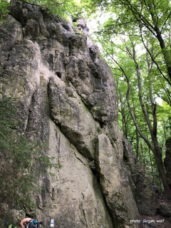  |
1.2.13.24. Morgenleite 35 routes in Crag
- Summary:
-
Mostly Sport climbing
Lat / Long: 49.804019, 11.298912
summary
Some worthwhile climbs in the 8 grade and some very short and steep recent additions make this a crag suitable to strong and elsewhere bored locals. Lots of trees will keep it mostly cool in summer.
description
Not the crag you will take your overseas visitors to. It might still be worthwile if you look for a few routes in the 8-grade range, these routes certainly look best. There is drinking water from a fountain near the road.
approach
Drive from Behringersmühle towards Waischenfeld. A few km after Schottersmühle you will find a small sign on the left with "Riesenburg" and anoher 100m a bigger parking lot on the right (next to a little stone building), park here. Walk across the river and turn right on the walking track. 200m down the valley you will see the crag on your left; scramble up the hardly visible track (50m) GPS: 11.29882, 49.80401
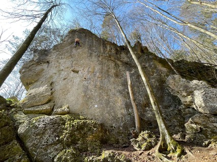 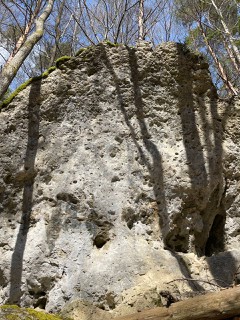 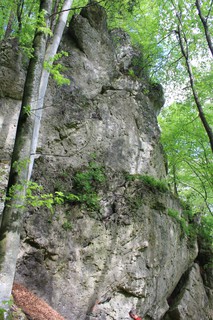 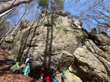 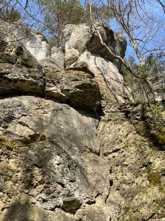 |
1.2.13.25. Mittagsleite 9 routes in Crag
- Summary:
-
All Sport climbing
Lat / Long: 49.804425, 11.297104
summary
The trees will keep it in the shade all day. There is drinking water from a fountain near the road.
description
Hardly visited, but at least you are going to be alone here. You will most likely need another crag on the same day, Morgenleite is just a few meters down the valley.
approach
Drive from Behringersmühle towards Waischenfeld. A few km after Schottersmühle, you will find a small sign on the left with "Riesenburg" and anoher 100m a bigger parking lot on the right (next to a little stone building), park here. Walk across the river and turn right on the walking track. 80m down the valley you will see the crag on your left; scramble up the hardly visible track (50m). GPS: 11.29709, 49.80447
1.2.13.26. Altersheim 8 routes in Crag
- Summary:
-
All Sport climbing
Lat / Long: 49.806599, 11.299025
1.2.13.27. Riesenburg 15 routes in Crag
- Summary:
-
Mostly Sport climbing
Lat / Long: 49.803248, 11.297035
approach
Drive from Behringersmühle towards Waischenfeld. After Schottersmühle, you will find a small parking spot on the left signed with "Riesenburg"; park here. Walk up a track to the crag.
GPS: 11.29728, 49.80316
1.2.13.28. Obere Riesenburgwand 3 routes in Crag
- Summary:
-
All Sport climbing
Lat / Long: 49.803492, 11.295810
approach
GPS:11.29586, 49.80351
1.2.13.29. Altherrnwand 5 routes in Crag
- Summary:
-
Sport climbing and Trad climbing
Lat / Long: 49.803657, 11.294674
summary
Tall east face with long, adventurous routes. Vegetated lower part.
description
Only advisable after a long dry spell. The lower 10 to 15 meters are full of moss and other vegetation and for the most part are unprotected. A few nuts and slings are advisable for the upper part as well.
approach
GPS: 11.29481, 49.80282
1.2.13.30. Moosiger Turm 1 route in Cliff
- Summary:
-
All Trad climbing
1.2.13.31. Grünbauer Gedenkwand 13 routes in Crag
- Summary:
-
Mostly Sport climbing
Lat / Long: 49.803837, 11.294593
approach
GPS: 11.29441, 49.80396
1.2.13.32. Dohlenwand 10 routes in Crag
- Summary:
-
All Sport climbing
Lat / Long: 49.804735, 11.293371
description
The crag has two tiers, untere (lower) und obere (upper) Dohlenwand with different approach.
access issues
This crag is closed from January 1 until July 31. An active closure is indicated by a warning and 'closed' tag here on the site; when in doubt, signs put up at the crag have precedence!
Dieser Fels ist von 1. Januar bis 31. Juli gesperrt. Eine aktive Sperrung wird auf dieser Seite durch eine Warnung und ein 'gesperrt'-Tag markiert; im Zweifelsfall haben die örtlich aufgehängten Schilder Vorrang!
approach
GPS: 11.29384, 49.80474
1.2.13.33. Galawand 9 routes in Crag
- Summary:
-
All Sport climbing
Lat / Long: 49.806232, 11.297593
summary
Impressive grotto, steep on the left, vertical on the right. Some very good looking lines, perfect for summer since it's always very shady here.
description
Steeply overhanging grotto, the bottom of which is filled with massive boulders. Mainly athletic overhang climbing in the left part. The right-hand side offers good climbing in vertical terrain.
The proximity to the creek and the hillside above keep it wet for a long time and it's rarely possible to climb the steep routes on the left.
approach
Drive from Behringersmühle towards Waischenfeld. One kilometer after Schottersmühle, you will find a small sign on the left for "Riesenburg" and a bigger parking lot on the right a bit further on (next to a little stone building). Park here, cross the river and turn left onto the walking track. 150 m up the valley you will see the crag on your right.
Coordinates:
1.2.13.34. Kajakwand 5 routes in Crag
- Summary:
-
Sport climbing and Bouldering
Lat / Long: 49.811031, 11.294637
approach
GPS: 11.29462, 49.81101
 |
1.2.13.35. Sieghardtsfelsen 9 routes in Cliff
- Summary:
-
All Sport climbing
Lat / Long: 49.809670, 11.298760
description
Großes Felstor
approach
Vom Parkplatz am Kajakverleih über die Wiesentbrücke und der Beschilderung folgen.
1.2.13.36. Sonnwendwände 64 routes in Crag
- Summary:
-
Mostly Sport climbing
Lat / Long: 49.811485, 11.303004
summary
Shady crag with lots of routes in the middle grades. Many of the routes in the right part lack an anchor, so bring long slings.
approach
Park in Doos. Cross the bridge over the Wiesent (hiking trail towards Behringersmühle/Waischenfeld) and take a right at the first intersection. After a few meters, take a left onto a hiking trail marked red/white, follow that for about 100 meters. You will reach a broader path, from which you can see a forest road to the left. Approach that road and follow it uphill for a few hundred meters. The crag will be on your right above the road.
1.2.13.37. Blechfass 11 routes in Crag
- Summary:
-
All Sport climbing
Lat / Long: 49.814113, 11.300578
summary
The rock quality isn't as good as in other areas but the routes climb well and are worth a visit.
description
Vertical to slightly overhanging; all routes by Stefan Löw.
approach
Park in Doos, walk on the road upstream and turn left 40m after the last house onto a dirt road with a gate. Follow the ascending path for about 250 m to the crag, continue along to Megalumania in 1 minute.
GPS: 11.30058, 49.81412
/c3/d7/c3d7e21a2a56ef7f35797296c52132378737122c) |
1.2.13.38. Megalumania 13 routes in Crag
- Summary:
-
All Sport climbing
Lat / Long: 49.814599, 11.301090
approach
GPS: 11.30123, 49.81432
1.2.13.39. Eigerwand 2 routes in Crag
- Summary:
-
All Trad climbing
Lat / Long: 49.815181, 11.302296
summary
Chossy wall with two alpine routes that haven't seen many repeats.
description
Forgotten wall shortly north of Doos. The name already suggests what awaits you here: alpine routes in brittle rock with scarce protection.
approach
Park in Doos. Then walk towards Waischenfeld on the cycle path for around 600 m. The crag is on the left, behind a boulder directly next to the road.
1.2.13.40. Bischofsberg 8 routes in Crag
- Summary:
-
All Sport climbing
Lat / Long: 49.814437, 11.308740
1.2.13.41. Leykauf Gedenkwand 21 routes in Crag
- Summary:
-
Mostly Sport climbing
Lat / Long: 49.816849, 11.311550
summary
Two walls with a variety of routes in the 7th and 8th grades UIAA.
description
The left part of the crag is a vertical wall with a bulge in the middle and a slightly overhanging top part. The routes are mainly in the 8th grade. The right wall harbours the classic dihedral, which separates the routes in the 7th grade (left) from the ones in the 8th grade (right). The protection is not always good, but you can judge it relatively well from below. Also, the rock quality varies, with some fragile structures which should be treated carefully. Overall, there are some gems to be found.
approach
Park in Doos. Cross the bridge across the Wiesent opposite the therapy centre, then turn left (east) towards Rabeneck. Follow the hiking trail until you reach a small hydroelectric power plant. You can see the crag above you to the right. After a few meters, a faint track leads uphill to its base.
GPS: 11.31183, 49.81685
1.2.13.42. Schwarze Wand 31 routes in Crag
- Summary:
-
All Sport climbing
Lat / Long: 49.818622, 11.310151
approach
Drive from Doos towards Waischenfeld. After 1.25 km there is a parking bay on the right side (there is a small hydro station at the river). Park here, cross the street and walk up the small footpath to the crag.
GPS: 11.31012, 49.81867
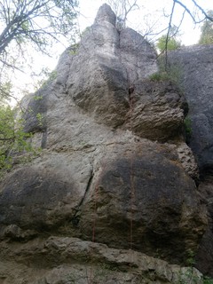 |
1.2.13.43. Bandstein 28 routes in Crag
- Summary:
-
Mostly Sport climbing
Lat / Long: 49.819417, 11.310521
access issues
This crag is usually closed from February 1 until June 30. An active closure is indicated by a warning and 'closed' tag here on the site; when in doubt, signs put up at the crag have precedence!
Dieser Fels ist üblicherweise von 1. Februar bis 30. Juni gesperrt. Eine aktive Sperrung wird auf dieser Seite durch eine Warnung und ein 'gesperrt'-Tag markiert; im Zweifelsfall haben die örtlich aufgehängten Schilder Vorrang!
approach
(49.819703, 11.311196) You already see the wall up left, just follow a path for 100m.
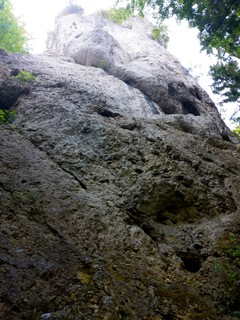 |
1.2.13.44. Zwergenschloss 48 routes in Crag
- Summary:
-
Mostly Sport climbing
Lat / Long: 49.822141, 11.309643
access issues
Parts of this crag are usually closed from October 1 until March 31. An active closure is indicated by a warning and 'closed' tag here on the site; when in doubt, signs put up at the crag have precedence!
Teile dieses Felsens sind üblicherweise von 1. Oktober bis 31. März gesperrt. Eine aktive Sperrung wird auf dieser Seite durch eine Warnung und ein 'gesperrt'-Tag markiert; im Zweifelsfall haben die örtlich aufgehängten Schilder Vorrang!
approach
GPS: 11.30940, 49.82226
1.2.13.45. Hacke Gedenkwand 10 routes in Crag
- Summary:
-
Sport climbing and Trad climbing
Lat / Long: 49.820586, 11.317499
summary
An old crag that has recently been revived. The classic routes with meagre protection have been complemented with a few well-protected sport climbs.
description
The south-facing wall is named after a guy named Erwin Hacke – whose significance, to my knowledge, has been long forgotten. It features a deep, narrow chimney, separating the main wall from a broad buttress. The classic routes are sort of daring, but all in all worthwile.
approach
Drive from Doos towards Waischenfeld. Park either after 1.25 km (the parking bay on the right, as for "Schwarze Wand" and "Bandstein") or continue to the hamlet Rabeneck and park there. The crag is halfway between the parking lots, so walk along the cycle path that is currently constructed (or the road) for 750 meters, where a hardly visible path leads up to the wall.
GPS: 11.31744,49.82054
1.2.13.46. Peterswandl 3 routes in Crag
- Summary:
-
All Trad climbing
Lat / Long: 49.821015, 11.318657
summary
Small wall-like tower between "Hacke Gedenkwand" and "Alitzstein", hard to find.
description
Forgotten little tower. The weather vane is broken off and rusted, so there's currently no way to abseil down.
1.2.13.47. Alitzstein 5 routes in Crag
- Summary:
-
Trad climbing and Sport climbing
Lat / Long: 49.820698, 11.319756
approach
GPS: 11.31969, 49.82073
1.2.13.48. Fischer-Schneider Gedenkwand 7 routes in Crag
- Summary:
-
Sport climbing, Aid climbing and Trad climbing
Lat / Long: 49.820846, 11.321456
summary
Small, forgotten crag with easy routes.
description
The old route in the south face (which now has a good direct start) has been supplemented with easy routes in the west face in the early 90's.
history
The first route here was set up in remembrance of members of the Bayreuth section of the German Alpine Club who died in the second world war, Wilhelm Fischer and Max Schneider.
1.2.13.49. Schrollwand 13 routes in Crag
- Summary:
-
Mostly Sport climbing
Lat / Long: 49.819324, 11.321368
approach
GPS: 11.32143, 49.81941
1.2.13.50. Bayreuther Riss 17 routes in Crag
- Summary:
-
Mostly Sport climbing
Lat / Long: 49.821497, 11.323786
summary
South-east face with one classic crack and a lot of new routes in the 9th and 10th grades in slightly overhanging white rock. Good in winter.
approach
Drive from Doos towards Waischenfeld and park at the hamlet Rabeneck. Walk back along the street for around 200 meters, where a faint track leads perpendicularly up the hill; at the end of the first fixed rope, turn left and walk around the overhanging block, where another fixed rope brings you up to the foot of the crag.
GPS: 11.32389, 49.82145
1.2.13.51. Treusteiner Wand 15 routes in Crag
- Summary:
-
All Sport climbing
Lat / Long: 49.821889, 11.323847
summary
Impressive free standing pillar with great routes in the mid range.
description
It's 25m high and up above the somewhat noisy road, you can hear the chooks from the mill opposite the road while hanging on the tiny crimps. (They only stop when you get falcons circling above.)
approach
Drive from Behringersmühle towards Waischenfeld. After Doos you will find a small hamlet called Rabeneck (below the castle), park here. Walk back along the road for 150m and up a steep footpath towards the "Bayreuther Riss", but instead of going left below the overhanging block, keep going up and right along the fixed ropes to the crag. GPS: 11.32392, 49.82201
Map of approach: https://ig-klettern.org/2018/05/achtung-aenderung-des-zustiegs-zur-treusteiner-wand/
1.2.13.52. Rabenecker Wand 24 routes in Crag
- Summary:
-
Mostly Sport climbing
Lat / Long: 49.821078, 11.325881
access issues
This crag is usually closed from January 1 until July 31. An active closure is indicated by a warning and 'closed' tag here on the site; when in doubt, signs put up at the crag have precedence!
Dieser Fels ist üblicherweise von 1. Januar bis 31. Juli gesperrt. Eine aktive Sperrung wird auf dieser Seite durch eine Warnung und ein 'gesperrt'-Tag markiert; im Zweifelsfall haben die örtlich aufgehängten Schilder Vorrang!
approach
GPS:
1.2.13.53. Mariandlwand 2 routes in Crag
- Summary:
-
All Sport climbing
Lat / Long: 49.821624, 11.326269
access issues
This crag is usually closed from January 1 until July 31. An active closure is indicated by a warning and 'closed' tag here on the site; when in doubt, signs put up at the crag have precedence!
Dieser Fels ist üblicherweise von 1. Januar bis 31. Juli gesperrt. Eine aktive Sperrung wird auf dieser Seite durch eine Warnung und ein 'gesperrt'-Tag markiert; im Zweifelsfall haben die örtlich aufgehängten Schilder Vorrang!
approach
GPS: 11.32638, 49.82168
1.2.13.54. Headwall 4 routes in Crag
- Summary:
-
All Sport climbing
Lat / Long: 49.826886, 11.326714
approach
GPS: 11.32675, 49.82686
1.2.13.55. Große Dooser Welle 10 routes in Crag
- Summary:
-
All Sport climbing
Lat / Long: 49.829467, 11.331829
summary
two short and steep walls
approach
GPS: 11.33179, 49.82953
1.2.13.56. Dooser Wand 22 routes in Crag
- Summary:
-
Mostly Sport climbing
Lat / Long: 49.829272, 11.332265
approach
Drive from Behringersmühle towards Waischenfeld. After a small hamlet called Rabeneck (below the castle), turn right towards Eichenbirkig (Dooser Wand and the pavilon below are visible just across the river). Park here. Follow a steep footpath to the crag.
GPS: 11.33220, 49.82936
1.2.13.57. Jungfernriss 22 routes in Crag
- Summary:
-
All Sport climbing
Lat / Long: 49.831307, 11.331388
approach
GPS: 11.33150, 49.83156
1.2.13.58. Schrumpelrisse 7 routes in Crag
- Summary:
-
All Sport climbing
Lat / Long: 49.830486, 11.333586
summary
High west face with two classic crack lines and a few worthwhile newer routes.
access issues
Zone 2
approach
Drive from Behringersmühle towards Waischenfeld. After a small hamlet called Rabeneck (below the castle), turn right towards Eichenbirkig (Dooser Wand and the pavilion below are visible just across the river). Park here. Walk upstream along the river for 250m, slightly past the crag which you can see up above the clearing. Up a footpath to the "Schrumpelrisse".
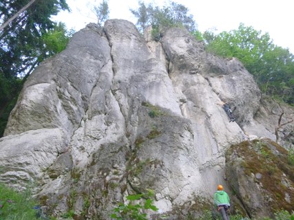 |
1.2.13.59. Kleine Dooser Welle 6 routes in Crag
- Summary:
-
All Sport climbing
Lat / Long: 49.832078, 11.334426
1.2.13.60. Gockerlwand 11 routes in Crag
- Summary:
-
All Sport climbing
Lat / Long: 49.832886, 11.332220
approach
GPS: 11.33218, 49.83294
1.2.13.61. Enigma 20 routes in Crag
- Summary:
-
Mostly Sport climbing
Lat / Long: 49.834795, 11.338465
summary
If you are sick of pockets go here!
description
Face climbing on sharp edges and painful holds is what you mostly get here. The road is unfortunately very close.
approach
Drive up the Wiesenttal past Doos towards Waischenfeld. Directly after Pulvermühle is a parking bay on your right, park here and walk back on the road for about 400m. When the crash barrier on your left ends, crawl up to the crag in 50m.
GPS: 11.33847, 49.83482
1.2.13.62. Pulverfass 7 routes in Crag
- Summary:
-
All Sport climbing
Lat / Long: 49.834116, 11.341797
description
Dusty and shady, but the routes are not that bad. Take a brush with you and you will have a nice lonely day there …
approach
GPS: 11.34181, 49.83419
1.2.13.63. Freistein 6 routes in Crag
- Summary:
-
All Sport climbing
Lat / Long: 49.841033, 11.348705
summary
West-facing crag with outstanding vertical routes on small holds.
description
Directly at the edge of Waischenfeld, this west face offers some of the best vertical climbing in the area. Footwork and finger strength is paramount for the small crimpers and pockets. There isn't a real warmup route around, so maybe stop by another crag before walking here if necessary. The easiest route, "Halluzination" is actually a quite challenging, but at the same time rewarding slab. The highlight of the main wall is "Break Free", but all the routes are worth trying.
approach
In Waischenfeld, cross the Wiesent and turn south towards Zeubach. After the last houses, you can see the crag on your left. Shortly afterwards, there is a turnoff on the right with a parking lot (the sign for parking is hard to see). Park there and walk back the 50 meters to the crag.
GPS: 11.34848, 49.84099
 |
1.2.13.64. Moby Dick 11 routes in Crag
- Summary:
-
All Sport climbing
Lat / Long: 49.841341, 11.349677
approach
GPS: 11.34971, 49.84137
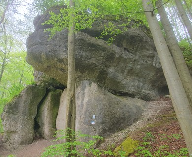 |
1.2.13.65. Steinpilz 10 routes in Crag
- Summary:
-
Sport climbing and Bouldering
Lat / Long: 49.841902, 11.350184
1.2.13.66. Kindergarten 10 routes in Crag
- Summary:
-
Mostly Sport climbing
Lat / Long: 49.842216, 11.349932
summary
Face climbing on small holds, mostly vertical.
approach
GPS: 11.34960, 49.84212
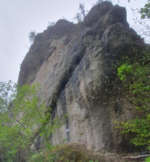 |
1.2.13.67. Waischenfelder Turm 21 routes in Crag
- Summary:
-
Sport climbing, Bouldering and Trad climbing
Lat / Long: 49.845074, 11.364756
summary
Exposed tower-like south face with great pocket climbs and accompanying boulder blocks.
approach
GPS: 11.36470, 49.84503
1.2.13.68. Schlumpfendorf 31 routes in Crag
- Summary:
-
Mostly Sport climbing
Lat / Long: 49.850565, 11.337381
approach
GPS: 11.33684, 49.85066
1.2.13.69. Waldnaabtaler Turm 1 route in Crag
- Summary:
-
All Trad climbing
Lat / Long: 49.850615, 11.333157
summary
Forgotten little tower with a single easy trad route.
1.2.13.70. Harry Potter Wand 20 routes in Crag
- Summary:
-
All Sport climbing
Lat / Long: 49.850486, 11.330486
approach
GPS: 11.33138, 49.85099
1.2.13.71. Clubbwall 11 routes in Crag
- Summary:
-
Sport climbing and Bouldering
Lat / Long: 49.851195, 11.330555
access issues
This crag is usually closed from January 1 until July 30. An active closure is indicated by a warning and 'closed' tag here on the site; when in doubt, signs put up at the crag have precedence!
Dieser Fels ist üblicherweise von 1. Januar bis 31. Juli gesperrt. Eine aktive Sperrung wird auf dieser Seite durch eine Warnung und ein 'gesperrt'-Tag markiert; im Zweifelsfall haben die örtlich aufgehängten Schilder Vorrang!
approach
GPS: 11.33068, 49.85131
1.2.13.72. Terrarium 8 routes in Crag
- Summary:
-
Sport climbing and Bouldering
Lat / Long: 49.851420, 11.328105
summary
Small, steeply overhanging wall with short routes on pockets. It is dry even after days of rain.
approach
Drive from Waischenfeld towards Nankendorf. There is a big parking lot on the left side of the street shortly before the turnoff towards Hubenberg, park here. Walk up the forest road between the street towards Hubenberg and the houses of a bus company. After about 450 meters, shortly before you reach a crossing with a signpost, turn right onto a small path that leads uphill. Once you see a rock tower appearing at the top of the hill, look out for an even smaller path on your right that leads along the edge of the hillside. This path will get you to the crag in a few minutes.
GPS: 11.32810, 49.85143
 |
1.2.13.73. Zellblock / Gummizelle 6 routes in Crag
- Summary:
-
All Sport climbing
Lat / Long: 49.851180, 11.328750
approach
GPS: 11.32872, 49.85120
/e7/b6/e7b6b4622688cd401c86b4749fcd61500ae8e16f)  |
1.2.13.74. Andeltodrom 14 routes in Crag
- Summary:
-
All Sport climbing
Lat / Long: 49.854279, 11.330180
summary
Short, steep routes with perfect Frankenjura pockets.
approach
Drive north from Waischenfeld towards Nankendorf. After a few hundred meters, there is a parking bay on the left. Park here, cross the street and follow the cycle/foot path towards Nankendorf for about 400 meters (bug hotel on the right). Cross the street again and follow the track up the meadow for just a few meters, where a small trail branches off left into the forest. Walk along this trail for about 100 meters and watch out for another small track on the left, which leads to the crag in about two minutes.
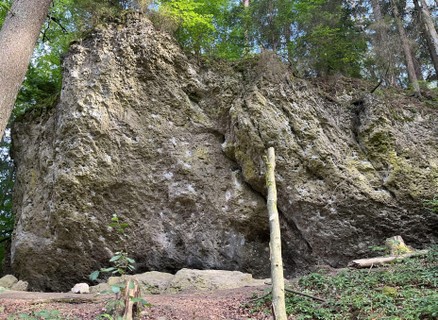 |
1.2.14. Unteres Wiesenttal 708 routes in Area
- Summary:
-
Mostly Sport climbing
Lat / Long: 49.795608, 11.233411
summary
From Behringersmühle to Ebermannstadt.
description
The last big stretch of the Wiesent valley, starting in Behringersmühle, where the Püttlach merges into the Wiesent, and ending in Ebermannstadt, where the valley becomes wider, the slopes become less steep, and the amount of climbable rock diminishes.
The main climbing attractions are found: around the village Streitberg, with its iconic 'Streitberger Schild', east of Burggaillenreuth, with popular crags like the 'Schlossbergwand', and around the hamlet Sachsenmühle, with high, classic crags like 'Norisbabawand'.
1.2.14.1. Ebermannstadt 56 routes in Area
- Summary:
-
Mostly Sport climbing
Lat / Long: 49.784440, 11.224671
1.2.14.2. Muggendorf 78 routes in Area
- Summary:
-
Mostly Sport climbing
Lat / Long: 49.798213, 11.259532
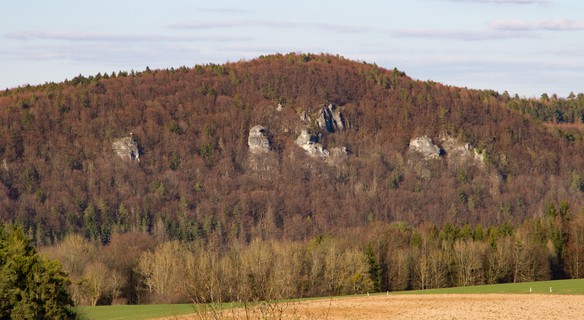 |
1.2.14.3. Burggaillenreuth 161 routes in Area
- Summary:
-
Mostly Sport climbing
Lat / Long: 49.778624, 11.285339
1.2.14.4. Streitberg 191 routes in Area
- Summary:
-
Mostly Sport climbing
Lat / Long: 49.815619, 11.227940
1.2.14.5. Sachsenmühle 222 routes in Area
- Summary:
-
Mostly Sport climbing
Lat / Long: 49.778258, 11.301972
1.2.15. Unteres Püttlachtal 668 routes in Area
- Summary:
-
Mostly Sport climbing
Lat / Long: 49.783219, 11.369072
description
round about Tüchersfeld between Behringersmühle and Pottenstein
1.2.15.1. Universum 34 routes in Crag
- Summary:
-
Mostly Sport climbing
Lat / Long: 49.776821, 11.395986
approach
GPS: 11.39695, 49.77685
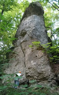 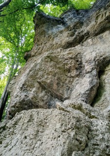 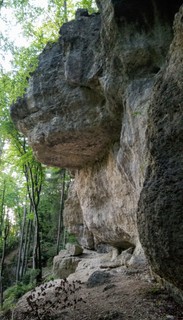 |
1.2.15.2. Paralleluniversum 7 routes in Crag
- Summary:
-
All Sport climbing
Lat / Long: 49.777358, 11.397345
1.2.15.3. Ballast der Republik 3 routes in Cliff
- Summary:
-
All Sport climbing
1.2.15.4. Bärenschluchtwände 80 routes in Crag
- Summary:
-
Mostly Sport climbing
Lat / Long: 49.778052, 11.387722
approach
GPS: 11.38744, 49.77826
1.2.15.5. Ringlerwand 43 routes in Crag
- Summary:
-
Mostly Sport climbing
Lat / Long: 49.779765, 11.379962
summary
some real classics here and popular for a reason.
description
Very good pocket pulling, some of the bolts are quite spaced and you want to be feeling strong. its not too dangerous though and a lot of people use clipsticks anyway.
approach
drive from Pottenstein towards Behringersmühle and shortly after the Camping Bärenschlucht you can see a parking bay on your right. Walk over the bridge from here and turn sharp right through someones property (please be quiet here.) shortly after the buildings you will see the crag on your left. GPS: 11.38042, 49.77994
where to stay
camping Bärenschlucht
1.2.15.6. Püttlacher Turm 2 routes in Crag
- Summary:
-
All Trad climbing
Lat / Long: 49.776058, 11.388937
/10/6f/106f0984cf81decc07ff9441ebc38857e8585edf) |
1.2.15.7. Trockauer Wand 37 routes in Crag
- Summary:
-
Mostly Sport climbing
Lat / Long: 49.776469, 11.388260
summary
Sensational climbing in a shady hole.
description
Some really fantastic lines for those who can climb 9- and up. Some more recent additions by local Markus Bock add to the appeal for strong men & women. The only disadvantage is that lots of routes share the start and it is partly wet quite often.
approach
Drive from Pottenstein towards Behringersmühle, park at Camping Bärenschlucht. From the campsite, walk across the street, up towards Erinnerungswand and follow the walking track to the left past Weidener Wand. GPS: 11.38820, 49.77654
where to stay
Camping Bärenschlucht
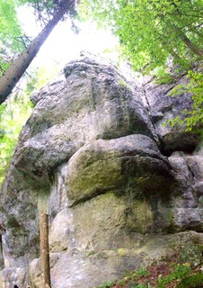 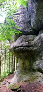 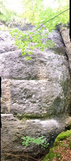 |
1.2.15.8. Weidener Wand 27 routes in Crag
- Summary:
-
Mostly Sport climbing
Lat / Long: 49.777109, 11.386620
approach
Drive fom Pottenstein towards Behringersmühle and park at Camping Bärenschlucht. Cross the main street (B470) and walk up to the crag in 1 min to the left of Erinnerungswand.
/34/7f/347fac116ade3b4ba9f1787718e22588387e363c) /42/b7/42b7fdcb92a8e2a965e27723c92c9160683ebf23) /53/e7/53e797400744cab00595d7baf810e37e82f4e53b) |
1.2.15.9. Erinnerungswand 16 routes in Crag
- Summary:
-
All Sport climbing
Lat / Long: 49.777585, 11.385999
approach
Drive from Pottenstein towards Behringersmühle, park at the campsite "Bärenschlucht" cross the street and up to the visible crag in 1min. GPS: 11.38608, 49.77751
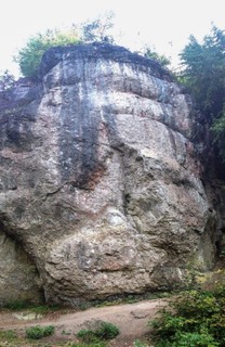 |
1.2.15.10. Püttlachkamin 17 routes in Crag
- Summary:
-
Mostly Sport climbing
Lat / Long: 49.778128, 11.384837
summary
Some classic lines, which climb well if you are not pushing your grade limit.
description
Unfortunately, these routes are often wet, but if they are dry, go for it! It's worth it (maybe bring a brush though).
approach
Drive from Pottenstein towards Behringersmühle, park at the campsite "Bärenschlucht". Walk across the street and up to the visible crag (Erinnerungswand), turn right in front and to the crag in a few meters. GPS: 11.38481, 49.77816
1.2.15.11. Teufelskrallenturm 6 routes in Crag
- Summary:
-
Sport climbing and Trad climbing
Lat / Long: 49.778245, 11.384228
approach
GPS: 11.38428, 49.77822
1.2.15.12. Frankenjoggerturm 7 routes in Crag
- Summary:
-
All Sport climbing
Lat / Long: 49.778523, 11.383517
approach
GPS: 11.38360, 49.77852
1.2.15.13. Piazwand 9 routes in Crag
- Summary:
-
Mostly Sport climbing
Lat / Long: 49.778709, 11.383176
approach
GPS: 11.38311, 49.77873
1.2.15.14. Püttlacher Wand 41 routes in Crag
- Summary:
-
Mostly Sport climbing
Lat / Long: 49.779077, 11.382425
access issues
Parts of this crag are usually closed from February 1 until June 30. An active closure is indicated by a warning and 'closed' tag here on the site; when in doubt, signs put up at the crag have precedence!
Teile dieses Felsens sind üblicherweise von 1. Februar bis 30. Juni gesperrt. Eine aktive Sperrung wird auf dieser Seite durch eine Warnung und ein 'gesperrt'-Tag markiert; im Zweifelsfall haben die örtlich aufgehängten Schilder Vorrang!
approach
Either walk from the campsite across the street, up towards Erinnerungswand and follow the walking track to the right, or park downriver at a little parking bay on the right (same as Ringlerwand) and cross here, then up for 30m and follow the walking track to the left. GPS: 11.38266, 49.77922
 |
1.2.15.15. Püttlachnadel 1 route in Crag
- Summary:
-
All Trad climbing
Lat / Long: 49.777023, 11.370853
summary
A collector's item. Small needle with a weather vane. Probably used to be visible from the valley, but has long been forgotten.
1.2.15.16. Schlossbergwände 8 routes in Crag
- Summary:
-
All Sport climbing
Lat / Long: 49.776521, 11.377901
summary
Generous lines in the 7th UIAA grades in black rock.
description
Two smaller walls with good rock quality, hidden behind a thick spruce forest. Bolted in the 80s almost exclusively by the eager developer Stefan Löw, the crag offers a series of climbs in the 7th UIAA grades. The bulk of the left part faces south-west, but the beech forest provides shade in the summer. The right part is a higher, shady north face.
approach
Coming from direction Pottenstein, drive past the Bärenschlucht camping ground. After a few meters, there is a parking lot on the right (near a house with a little hydroelectric station). Park there, then follow the hiking trail across the street straight into the forest and turn right (west) at the first fork after a few meters. About 180 m from the fork, there is a faint track leading uphill on the left. Just go straight uphill from there and you will end up at the foot of the left part.
GPS: 11.37837, 49.77662
1.2.15.17. Mäusewand 2 routes in Crag
- Summary:
-
All Sport climbing
Lat / Long: 49.776594, 11.377066
approach
GPS: 11.37728, 49.77661
1.2.15.18. Toni Rockstroh Gedenkwand 7 routes in Crag
- Summary:
-
All Sport climbing
Lat / Long: 49.779605, 11.369991
access issues
This crag is usually closed from January 1 until July 31. An active closure is indicated by a warning and 'closed' tag here on the site; when in doubt, signs put up at the crag have precedence!
Dieser Fels ist üblicherweise von 1. Januar bis 31. Juli gesperrt. Eine aktive Sperrung wird auf dieser Seite durch eine Warnung und ein 'gesperrt'-Tag markiert; im Zweifelsfall haben die örtlich aufgehängten Schilder Vorrang!
approach
GPS: 11.36983, 49.77954
1.2.15.19. Tüchersfelder Campingplatzwand 14 routes in Crag
- Summary:
-
Sport climbing and Bouldering
Lat / Long: 49.781962, 11.366283
approach
GPS: 11.36651, 49.78195
/cf/7c/cf7c603229f442bcbeb628aa23450542ee397b18) |
1.2.15.20. Tüchersfelder Wand 14 routes in Crag
- Summary:
-
All Sport climbing
Lat / Long: 49.784690, 11.364092
summary
In the Sun all day, in winter even the base of the cliff gets sun.
description
Long and exciting face climbing in a great setting, only the closeness to the road distracts a bit.
approach
Drive from Pottenstein towards Behringersmühle, park in Tüchersfeld at the designated Hikers-Parking. Walk back down to the B470, and head upriver towards the campsite for about 100m. As the walking track starts to your left there is a steep little path up to the bottom of the crag, 50m. GPS: 11.36349, 49.78489
where to stay
Campsite in Tüchersfeld, or another Campsite at Bärenschlucht.
1.2.15.21. Christinenwand 12 routes in Crag
- Summary:
-
All Sport climbing
Lat / Long: 49.783698, 11.361229
approach
GPS: 11.36125, 49.78372
/68/41/68410637e4edf2671de9a4b244c47d23fda800cf) /7a/33/7a335edc4bfb23d67c58017e82288d4ae7068313) 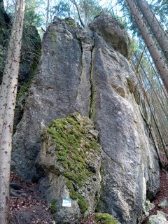 /4a/9c/4a9c68382dbfa89b6163e8c72aba3e18d9138ade) |
1.2.15.22. Intensivstation 137 routes in Crag
- Summary:
-
Mostly Sport climbing
Lat / Long: 49.784726, 11.358132
summary
lots of small craglets spread all over the property, some of them are very bouldery in character. there are some longer lines, especially in the lower grade range. property website
access issues
This crag is on private property. On weekends and public holidays it is closed to the public, between 1 May and 30 September. Only guests who are staying in the sports camp are allowed to enter and climb then.
approach
(49.78551900, 11.356184292) Drive from Pottenstein to Tüchersfeld, stay on the main road and just before you leave town are some parking spots at Kohlstein. If these are taken drive over the bridge and you will find a little parking spot on the left side of the road that should fit another 5-8 cars. Walk back across the bridge and up the sealed driveway following the sign. The climbing starts right behind the house!
where to stay
The property itself - https://www.die-intensivstation.de/
1.2.15.23. Bröggerla 8 routes in Crag
- Summary:
-
Mostly Sport climbing
Lat / Long: 49.793484, 11.368506
 |
1.2.15.24. Wallfahrt 2 routes in Crag
- Summary:
-
All Sport climbing
Lat / Long: 49.784126, 11.354919
approach
GPS: 11.35502, 49.78419
1.2.15.25. Schonunger Wand 10 routes in Crag
- Summary:
-
All Sport climbing
Lat / Long: 49.783793, 11.350541
approach
Drive from Pottenstein towards Behringersmühle. When you see the first houses of Behringersmühle (about 300m before), there is a parking spot on the right that suits 2 cars. If this is already full, drive into Behringersmühle and park there. Walk up the little path opposite the parking to reach "Dornröschenwand". Follow the path in front of it to the left for about 400m, where a small path branches off to the right, which leads to the crag in 50m. GPS: 11.35071, 49.78486
1.2.15.26. Dornröschenwand 29 routes in Crag
- Summary:
-
Mostly Sport climbing
Lat / Long: 49.782506, 11.346295
description
some awesome looking lines but certainly no gifts here. get ready for some spanking.
approach
Drive from Pottenstein towards Behringersmühle, when you see the first houses in Behringersmühle ( about 300m before) is a parking spot that suits 2 cars to your right. if this is already full drive into Behringersmühle and park here. walk up the little path oposite the parking to reach Dornröschenwand. GPS: 11.34613, 49.78283
1.2.15.27. Märchenwand 7 routes in Crag
- Summary:
-
Mostly Sport climbing
Lat / Long: 49.782052, 11.345700
summary
The crag gets some evening sun in autumn when the trees lose their leaves.
description
Popular for a reason, these are some nice face climbs which will keep you on your feet. Getting to the last bolt is often exciting but not dangerous.
approach
Drive from Pottenstein towards Behringersmühle; when you see the first houses in Behringersmühle (about 300m before), there is a tight parking spot that suits 2 cars to your right. If this is already full drive into Behringersmühle and park here. Walk up the little path opposite the parking to reach Dornröschenwand. Up along the cliff to the right, and about 50 m above you will reach Märchenwand.
GPS: 11.34552, 49.78226
 |
1.2.15.28. Planetarium 13 routes in Crag
- Summary:
-
All Sport climbing
Lat / Long: 49.784335, 11.345810
summary
Slightly overhung to nearly roof is what to expect here. Good rock quality and few people make this a great choice even on weekends.
description
Since this crag is up on the hillside it has a very nice and open feeling to it, even though it's in the forest. The climbing is technical, and on three of the routes, well, bloody steep is the correct term I believe.
approach
Drive from Pottenstein to Behringersmühle. Turn right towards Bayreuth, and park at the signed parking lot on your right. Walk further on this track past a house on your right and a little crag on your left with two projects. From here, another 300m on the track, then turn left onto a steep footpath uphill to the crag in another 200m (the path starts in a dry creek bed in front of a large boulder).
GPS: 11.34586, 49.78438
1.2.15.29. Das Weiße Haus 0 routes in Crag
approach
GPS: 11.34252, 49.78283
1.2.15.30. Amerikanische Botschaft 14 routes in Crag
- Summary:
-
Mostly Sport climbing
Lat / Long: 49.783363, 11.339537
summary
Great in winter, dries quickly!
description
South facing crag with relatively short routes on mostly small pockets in white limestone, almost exclusively developed by the late Karsten Oelze in 2001. Perfect on a sunny winter's day.
approach
Park at the parking lot for hikers in Behringersmühle and follow the road until it turns into a gravel road. When passing a red bench after about 300 metres from the parking lot, turn left into the woods and follow the narrow uphill path to the crag.
GPS: 49.7823, 11.3344
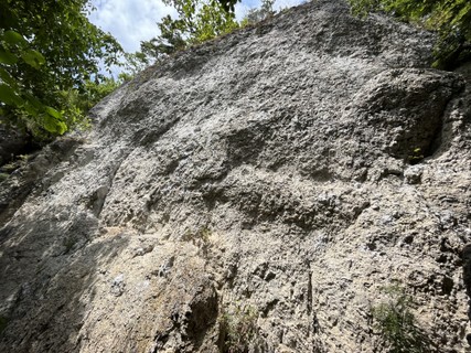 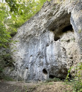 |
1.2.15.31. Eliade 9 routes in Crag
- Summary:
-
Mostly Sport climbing
Lat / Long: 49.791046, 11.356308
approach
GPS: 11.35625, 49.79109
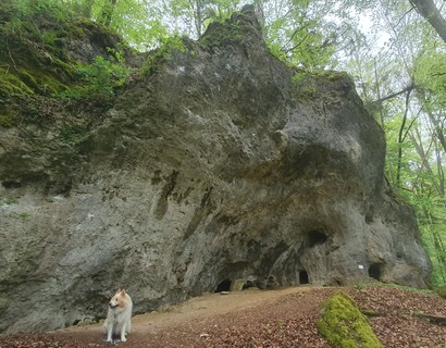 |
1.2.15.32. Rammstein 4 routes in Crag
- Summary:
-
Sport climbing and Trad climbing
Lat / Long: 49.783971, 11.346823
approach
GPS: 11.34682, 49.78398
1.2.15.33. Geißleinwand 27 routes in Crag
- Summary:
-
All Sport climbing
Lat / Long: 49.785407, 11.349859
summary
Short routes in compact rock on the left, longer routes in the middle around a perfect layback crack, slightly splintery lines in the 9th grade on the right.
description
The Geißleinwand ("young goats wall") is a good spring and autumn crag. The shady left part consists of short, technical routes with small holds. The middle part, which is centered around the striking crack of "Raunzender Kröterich", offers, among other routes, two good lines in the 7th grade and a classic, sharp dihedral crack ("Aufritzer"). The right part has seen quite a few first ascents around the 9th grade UIAA in recent years.
approach
When driving through Tüchersfeld in the direction of Behringersmühle, shortly before the town exit, head right towards Kohlstein. Right at the town sign (exit of Tüchersfeld), there is a small parking possibility on the left at a forest road.
Follow that same forest road for a few meters and then take a left turn at the junction. After 350 meters, the crag is on your right.
GPS: 11.34962, 49.78534
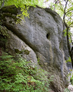 |
1.2.15.34. Fuchsenstein 6 routes in Crag
- Summary:
-
Aid climbing, Sport climbing and Trad climbing
Lat / Long: 49.779490, 11.371667
1.2.15.35. Lummerland 15 routes in Crag
- Summary:
-
Sport climbing and Bouldering
Lat / Long: 49.782807, 11.368258
1.2.16. Pottenstein 333 routes in Area
- Summary:
-
Mostly Sport climbing
Lat / Long: 49.775990, 11.429590
1.2.16.1. Schwarzes Riff 27 routes in Crag
- Summary:
-
All Sport climbing
Lat / Long: 49.776059, 11.397948
approach
From Pottenstein, drive towards Tüchersfeld; about 200m after leaving the village, there is a parking lot to your left. Park here, walk back 100m towards Pottenstein and turn sharp right uphill on the "Frankenweg". After 400m, follow this path rightwards to the crag.
1.2.16.2. Kleine Pottensteiner Wand 6 routes in Crag
- Summary:
-
Sport climbing, Bouldering and Trad climbing
Lat / Long: 49.773133, 11.401170
approach
GPS: 11.40117, 49.77311
1.2.16.3. Totentaler Wand 7 routes in Crag
- Summary:
-
All Sport climbing
Lat / Long: 49.783606, 11.420590
approach
GPS: 11.42059, 49.78371
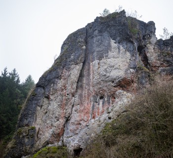 |
1.2.16.4. Jules-Verne-Massiv 8 routes in Crag
- Summary:
-
All Sport climbing
Lat / Long: 49.782051, 11.419305
approach
Drive from Pottenstein towards Bayreuth. After about 800 m, right at the turnoff towards Prüllsbirkig, there is a parking lot for hikers. Park here and walk north (either along the street or on the trail opposite the parking lot) for about 300 m; the crag is on your right directly above the street.
GPS: 11.41868, 49.78214
1.2.16.5. Neue Heimat 13 routes in Crag
- Summary:
-
All Sport climbing
Lat / Long: 49.780762, 11.420771
approach
from Pottenstein towards Prüllsbirkig, past Marientaler Wand to a fork in the road, parking at a signed hikers spot. across the sideroad is a little sealed thingy, follow the path from here up and left for about 5 min. GPS: 11.42073, 49.78078
1.2.16.6. Schöfflblock 2 routes in Crag
- Summary:
-
All Sport climbing
Lat / Long: 49.779327, 11.423823
approach
GPS: 11.42382, 49.77933
1.2.16.7. Schwalbenloch 0 routes in Crag
access issues
Zone 1 - NO climbing
1.2.16.8. Mariengrotte 1 route in Crag
- Summary:
-
All Bouldering
1.2.16.9. Marientaler Wand 55 routes in Crag
- Summary:
-
All Sport climbing
Lat / Long: 49.775939, 11.416112
approach
GPS: 11.41601,49.77607 (of the bottom, left side)
1.2.16.10. Dohlenloch 9 routes in Crag
- Summary:
-
All Sport climbing
Lat / Long: 49.770027, 11.414974
access issues
This crag is usually closed from February 1 until June 30. An active closure is indicated by a warning and 'closed' tag here on the site; when in doubt, signs put up at the crag have precedence!
Dieser Fels ist üblicherweise von 1. Februar bis 30. Juni gesperrt. Eine aktive Sperrung wird auf dieser Seite durch eine Warnung und ein 'gesperrt'-Tag markiert; im Zweifelsfall haben die örtlich aufgehängten Schilder Vorrang!
approach
GPS: 11.41493, 49.76993
1.2.16.11. Pottensteiner Wand 10 routes in Crag
- Summary:
-
Sport climbing, Rock climbing and other styles
Lat / Long: 49.770737, 11.413755
summary
A massive 40 m north face in the middle of Pottenstein.
description
Grades range from 6+ to 9 and almost all the climbs deserve stars. A lot of the climbs are by Stefan Löw.
The crag is not on but above private property. The owners are afraid of rocks hitting, so be really careful and watch loose rock!
access issues
This crag is usually closed from February 1 until June 30. An active closure is indicated by a warning and 'closed' tag here on the site; when in doubt, signs put up at the crag have precedence!
Dieser Fels ist üblicherweise von 1. Februar bis 30. Juni gesperrt. Eine aktive Sperrung wird auf dieser Seite durch eine Warnung und ein 'gesperrt'-Tag markiert; im Zweifelsfall haben die örtlich aufgehängten Schilder Vorrang!
approach
Drive into Pottenstein and park reasonably near the turnoff towards Waldcafé; the crag is hard to miss. GPS: 11.41383, 49.77079
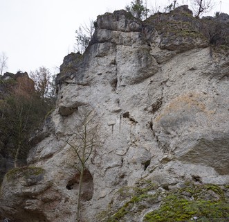 |
1.2.16.12. Brotzeitwand 8 routes in Crag
- Summary:
-
All Sport climbing
Lat / Long: 49.771522, 11.416069
summary
Little east facing crag above Pottenstein with wall climbing in white rock.
description
The east face below the little tower with a weathervane at the entrance of the upper Püttlach valley offers a good selection of climbs for a sunny morning. The routes are mostly vertical, with some slightly overhanging sections, and overall good rock quality. The routes are well-protected, except for the two old ones, "Alter Weg" and "Brotzeitplatte".
approach
In Pottenstein, drive towards Bayreuth and park at the turnoff towards Waldcafé. Walk east for 250 meters. The crag is already directly above you. On your left, some stairs lead up and around an abandoned building, follow that path for another 50 meters, then turn left to reach the base of the crag in a minute.
GPS: 11.41638, 49.77149
1.2.16.13. Soul Kitchen 8 routes in Crag
- Summary:
-
All Sport climbing
Lat / Long: 49.770025, 11.416937
1.2.16.14. Trautner Gedenkwand 24 routes in Crag
- Summary:
-
Mostly Sport climbing
Lat / Long: 49.769574, 11.420470
description
Fantastic endurance climbing on good rock, with some very hard classics on the right side.
approach
Drive in Pottenstein to the turnoff for Waldcafé, park here (since the road to Waldcafe is private & for customers only). Walk towards Waldcafé (about 500m) and cross the creek on the right on a small bridge. Now turn right on the path for 100m, and sharp left uphill for another 100m. you can see the crag high up on the right, scramble up the path for 200m . GPS: 11.42046, 49.76947
1.2.16.15. Zum Waldcafé 6 routes in Crag
- Summary:
-
All Sport climbing
Lat / Long: 49.769150, 11.421618
summary
Small crag but well worth a visit and it's next to Trautner Gedenkwand.
description
Face climbing with little bulges on nice rock!
approach
Drive in Pottenstein to the turnoff for Waldcafé, park here (since the road to Waldcafé is private & for customers only). Walk towards Waldcafé (about 500m) and cross the creek on the right on a small bridge. Now turn right on the path for 100m, and sharp left uphill for another 100m. You can see Trautner Gedenkwand high up on the right, scramble up the path for 150m and take a turnoff to the left to the visible crag. GPS: 11.42156, 49.76925
1.2.16.16. Streichelzoo 3 routes in Crag
- Summary:
-
All Sport climbing
Lat / Long: 49.768737, 11.424120
1.2.16.17. Emil Riedl Gedenkwand 20 routes in Crag
- Summary:
-
All Sport climbing
Lat / Long: 49.768623, 11.426471
approach
GPS: 11.42658, 49.76883
1.2.16.18. Adamsfels 8 routes in Crag
- Summary:
-
All Sport climbing
Lat / Long: 49.770059, 11.426823
approach
GPS: 11.42684, 49.77005
1.2.16.19. Predigtstuhl 4 routes in Crag
- Summary:
-
All Sport climbing
Lat / Long: 49.769821, 11.433155
approach
GPS: 11.43338, 49.76983
1.2.16.20. Trierer Wand 17 routes in Crag
- Summary:
-
All Sport climbing
Lat / Long: 49.767515, 11.434254
approach
GPS: 11.43398, 49.76764
  |
1.2.16.21. Glawe-Wand 9 routes in Crag
- Summary:
-
All Sport climbing
Lat / Long: 49.769194, 11.434502
approach
GPS: 11.43431, 49.76900
1.2.16.22. Laurins Burg 14 routes in Area
- Summary:
-
All Sport climbing
approach
Am Veilchenbrunnen links hoch in den Wald
1.2.16.23. Püttlachturm 7 routes in Crag
- Summary:
-
All Sport climbing
Lat / Long: 49.767222, 11.435695
approach
GPS: 11.43560, 49.76727
1.2.16.24. Bleisteinwand 24 routes in Crag
- Summary:
-
Mostly Sport climbing
Lat / Long: 49.765613, 11.437092
approach
GPS: 11.43729, 49.76565
1.2.16.25. Deppentempel 7 routes in Crag
- Summary:
-
All Sport climbing
Lat / Long: 49.765181, 11.442822
approach
GPS: 11.44286, 49.76526
1.2.16.26. Hohe Nase 17 routes in Crag
- Summary:
-
Sport climbing and Aid climbing
Lat / Long: 49.766432, 11.444782
summary
Massive south face with impressive routes in chossy rock.
description
A giant, overhanging south face with a striking prow (the "nose") directly above the hiking path. Three more or less alpine classics ("Alter Weg", "Dieter Dörrer Gedenkweg", "Knüppelweg") are accompanied by two (very rarely repeated) aid climbs through the left part of the wall and quite a few recent sport climbs established by Stefan Löw. Do not be fooled by the word "sport", though. Expect serious choss in the lower part of the wall. The rock quality gets better in the middle, but wearing a helmet is an absolute necessity here for both climber and belayer.
approach
GPS: 11.44464, 49.76617
1.2.16.27. Hätzerkirche 10 routes in Cliff
- Summary:
-
All Sport climbing
Lat / Long: 49.764780, 11.455895
description
Eindrucksvolles Felsentor mit steilen und schweren Routen.
approach
In Elbersberg bei der Kapelle parken. Rechts der Kapelle dem geteerten Feldweg bergab folgen. Die Püttlach überqueren und nach rechts gehen. Nach 700 m links 100 m steil bergauf zum Fels.
1.2.16.28. Hauensteiner Wand 4 routes in Crag
- Summary:
-
All Sport climbing
Lat / Long: 49.766881, 11.465387
1.2.16.29. Tiwall 5 routes in Cliff
- Summary:
-
All Sport climbing
description
kleine schattige Wand mit gutem löchrigem Fels
approach
Im Obersten Püttlachtal 50 m nach dem Adamsfels die Püttlach überqueren. Geradeaus bergauf dem Weg 150 m zum Fels folgen.
1.2.17. Weihersbachtal 215 routes in Area
- Summary:
-
Mostly Sport climbing
Lat / Long: 49.750003, 11.453336
description
Elbersberg, Wannberg
1.2.17.1. Solarium 9 routes in Crag
- Summary:
-
All Sport climbing
Lat / Long: 49.763539, 11.446395
approach
GPS: 11.44646, 49.76361
1.2.17.2. UFA-Palast 6 routes in Crag
- Summary:
-
All Sport climbing
Lat / Long: 49.763092, 11.447069
approach
GPS: 11.44709, 49.76310
1.2.17.3. Zerplatztes Alien 6 routes in Crag
- Summary:
-
All Sport climbing
Lat / Long: 49.763878, 11.450661
approach
GPS: 11.45052, 49.76400
1.2.17.4. Zwergenhöhle 5 routes in Crag
- Summary:
-
All Sport climbing
Lat / Long: 49.764461, 11.483274
approach
GPS: 11.48365, 49.76444
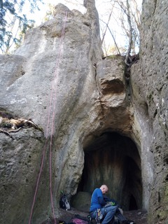 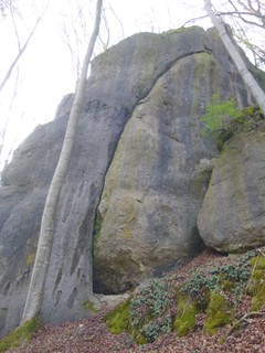 |
1.2.17.5. Edelsteine 30 routes in Crag
- Summary:
-
Mostly Sport climbing
Lat / Long: 49.736686, 11.441704
approach
GPS: 11.44134, 49.73697
1.2.17.6. Bronner Brummer 3 routes in Crag
- Summary:
-
All Sport climbing
Lat / Long: 49.735208, 11.446418
approach
near Winterleite
1.2.17.7. Winterleite 4 routes in Crag
- Summary:
-
All Sport climbing
Lat / Long: 49.733313, 11.448723
access issues
This crag is usually closed from January 1 until July 31. An active closure is indicated by a warning and 'closed' tag here on the site; when in doubt, signs put up at the crag have precedence!
Dieser Fels ist üblicherweise von 1. Januar bis 31. Juli gesperrt. Eine aktive Sperrung wird auf dieser Seite durch eine Warnung und ein 'gesperrt'-Tag markiert; im Zweifelsfall haben die örtlich aufgehängten Schilder Vorrang!
approach
GPS: 11.44867, 49.73336
1.2.17.8. Orakel 9 routes in Crag
- Summary:
-
All Sport climbing
Lat / Long: 49.745300, 11.441230
1.2.17.9. Teufelwand 5 routes in Crag
- Summary:
-
All Sport climbing
access issues
Zone 1, climbing forbidden.
1.2.17.10. Schüttersmühler Wand 6 routes in Crag
- Summary:
-
All Sport climbing
Lat / Long: 49.752090, 11.427208
approach
GPS: 11.42713, 49.75217
1.2.17.11. Dromedar 26 routes in Crag
- Summary:
-
Mostly Sport climbing
Lat / Long: 49.753607, 11.425257
approach
GPS: 11.42499, 49.75357
1.2.17.12. Weiherbacher Männchen 0 routes in Crag
description
Zone 1 - NO CLIMBING
1.2.17.13. Amphitheater 27 routes in Crag
- Summary:
-
All Sport climbing
Lat / Long: 49.751616, 11.426826
approach
GPS: 11.42728, 49.75212
   |
1.2.17.14. Amphitheater Nebenmassiv 2 routes in Cliff
- Summary:
-
Bouldering and Sport climbing
Lat / Long: 49.751215, 11.425245
description
This little wall has been fortified with sprayed concrete and therefore made unclimbable. This lead to a re-assessment, it is now in Zone 1 (no climbing).
1.2.17.15. Entenstein 5 routes in Boulder
- Summary:
-
All Bouldering
Lat / Long: 49.748075, 11.424018
approach
GPS: 11.42447, 49.74815
1.2.17.16. Terra Australis 66 routes in Crag
- Summary:
-
Mostly Sport climbing
Lat / Long: 49.749234, 11.426604
approach
GPS: 11.42585, 49.74960
GPS: 11.42687, 49.74947
1.2.17.17. Lindigsbühler Wand 6 routes in Crag
- Summary:
-
All Sport climbing
Lat / Long: 49.766750, 11.478291
description
A lovely spot in the forest, nice and sunny in the cold months and shaded by the trees in summer.
approach
Drive in Pegnitz past the hospital towards Körbeldorf. Turn left towards Hollenberg. Drive through the village and take the left fork where the tarmac ends. 20m past the edge of the forest, a walking track starts to your right. Park sensibly to avoid blocking the way for tractors. you can follow the track for nearly 200m to another fork, the crag is 30m to your right. GPS: 49.7667358, 11.4782852
 |
1.2.18. Walberla 57 routes in Area
- Summary:
-
Mostly Sport climbing
Lat / Long: 49.716360, 11.169006
1.2.18.1. Rodenstein 49 routes in Crag
- Summary:
-
Mostly Sport climbing
Lat / Long: 49.713718, 11.156640
summary
Classic autumn and winter crag with lots of routes in the lower grades.
description
The Rodenstein is the south peak of the "Ehrenbürg" hill and is its only crag that remains open for climbing. The wall is facing south-west and is sunny from late morning until sunset. The routes all have a classical touch – you may be happy about camming devices, slings and a clip stick – and there is a big selection of climbs in the lower grades. Wide view from the top.
The most popular routes (easiest first) are "Schlaifhausener Kante", "Margarethenwand" and "Frankenschnellweg".
approach
In Schlaifhausen follow the signs towards Walbela. After 800 m, there is a gravelled (49.71623, 11.15246). Walk up the asphalt track to the saddle between Walberla and Rodenstein in the north-east. There, turn right/southeast. After about 350 meters, a small path to the right leads through the trees down to the foot of the crag.
/fb/6c/fb6c950648c33d30264598c328a1f95881904fea)   |
1.2.18.2. Leutenbacher Kreuzfelsen 8 routes in Crag
- Summary:
-
All Sport climbing
Lat / Long: 49.709178, 11.182744
approach
GPS: 11.18243, 49.70914
1.2.19. Unteres Trubachtal 805 routes in Area
- Summary:
-
Mostly Sport climbing
Lat / Long: 49.724505, 11.248395
1.2.19.1. Wichsenstein 273 routes in Area
- Summary:
-
Mostly Sport climbing
Lat / Long: 49.750060, 11.245570
1.2.19.2. Zaunsbachtal 46 routes in Area
- Summary:
-
Mostly Sport climbing
Lat / Long: 49.713324, 11.223715
description
lower Trubach valley
1.2.19.3. Schlehenmühle 121 routes in Area
- Summary:
-
Mostly Sport climbing
Lat / Long: 49.723749, 11.252526
1.2.19.4. Mostviel - Affalterthal 118 routes in Area
- Summary:
-
Mostly Sport climbing
Lat / Long: 49.709170, 11.279279
approach
Parking for many Mostvieler crags (49.7111609, 11.2748223)
1.2.19.5. Egloffstein 133 routes in Area
- Summary:
-
Mostly Sport climbing
Lat / Long: 49.703946, 11.257551
approach
Public transport at weekends:
Train R21 til Gräfenberg. Then take bus 229 bis Egloffstein.
http://www.vgn.de/freizeitlinien/trubachtal-express/ (1.5.- 1.11.)
1.2.19.6. Todsfelder Tal 114 routes in Area
- Summary:
-
Mostly Sport climbing
Lat / Long: 49.690031, 11.247041
1.2.20. Großenoher Tal 94 routes in Area
- Summary:
-
Mostly Sport climbing
Lat / Long: 49.671170, 11.288633
1.2.20.1. Rechte Dörnhofer Wände 17 routes in Crag
- Summary:
-
All Sport climbing
Lat / Long: 49.683235, 11.276476
1.2.20.2. Linke Dörnhofer Wand 6 routes in Crag
- Summary:
-
All Sport climbing
Lat / Long: 49.680681, 11.275849
approach
GPS: 11.27622, 49.68269
1.2.20.3. Großenoher Wand 22 routes in Crag
- Summary:
-
Mostly Sport climbing
Lat / Long: 49.678616, 11.278225
summary
a beautyful crag in a quiet valley, well worth a visit if you want to get away from the crowds of Trubachtal.
description
shady location and interesting routes much more varied than the length will suggest make this a great day out, or more if you include the nearby walls.
approach
GPS:
1.2.20.4. Hohe Geisel 9 routes in Crag
- Summary:
-
Mostly Sport climbing
Lat / Long: 49.678102, 11.278702
approach
GPS: 11.27884, 49.67828
/0f/20/0f20828f7eb650ab753c0b30c6c9ad7fb4bd5c6b) |
1.2.20.5. Höfleser Wand und Turm 13 routes in Crag
- Summary:
-
Mostly Sport climbing
Lat / Long: 49.677837, 11.279175
approach
GPS: 11.27927, 49.67803
1.2.20.6. Waldmannspitze 7 routes in Crag
- Summary:
-
All Sport climbing
Lat / Long: 49.677887, 11.279372
summary
A major rockfall in 2004 has carried most of the tower down into the valley. It is strongly advised not to climb the remaining routes.
1.2.20.7. Kurfürst 5 routes in Crag
- Summary:
-
Sport climbing and Trad climbing
Lat / Long: 49.677212, 11.280797
1.2.20.8. Drei Zinnen 15 routes in Crag
- Summary:
-
Mostly Sport climbing
Lat / Long: 49.671994, 11.291224
approach
GPS: 11.29125, 49.67193
   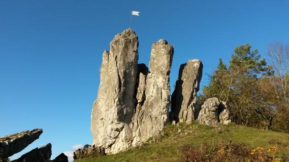 |
1.2.21. Obertrubach 591 routes in Area
- Summary:
-
Mostly Sport climbing
Lat / Long: 49.695776, 11.324260
where to stay
Untertrubach camping site "Oma Eichler"
1.2.21.1. Herzwand 5 routes in Crag
- Summary:
-
All Sport climbing
Lat / Long: 49.704463, 11.356076
approach
GPS: 11.35610, 49.70446
1.2.21.2. Pitztaler Wand 8 routes in Crag
- Summary:
-
All Sport climbing
Lat / Long: 49.701448, 11.367209
approach
GPS: 49.700858,11.367624
1.2.21.3. Kascholong 13 routes in Crag
- Summary:
-
Mostly Sport climbing
Lat / Long: 49.703019, 11.349228
approach
GPS: 11.34924, 49.70300
1.2.21.4. Eldorado 13 routes in Crag
- Summary:
-
All Sport climbing
Lat / Long: 49.691668, 11.341253
description
playground at the bottom of it.
approach
Drive from Obertrubach towars Egloffstein. The crag is directly near the road on the right as soon as you leave the village. GPS: 11.34130, 49.69173
 |
1.2.21.5. Dachlwand 14 routes in Crag
- Summary:
-
Mostly Sport climbing
Lat / Long: 49.690886, 11.336883
access issues
Parts of this crag are usually closed from January 1 until July 31. An active closure is indicated by a warning and 'closed' tag here on the site; when in doubt, signs put up at the crag have precedence!
Teile dieses Felsens sind üblicherweise von 1. Januar bis 31. Juli gesperrt. Eine aktive Sperrung wird auf dieser Seite durch eine Warnung und ein 'gesperrt'-Tag markiert; im Zweifelsfall haben die örtlich aufgehängten Schilder Vorrang!
approach
GPS: 11.33679, 49.69087
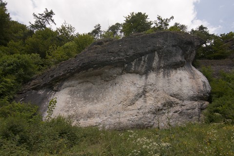 |
1.2.21.6. Schlöttermühler Wände 9 routes in Crag
- Summary:
-
Sport climbing and Trad climbing
Lat / Long: 49.690520, 11.335366
access issues
This crag is usually closed from February 1 until June 30. An active closure is indicated by a warning and 'closed' tag here on the site; when in doubt, signs put up at the crag have precedence!
Dieser Fels ist üblicherweise von 1. Februar bis 30. Juni gesperrt. Eine aktive Sperrung wird auf dieser Seite durch eine Warnung und ein 'gesperrt'-Tag markiert; im Zweifelsfall haben die örtlich aufgehängten Schilder Vorrang!
approach
GPS: 11.33581, 49.69059
 |
1.2.21.7. Bleisteine 21 routes in Crag
- Summary:
-
Mostly Sport climbing
Lat / Long: 49.689501, 11.333214
summary
A series of smaller north faces, mostly with high quality rock, known primarily for the two Kurt Albert † classics: "Offenbarung" and "Eraserhead".
approach
GPS: 11.33374, 49.68954
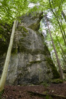   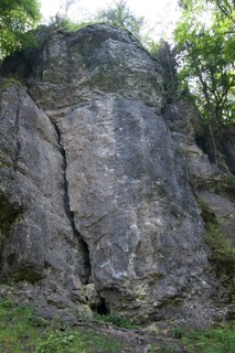 |
1.2.21.8. Rumpelkammer 5 routes in Cliff
- Summary:
-
All Sport climbing
Lat / Long: 49.690972, 11.336217
approach
GPS: 11.33623, 49.69097
 |
1.2.21.9. Auenland 6 routes in Sector
- Summary:
-
All Sport climbing
Lat / Long: 49.691150, 11.336438
approach
GPS: 11.33646, 49.69117
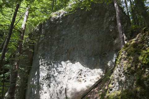 |
1.2.21.10. Schlötterturm 8 routes in Crag
- Summary:
-
All Sport climbing
Lat / Long: 49.691094, 11.336762
description
a good one to escape to if it gets to warm down at Dachlwand.
access issues
This crag is usually closed from January 1 until July 31. An active closure is indicated by a warning and 'closed' tag here on the site; when in doubt, signs put up at the crag have precedence!
Dieser Fels ist üblicherweise von 1. Januar bis 31. Juli gesperrt. Eine aktive Sperrung wird auf dieser Seite durch eine Warnung und ein 'gesperrt'-Tag markiert; im Zweifelsfall haben die örtlich aufgehängten Schilder Vorrang!
approach
Walk from Dachlwand on the walking track right towards Obertrubach for about 50m , then on overgrown path steep uphill to reach the crag, if you scramble further you can reach Auenland comfortably as well.
 |
1.2.21.11. Ziegelmühler Wand 2 routes in Crag
- Summary:
-
All Sport climbing
Lat / Long: 49.690425, 11.330529
approach
GPS: 11.33055, 49.69044
 |
1.2.21.12. Prodigywand 1 route in Cliff
- Summary:
-
All Sport climbing
Lat / Long: 49.686570, 11.329985
approach
GPS: 11.33002, 49.68658
1.2.21.13. Zauberberg 11 routes in Crag
- Summary:
-
All Sport climbing
Lat / Long: 49.691172, 11.328316
approach
GPS: 11.32827, 49.69116
1.2.21.14. Richard-Wagner-Fels 24 routes in Crag
- Summary:
-
Mostly Sport climbing
Lat / Long: 49.690073, 11.325486
- In 2007, the trees around the rock have been cut down.
summary
Famous for being the home of the extreme classics "Fight Gravity" and "Magnet".
description
Probably one of the most famous crags in the Frankenjura. It was given its name due to its silhouette when looked upon from the west, which bears a striking resemblance to the German composer. Yet its fame largely doesn't derive from this curious circumstance. Instead, the rock was catapulted to fame by Kurt Albert † and Wolfgang Güllich † at the beginning of the 80's, when they made first free ascents of "Direkte Westwand", "Fight Gravity" and "Magnet", the former two having seen solo ascents by Kurt Albert † in the years to come.
Aforementioned classics have all gained a fair amount of polish over the years; the easier routes are climbed far less often, which might also lend itself to their rather runout nature.
There is a ring cemented in the very top, hard to find in the moss under a little pine tree. Good for setting up belay but not suitable for toproping.
approach
Drive down the valley from Obertrubach. When you drive past Reichelsmühle (a big sawmill), the crag is on your right, but keep driving, there is a parking lot 200m down the road. GPS: 11.32554, 49.69007
history
 |
1.2.21.15. Reichelsmühler Wand 16 routes in Crag
- Summary:
-
All Sport climbing
Lat / Long: 49.693580, 11.327746
approach
GPS: 11.32779, 49.69357
1.2.21.16. Hartelstein 27 routes in Crag
- Summary:
-
Mostly Sport climbing
Lat / Long: 49.689824, 11.321159
where to stay
camping site Untertrubach
/d2/76/d276e315509e1240881d929ff8fdbcda8f1f2cde) |
1.2.21.17. Wolfsberger Wand 10 routes in Crag
- Summary:
-
Mostly Sport climbing
Lat / Long: 49.688380, 11.321707
approach
GPS: 11.32158, 49.68844
1.2.21.18. Neudorf 57 routes in Crag
- Summary:
-
Bouldering and Sport climbing
Lat / Long: 49.691547, 11.355106
description
mostly Bouldering with the odd Route thrown in
approach
GPS: 11.35556,49.69204
1.2.21.19. Nonne 11 routes in Crag
- Summary:
-
Mostly Sport climbing
Lat / Long: 49.684695, 11.288319
approach
GPS: 11.28847, 49.68459
1.2.21.20. Kleiner Mönch 7 routes in Crag
- Summary:
-
Mostly Sport climbing
Lat / Long: 49.684776, 11.288466
approach
GPS: 11.28817, 49.68482
1.2.21.21. Topfstein 9 routes in Crag
- Summary:
-
Mostly Sport climbing
Lat / Long: 49.685358, 11.288203
approach
GPS:
1.2.21.22. Großer Mönch 16 routes in Crag
- Summary:
-
Sport climbing and Trad climbing
Lat / Long: 49.685417, 11.287715
approach
GPS: 11.28767, 49.68515
1.2.21.23. Sargträgerwand 4 routes in Crag
- Summary:
-
All Sport climbing
Lat / Long: 49.687775, 11.281529
summary
Well-protected and easy routes.
access issues
Parking at Haselstauden. Follow forest track to west. After 200m go forest track to right. After 300m you could see the crag 50m up the hill.
where to stay
Oma Eichler
/cc/4a/cc4a20bd1c86b40bfa24e4a092e0c98328f0a581) /27/ab/27abad433f97741527c3e5b280e8080ef8ab673c) |
1.2.21.24. Rudi Mehl Gedenk-Block 6 routes in Crag
- Summary:
-
All Sport climbing
Lat / Long: 49.687582, 11.281746
approach
See Sargträgerwand
/3a/1a/3a1aa79c5a9ee8e080008f5164c4c8efc8112af8) /16/19/16199b7839f61debf132c030bfabe40eb78ae58b) /22/d8/22d8143503d517718b08e08cdf2b5603bad06f70) |
1.2.21.25. Haselstaudener Wände 26 routes in Crag
- Summary:
-
Mostly Sport climbing
Lat / Long: 49.685724, 11.284842
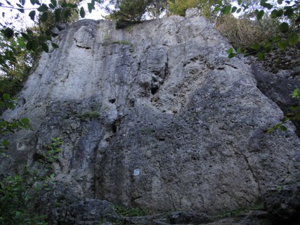    |
1.2.21.26. Fürther Turm 7 routes in Crag
- Summary:
-
All Sport climbing
Lat / Long: 49.681947, 11.283254
approach
GPS: 11.28304, 49.68223
 |
1.2.21.27. Wetterstein 6 routes in Crag
- Summary:
-
Mostly Sport climbing
Lat / Long: 49.681875, 11.288513
approach
GPS: 11.28853, 49.68187
1.2.21.28. Wolfsberger Nadel 4 routes in Crag
- Summary:
-
Trad climbing and Sport climbing
Lat / Long: 49.686497, 11.315078
1.2.21.29. Wolfsberger Block 10 routes in Crag
- Summary:
-
Sport climbing and Trad climbing
Lat / Long: 49.686677, 11.315037
approach
GPS: 11.31508, 49.68671
1.2.21.30. Wolfsberger Grotte 13 routes in Crag
- Summary:
-
Mostly Sport climbing
Lat / Long: 49.686037, 11.314208
description
Athletic roof and overhang climbing with vertical routes on both sides of a cave
approach
GPS: 11.31424, 49.68606
1.2.21.31. Zehnerstein 42 routes in Crag
- Summary:
-
Sport climbing and Trad climbing
Lat / Long: 49.687574, 11.303294
description
High, classic tower throning over the first houses of the village Wolfsberg. First climbed probably before 1900 and with over 30 routes ranging from UIAA 2 to 9-, the rock is one of the most popular crags in the Trubach valley.
approach
Park at the sports field of Wolfsberg. Cross the street and follow the small road uphill into the village to the right for 50 meters. Then take a sharp left; after a few meters, a small path branches off to the right, leading to the rock.
 /05/53/055339c68ed23d2207c2789941be2c9491de51ad) |
1.2.21.32. Wolfsberger Burgfelsen 12 routes in Crag
- Summary:
-
All Sport climbing
Lat / Long: 49.688988, 11.312526
approach
In Wolfsberg turn to direction to Geschwand. Parking side after 100 meters on right side. Then walk road 60m uphill and turn left into gravel road. After few meter there's a small path to the rock. GPS: 11.31259, 49.68898
history
Four small summits behind castle ruin. All summits mounted circa in year 1911. The two summits westwards are crushed rock and not interessing - now zone 1. The first real climbing routes developed in year 1971 at two summits eastwards by Paul Schellhorn.
1.2.21.33. Endorama 10 routes in Crag
- Summary:
-
All Sport climbing
Lat / Long: 49.702061, 11.314489
summary
Overhanging prow in idyllic surroundings with short, bouldery routes.
description
Steep crag developed in 2001 by Heiko Queitsch. The last addition was made in 2005 by Markus Bock with a route in the 11th grade UIAA. Quite a variety of styles, but most routes have boulder problems. The routes from "Ratz und Rübe" to "Dauermauer" share the start.
access issues
Please do not enter the meadows in the vicinity of the crag.
approach
Drive from Wolfsberg towards Geschwand. After 1.8 km, just where the meadows on the left end and the ones on the right start, there is a little tarmac parking bay on the left. Park here and continue on the street for another 100 meters to the edge of a little patch of forest. Turn right and follow the path to reach the crag in under a minute.
GPS: 11.31469, 49.70198
1.2.21.34. Saufels 13 routes in Crag
- Summary:
-
All Sport climbing
Lat / Long: 49.683055, 11.302707
summary
short, pockets,grades from 3 to 8+, close to the campground, whats not to like?
access issues
stick to the bloody path! the landowner is pissed off already....
approach
Park at the Campground Oma Eichler, walk into the little Village Untertrubach for 100m until you see the sign for Bergwacht Hütte. left here, up the hill for about 200 m into the forest an then right and uphill on a forest track. Follow this for another 200m to some sort of crest and then follow the path leftwards. you should stumble upon the crag in about 100 m from here. GPS: 11.30277, 49.68311
where to stay
Obvious here Oma Eichlers Campgroud!
history
some old pitons on this crag but it has been boltet in 2003, and it is well done as well.
1.2.21.35. Hohle Kirche 8 routes in Crag
- Summary:
-
Mostly Sport climbing
Lat / Long: 49.682028, 11.282233
access issues
This crag is usually closed from February 1 until June 30. An active closure is indicated by a warning and 'closed' tag here on the site; when in doubt, signs put up at the crag have precedence!
Dieser Fels ist üblicherweise von 1. Februar bis 30. Juni gesperrt. Eine aktive Sperrung wird auf dieser Seite durch eine Warnung und ein 'gesperrt'-Tag markiert; im Zweifelsfall haben die örtlich aufgehängten Schilder Vorrang!
approach
parking in Haselstauden, pass electric station - then right to Großennohe. after 175m go left on track to Fürther Turm. go 100m high and 100m right
1.2.21.36. Golem 10 routes in Crag
- Summary:
-
All Sport climbing
Lat / Long: 49.691438, 11.296651
summary
Small crag with good rock quality and a few good routes in the intermediate grades. Some of the routes have been rebolted recently and are therefore well-protected now.
approach
GPS: 11.29664, 49.69144
/8c/a6/8ca661a48b4345729a70d4d1f309adcafabcb8bb) /13/44/1344c1051a2e92e52bc5ac70659aa63326addf3c) |
1.2.21.37. Rondell 9 routes in Boulder
- Summary:
-
All Bouldering
Lat / Long: 49.699290, 11.300908
description
one of the few published Boulders in Franken
approach
GPS: 11.30089, 49.69930
history
an early Boulder found by Wolfgang Fietz in the 80s.
1.2.21.38. Nagelstudio 6 routes in Crag
- Summary:
-
Mostly Sport climbing
Lat / Long: 49.696847, 11.301387
approach
GPS: 11.30137, 49.69687
1.2.21.39. Klagemauer 25 routes in Crag
- Summary:
-
Sport climbing and Bouldering
Lat / Long: 49.696273, 11.301286
approach
GPS: 11.30123, 49.69628
1.2.21.40. Signalstein 8 routes in Crag
- Summary:
-
Mostly Sport climbing
Lat / Long: 49.696152, 11.301741
approach
GPS: 11.30171, 49.69611
1.2.21.41. Duplo 10 routes in Crag
- Summary:
-
All Sport climbing
Lat / Long: 49.696115, 11.301561
1.2.21.42. Kleiner Turm 7 routes in Crag
- Summary:
-
Mostly Sport climbing
Lat / Long: 49.695949, 11.301695
approach
park 80m after Sorg on the right and take the right path to the crag located behind Klagemauer and Duplo
/dc/fc/dcfc80d3c87614e5fe7566cf192859c97468b416) |
1.2.21.43. Grüne Hölle 41 routes in Crag
- Summary:
-
Mostly Sport climbing
Lat / Long: 49.701672, 11.304004
approach
GPS: 11.30528, 49.70143
1.2.21.44. Fuchsstein 21 routes in Crag
- Summary:
-
Sport climbing and Trad climbing
Lat / Long: 49.682064, 11.289531
summary
Shady north face that offers some classical lines in the lower grades. Some gear required in most routes in addition to the fixed protection.
approach
Drive from Hammerbühl towards Obertrubach. At the hamlet "Haselstauden", turn right and follow the small road towards Untertrubach to a designated hiker's parking lot.
Walk into Untertrubach. After passing the church, turn right and immediately left again. The street runs out into a forest road in a sharp right turn. Continue on that forest road for about 300 meters to a fenced off pasture. Walk along the fence (on the left side) to the edge of the forest, then follow a small path slightly downhill that leads directly to the crag.
Coordinates:
1.2.22. Gößweinstein 430 routes in Area
- Summary:
-
Mostly Sport climbing
Lat / Long: 49.767360, 11.342063
1.2.22.1. Obere Gößweinsteiner Wände 45 routes in Crag
- Summary:
-
Mostly Sport climbing
Lat / Long: 49.768472, 11.329143
summary
Historic crag, home to the Frankenjura's first route in the lower 9th grade UIAA, "Sautanz", by Kurt Albert †. Mostly vertical pocket climbing.
description
Fantastic crag with lots of classics from the golden era of Frankenjura sport climbing.
approach
Park at the hiker's parking lot at the northern end of the street "An der Martinswand". From the parking lot, follow a broad path to the west, which leads you directly to the east face of the crag in two minutes.
GPS: 11.32905, 49.76864
/db/64/db64c5a9f09266b81726aa7f9a4dc99fe5022dbd) /00/08/00088bbbf6eed8102e7460185f8d497a3cf88578)    |
1.2.22.2. Untere Gößweinsteiner Wände 10 routes in Crag
- Summary:
-
Mostly Sport climbing
Lat / Long: 49.768646, 11.329916
summary
Small north face in the forest with good, pocketed routes.
description
Actually, what remains of the crag "Untere Gößweinsteiner Wände" is just what is called "Wiesenttalwand", after everything else between it and "Martinswand" had been banned for climbing in the early 90s in accordance with the climbing concepts worked out between climbers and officials.
Notwithstanding, the remaining crag offers high quality pocketed routes and is worth a visit on its own, not just passing by for "Martinswand".
approach
GPS: 11.32994, 49.76865
1.2.22.3. Martinswand 29 routes in Crag
- Summary:
-
Mostly Sport climbing
Lat / Long: 49.768874, 11.328197
summary
One of the few crags which offer some Grade 6+ climbs which stay dry if it starts raining. Sometimes it seeps after long periods of rain, though.
description
One of the highest crags in the Frankenjura, and after the rebolting efforts of Stefan Löw certainly worth a visit. Some real gems here, long and sustained climbs, bring your 70m rope!
approach
Drive from the center of Gössweinstein west towards Morschreuth. just before you reach the gas station, turn right into a road named "An der Martinswand", straight down to the parking lot at its end. Walk further down for a few meters and turn left onto a small path. Follow this along leftwards without loosing too much height until you reach the crag. GPS: 11.32836, 49.76913
1.2.22.4. Schwalbenstein 10 routes in Crag
- Summary:
-
Mostly Sport climbing
Lat / Long: 49.769179, 11.327804
approach
GPS: 11.32808, 49.76930
 |
1.2.22.5. Napoleon 25 routes in Crag
- Summary:
-
Sport climbing and Trad climbing
Lat / Long: 49.769669, 11.331253
summary
High, two-summited tower with amazing climbs in many grades.
description
The big "Napoleon" tower consists of two summits, the "Napoleonsblock" and the amazingly thin "Napoleonswand", separated by a plateau. Both summits are reachable via a few exquisite climbs in various grades; the "Block", for example, via the brilliant classic "Westriss", the fantastic "Freundschaftsweg" and the bold "Membrane"; the summit of the "Wand" is often reached by climbing up the "Plateau Normalweg" and choosing one of "Nordkante", "Ostwand" and "Westwand" from there, but there are also good lines from the ground, like the stunning "Südkante" and the bold "Direkte Ostwand".
approach
In Gößweinstein, drive into "An der Martinswand" (diagonally opposite the petrol station); there is a parking lot for hikers at the end. From there, follow the hiking path north to reach the crag after a few meters.
1.2.22.6. Emporwand 13 routes in Crag
- Summary:
-
Sport climbing and Trad climbing
Lat / Long: 49.769809, 11.331705
summary
Imposing wall with generous lines (nuts, slings, friends recommended) and three Martin Grulich classics in the 7th grade.
approach
In Gößweinstein, drive into "An der Martinswand" (diagonally opposite the petrol station); there is a parking lot for hikers at the end. From there, follow the hiking path north to reach "Napoleon" after a few meters, pass it on the south end towards the east and you can already see the crag before you.
GPS: 11.33170, 49.76981
/87/5d/875d9090a23a50db4aecc44962f6b95c19cf873a) /ef/ee/efeeddbbb805a8d78b089cbf343b92ded71f0ff0) |
1.2.22.7. Fehensteine 17 routes in Crag
- Summary:
-
Sport climbing and Trad climbing
Lat / Long: 49.773388, 11.337477
approach
GPS: 11.33729, 49.77378
 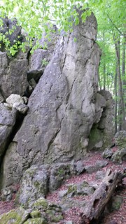 |
1.2.22.8. Eibenwände 77 routes in Crag
- Summary:
-
Sport climbing, Trad climbing and Aid climbing
Lat / Long: 49.772808, 11.336348
summary
Large crag with lots of easy to mid-range routes, mostly slabby to vertical, best enjoyed during the summer months due to its north-west aspect.
description
This large summer crag, stretching out for about 200 meters, has to offer something for everyone. At the left end, a small free-standing tower called "Gnom" waits with nice pleasure lines in its west face ("Linke Westwand", "Rechte Westwand") and hard testpieces ("Nonplusultra", "Superfly") in its north face.
To the right of the gnome, "Kaffeepause" and "Hobbitkante" are worth pointing out.
The central sector continues this varied supply of routes; worth mentioning: "Gerader Riss" (easy to protect trad line) and "Halve Hahn" (tricky wall climbing on pockets and crimps).
Three good routes right next to each other in the seventh grade (UIAA) can be found in the right sector ("Sepplriss", "Schlendrian", "Volle Lotte").
approach
In Gößweinstein, follow the main road in the direction of Behringersmühle. Before leaving the village, turn left into Badangerstraße and park your car (considerably, do not obstruct the road) around here (49.774427, 11.339476). Walk down Badangerstraße past "Hotel Stempferhof". After going downhill for a few meters, you will see a yellow bench. Turn left here and follow the broad path for 200 meters. The crag is just above the path.
history
This crag functioned as a precursor to the zoning concepts regulating the interplay of climbing and nature/bird protection. In 1992, it was the first crag (together with "Weiße Wand") for which regulations have been worked out between the local government, several nature conservation groups, the german alpine club (DAV) and the IG Klettern (pressure group climbing), providing a compromise between perpetuating important climbing destinations for the sport and maintaining habitats for rare or endangered species of plants and animals.
1.2.22.9. Wickenstein 6 routes in Crag
- Summary:
-
All Sport climbing
Lat / Long: 49.767753, 11.335511
summary
Small crag in the middle of Gößweinstein featuring a pocketed slab covered by a powerful overhang.
description
The main part of Wickenstein offers three routes around the lower 8th grade UIAA with a slabby start and an overhanging finish; the rock quality is perfect.
On the right, there are two shorter routes through a roof-like overhang with dubious protection, and a very good (and recently re-equipped), vertical route in the seventh grade.
approach
There is free parking available at the end of the small street "An der Martinswand" (same parking as for e.g. Napoleon). Walk back up to the main street, and walk into "Gartenweg" (diagonally left across the street). After a few meters, turn left into "Gartenstraße" and shortly after, turn right again to reach the crag in a few meters.
GPS: 11.33552, 49.76773
1.2.22.10. Gernerfels 5 routes in Crag
- Summary:
-
All Sport climbing
Lat / Long: 49.768165, 11.336014
summary
Small, but iconic crag with overhanging classics.
description
The three main routes here share the same characteristics: small holds and slabby in the beginning, then a powerful, steep overhang. The middle one, "Supernase", is well-known for Wolfgang Güllich †'s solo ascents in the 80s. The route is accompanied to the left with another classic Martin Grulich route, "Albatros", and to the right with a later addition by Stefan Löw, "Top Ten". A good warmup route is the vertical crack line of "Gaffer im Nacken".
access issues
This is as much in someone's personal space as it gets, so please be careful here! You can chat to the owners of the place since you're in their garden in front of the terrace. Stay away in the evenings and on Sundays.
approach
GPS: 11.33591, 49.76817
1.2.22.11. Bärenstein 5 routes in Crag
- Summary:
-
All Sport climbing
Lat / Long: 49.763227, 11.332265
- Park at the sports field's at (49.76364, 11.34357) and walk the 1.2km to the ⛰️ in the west at (49.7632, 11.33232)
- Park on an official parking in Gößweinstein, for example the for hikers and climbers at (49.76823, 11.33362) near the north end of the small street "An der Martinswand". From there, walk south-west to the gas station (Raimund), turn left into the street "Am Bärenstein" and follow it till the beginning of the left curve, where a hiking path towards Stadelhofen leads slightly uphill. Pass the open area on the left and follow the trail through a little ravine up the hill; shortly before you reach the viewpoint on top of the hill, branch off to the right to the routes.
summary
Small north face on the top of a hill with slightly overhanging, extremely pocketed rock.
description
A worthwile crag with a literal handful of routes. All the routes in the seventh grade are worth doing and offer overhanging climbing on amazing pockets.
approach
Please do not park in the residential area around the street "Am Bärenstein" but
For more information, see blog post of IG Klettern (German)
1.2.22.12. Im Bärenkäfig 10 routes in Crag
- Summary:
-
All Sport climbing
Lat / Long: 49.761956, 11.333969
approach
Bitte am Sportplatz parken (49.76364, 11.34357).
Siehe https://ig-klettern.org/2020/06/parkplatzsituation-am-baerenstein/
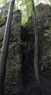 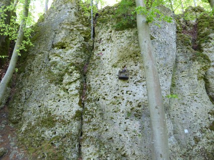 /8c/57/8c574b877578136cfce439d99873cf3dd39c9f50) |
1.2.22.13. Bärensteinwände 27 routes in Crag
- Summary:
-
All Sport climbing
Lat / Long: 49.763524, 11.331040
approach
Bitte am Sportplatz parken (49.76364, 11.34357).
Siehe https://ig-klettern.org/2020/06/parkplatzsituation-am-baerenstein/
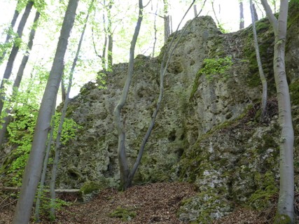 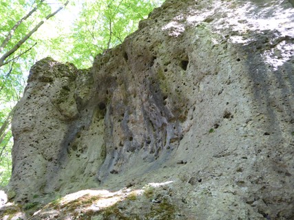 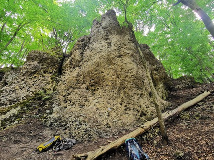 /cd/23/cd230824a871bfbe22c0927e7db5a2798931e467) /00/d1/00d1cb4b718d66e5e24bbd1ac7e89f0797058676) |
1.2.22.14. Breitenberg Südwand 18 routes in Crag
- Summary:
-
Sport climbing and Trad climbing
Lat / Long: 49.766468, 11.349666
summary
Sunny sport climbs, partly chossy, pretty easy for the grades.
access issues
"Zone 2" classification, i.e. no new routes
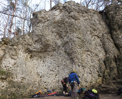 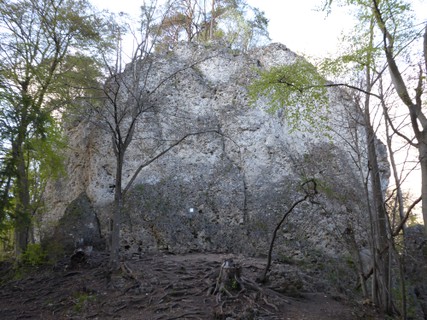 /91/2d/912d0cbe518d59765c7789ce83fa39f71942c614) |
1.2.22.15. Fellner Dolinenwand 9 routes in Crag
- Summary:
-
All Sport climbing
Lat / Long: 49.767053, 11.350034
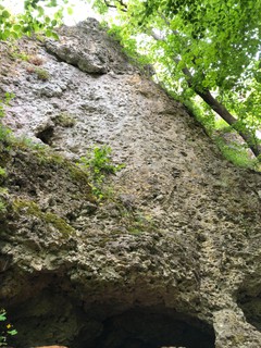 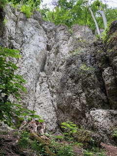 |
1.2.22.16. Breitenberger Nordwand 12 routes in Crag
- Summary:
-
Mostly Sport climbing
Lat / Long: 49.768921, 11.349908
approach
GPS: 11.34991, 49.76897
1.2.22.17. Breitenberg Parkplatzwand 2 routes in Crag
- Summary:
-
All Sport climbing
Lat / Long: 49.767477, 11.346493
approach
GPS: 11.34651, 49.76749
1.2.22.18. Oma Eichler Wand 5 routes in Crag
- Summary:
-
All Sport climbing
Lat / Long: 49.769405, 11.347752
summary
Small crag directly next to "Aussichtsfels am Breitenberg" with a handful of good routes on pockets.
description
All the routes to the right of "Sonne, Mond und Sterne" start from a ledge halfway up the wall; you need to climb the first half of "SMUS" (around 4 UIAA) to reach the belays.
1.2.22.19. Kesselpfeiler 3 routes in Crag
- Summary:
-
Sport climbing and Trad climbing
Lat / Long: 49.768780, 11.349529
description
Kleiner Turm zwischen "Breitenberg Nordwand" und "Tanzboden"
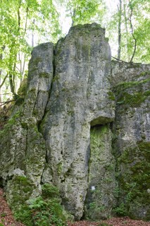 |
1.2.22.20. Tanzboden 10 routes in Crag
- Summary:
-
All Sport climbing
Lat / Long: 49.768908, 11.349136
1.2.22.21. Aussichtsfels am Breitenberg 6 routes in Crag
- Summary:
-
All Sport climbing
Lat / Long: 49.769061, 11.348242
1.2.22.22. Silvesterfels 4 routes in Crag
- Summary:
-
All Sport climbing
Lat / Long: 49.767607, 11.346976
1.2.22.23. Freibadwand 15 routes in Crag
- Summary:
-
Mostly Sport climbing
Lat / Long: 49.775468, 11.346290
summary
Shady wall in the forest with short routes from 5 to 7 UIAA.
approach
In Gößweinstein, park below the swimming pool "Höhenschwimmbad". Walk up "Schützenstraße", then a few meters before the town sign, turn right into a dirt road. After around 80 meters, a track leads left over the hill to the right part of the crag.
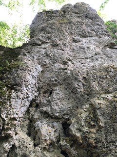 /c7/03/c703a00b98949229500c4722fc649b9d2c0b7209) 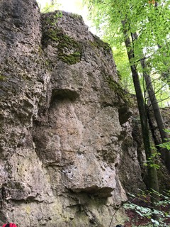 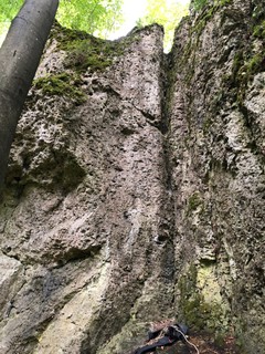 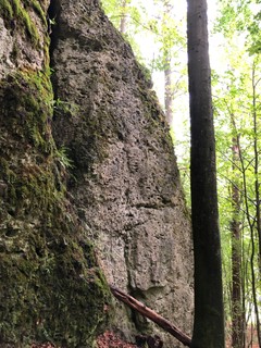 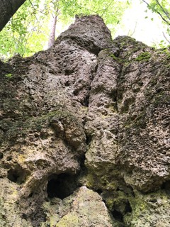 |
1.2.22.24. Lustige Zaubererwand 15 routes in Crag
- Summary:
-
All Sport climbing
Lat / Long: 49.760827, 11.346210
approach
Drive from Gößweinstein towards Stadelhofen, a few hundred meters after the Soccer ground is a turnoff towards Prügeldorf. park at the hikers parking lot here. Walk up the road towards Prügeldorf and you will see the first routes appearing to your right.
GPS: 11.34626, 49.76103
1.2.22.25. Lustige Wand 8 routes in Crag
- Summary:
-
All Sport climbing
Lat / Long: 49.760282, 11.347615
approach
GPS: 11.34756, 49.76032
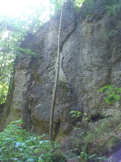 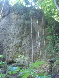 |
1.2.22.26. Vogeltränke 3 routes in Crag
- Summary:
-
All Sport climbing
Lat / Long: 49.761348, 11.348601
approach
GPS: 11.34860, 49.76132
1.2.22.27. Frankenwohnheim 12 routes in Crag
- Summary:
-
All Sport climbing
Lat / Long: 49.767544, 11.342272
description
NOTE: Someone clenched all bolts. The misbehaviour of climbers seems to lead to problems with residents.
access issues
This Crag is closed.
Massive misbehaviour of climbers lead to problems with the neighbours.
For more information see here: http://www.frankenjura.com/klettern/news/artikel/1106
approach
GPS: 11.34203, 49.76752
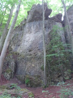 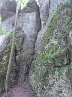 |
1.2.22.28. Zaubererturm 5 routes in Crag
- Summary:
-
All Sport climbing
Lat / Long: 49.767502, 11.342910
 |
1.2.22.29. Elfenwelt 24 routes in Crag
- Summary:
-
Mostly Sport climbing
Lat / Long: 49.745688, 11.320279
approach
GPS: 11.31913, 49.74506
1.2.23. Allersdorf 304 routes in Area
- Summary:
-
Mostly Sport climbing
Lat / Long: 49.742845, 11.349820
1.2.23.1. Allersdorfer Turm 0 routes in Crag
1.2.23.2. Allersdorfer Wand 8 routes in Crag
- Summary:
-
All Sport climbing
Lat / Long: 49.735858, 11.340047
description
just next to Daggi Wöhrl Ged. Wand, and together it might be worth a visit.
/b9/f7/b9f7246dc5bdeaed58ad5973db4a24eae7411b13) /64/72/6472be1f559e6b67fd6ede243fb067523d778b8b) |
1.2.23.3. Daggi Wöhrl Gedenkwand 15 routes in Crag
- Summary:
-
All Sport climbing
Lat / Long: 49.736167, 11.340003
approach
Parking (49.737530, 11.337738)
GPS: (49.73626, 11.34015)
Head up the forest road ~200m. Take a sharp left and follow the hiking trail up the slope. The cliff should be visible through the trees to your right, the access footpath forks off the hiking trail after ca 50m.
1.2.23.4. Fritz Fertinger Gedenkwand 8 routes in Crag
- Summary:
-
All Sport climbing
Lat / Long: 49.744895, 11.346111
description
Kleinerer, wenig frequentierter Fels im lichten Mischwald (vor allem Buchen) mit kurzem Zustieg, der auf den letzten Metern zur Nordwand bequem und zur Ostwand steil & rutschig ist. Man hört die Straße; wochenends/feiertags einige Motorräder aber nicht wirklich viele. Um den Fels herum können Kinder ohne Absturzgefahr spielen. In alle Routen kann man Toprope einhängen, einige sind zur rund 1/3 moosig, bei fast allen sind die Ausstiege botanisch.
approach
Auf der Straße von Stadelhofen Richtung Allersdorf, am Ende der Steigung endet linker Hand der Wald und geht in ein Feld über. Dazwischen geht ein Feldweg nach Nordost / links ab und nach Süden/rechts sieht man den Fels schon im Wald. Rund 100m nordwestlich/zurück ist der (49.7465, 11.3464) und 35m südöstlich/weiter geht nach rechts ein Pfad in den Wald, darauf nach 30m rechts abbiegen, nach knapp 100m steht man vorm Fels (49.7465, 11.3464).
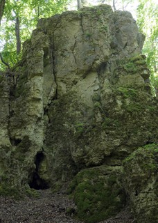 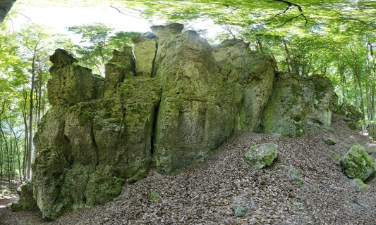 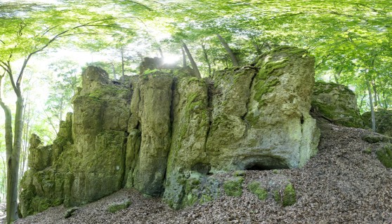 |
1.2.23.5. Föhrenstein 33 routes in Crag
- Summary:
-
Sport climbing, Trad climbing and Aid climbing
Lat / Long: 49.740258, 11.355208
summary
a good grade range and a quiet setting make this a good day out!
description
W-facing but shaded by trees, nice in summer unless it's really hot.
approach
drive from Gössweinstein to Stadelhofen and further to Allersdorf. park on the side of the road when you enter the village. Walk down the dirt road after the first house on the left for maybe 300m, you will leave the forest, cross a little field and when you enter the forest again a litte path will lead you to the crag in 200m. you will hit the main wall first. the Turm is another 100 further.
1.2.23.6. Östliche Förstelsteinkette 50 routes in Crag
- Summary:
-
Mostly Sport climbing
Lat / Long: 49.747670, 11.347724
summary
Access issues!!! Many routes was closed and bolts are cut off! Also among book and internet guides there is confusion in the naming and designation of roads
description
Perfect crag for children and beginners. But of course some older routes needs nuts and good lead climber. Most time overcrowded by groups.
access issues
https://ig-klettern.org/2021/10/foerstelsteinkette-kann-wieder-beklettert-werden/
Sperrungsgeschichte: Die Östliche Förstelsteinkette zwischen Allersdorf und Stadelhofen wurde auf Veranlassung der Naturschutzbehörde der Regierung Oberfranken, vom 1. August 2020 bis 30. September 2021, der Zone 1 zugeordnet. Das bedeutet, die Wand war mit einem Kletterverbot belegt. Diese Maßnahme war notwendig, da Aufgrund der hohen Besucherzahlen Waldschäden entstanden sind.
approach
250 Meter nach der Straßengabelung rechts parken (49.746283, 11.3464807). Die ehemalige Parkbucht direkt unterm Fels ist gesperrt.
where to stay
camping site Kormershof (http://www.kormershof.de)
history
temporär bis 30. September 2021 gesperrt, siehe https://ig-klettern.org/2020/08/achtung-foerstelsteinkette-bis-30-sept-2021-gesperrt/
    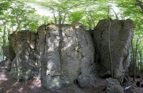 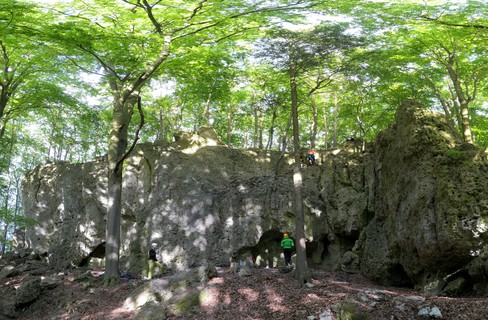 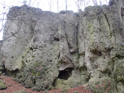 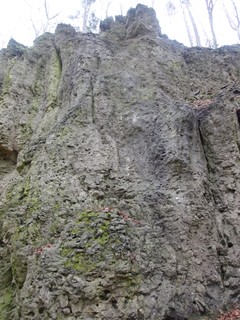 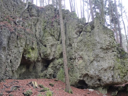    |
1.2.23.7. Frauenstein 6 routes in Crag
- Summary:
-
All Sport climbing
Lat / Long: 49.748871, 11.349605
approach
GPS: 11.34966, 49.74889
1.2.23.8. Herbstwand 6 routes in Crag
- Summary:
-
All Sport climbing
Lat / Long: 49.754790, 11.353684
summary
Shady little wall with great pockets providing a good day's worth of climbing in the intermediate grades.
access issues
Parking along the road between Stadelhofen and Prügeldorf is generally not allowed, there have been problems with farmers. Please park sensibly, don't obstruct any pathways.
approach
300 meters south west of the turnoff to Prügeldorf (900 meters from Stadelhofen), walk north along the edge of a little forest. After around 100 meters, the wall is on your left.
GPS: 11.35386, 49.75486
 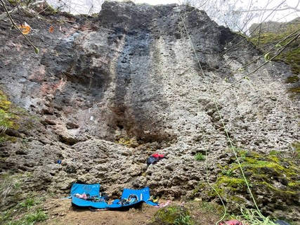 |
1.2.23.9. Vordere Stadelhofener Wände 9 routes in Cliff
- Summary:
-
All Sport climbing
Lat / Long: 49.754883, 11.347864
description
Sunny cliff with shady base. Small cave makes excellent playground for kids.
approach
GPS: 11.34796, 49.75498
 |
1.2.23.10. Hintere Stadelhofener Wände 23 routes in Crag
- Summary:
-
Mostly Sport climbing
Lat / Long: 49.755849, 11.347476
approach
Geparkt wird auf dem Wanderparkplatz zwischen Gößweinstein und Stadelhofen. In der Mitte des Parkplatzes führt ein Pfad hoch in den Wald und bald auf einen Forstweg. Diesem nach rechts folgen, bis nach ca. 300m der mit gelbem Kreis markierte Weg auf eine Lichtung führt. Direkt auf der gegenüberliegenden Seite sieht man schon die hinteren Stadelhofener Wände am Waldrand stehen.
 /6d/03/6d03406581c80cd077873745168572f6a8c90b9e) 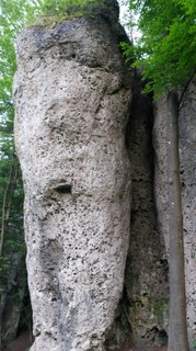 |
1.2.23.11. Heidepfeiler 5 routes in Area
- Summary:
-
All Sport climbing
Lat / Long: 49.758352, 11.345421
1.2.23.12. Stadelhofener Dunkelkammer 24 routes in Crag
- Summary:
-
Sport climbing and Bouldering
Lat / Long: 49.754192, 11.351705
summary
Shady crag with short routes and boulders in the range of grade 7 and 8 UIAA.
access issues
Parking between Stadelhofen and Sachsendorf seems to be a touchy subject.
approach
Park in Stadelhofen (parking is forbidden along the road between Stadelhofen and Sachsendorf; rumour has it that cars got hauled off in the past). Walk east out of the village towards Sachsendorf. After a few hundred meters, where the forest almost touches the road, cross the narrow stretch of field and follow a small path to the crag.
GPS: 11.35181, 49.75426
1.2.23.13. Lindenstein 38 routes in Crag
- Summary:
-
Mostly Sport climbing
Lat / Long: 49.741252, 11.342610
summary
A lot of routes between 4- and 6+, but often with few bolts, so bring your nuts and slings.
description
Mixture of bolted and clean routes, although many of the easy routes might need some additional protection for beginners. At weekends often crowded. The more difficult routes are also recommendable.
approach
Park at the northern end of Allersdorf, then walk into the village and take the first to the right to camping Kormershof. Behind the camping ground you can see a lonely house at the edge of the forest. From there, a path leads into the forest. After a few meters, turn left and follow the path to the visible rocks.
where to stay
http://www.kormershof.de (camping 5min away from crag)
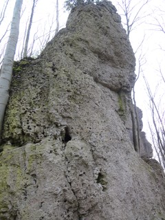 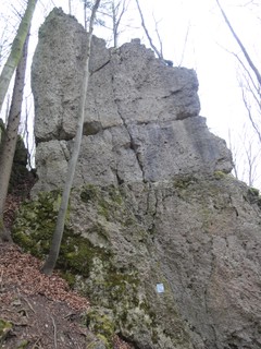 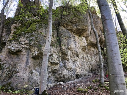 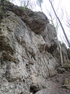 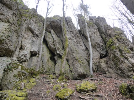 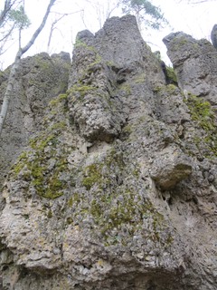 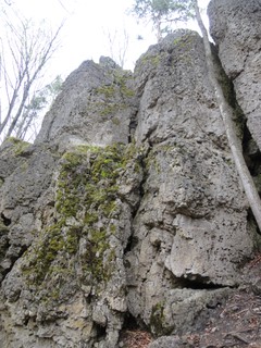 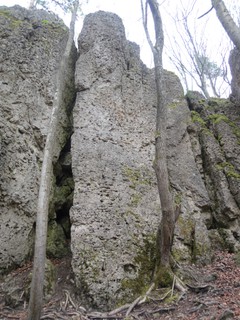 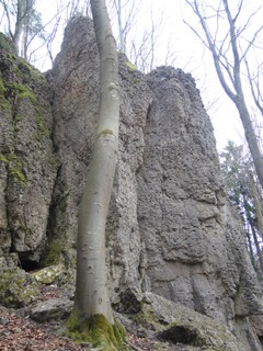 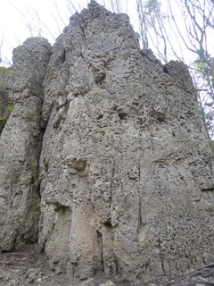 |
1.2.23.14. Prügeldorfer Turm 8 routes in Crag
- Summary:
-
All Sport climbing
Lat / Long: 49.752503, 11.353146
summary
Little tower with pocketed routes on its east face.
description
Small tower, vegetated on most sides, but with a nice, vertical to slightly overhanging east face with pocketed routes in good rock. Unfortunately, there's a liquid manure tank right next to it, so it often smells.
 |
1.2.23.15. Parkplatzwandl 1 route in Crag
- Summary:
-
All Sport climbing
summary
Zone 1
1.2.23.16. Preßknockwände 36 routes in Crag
- Summary:
-
Mostly Sport climbing
Lat / Long: 49.730453, 11.344559
approach
Park in Kleingesee near the playground (49.729267, 11.338483)
 /66/cf/66cf8c9e195215b6641f453a7f42046b636ad593) 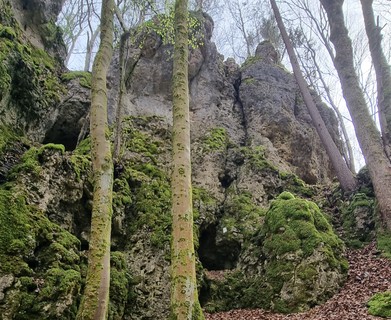  /fc/03/fc0323c04dc4c02b6a6bde9003beb2a244509bbc) 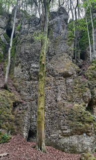 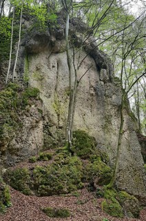 |
1.2.23.17. Prügeldorfer Wand 6 routes in Crag
- Summary:
-
All Sport climbing
Lat / Long: 49.757113, 11.350256
summary
Very short routes in quiet surroundings.
description
Pocketed routes that are best climbed as boulders. Even more so since some of the bolts have been rendered unusable with a hammer.
approach
GPS: 11.35046, 49.75704
1.2.23.18. Wappenwände 14 routes in Crag
- Summary:
-
All Sport climbing
Lat / Long: 49.733066, 11.338178
summary
Pocketed wall with easier routes.
description
The wall, named after the painted coat of arms in the right part, was mostly developed by Hans Frost in the early 2000s. In most routes, a set of nuts and some slings are recommended.
  |
1.2.23.19. Wappenwand Nebenfels 4 routes in Crag
- Summary:
-
All Sport climbing
Lat / Long: 49.734354, 11.339524
summary
Small wall. Only few, but nice routes
description
Only a few hundred meters away from the name giving Wappenwände. Easy routes are a bit mossy. Well bolted.
approach
Parking along the street, about 500m after Kleingesee in the direction of Stadelhofen. Follow forest road for 200m. Small path to the wall on the right side.
/19/e0/19e040025bb425d3202fe606a43c22b70cd05d99) |
1.2.23.20. Wasserstein 10 routes in Crag
- Summary:
-
Mostly Sport climbing
Lat / Long: 49.742355, 11.354312
 |
1.2.24. Graisch, Leienfels, Bärnfels 357 routes in Area
- Summary:
-
Mostly Sport climbing
Lat / Long: 49.715323, 11.362089
1.2.24.1. Graischer Bleisteinwände 86 routes in Crag
- Summary:
-
Mostly Sport climbing
Lat / Long: 49.714689, 11.376271
description
Traum-Kalk: Griffig, einige kleine Höhlen, viele Löcher, Schuppen und Risse. Die Wände ziehen sich um den Berg herum. Bei 'Balkentoni' kann man bequem durch den Felsriegel hindurch gehen, um die Seite zu wechseln. Der Wald besteht hauptsächlich aus Buchen mit einigen eingestreuten Nadelbäumen.
approach
(48.71280, 11.37787) an der Gabelung südlich vom Sektor 'Rechte Wand', wenn dort voll ist, rund 300m südöstlich beim (48.71078, 11.38062) vor der 'Graischer Nadel'. Vom näheren P den Wirtschaftsweg nach Nordwest rund 125m gehen, dann rechts dem Pfad bergauf bis zum jeweiligen Sektor folgen.
1.2.24.2. Graischer Nadel 7 routes in Crag
- Summary:
-
Sport climbing and Trad climbing
Lat / Long: 49.710108, 11.380247
approach
GPS: 11.38021, 49.71012
1.2.24.3. Graischenstein 40 routes in Crag
- Summary:
-
Mostly Sport climbing
Lat / Long: 49.711940, 11.383910
approach
GPS: 11.38392, 49.71255 (left side)
1.2.24.4. Leienfelser Türmchen 6 routes in Crag
- Summary:
-
All Sport climbing
Lat / Long: 49.705087, 11.369819
/8f/c5/8fc58b58a7d5969d11a0d68340e761cc9f28be68) |
1.2.24.5. Leienfelser Pfeiler 14 routes in Crag
- Summary:
-
All Sport climbing
Lat / Long: 49.708012, 11.369739
summary
Mehr als eine (nordwestseitige) Ergänzung zur Leienfelser Ruine.
description
Gut abgesicherte Routen von 3 bis 7 in festem Fels.
approach
100 Meter von den Einstiegen der Ruine rechts dem Wanderweg folgen.
 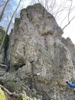  |
1.2.24.6. Leienfelser Block 16 routes in Crag
- Summary:
-
Sport climbing and Trad climbing
Lat / Long: 49.705306, 11.373102
/a8/0c/a80cb791de1192c82874a39c20e726b4eb3893d9)  |
1.2.24.7. Ruine Leienfels 19 routes in Crag
- Summary:
-
All Sport climbing
Lat / Long: 49.709433, 11.369645
approach
From the center of the village Leienfels (restaurant "Zur Burgruine"), follow the signs "Burgruine" in northwest direction. Arriving in front of the ruins, a small path to your left leads downwards to the crag (directly below the ruins).
1.2.24.8. Linke Reibertsbergwand 7 routes in Crag
- Summary:
-
All Sport climbing
Lat / Long: 49.721226, 11.346271
1.2.24.9. Rechte Reibertsbergwand 12 routes in Crag
- Summary:
-
All Sport climbing
Lat / Long: 49.721959, 11.345374
  |
1.2.24.10. Ganz rechte Reibertsbergwand 16 routes in Crag
- Summary:
-
All Sport climbing
Lat / Long: 49.722069, 11.345008
summary
DE: Viele sehr leichte und gut gesicherte Routen. Gut für Kinder geeignet.
EN: Very easy plaisir routes for beginners and childrens. Nice area for childs to play.
approach
Parking side north east of Bärnfels. Follow road a little bit to north. Then left.
/26/05/26053ec5c3b4352b8966e7e0fab56f0ddb928d19) /a1/29/a1290151fffbef0fae835af696fcf6de1e024947) /d8/89/d8899093a8c6be260ca4cf1278079c27867391ce)   |
1.2.24.11. Gräfenberger Turm 6 routes in Crag
- Summary:
-
All Sport climbing
Lat / Long: 49.723031, 11.343870
approach
go to Reibertsbergwand and than straight on to north - turn left.
/8b/1a/8b1a0d285844b9f7cf50e147fe1cd149fc737a8f) /16/8a/168a4da9819128d4129a81cbf6e6f7190f9faf5d) |
1.2.24.12. Schda Schdum 63 routes in Crag
- Summary:
-
Sport climbing, Bouldering and Trad climbing
Lat / Long: 49.713181, 11.344165
summary
DE: Einige leichte und gut gesicherte Routen für die ersten Vorstiegsversuche.
description
The crag covers a wide range of grades and is always shady (if the trees have leaves that is)
approach
DE: Von Obertrubach nach Bärnfels und die erste Straße rechts zum Friedhof abbiegen.. Dem Weg entlang der Kirche folgen und rechts in the Straße abbiegen. Diese geht wieder in einen Feldweg über und führt zum Wald. Nach wenigen Metern an einer Kreuzung nach links
EN: From Obertrubach to Bärnfels, turn right and park next to the cemetary. follow a path next to the church over the hill and turn right at the bottom near the edge of the forest. follow the path into the forest for about 100m until you can see the crag to left.
Parking:
1.2.24.13. Soranger Wand 32 routes in Crag
- Summary:
-
All Sport climbing
Lat / Long: 49.721335, 11.367336
approach
GPS: 11.36728,49.72131
/75/40/75400ecffe908a694c74cda0121191ce0d701048)  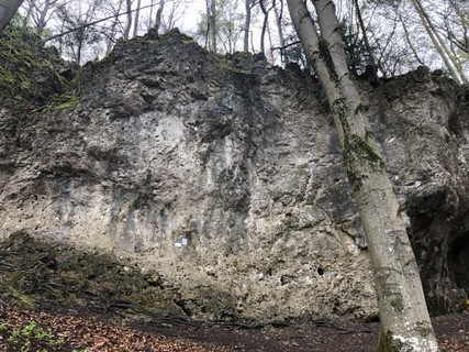   |
1.2.24.14. Wolfstein 33 routes in Crag
- Summary:
-
Mostly Sport climbing
Lat / Long: 49.717515, 11.354795
 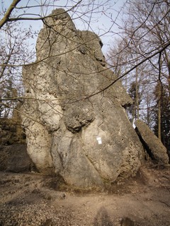 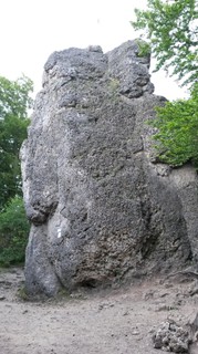  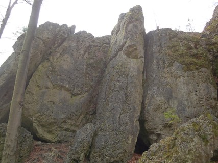  |
1.2.25. Betzenstein-Stierberg-Leupoldstein 457 routes in Area
- Summary:
-
Mostly Sport climbing
Lat / Long: 49.681794, 11.404355
1.2.25.1. Betzensteiner Sportkletterwand 45 routes in Crag
- Summary:
-
Mostly Sport climbing
Lat / Long: 49.681011, 11.408815
approach
GPS: 11.40951, 49.68080 park site near open air bath
where to stay
camping in Betzenstein
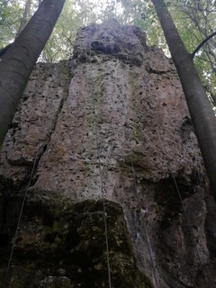 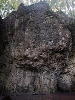 /74/f7/74f7305d5a0a5e4c1f598c40a28651ada0e97848) 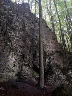 |
1.2.25.2. Parkplatzwand 8 routes in Crag
- Summary:
-
All Sport climbing
Lat / Long: 49.684520, 11.406952
approach
At the signpost "Rund um Betzenstein" please walk 20 metres to the forest and turn right to the wall. Please do not walk directly across the field.
/33/07/330750908dad5a9c0b9557dbe910bd56108d0776) /80/11/80117b62c01a0c766820e33d8fd5c98522123b2f) /f9/3a/f93a3b7b3f20ef85715c7ca6f6e4155ed9ece18c) /52/6a/526a125d9842c8895d8069d5d695b52e2bf1782d) |
1.2.25.3. Dreistaffelfels 91 routes in Crag
- Summary:
-
Mostly Sport climbing
Lat / Long: 49.676802, 11.415035
approach
Bitte den Wanderparkplatz am Ortsausgang benutzen (49.677073, 11.413747). Please leave your car here (49.677073, 11.413747). Bitte aus Rücksicht auf die Anwohner nicht in die Straße Am Gerhardsfelsen fahren und NICHT auf der Wiese (49.677247, 11.414745) parken. Please don't use the lawn for parking.
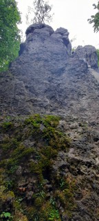 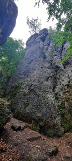 |
1.2.25.4. Leupoldsteiner Wand 73 routes in Crag
- Summary:
-
Mostly Sport climbing
Lat / Long: 49.693014, 11.389995
summary
Very popular with a huge grade range and sun on the south side, shade all day on the north east side of the crag.
description
Bring some wires for additional protection, you can expect there to be bolts when it gets tough though. This is mostly the case because the crag offers more "natural lines" than many other crags in Franken. Expect some great corners, cracks but of course no shortage of pockets either!
approach
Drive from Betzenstein to Leupoldstein, in L. turn left and when the road bends rightwards turn left again into a little sideroad next to the bus stop. Down this for a bit until you can see a parking spot on the right (and possibly a lot of cars). Park here (49.692868, 11.391619). Please drive slowly for the neighbours with kids and animals. Walk to the edge of the forest, some rock might peak out above. Creep into the left side which is southfacing or rightwards to the long NE face.
GPS: (49.69267, 11.39073)
   /af/c8/afc834618485c92e7251d6d45e6f027be14903ff)  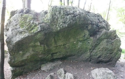  /2f/af/2faf316a349015c55c49afe4579e7c7e43606843)  /a8/36/a836a2ee53ff05966fb16da4ec9ad1669656223b)   |
1.2.25.5. Münchser Wand 45 routes in Crag
- Summary:
-
Mostly Sport climbing
Lat / Long: 49.677322, 11.376870
approach
Drive from Münchs in the direction of Stierberg. After 300 meters, parking is on the left. Enter the forest and walk uphill 150 meters to the already visible rocks.
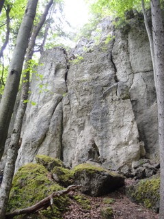 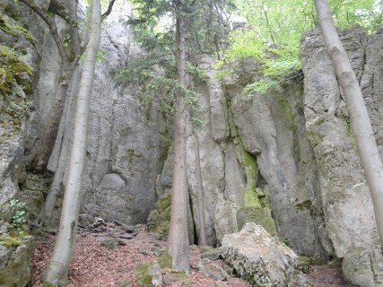 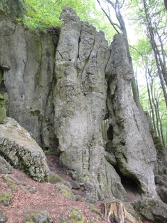 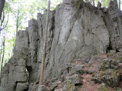 |
1.2.25.6. Münchser Türmchen 8 routes in Sector
- Summary:
-
All Sport climbing
Lat / Long: 49.676954, 11.377041
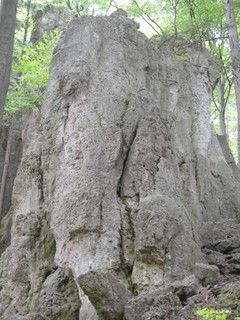 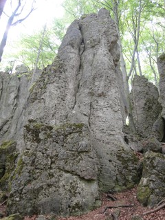 |
1.2.25.7. Stierberger Wand 11 routes in Crag
- Summary:
-
All Sport climbing
Lat / Long: 49.677110, 11.387464
approach
GPS: 11.38745, 49.67711
1.2.25.8. Stierberger Nordwand 15 routes in Crag
- Summary:
-
All Sport climbing
Lat / Long: 49.676415, 11.381247
approach
GPS: 11.38133, 49.67571
 |
1.2.25.9. Langer Berg Wand 45 routes in Crag
- Summary:
-
Mostly Sport climbing
Lat / Long: 49.681168, 11.371941
access issues
Parts of this crag are usually closed from January 1 until July 31. An active closure is indicated by a warning and 'closed' tag here on the site; when in doubt, signs put up at the crag have precedence!
Teile dieses Felsens sind üblicherweise von 1. Januar bis 31. Juli gesperrt. Eine aktive Sperrung wird auf dieser Seite durch eine Warnung und ein 'gesperrt'-Tag markiert; im Zweifelsfall haben die örtlich aufgehängten Schilder Vorrang!
1.2.25.10. Stierberger Gemsenwand 50 routes in Crag
- Summary:
-
Mostly Sport climbing
Lat / Long: 49.676208, 11.378966
1.2.25.11. Hetzendorfer Wand 29 routes in Crag
- Summary:
-
All Sport climbing
Lat / Long: 49.671569, 11.414267
approach
GPS: 11.41406, 49.67149
 /d0/ab/d0ab54f94b9ac3cf506bc51cdf11045fa766750b) /3b/7e/3b7e44aa2593f27b8c45eea52b923f6aaa485206) /35/08/3508ed79a934a9b58a5ea30220ca8a2f6bb59b10)  |
1.2.25.12. Hetzendorfer Felsengnom 2 routes in Crag
- Summary:
-
All Sport climbing
Lat / Long: 49.669865, 11.416356
approach
GPS: 11.41635, 49.66987
1.2.25.13. Wasserkröte 10 routes in Crag
- Summary:
-
All Sport climbing
Lat / Long: 49.693362, 11.411626
summary
Schöne fränkische Lochkletterei in festem Fels.
description
Routen üerwiegend im 7ten und 8ten Grad, bei denen gutes Stehen und Fingerkraft gefragt ist.
access issues
Bitte verhaltet euch ruhig wegen angrenzendem Jagdgebiet.
approach
100 Meter auf dem Wanderweg nach dem Wasserstein leicht erreichbar.
ethic
Keine Neutouren erlaubt, bitte Tickmarks entfernen.
history
2023 erschlossen.
 /7a/4f/7a4f9a7c9b9de767129653ea94448efff0146baf) 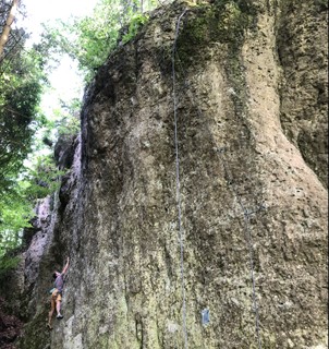 |
1.2.25.14. Vergessene Welt 4 routes in Crag
- Summary:
-
All Sport climbing
Lat / Long: 49.694467, 11.413079
approach
GPS: 11.41312, 49.69459
1.2.25.15. Kleiner Wasserstein 21 routes in Crag
- Summary:
-
Mostly Sport climbing
Lat / Long: 49.681245, 11.399671
approach
GPS: 11.39960, 49.68113
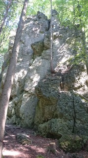   |
1.2.26. Hiltpoltstein 301 routes in Area
- Summary:
-
Mostly Sport climbing
Lat / Long: 49.661110, 11.356922
1.2.26.1. Hexenküche 109 routes in Crag
- Summary:
-
Mostly Sport climbing
Lat / Long: 49.664102, 11.332474
approach
GPS: 11.33310, 49.66406 (Sector 1&2)
1.2.26.2. Almoser Wand 15 routes in Crag
- Summary:
-
Mostly Sport climbing
Lat / Long: 49.669479, 11.349654
approach
the crag is situated directly near the B2 at Almos, (traffic) and is easyly reached if you drive from Hilpoltstein towards Leupoldstein (Bayreuth).
  |
1.2.26.3. Bitzenberg 8 routes in Crag
- Summary:
-
All Sport climbing
Lat / Long: 49.666769, 11.328723
approach
GPS: 11.32869, 49.66688
/49/f4/49f419b26d045335eaf260b68063d71145e18844) /f4/ac/f4acb4e47c99e91e5f3992182807194cab356ed0) |
1.2.26.4. Ochsenbrand 39 routes in Crag
- Summary:
-
Mostly Sport climbing
Lat / Long: 49.679060, 11.351661
summary
Schöner Fels mit Sportkletterrouten vom 3. bis zum 8. Grad. Freunde von gut abgesicherten Routen und Benutzer von Keilen kommen auf ihre Kosten. Einen kinderfreundlichen Wandfuß gibts dazu.
description
Von Möchs aus in 10min zu erreichen. Ausrichtung Nord/Ost/Süd.
access issues
Die Wand bitte 2 Stunden vor Sonnenuntergang verlassen.
Please leave the wall 2 hours before sunset.
approach
/84/b3/84b3d062f0e1cb10c24f15a4164f06d4baadf36f)  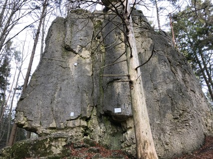  /0f/e1/0fe1e7a08faab265a99548cdbf69a949f2bc9701) |
1.2.26.5. Stumpfelestein 27 routes in Crag
- Summary:
-
All Sport climbing
Lat / Long: 49.666362, 11.333998
approach
GPS: 11.32919, 49.66576
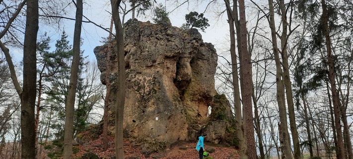 /77/fd/77fd7c6759f8fd71fe8e8f536726323b9564ccbf) /b2/11/b211cc4be06174bf55d15cbf7ec9b89b600c737b) |
1.2.26.6. Ittlinger Wand 18 routes in Crag
- Summary:
-
Sport climbing and Trad climbing
Lat / Long: 49.657100, 11.382742
approach
GPS: 11.38286,49.65709 Parking at the bus-stop in Reipertsgesee, then follow the path to "Strahlenfels" (green mark), heading south to the forest. Sector main is about 200m in the forest right of the path.
park in Reipertsgesee near the little green pond (bus stop), walk between the pond and house no. 1 past 1a (follow green arrows towards strahlenfels)for about 250m into the forest. the Ittlinger Fels is to the left of the path, the main crag 50m further on the right
/ea/7a/ea7a23d35b331c0dd3768951b823d6c96ab0f461) /0e/2e/0e2e20f57d7767f9163871d887c2b6bbde97bff5) /51/a0/51a0bf52f33c89c24037714d627896c46e370c41) |
1.2.26.7. Ittlinger Fels 17 routes in Crag
- Summary:
-
Sport climbing, Aid climbing and Bouldering
Lat / Long: 49.657303, 11.383669
description
GPS. 11.38367, 49.65732
approach
PS: 11.38286,49.65709 Parking at the bus-stop in Reipertsgesee, then follow the path to "Strahlenfels" (green mark), heading south to the forest. Sector main is about 200m in the forest right of the path.
park in Reipertsgesee near the little green pond (bus stop), walk between the pond and house no. 1 past 1a (follow green arrows towards strahlenfels)for about 250m into the forest. the Ittlinger Fels is to the left of the path.
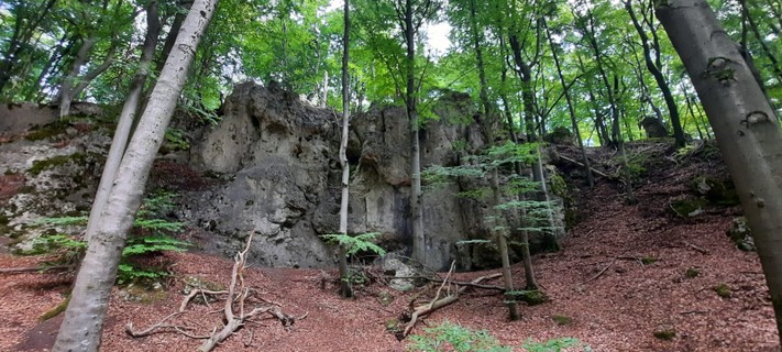 |
1.2.26.8. Hühnersteinwand 27 routes in Crag
- Summary:
-
Mostly Sport climbing
Lat / Long: 49.657328, 11.395888
approach
GPS: 11.39568, 49.65741
/38/3a/383aaa6c09f32cbf022a862961718132669579de) /a8/e5/a8e5e0cd961eb7cbe2cbbe56e52d8e9298434948) /0f/e0/0fe04b4eb304e2ec3c57ff8d842c89a432578eb4) /0f/b3/0fb3dc527a3154ef6209f78d0bab200e2dac7e62) |
1.2.26.9. Hühnerstein 17 routes in Crag
- Summary:
-
Sport climbing and Trad climbing
Lat / Long: 49.656268, 11.396925
approach
GPS:
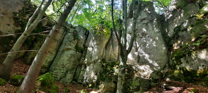 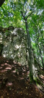 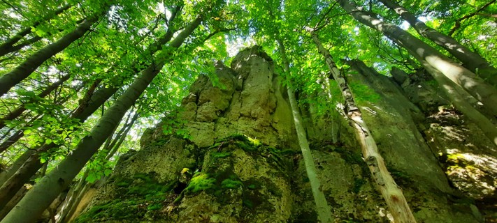 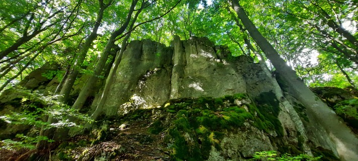 |
1.2.26.10. Reipertsgeseer Wand 11 routes in Crag
- Summary:
-
All Sport climbing
Lat / Long: 49.658211, 11.382189
approach
parking centre Reipertsgesee - walk to direction Strahlenfels. On the forestborder go in the right direction-
/13/c4/13c454ca45e57ad607dba4504013281067fad5ff) /68/fe/68fea4a380d0712f5ac204e3dff14031ee36b494) /6d/a4/6da4ffa019a36452dda35629e4078ad69a9bcdb3) 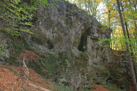 |
1.2.26.11. Strahlenfels 13 routes in Crag
- Summary:
-
All Sport climbing
Lat / Long: 49.653207, 11.377392
access issues
Bitte keine Abkürzungen durch das Dorf nehmen, sondern den ausgeschriebenen Zustiegsweg benutzen!
Please do not take any shortcuts through the village, but use the advertised access route!
approach
GPS: (11.37755, 49.65334)
1.2.27. Spies 243 routes in Area
- Summary:
-
Mostly Sport climbing
Lat / Long: 49.629924, 11.374479
1.2.27.1. Hohe Reute 51 routes in Cliff
- Summary:
-
Sport climbing and Trad climbing
Lat / Long: 49.634169, 11.409392
approach
Drive to Spies. Only few meters after sign village "Spies" turn right to parking site (49.6353633, 11.4066468). From parking site, walk east on a forest track. Pass below a house.
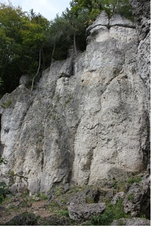 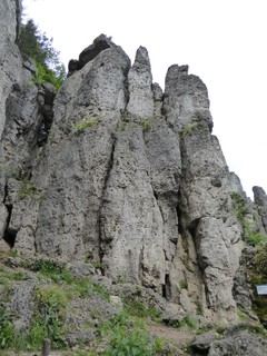 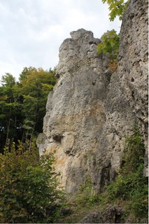 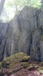 |
1.2.27.2. Spieser Wand 15 routes in Crag
- Summary:
-
Mostly Sport climbing
Lat / Long: 49.636863, 11.408726
approach
GPS: 11.40871, 49.63684
1.2.27.3. Leonhardsturm 10 routes in Crag
- Summary:
-
Mostly Sport climbing
Lat / Long: 49.636425, 11.411462
approach
GPS: 11.41119, 49.63651
1.2.27.4. Vogler Gedenkwand 9 routes in Crag
- Summary:
-
Sport climbing and Trad climbing
Lat / Long: 49.635546, 11.411779
approach
GPS of crag: (11.41195, 49.63556)
1.2.27.5. Kanzelwand 10 routes in Crag
- Summary:
-
Mostly Sport climbing
Lat / Long: 49.635639, 11.412284
approach
GPS of crag: (11.41216, 49.63568)
 |
1.2.27.6. Spieser Felsen 9 routes in Crag
- Summary:
-
All Sport climbing
Lat / Long: 49.639490, 11.400937
1.2.27.7. Hunger Wand 3 routes in Crag
- Summary:
-
All Sport climbing
Lat / Long: 49.657272, 11.426120
summary
A shady option if Schimmelecke gets too hot.
description
Short walk makes for easy access. Rock quality is decent and the shade is nice in summer.
approach
From Spies drive towards Plech and turn left to Klausberg. From the A9 take the exit Plech, drive through Ottenhof in direction of Betzenstein and right after the village ends, there is a left turn towards Klausberg. The crag is just next to a turnoff towards Reuthof.
GPS: (11.42611, 49.65721)
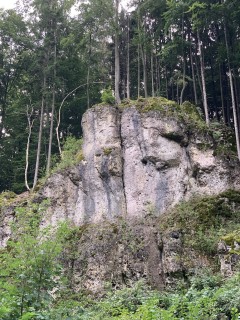 |
1.2.27.8. Ruine Riegelstein 40 routes in Crag
- Summary:
-
All Sport climbing
Lat / Long: 49.636571, 11.422898
approach
Please park in the parking lot at the kindergarten (eastside of the A9) and cross then through the tunnel to the other side. (49.633641, 11.424581)
https://ig-klettern.org/2020/09/parkplatzsituation-burgruine-riegelstein/
    |
1.2.27.9. Schiepfenstein 20 routes in Crag
- Summary:
-
All Sport climbing
Lat / Long: 49.630490, 11.389910
 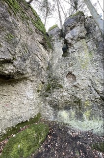 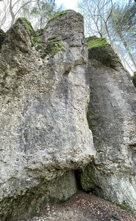 /ad/19/ad1927d1df7afa3e0e0f1d6e927021b316702dc8) /f2/80/f280595c7609841a381b6841942a30bc0841cc9b) /4f/77/4f77a19543362afe871e1d609b6565ec945da9fe) |
1.2.27.10. Eibgrat Nordwand 13 routes in Crag
- Summary:
-
All Sport climbing
Lat / Long: 49.645544, 11.420088
description
Hohe Nordwand mit genialen Routen, die aber noch ein bisschen abgeklettert werden müssen. Topo: https://ig-klettern.org/wp-content/uploads/2019/10/topo-eibgrat-nordwand.png
1.2.27.11. Bärleinhuter 22 routes in Crag
- Summary:
-
Mostly Sport climbing
Lat / Long: 49.645153, 11.422721
summary
Update 2022: All of routes were equipped with new bolts. Therefore routes 1-9 are climbable and offer good rock. All other routes have more bolts as well, so every route is very well protected now.
1.2.27.12. Schimmelecke 10 routes in Crag
- Summary:
-
All Sport climbing
Lat / Long: 49.651337, 11.424375
approach
GPS: (49.65141, 11.42440)
/c6/bc/c6bc7e4d4e4b5b79830133c709f70363e03d4142) /5d/ab/5dab752d3db503a565b09edad360f32a5798ab94) |
1.2.27.13. Devils Garden 3 routes in Crag
- Summary:
-
All Sport climbing
Lat / Long: 49.636094, 11.359149
approach
GPS: 11.35914, 49.63610
1.2.27.14. Naifertaler Klettergarten 21 routes in Crag
- Summary:
-
Mostly Sport climbing
Lat / Long: 49.625031, 11.361002
summary
Shady north-east face with short, bouldery routes. A few sunny routes around the corner.
approach
 |
1.2.27.15. Wintersteiner Wand 7 routes in Crag
- Summary:
-
All Sport climbing
Lat / Long: 49.629964, 11.337587
1.3. Hersbrucker Schweiz 3,719 routes in Area
- Summary:
-
Mostly Sport climbing
Lat / Long: 49.589078, 11.565519
description
1.3.1. Oberes Pegnitz- und Flembachtal 177 routes in Area
- Summary:
-
Sport climbing, Bouldering and other styles
Lat / Long: 49.730057, 11.608723
1.3.1.1. Welle 12 routes in Crag
- Summary:
-
Sport climbing and Bouldering
Lat / Long: 49.746176, 11.546433
approach
GPS: 11.54643,49.74622
1.3.1.2. Weidlwanger Wand 15 routes in Crag
- Summary:
-
Mostly Sport climbing
Lat / Long: 49.730950, 11.558009
approach
GPS: 11.56266,49.73187
1.3.1.3. Hainbronner Pfeiler 11 routes in Crag
- Summary:
-
All Sport climbing
Lat / Long: 49.739350, 11.556076
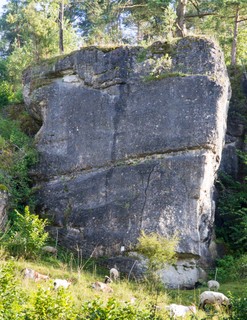 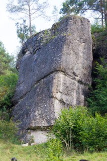 |
1.3.1.4. Wachbergfelsen 44 routes in Crag
- Summary:
-
Mostly Sport climbing
Lat / Long: 49.738941, 11.555692
summary
Large crag with phenomenal dark lime stone but sometimes huge distances between bolts. Mostly vertical wall climbing. Shady until late in the afternoon.
approach
From Hainbronn in direction of Weidlwang. After a few meters, there is parking space on the left. Follow the street for a few minutes and you can already see "Hainbronner Pfeiler". Walk up to it through the trail in the grass and continue at the right end of the crag along a small path. You will reach the crag in about 2 minutes.
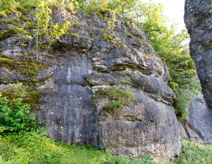 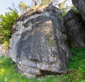  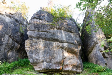  |
1.3.1.5. Geheimaktion 23 routes in Crag
- Summary:
-
Mostly Sport climbing
Lat / Long: 49.704722, 11.592566
description
North-facing crag with lots of beautiful climbs on small pockets and crimps. The protection is sometimes a bit bold. Lots of stinging-nettles in the summer.
approach
Park in Hofmühlweg near the junction to Auerbacher Straße. Follow Hofmühlweg northward and go left after reaching the round building; you should see the right-hand side of the crag after a few steps. GPS: 11.59245,49.70465
 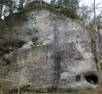 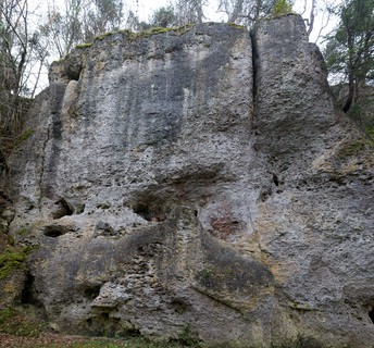 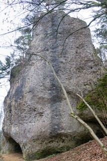 |
1.3.1.6. Flemtalpilz 5 routes in Area
- Summary:
-
Aid climbing, Trad climbing and Sport climbing
Lat / Long: 49.723464, 11.594675
access issues
This crag is usually closed from February 1 until June 30. An active closure is indicated by a warning and 'closed' tag here on the site; when in doubt, signs put up at the crag have precedence!
Dieser Fels ist üblicherweise von 1. Februar bis 30. Juni gesperrt. Eine aktive Sperrung wird auf dieser Seite durch eine Warnung und ein 'gesperrt'-Tag markiert; im Zweifelsfall haben die örtlich aufgehängten Schilder Vorrang!
1.3.1.7. Flemtalwächter 7 routes in Crag
- Summary:
-
Sport climbing and Aid climbing
Lat / Long: 49.722354, 11.594568
summary
Bulky tower in an idyllic valley.
access issues
This crag is usually closed from February 1 until June 30. An active closure is indicated by a warning and 'closed' tag here on the site; when in doubt, signs put up at the crag have precedence!
Dieser Fels ist üblicherweise von 1. Februar bis 30. Juni gesperrt. Eine aktive Sperrung wird auf dieser Seite durch eine Warnung und ein 'gesperrt'-Tag markiert; im Zweifelsfall haben die örtlich aufgehängten Schilder Vorrang!
approach
GPS: 11.59460,49.72248
1.3.1.8. Hüttenwand 2 routes in Crag
- Summary:
-
Aid climbing and Sport climbing
Lat / Long: 49.721948, 11.593393
approach
GPS: 11.59343,49.72196
/89/c8/89c8642a39517848efabd411afc4655f93f59ceb) |
1.3.1.9. Flemtalwand 7 routes in Crag
- Summary:
-
All Sport climbing
Lat / Long: 49.723080, 11.593108
access issues
This crag is usually closed from February 1 until June 30. An active closure is indicated by a warning and 'closed' tag here on the site; when in doubt, signs put up at the crag have precedence!
Dieser Fels ist üblicherweise von 1. Februar bis 30. Juni gesperrt. Eine aktive Sperrung wird auf dieser Seite durch eine Warnung und ein 'gesperrt'-Tag markiert; im Zweifelsfall haben die örtlich aufgehängten Schilder Vorrang!
approach
GPS: 11.59327,49.72301
/3f/ce/3fcefdc2f3703abded4f5e0f9e9686c92962a44f) /16/91/1691977590669124cbf555851d80b230a680faa1) |
1.3.1.10. Großer Lochstein 4 routes in Crag
- Summary:
-
Aid climbing and Sport climbing
1.3.1.11. Felsenländl 5 routes in Crag
- Summary:
-
All Bouldering
Lat / Long: 49.707289, 11.610988
summary
Three bouldering crags with one big cave with some roped routes. The location is on a large field with a little creek running nearby and nice hiking trails passing through.
description
Three bouldering crags with one big cave with some roped routes. The location is on a large field with a little creek running nearby and nice hiking trails passing through. For those with children, it's ideal for them to play here safely, but watch out for ticks. The approach is stroller-friendly.
approach
49.707, 11.615 GPS indicates parking area Take the Pegnitz exit from the Autobahn A9 and head towards Auerbach on the B470. Stay on the B470 towards Weiden shortly before you reach Auerbach. After about 1km there's a parking area on both sides of the road. Park on the one on the opposite (north) side of the road to the direction in which you're traveling.
From here, locate a little path into the woods. Follow this path for about 20m and turn left. After about 70m you'll be out of the woods. Turn right and go to the road and follow it to the left for about 100m. Before you reach the creek there's a little trail in the grass leading to the already visible crags. The approach takes about 5 minutes.
1.3.1.12. Lochbergwände 42 routes in Crag
- Summary:
-
Sport climbing, Bouldering and other styles
Lat / Long: 49.744678, 11.547708
approach
GPS:11.54740,49.74483
1.3.1.13. Beilensteiner Felsen 0 routes in Crag
description
Gottvaterberg / closed
1.3.2. Neuhaus 58 routes in Area
- Summary:
-
Mostly Sport climbing
Lat / Long: 49.635099, 11.525612
1.3.2.1. Weißenstein 51 routes in Crag
- Summary:
-
Mostly Sport climbing
Lat / Long: 49.634586, 11.532078
summary
description
Very popular crag with a myriad of good routes with most of the time sensible protection in various styles. Short, bouldery routes with sometimes overhanging start in the left part ('Linker Teil'); mostly vertical routes in the middle ('Mittlerer Teil') and the famous bulge/overhang to the right ('Rechter Teil') with classics like 'Entsafter' and 'Dampfhammer'.
approach
This crag is ideal to reach by train and bike. Take the train to Neuhaus an der Pegnitz (27 min from Nuremberg main station), then cycle another 10-15 minutes without much of incline.
Also car parking is provided directly at the crag (49.6345778, 11.5308468). Just grab your gear and walk to the wall.
/2d/7d/2d7d0fa9fc5e244cf79ad9ff23c758e950abbc87)  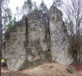 /f8/09/f80958cf1a99b9eefca20a70a6a4f82e75ef4d1e) /f1/a4/f1a4e75cb73e872921f1abbd62cf3f4b0055a2c8) 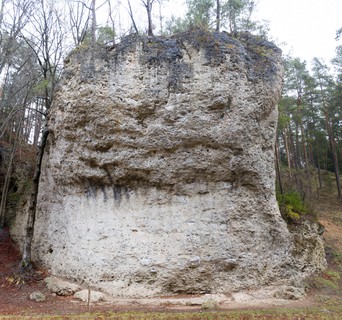 /04/21/0421fa3a0915d6b89dc2a692d0eeaf5b6330cc11) |
1.3.2.2. Gambrinus 7 routes in Crag
- Summary:
-
All Sport climbing
Lat / Long: 49.636952, 11.495356
/76/9d/769d14f481eb8df75e482cbee5b32f2e18169dda) |
1.3.3. Hartenstein 230 routes in Area
- Summary:
-
Mostly Sport climbing
Lat / Long: 49.596859, 11.535886
1.3.3.1. Hainkirche 7 routes in Crag
- Summary:
-
All Sport climbing
access issues
Zone 1 (Pegnitztalkonzept), klettern verboten!
Zone 1, climbing prohibited!
1.3.3.2. Piccolino 5 routes in Crag
- Summary:
-
All Sport climbing
Lat / Long: 49.600577, 11.525495
approach
GPS: 11.52549, 49.60061
1.3.3.3. Gotthardskirche 16 routes in Crag
- Summary:
-
Mostly Sport climbing
Lat / Long: 49.603634, 11.525192
approach
GPS: 11.52519, 49.60368
Great for ecopoint: Take the train to Velden then walk in 25 min to the crag.
/c0/5b/c05ba679bb5ca0f40d019d4309a887dd7b55610c) /8e/54/8e54a06801e06ca7c30355a37b27fbf465fea8a2) 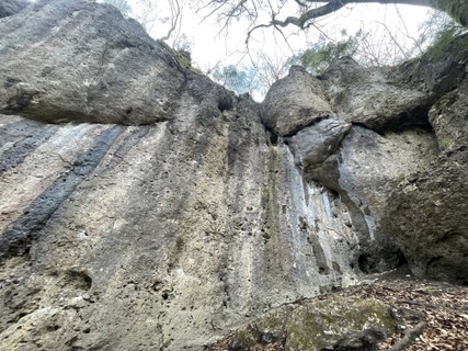 |
1.3.3.4. Zimmerbergwände 61 routes in Crag
- Summary:
-
Mostly Sport climbing
Lat / Long: 49.601099, 11.543864
approach
GPS: 11.54511,49.60083
1.3.3.5. Hirtenstreich 20 routes in Crag
- Summary:
-
All Sport climbing
Lat / Long: 49.595247, 11.527512
description
small shady crags
access issues
Park only in town, not in pub parking
1.3.3.6. Hartensteiner Wand 41 routes in Crag
- Summary:
-
Mostly Sport climbing
Lat / Long: 49.592075, 11.524735
access issues
Reopened again (see https://www.frankenjura.com/frankenjura/news/artikel/2532).
approach
By Car: Either park in centre of Hartenstein or drive past the cemetery (no parking at the cemetery!) and then turn left into the steep road going up to the sports field. Park there on the left.
https://www.openstreetmap.org/?mlat=49.59117&mlon=11.52521#map=18/49.59117/11.52521
Go back down the street and turn right just before the cemetery to approach the crag. Don't cross any barrier tapes.
For ecopoint take the train to Velden, then bike about 30 min uphill to Hartenstein. For parking and approach s. 'by car'.
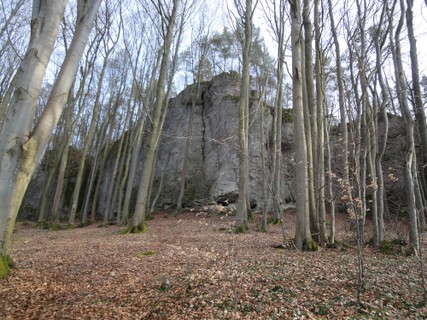 /9a/5c/9a5cd1c95576d45e345c588f2b0c4ef0c488c2ce)   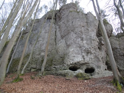   |
1.3.3.7. Rabensberger Wand 8 routes in Crag
- Summary:
-
All Sport climbing
Lat / Long: 49.593775, 11.529935
approach
GPS: 11.52993,49.59379
1.3.3.8. Grünreuther Wand 25 routes in Crag
- Summary:
-
All Sport climbing
Lat / Long: 49.590469, 11.548556
/30/0a/300a33f6ee19cee3a17ef1b8e5d49a41d234b52b) /1e/59/1e59ccab42655e121070f85947843bdb35428492)     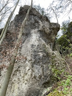 |
1.3.3.9. Stadeltenne 31 routes in Crag
- Summary:
-
All Sport climbing
Lat / Long: 49.607604, 11.544632
approach
GPS: 11.5440629395195,49.6078576765574
/a4/70/a4701c0b2a83a5b9d46f19f2484a3f344e1b96d7) /63/8f/638fb81ebdd9cea84114c3337cdc2b38b704d598) /f7/f2/f7f20b79730c6f7ff25e9106b20e29814cbeea63)  /bc/2f/bc2f5bcfed8213ef5571513046e3f9cd09aa2f7f) |
1.3.3.10. Neue Stadeltenne 12 routes in Crag
- Summary:
-
All Sport climbing
access issues
Climbing prohibited all year. http://www.ig-klettern.com/natur/zonierung.php#b
1.3.3.11. Schwatzhammer 4 routes in Crag
- Summary:
-
All Sport climbing
Lat / Long: 49.608836, 11.523816
access issues
Es besteht eine Nichtveröffentlichungsvereinbarung mit der IG und den Behörden! Der Grundstückseigentümer stimmt einer Veröffentlichung nicht zu!
1.3.4. Bärnhof 140 routes in Area
- Summary:
-
Mostly Sport climbing
Lat / Long: 49.614939, 11.571538
description
Hersbrucker Schweiz und Gegend um Auerbach
1.3.4.1. Sulzfels & Wächter 12 routes in Crag
- Summary:
-
All Sport climbing
Lat / Long: 49.612898, 11.564945
approach
Drive from Neuhaus towars Velden for about 1.7km to Rothenbruck. turn left to Bärnfels and at the end of the village turn LEFT towards Königstein. after 200m park near a fainting track to your right. walk this track uphil for 50m and you should se a path to your right. up this for another 50m to of the Stefansturm, Sulzfels in around the left .
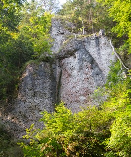 |
1.3.4.2. Stefansturm Nebenfels 3 routes in Cliff
- Summary:
-
All Sport climbing
Lat / Long: 49.612955, 11.563680
approach
Drive from Neuhaus towars Velden for about 1.7km to Rothenbruck. Turn left to Bärnfels and at the end of the village turn LEFT towards Königstein. After 200m park near a fainting track to your right. Walk this track uphill for 50m and you should see a path to your right. Up this for another 50m. Sulzfels is around the left and Stefansturm Nebenfels 30m uphill to the right.
 |
1.3.4.3. Stefansturm 21 routes in Crag
- Summary:
-
Mostly Sport climbing
Lat / Long: 49.613058, 11.564395
access issues
Please do not block access to fields with parking cars.
approach
Drive from Neuhaus towars Velden for about 1.7km to Rothenbruck. turn left to Bärnfels and at the end of the village turn LEFT towards Königstein. after 200m park near a fainting track to your right. walk this track uphil for 50m and you should se a path to your right. up this for another 50m Sulzfels in around the left and Stefansturm, Nebenfels and Waldschänke to the right. GPS: 11.56447,49.61310
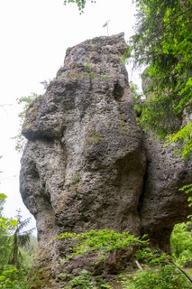 |
1.3.4.4. Waldschänke 5 routes in Crag
- Summary:
-
All Sport climbing
Lat / Long: 49.612391, 11.563021
approach
Drive from Neuhaus towars Velden for about 1.7km to Rothenbruck. Turn left to Bärnhof and at the end of the village turn LEFT towards Königstein. After 200m park near a fainting track to your right. Walk this track uphill for 50m and you should see a path to your right. Follow this path for another 50m to reach Stefansturm. Walk uphill between Stefansturm and Nebenfels and over the saddle for another 100m straight through the forest to reach the crag on your left.
1.3.4.5. Vöderreuther Wand 24 routes in Crag
- Summary:
-
All Sport climbing
Lat / Long: 49.612032, 11.561566
approach
GPS: 11.56168,49.61209
1.3.4.6. Katzenlöcher 42 routes in Crag
- Summary:
-
Mostly Sport climbing
Lat / Long: 49.605278, 11.552521
1.3.4.7. Däumling 8 routes in Crag
- Summary:
-
All Sport climbing
Lat / Long: 49.603003, 11.552994
1.3.4.8. Brändelstein 10 routes in Crag
- Summary:
-
All Sport climbing
Lat / Long: 49.598734, 11.556411
approach
GPS: 11.55641,49.59874
1.3.4.9. Ewige Jagdgründe 11 routes in Crag
- Summary:
-
All Sport climbing
Lat / Long: 49.609933, 11.572756
approach
GPS: 11.57270,49.61001
1.3.4.10. Sonnenuhr 4 routes in Crag
- Summary:
-
All Sport climbing
Lat / Long: 49.607098, 11.589508
approach
GPS: 11.58949,49.60709
1.3.5. Königstein 417 routes in Area
- Summary:
-
Mostly Sport climbing
Lat / Long: 49.599160, 11.632605
where to stay
village Königstein
1.3.5.1. Weiße Hülle 20 routes in Crag
- Summary:
-
All Sport climbing
Lat / Long: 49.620553, 11.610430
summary
Short and punchy boulder-like or some techy faceclimbs that are quite sustained are on offer here.
description
It's a bit dark but in a beautiful forest, kid friendly apart from the walk and short enough that you can tick the whole crag in a day or two. ")
approach
Drive in Königstein towards Neuhaus and still in town right towards Funkenreuth. In F. left towards Maximiliansgrotte and park on a little hill before the road turns to gravel. Walk further along the road for 500m, here you should look for a turnoff left and right, take the not so obvious left track into the forest, slightly uphill for about 250m. Pass a few rocks on your left, when it flattens a bit you should be able to spot the cliff only about 30m to your right through the dense undergrowth. You will see the short section of the crag first, the other parts hide behind it. GPS: E 11.61131, N 49.62044
1.3.5.2. Aussiedlerhof / Eremit 12 routes in Crag
- Summary:
-
All Sport climbing
Lat / Long: 49.619340, 11.624895
1.3.5.3. Locher Fels 29 routes in Crag
- Summary:
-
All Sport climbing
Lat / Long: 49.614782, 11.644650
description
Short routes on very compact rock; it's on private property and the owners allow access! There are goats around, kids will love it, just make sure the gate is closed.
access issues
/02/a0/02a01ae7c3f958e8ade7d15d3dbb67683837b106) 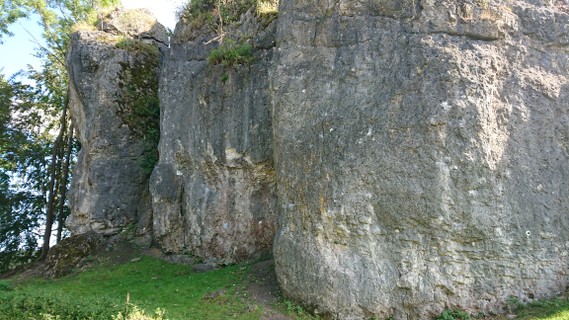 |
1.3.5.4. Teufelsstuhl 23 routes in Crag
- Summary:
-
All Sport climbing
Lat / Long: 49.610113, 11.645184
/62/cf/62cf0df4e2c1110ac9557c139518ebe3420b2f31) /1e/77/1e7710619e74312d1e5807c4384e5787bf4487dd) 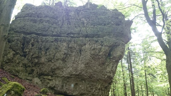 /78/ed/78ed61c40fd84f7db323d05844b71cecf3701072) /4c/81/4c813256c40f4b4b541defd83e658f33aa85f532) |
1.3.5.5. Schafberg 0 routes in Crag
approach
GPS: 11.64582, 49.61019
1.3.5.6. Steinbergpilz 4 routes in Crag
- Summary:
-
All Sport climbing
Lat / Long: 49.610440, 11.648036
1.3.5.7. Kühlochfels 90 routes in Crag
- Summary:
-
Mostly Sport climbing
Lat / Long: 49.610543, 11.658118
approach
Park your car in Loch. From the bus station, follow a gravel road southeast (go left at the only fork). After 1 km, you reach the edge of the forest; turn left onto the small hiking path marked with a red circle, which leads up the hill. Keep slightly left at the top to reach the right end of the crag. GPS: 11.65790,49.61082
1.3.5.8. Thorstein 15 routes in Crag
- Summary:
-
Mostly Sport climbing
Lat / Long: 49.604027, 11.643236
approach
from Königstein
1.3.5.9. Steinberg 145 routes in Crag
- Summary:
-
Mostly Sport climbing
Lat / Long: 49.604896, 11.653931
summary
Large area with many smaller crags. Routes in all grades offer climbing possibilities throughout the year.
description
The Steinberg is a hill east of the village Königstein featuring numerous smaller crags with routes in all grades.
It is basically possible to climb here all year: the south facing sectors, especially "Südseite", are viable in Winter. The sectors around "Schluchtwände" are great from spring until autumn, and for the hot days, just walk around to the crags facing north.
access issues
Parts of this crag are usually closed from January 1 until July 31. An active closure is indicated by a warning and 'closed' tag here on the site; when in doubt, signs put up at the crag have precedence!
Teile dieses Felsens sind üblicherweise von 1. Januar bis 31. Juli gesperrt. Eine aktive Sperrung wird auf dieser Seite durch eine Warnung und ein 'gesperrt'-Tag markiert; im Zweifelsfall haben die örtlich aufgehängten Schilder Vorrang!
approach
Exit the village Königstein to the south towards Holnstein. After 500 meters, go left and up the hill to the small hamlet Breitenstein. There is a small parking lot on the left (49.5984593, 11.6481377).
From the parking, walk north on a forestal road (passing the hamlet Breitenstein on the east) up to a point where it makes a 90 degrees right turn. Continue straight on a smaller path until you reach the forest. From here, the path diverges to reach the different sectors:
For the south facing sectors, follow the path slightly to the right. The north and west faces are reached by going straight and then left. See the descriptions of the respective sectors for details.
1.3.5.10. Nussbergwand 7 routes in Crag
- Summary:
-
All Sport climbing
Lat / Long: 49.597164, 11.602783
1.3.5.11. Sutzer Berg 11 routes in Crag
- Summary:
-
All Sport climbing
Lat / Long: 49.598241, 11.627369
approach
GPS: 11.62744, 49.59827
1.3.5.12. Gewitterstein 9 routes in Crag
- Summary:
-
All Sport climbing
Lat / Long: 49.599647, 11.646385
1.3.5.13. Breitenstein 23 routes in Crag
- Summary:
-
All Sport climbing
Lat / Long: 49.599963, 11.647735
summary
some of the routes stay dry in the rain, not when it's windy though.
description
Some real classics on this crag and all the routes are solid for the grade.
approach
Drive in Königstein past the (quite lovely) swimming pool towards Steinbach (Sulzbach R.). On top of the Hill is Breitenstein to your left, drive into the village and park in front of the hikers-map. Walk up the street until you see the chappel to your right (2min), the crag is right underneath.
ethic
be prepared for some exiting bolt distances.
1.3.5.14. Rosengarten 10 routes in Crag
- Summary:
-
All Sport climbing
Lat / Long: 49.590951, 11.608648
approach
GPS: 11.60866, 49.59097
1.3.5.15. Eschenfelder Wändchen 4 routes in Crag
- Summary:
-
All Sport climbing
Lat / Long: 49.580538, 11.608346
1.3.5.16. Riglashofer Wand 10 routes in Crag
- Summary:
-
All Sport climbing
Lat / Long: 49.574625, 11.629446
approach
GPS: 11.62940, 49.57476
1.3.5.17. Zur Liegenschaft 5 routes in Crag
- Summary:
-
All Sport climbing
Lat / Long: 49.574385, 11.629740
approach
GPS: 11.62729, 49.57165
/fb/d3/fbd3d04b4f39da9dd13261cb189ac93613029f3d) |
1.3.6. Mittleres Pegnitztal 301 routes in Area
- Summary:
-
Mostly Sport climbing
Lat / Long: 49.600014, 11.491179
description
from Velden to Enzendorf
1.3.6.1. Pavian 18 routes in Crag
- Summary:
-
Sport climbing and Trad climbing
Lat / Long: 49.583297, 11.486925
summary
Tall tower in the forest near the more famous "Student". The routes have an alpine touch, the rock is relatively chossy.
description
The tower got its name because it looks like a sitting monkey when looked at from the right perspective. Despite loose rock, there are a few interesting and worthwhile lines. Wearing a helmet is recommended, bring some gear for the easier routes.
approach
GPS: 11.48689, 49.58327
1.3.6.2. Student 22 routes in Crag
- Summary:
-
Mostly Sport climbing
Lat / Long: 49.585480, 11.484951
approach
GPS: 11.48492, 49.58552
/5f/ee/5fee38578603a419860a8fa58e963b67ce0da2ff) |
1.3.6.3. Weißer Grat 5 routes in Crag
- Summary:
-
Aid climbing, Trad climbing and Sport climbing
Lat / Long: 49.588033, 11.479733
approach
GPS: 11.47968, 49.58797
1.3.6.4. Freudenmauer 13 routes in Crag
- Summary:
-
All Bouldering
Lat / Long: 49.608563, 11.464907
approach
GPS: 11.46453, 49.60857
1.3.6.5. Rupprechtwand 4 routes in Crag
- Summary:
-
All Sport climbing
Lat / Long: 49.598689, 11.484667
approach
behind railway station
1.3.6.6. Ankatalwand 39 routes in Crag
- Summary:
-
All Sport climbing
Lat / Long: 49.601853, 11.486318
approach
GPS: 11.48642, 49.60176
1.3.6.7. Ankatalturm 4 routes in Cliff
- Summary:
-
Sport climbing, Aid climbing and Trad climbing
Lat / Long: 49.602492, 11.487211
approach
GPS: 11.48722, 49.60249
1.3.6.8. Ochsenstein 10 routes in Crag
- Summary:
-
Sport climbing and Trad climbing
Lat / Long: 49.603600, 11.486226
approach
GPS: 11.48645, 49.60365
/43/f0/43f0362e908828dbd4d490af4c0eaf00e5ea34e1) /7b/06/7b06cc937070b06d06d80cca7ff3fe27618a6db3) |
1.3.6.9. Brückenwand 9 routes in Crag
- Summary:
-
All Sport climbing
Lat / Long: 49.602850, 11.492318
approach
GPS: 11.49211, 49.60270
1.3.6.10. Emporwand 19 routes in Crag
- Summary:
-
Mostly Sport climbing
Lat / Long: 49.601052, 11.494435
summary
Two classic crack lines and a few mid-range sport routes on the left, mainly high end wall climbing in reddish rock on the right.
description
Impressive, shady north face, divided in the middle by the so-called "Emporschlucht".
While the first route here was already established in 1926, in the more structured wall left of the ravine, except for a dihedral climb around the corner from 1930 ("Eitrobieweg"), the right wall was deemed absolutely smooth and holdless. In 1973, an aid climb was established there, which was freed in 1989, followed by an original route to the right by Bernhard Thum in 1990 ("Land of confusion"). Meanwhile, a few more variants to these routes have been bolted, all somewhere around the 10th grade UIAA.
Although these hard climbs are probably the most prestigious routes at the crag, the wall on the left is not to be neglected. After all, grandmaster Güllich left an intriguing face/slab climb with "Grundkurs", and don't underestimate the classic "Emporweg"!
approach
Drive from Rupprechtstegen towards Velden. 180 m after you pass beneath a railway bridge, there is a parking lot on the left.
Walk back along the street. Pass the wooden bridge on the left, shortly before you reach the railway bridge. Turn left and follow the path for 120 m. The crag is up the hill on your right.
GPS: 11.49445, 49.60154
1.3.6.11. Roter Fels 50 routes in Crag
- Summary:
-
Mostly Sport climbing
Lat / Long: 49.602638, 11.496101
summary
Drawn-out, high east facing crag with a high concentration of classic endurance routes.
description
15.4.23 Linker Teil darf beklettert werden (Hersbrucker Weg bis Dülferriss)
access issues
Parts of this crag are usually closed from February 1 until June 30. An active closure is indicated by a warning and 'closed' tag here on the site; when in doubt, signs put up at the crag have precedence!
Teile dieses Felsens sind üblicherweise von 1. Februar bis 30. Juni gesperrt. Eine aktive Sperrung wird auf dieser Seite durch eine Warnung und ein 'gesperrt'-Tag markiert; im Zweifelsfall haben die örtlich aufgehängten Schilder Vorrang!
approach
Take the train to Rupprechtstegen. Then walk 20 min along the river heading to Velden. Cross the river after the railway bridge and pass the parking.
Continue walking along the street; after a few meters, a path leads up to the left sector. For the other sectors, follow the street for another 50 meters.
By Car: Drive from Rupprechtstegen towards Velden. 180 m after you pass beneath a railway bridge, there is a parking lot on the left.
(49.60286, 11.49636) (middle Sector)
/a7/4c/a74cc870017a2fcc5957800d7e45189c549d9d2f) /1a/fd/1afd9400efaa244a29de76a62deaaf869b54e24a) |
1.3.6.12. Zsigmondy Gedenkwand 16 routes in Crag
- Summary:
-
Mostly Sport climbing
Lat / Long: 49.602320, 11.497487
summary
Tall north west face with long routes with a slightly alpine touch, mostly cracks and dihedrals, plus a few sport climbs.
approach
Drive from Rupprechtstegen towards Velden. 180 m after you pass beneath a railway bridge, there is a parking lot on the left.
Walk back along the street. Pass the wooden bridge on the left, shortly before you reach the railway bridge. Turn left and follow the path for 250 m. The crag is directly next to the path.
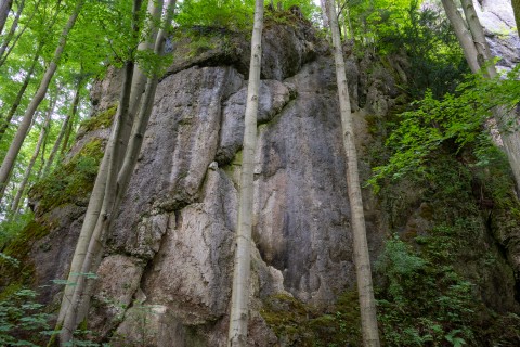 |
1.3.6.13. Immer-Höher-Turm 9 routes in Crag
- Summary:
-
Mostly Sport climbing
Lat / Long: 49.608412, 11.499863
summary
Sunny tower above Lungsdorf.
approach
Park in Lungsdorf. In the middle of the village, at the mail box, follow a little street, past a kayak rental. Shortly after a left turn, you will see a house on the left. Walk up the steep hill (no real path) to the already visible tower.
1.3.6.14. Löwenstein 5 routes in Crag
- Summary:
-
Sport climbing and Trad climbing
Lat / Long: 49.605131, 11.507309
summary
One of the highest climbable rock faces in the Frankenjura. Alpine touch due to lots of ledges.
approach
Drive from Rupprechtstegen towards Velden. Shortly after exiting Lungsdorf, just after passing beneath the railroad bridge, turn right over a bridge to a parking area.
Walk east for 150 meters and you'll arrive directly below the wall.
Coordinates:
1.3.6.15. Hängender Stein 21 routes in Crag
- Summary:
-
All Sport climbing
Lat / Long: 49.605414, 11.508307
approach
GPS: 11.50788, 49.60615
1.3.6.16. Mühlwand 27 routes in Crag
- Summary:
-
Mostly Sport climbing
Lat / Long: 49.612599, 11.507253
description
Climbing wall right next to the river Pegnitz in the heart of Velden.
approach
GPS: 11.50690, 49.61254
  /f0/50/f050ccf4cae5dd9851993018de64485b4f81a6c5) /8f/55/8f5571682cff65761efa770d07dda04818beefd3) |
1.3.6.17. Veldener Turm 6 routes in Crag
- Summary:
-
All Sport climbing
Lat / Long: 49.610290, 11.512724
approach
GPS: 11.51280, 49.61037
1.3.6.18. Veldener Wand 24 routes in Crag
- Summary:
-
Mostly Sport climbing
Lat / Long: 49.612118, 11.519175
approach
Perfect crag for ecopoint! Take the train to Velden then follow the trail that leads northeast. Walk on the left path uphill (trail marked with a yellow circle). After a few meters, you can See the wall above on the left.
By Car: In Velden, shortly before leaving the village towards Neuhaus, drive up left towards the railway station and park there.
/4f/40/4f40f8a04d4b55a19c81e74b2a5708f3c8d10f2e) /50/f6/50f66deddc86e685e123c54722f4d9f7b625535a) /2d/34/2d3450f18cbbe42a2eeba8d87ce57b79375d2285) /ad/08/ad08602dc62a752b7e6f971f96104f1cb46e4c12) /52/90/529050bc57cba61f943993dcbc0517d7926c0309) |
1.3.7. Unteres Pegnitztal 186 routes in Area
- Summary:
-
Mostly Sport climbing
Lat / Long: 49.544190, 11.486798
1.3.7.1. Zankelstein 19 routes in Crag
- Summary:
-
Sport climbing, Trad climbing and Aid climbing
Lat / Long: 49.504020, 11.520451
summary
Double tower connected via a big chockstone with hard routes in the shade and exposed, easier climbs in the sun.
approach
In the center of Pommelsbrunn, drive towards Heuchling. Before leaving the village, there is a parking lot on the left, right next to a Zebra crossing.
Opposite the parking lot, walk up "Felsenweg" and just follow the path marked with a red "Z" steeply uphill, past an excellent viewpoint placed on an overhanging rock, to the crag.
1.3.7.2. Riffler 38 routes in Crag
- Summary:
-
Mostly Sport climbing
Lat / Long: 49.539945, 11.475396
summary
Iconic, jagged tower with three summits and lots of old classics.
approach
Park in Alfalter. Follow one of the streets going east and cross the bridge across the Pegnitz. Follow the gravel road southeast and you'll cross another bridge over the railroad after a few minutes. Turn left and follow the forest road along the rails and into the forest. About 250 meters after entering the forest, the path makes a right turn, and after another 250 meters, the crag is on your left.
1.3.7.3. Düsselbacher Wand 26 routes in Crag
- Summary:
-
Sport climbing and Trad climbing
Lat / Long: 49.547457, 11.482916
approach
GPS: 11.48241, 49.54737
1.3.7.4. Hohlleitenfels 11 routes in Crag
- Summary:
-
Mostly Sport climbing
Lat / Long: 49.566294, 11.466603
1.3.7.5. Langenstein 16 routes in Crag
- Summary:
-
All Sport climbing
Lat / Long: 49.568845, 11.462238
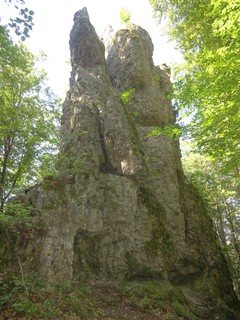 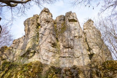 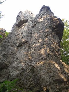 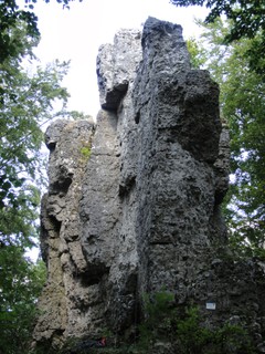 |
1.3.7.6. Kleine Wacht 38 routes in Crag
- Summary:
-
Sport climbing and Trad climbing
Lat / Long: 49.560989, 11.496452
approach
Park in Vorra Raiffeisenstrasse (49.560667, 11.496017). Walk staight ahead the Großmeinfeldweg, turn left into Oberer Höhenweg. After 200m follow a tail on the right side to the crag.
1.3.7.7. Große Wacht 19 routes in Crag
- Summary:
-
Mostly Sport climbing
Lat / Long: 49.563762, 11.500611
approach
GPS: 11.50060, 49.56380
1.3.7.8. Schmerzzentrum 6 routes in Crag
- Summary:
-
All Sport climbing
Lat / Long: 49.564561, 11.501468
approach
GPS: 11.50151, 49.56454
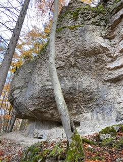 |
1.3.7.9. Sieglitzberger Nadel 9 routes in Crag
- Summary:
-
Mostly Sport climbing
Lat / Long: 49.572704, 11.490169
approach
GPS: 11.49014, 49.57273 go to Artelshofen. After railway underbridge drive right - after few meters is a parking site.
1.3.7.10. Artelshofener Wand 4 routes in Crag
- Summary:
-
All Sport climbing
Lat / Long: 49.577680, 11.497556
1.3.8. Krottenseer Forst 541 routes in Area
- Summary:
-
Mostly Sport climbing
Lat / Long: 49.641591, 11.615496
1.3.8.1. Weißingkuppe 0 routes in Crag
approach
GPS: 11.59281, 49.62634
1.3.8.2. Vogelherdgrotte 14 routes in Crag
- Summary:
-
Mostly Sport climbing
Lat / Long: 49.634515, 11.593923
approach
1.3.8.3. Ape-Index Grotte 7 routes in Crag
- Summary:
-
Mostly Sport climbing
Lat / Long: 49.634443, 11.599997
approach
GPS: 11.60001, 49.63445
 |
1.3.8.4. Vierte Dimension 18 routes in Crag
- Summary:
-
Mostly Sport climbing
Lat / Long: 49.633177, 11.605728
approach
GPS: 11.60578, 49.63320
1.3.8.5. Steinerne Stadt 93 routes in Crag
- Summary:
-
Mostly Sport climbing
Lat / Long: 49.635505, 11.603322
1.3.8.6. Krottenseer Turm 21 routes in Crag
- Summary:
-
Sport climbing, Trad climbing and Bouldering
Lat / Long: 49.635292, 11.614655
summary
Bulky tower at the north-west end of Maximilianswand, home of the world's first 11- (FB 8c) "Wallstreet" and several other classics.
approach
Drive from Krottensee towards Maximiliansgrotte and past its parking lot further into the forest. After 2 km on the forest road (always keep straight), there is a small bay on the left with a big info sign. Park here and walk east into the forest on a well-visible path. You'll see the crag after a few meters.
Coordinates:
/5b/57/5b576f6e6b859a273de6652df628b2c44e14ed2a) |
1.3.8.7. Maximilianswand 80 routes in Crag
- Summary:
-
Mostly Sport climbing
Lat / Long: 49.635147, 11.615222
1.3.8.8. Erdenkäuferwand 5 routes in Crag
- Summary:
-
All Sport climbing
Lat / Long: 49.632060, 11.620736
access issues
Zone 1 (since 31.10.2019)
https://ig-klettern.org/2019/10/sperrung-der-erdenkaeuferwand/
1.3.8.9. ZZ-Top Grotte 19 routes in Crag
- Summary:
-
Bouldering and Sport climbing
Lat / Long: 49.635283, 11.628225
approach
GPS: 11.62822, 49.63528
1.3.8.10. Pölze 7 routes in Crag
- Summary:
-
All Sport climbing
Lat / Long: 49.638063, 11.593634
approach
GPS: 11.59365, 49.63808
1.3.8.11. Wolfsfalle 7 routes in Crag
- Summary:
-
All Sport climbing
Lat / Long: 49.639762, 11.599166
approach
GPS: 11.59909, 49.63979
1.3.8.12. Bladerunnerwand 15 routes in Crag
- Summary:
-
Sport climbing and Bouldering
Lat / Long: 49.643323, 11.601365
approach
GPS: 11.60130, 49.64333
1.3.8.13. Projektwand 10 routes in Crag
- Summary:
-
All Sport climbing
Lat / Long: 49.642148, 11.600432
approach
GPS: 11.60041, 49.64224
1.3.8.14. Bastelstube 6 routes in Crag
- Summary:
-
Mostly Sport climbing
Lat / Long: 49.640495, 11.597828
approach
GPS: 11.59785, 49.64048
1.3.8.15. Folterkammer 37 routes in Crag
- Summary:
-
Mostly Sport climbing
Lat / Long: 49.643280, 11.604824
approach
GPS: 11.60491, 49.64340
1.3.8.16. Formula Uno 8 routes in Crag
- Summary:
-
Bouldering and Sport climbing
Lat / Long: 49.649664, 11.614213
approach
GPS: 11.61418, 49.64969
1.3.8.17. Geheimbund 27 routes in Crag
- Summary:
-
All Sport climbing
Lat / Long: 49.641132, 11.603367
summary
A great little crag well worth a visit if you are after a shady crag with a good range of grades. The climbs are short but varied and the rock quality is good.
approach
Drive from Neuhaus towards Auerbach, 2.4km after leaving Neuhaus is a small sealed road to your right (100m before you reach a chapel). stay on this as along as you are allowed, park here. Follow the left of the two closed dirt roads for 500m, at the intersection with the walking track "red cross" turn left, at the highest point of the track (200m) turn left for about 50m and then down to the left to reach the crag. GPS: 11.60306, 49.64112
1.3.8.18. Kanzelstein 35 routes in Crag
- Summary:
-
All Sport climbing
Lat / Long: 49.641480, 11.599049
approach
GPS:
1.3.8.19. Mosquito Rock 12 routes in Crag
- Summary:
-
All Sport climbing
Lat / Long: 49.644017, 11.603064
approach
GPS: 11.60303, 49.64402
1.3.8.20. Rabenfels 16 routes in Crag
- Summary:
-
Mostly Sport climbing
Lat / Long: 49.643146, 11.598963
- Excavations show that the rock has been used as cult site as early as the Bronze Age.
- In modern times, the rock has seen ascents only as late as the 1950s.
- The rock became famous with Wolfgang Güllich's first ascent of "Ghettoblaster" in 1986, for some time the hardest route in Germany.
- In the year 2000, the trees around the south face were cut down.
summary
Impressive lines, good rock quality and the home of Germany's first 10/10+, "Ghettoblaster".
description
The Rabenfels (Raven's Rock), a beautiful, cylindrical tower, offers good climbing in a sunny south face from 6- ("Herbstzauber") to 10/10+ ("Ghettoblaster").
All the routes in the south face can be recommended. The most enjoyable way to reach the summit (most of the routes end just below the mushroom-shaped block at the top) is probably the second length of "Robert Lukas Gedenkweg", which, in an exposed traverse, leads under the roof to the left into easy terrain.
Less popular and with far less protection are the lines in the east and north face, the latter of which offers the easiest routes to the summit.
access issues
This crag is usually closed from February 1 until June 30. An active closure is indicated by a warning and 'closed' tag here on the site; when in doubt, signs put up at the crag have precedence!
Dieser Fels ist üblicherweise von 1. Februar bis 30. Juni gesperrt. Eine aktive Sperrung wird auf dieser Seite durch eine Warnung und ein 'gesperrt'-Tag markiert; im Zweifelsfall haben die örtlich aufgehängten Schilder Vorrang!
approach
From the street from Neuhaus/Pegnitz to Ranna, turn right into a small forestal road just after the hamlet "Lehnerhof" and just before the small chapel. Follow the road for about 1 km and you will reach a hiker's parking lot.
From the parking, just follow the road east (signs towards Rabenfels) for 750 m.
GPS: 11.59904, 49.64298
history
  |
1.3.8.21. Rote Kante 28 routes in Crag
- Summary:
-
All Sport climbing
Lat / Long: 49.652844, 11.618635
approach
GPS: 11.61912, 49.65292
1.3.8.22. Sackdillinger Felsen 25 routes in Crag
- Summary:
-
All Sport climbing
Lat / Long: 49.643422, 11.639985
1.3.8.23. Stoneage 20 routes in Crag
- Summary:
-
All Sport climbing
Lat / Long: 49.650497, 11.629959
description
External topo provided by IG Klettern.
1.3.8.24. Into the Wild 31 routes in Crag
- Summary:
-
Mostly Sport climbing
Lat / Long: 49.630268, 11.616083
summary
Beautiful new discovery in the Krottenseer Forst.
description
approach
ethic
Please keep as quiet as possible in the forest, don't leave any garbage behind and, especially with this rock, keep an eye on the long ascent for the way back so that you are back at the parking lot before nightfall.
1.3.9. Plech 110 routes in Area
- Summary:
-
Mostly Sport climbing
Lat / Long: 49.644578, 11.471773
1.3.9.1. Plecher Wand 31 routes in Crag
- Summary:
-
All Sport climbing
Lat / Long: 49.646726, 11.461819
approach
Crag GPS: (49.64692, 11.46289)
/8c/4d/8c4d254bf3f77260e305a0b9ae3393d9007f2f76) /1a/83/1a83980b473a6d1438c35431203f7775240ab6b3) /a2/0c/a20c1a30ec2ad59e54ae4efd8f58b766acb26170) /e3/97/e39707b5b5e78c3620538e570be35814ef845ed8)  |
1.3.9.2. Plecher Turm 11 routes in Crag
- Summary:
-
Mostly Sport climbing
Lat / Long: 49.646926, 11.461449
/7d/a6/7da67f5bbb5e9708ac42ee7a7ab717f9fa1594bd) /62/83/628306391acc879d8f4f78e28e2d6fd8e5d51999) |
1.3.9.3. Gerhardsfels 5 routes in Area
- Summary:
-
All Sport climbing
Lat / Long: 49.647148, 11.461045
summary
Eine sanierte und vier neue Routen neben der Plecher Wand. Alle Informationen sind mit Erstbegeher Tom Bösl abgesprochen.
description
Schöne Touren im vierten bis siebten Grad direkt über dem Wanderweg.
access issues
Die Touren am Rand müssen noch etwas abgeklettert werden. Zone 2.
approach
50 Meter am Plecher Turm vorbei, leicht hangaufwärts.
 |
1.3.9.4. Schöne Aussicht 12 routes in Crag
- Summary:
-
All Sport climbing
Lat / Long: 49.643982, 11.457887
approach
GPS: 11.45775, 49.64403
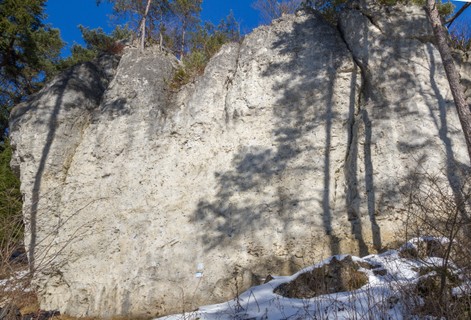 |
1.3.9.5. Plecher Klippen 30 routes in Crag
- Summary:
-
Bouldering and Sport climbing
Lat / Long: 49.651543, 11.481297
summary
Sport climbing and some boulders.
description
Vertical wall climbing at the main wall, furnished with some boulder blocks lying idyllically in the forest on the summit of a little hill.
approach
GPS: 11.48118, 49.65157
1.3.9.6. Pfingstwände 17 routes in Crag
- Summary:
-
Mostly Sport climbing
Lat / Long: 49.656026, 11.443873
1.3.9.7. Rufenberg 4 routes in Crag
- Summary:
-
All Sport climbing
Lat / Long: 49.631751, 11.473144
  |
1.3.10. Hirschbach 442 routes in Area
- Summary:
-
Mostly Sport climbing
Lat / Long: 49.553931, 11.529672
1.3.10.1. Klausener Wand 18 routes in Crag
- Summary:
-
All Sport climbing
Lat / Long: 49.561164, 11.551347
approach
GPS: 11.55149, 49.56118
1.3.10.2. Habichtstein 41 routes in Crag
- Summary:
-
All Sport climbing
Lat / Long: 49.560964, 11.560402
description
The longer walk-in makes sense on crowded weekends, the quiet setting makes up for it. The middle section stays wet after rain while both sides dry off quicker.
access issues
This crag is usually closed from January 1 until July 31. An active closure is indicated by a warning and 'closed' tag here on the site; when in doubt, signs put up at the crag have precedence!
Dieser Fels ist üblicherweise von 1. Januar bis 31. Juli gesperrt. Eine aktive Sperrung wird auf dieser Seite durch eine Warnung und ein 'gesperrt'-Tag markiert; im Zweifelsfall haben die örtlich aufgehängten Schilder Vorrang!
approach
From Hirschbach towards Unterklausen,turn right into the village. at a fork take the right and a few meters further to the left. Leave the village always staying left. Park 700m after the end of the village at a T-Intersection. Walk right from here for 40m, at the fork turn right again. when you hit the edge of the forest and another fork turn left and left again at a crossing. follow this for about 570m into the forest again and turn right at the next crossing. after 90m take the right on the next fork. after 210m a path leads down to the crag in about 80m. GPS: 11.56008, 49.56077
 /2b/a9/2ba9c5efe7f322515b7e8e688ea90986efac81dc) /4c/82/4c82fbff4a5ebc505febf1f2615e0541bd0f88e8) /23/96/23966167942b522e6da1642960b52753e838d827) /5e/6e/5e6e47ed831cdd0e82e38aba30128ca8954e1db3) |
1.3.10.3. Mittelbergwand 55 routes in Crag
- Summary:
-
Mostly Sport climbing
Lat / Long: 49.550494, 11.527895
1.3.10.4. Castellwand 55 routes in Crag
- Summary:
-
Mostly Sport climbing
Lat / Long: 49.549323, 11.527246
1.3.10.5. Kurt Albert Gedenkwand 20 routes in Crag
- Summary:
-
Mostly Sport climbing
Lat / Long: 49.548660, 11.523711
description
In remembrance of Kurt Albert †.
1.3.10.6. Norisbrettl 54 routes in Crag
- Summary:
-
Mostly Sport climbing
Lat / Long: 49.544123, 11.530645
approach
GPS: 11.53086, 49.54421
1.3.10.7. Sprungstein 26 routes in Crag
- Summary:
-
Mostly Sport climbing
Lat / Long: 49.548988, 11.511363
approach
GPS: 11.50943, 49.55209
/2b/b2/2bb269ab6e231979413f5e98ba693be9feb219df) |
1.3.10.8. Neue Fischbrunner Wand 12 routes in Crag
- Summary:
-
Sport climbing and Bouldering
Lat / Long: 49.545304, 11.513124
1.3.10.9. Neutrale Zone 10 routes in Crag
- Summary:
-
All Sport climbing
1.3.10.10. Schattenwand 5 routes in Crag
- Summary:
-
All Sport climbing
1.3.10.11. Todesstern 7 routes in Crag
- Summary:
-
All Sport climbing
/f4/b9/f4b9025fc5018f7aff38367b0b26413334bfabca) |
1.3.10.12. Schlaraffenland 139 routes in Crag
- Summary:
-
Mostly Sport climbing
Lat / Long: 49.552557, 11.532047
approach
Drive from Pommelsbrunn towards Hirschbach, right at the beginning of the village is a big Parking spot for hikers. walk into Hirschbach and turn right after 100 meters onto a narrow road leading uphill (Neutras). follow this to the end (120m), then left onto dirt and left again at a fork. after another 120m you can follow a path up towards Teufelsrissmassiv, the 1st crag of Schlaraffenland which lines the valley above Hirschbach.
1.3.10.13. Norissteig 0 routes in Feature
description
approach
history
Established 1928
1.3.11. Schwarzer Brand 293 routes in Area
- Summary:
-
Mostly Sport climbing
Lat / Long: 49.537405, 11.555392
1.3.11.1. Hohenbergturm 6 routes in Crag
- Summary:
-
Mostly Sport climbing
Lat / Long: 49.531750, 11.544432
approach
GPS: 11.57428, 49.55642
where to stay
Semler hut of DAV Sektion Nürnberg - only 20 meters far away.
   |
1.3.11.2. Schwarzbrennerei 25 routes in Crag
- Summary:
-
Mostly Sport climbing
Lat / Long: 49.538909, 11.545226
approach
GPS: 11.54523, 49.53891
1.3.11.3. Gemeindefels 6 routes in Crag
- Summary:
-
All Sport climbing
Lat / Long: 49.537833, 11.550928
description
Kleines Gebiet mit löchrigen Routen und guter Absicherung
approach
GPS: 11.55101, 49.53776 Parken am Wanderparkplatz in Neutras (neben dem Gasthof Zum Neutrasfelsen). Durch den Ort Richtung Etzelwang laufen. Am Ende des Ortes links den Feldweg am Waldrand entlang ca. 300m bis zu einer Rinne/Feldweg. Diesen ca. 100m gerade hoch, bis auf einen Querweg. Der Fels ist schon rechts oberhalb zu sehen.
/a0/dd/a0dd26db75e2c98faef28110704f2fcbaab161eb) /22/f3/22f3837aeae51bdf54930180d0da628e3be89eb3) |
1.3.11.4. Starenfels 21 routes in Crag
- Summary:
-
All Sport climbing
Lat / Long: 49.540356, 11.554993
approach
GPS: 11.55506, 49.54013
1.3.11.5. Bodenbergwand 12 routes in Crag
- Summary:
-
All Sport climbing
Lat / Long: 49.541970, 11.551506
approach
GPS:
1.3.11.6. Weiße Wand 51 routes in Crag
- Summary:
-
All Sport climbing
Lat / Long: 49.543952, 11.541933
description
Many routes in the sun. But overgrowed and polished.
approach
Parking at the parksite between Hegendorf and Neutras or in Neutrals.
1.3.11.7. Röthenbacher Turm 5 routes in Crag
- Summary:
-
All Sport climbing
Lat / Long: 49.543394, 11.543066
summary
Small tower in front of Röthenbacher Wand.
approach
GPS: 11.54315, 49.54336
1.3.11.8. Röthenbacher Wand 18 routes in Crag
- Summary:
-
Mostly Sport climbing
Lat / Long: 49.543477, 11.543324
summary
East and south face with white rock, not far from the more popular "Weiße Wand", but also with a good selection of routes.
approach
Drive from Fischbrunn in the Hirschbach valley to Hegendorf. In the village, turn left (inconspicuous sign) towards "Neutras". The road turns into a dirt road at the end of the village. Follow this to the big (paid!) hiker's parking lot.
From the parking, walk northeast (sign towards the via ferrata "Höhenglücksteig") on the dirt road. At the edge of the forest, follow the hiking path marked with a red dot. This leads to "Weiße Wand" after a few minutes. Walk along the base of the crag to the right (east) to reach Röthenbacher Wand after 100 meters.
Coordinates:
1.3.11.9. Drachenhöhle 7 routes in Crag
- Summary:
-
All Sport climbing
Lat / Long: 49.544669, 11.543275
summary
a nice addition to Drachenburg.
description
short and steep
approach
walk up to the climbs at Drachenburg, then just around the arete on the left
1.3.11.10. Drachenburg 13 routes in Crag
- Summary:
-
Mostly Sport climbing
Lat / Long: 49.544823, 11.543356
1.3.11.11. Nischenwand 12 routes in Crag
- Summary:
-
All Sport climbing
Lat / Long: 49.538981, 11.547446
1.3.11.12. Köhlerwand 5 routes in Crag
- Summary:
-
All Sport climbing
1.3.11.13. Lug ins Land 13 routes in Crag
- Summary:
-
Mostly Sport climbing
Lat / Long: 49.547393, 11.540379
approach
GPS: 11.54025, 49.54739
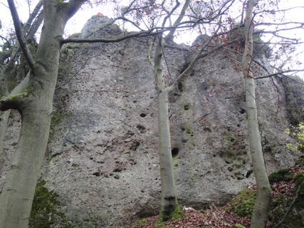 |
1.3.11.14. Steiler Zahn & Schwanzflosse 4 routes in Crag
- Summary:
-
All Sport climbing
Lat / Long: 49.547157, 11.541385
approach
GPS: 11.54140, 49.54717 Schwanzflosse is 20m right of Steiler Zahn
1.3.11.15. Petrus 7 routes in Crag
- Summary:
-
All Sport climbing
Lat / Long: 49.547736, 11.542120
approach
GPS: 11.54209, 49.54773
1.3.11.16. Sepp Bader Gedenkwand 6 routes in Crag
- Summary:
-
All Sport climbing
Lat / Long: 49.547726, 11.542562
approach
GPS: 11.54260, 49.54769
1.3.11.17. Prellstein 18 routes in Crag
- Summary:
-
All Sport climbing
Lat / Long: 49.548549, 11.543389
approach
GPS: 11.54320, 49.54857
1.3.11.18. Annaturm und Annawand 8 routes in Crag
- Summary:
-
All Sport climbing
Lat / Long: 49.547321, 11.544328
approach
GPS: 11.54434, 49.54747
1.3.11.19. Himmelsfels (Toni Schmid Gedenkwand) 6 routes in Crag
- Summary:
-
All Sport climbing
Lat / Long: 49.547416, 11.545478
approach
GPS: 11.54558, 49.54752
1.3.11.20. Hauseck 6 routes in Crag
- Summary:
-
All Sport climbing
Lat / Long: 49.546824, 11.555869
approach
GPS: 11.55592, 49.54682
1.3.11.21. Hauseckenwand 6 routes in Crag
- Summary:
-
All Sport climbing
Lat / Long: 49.555293, 11.562532
approach
GPS: 11.56253, 49.55528
1.3.11.22. Münchner Wand 7 routes in Crag
- Summary:
-
All Sport climbing
Lat / Long: 49.554812, 11.575279
approach
GPS: 11.57523, 49.55481
1.3.11.23. Wichtelfels 4 routes in Crag
- Summary:
-
All Sport climbing
Lat / Long: 49.554404, 11.575717
approach
parking in Oberschmidtstadt
1.3.11.24. Schmidtstadter Wand 9 routes in Crag
- Summary:
-
All Sport climbing
Lat / Long: 49.544558, 11.569317
approach
GPS: 11.56932, 49.54465
1.3.11.25. Höhenglücksteig 5 routes in Cliff
- Summary:
-
All Rock climbing
Lat / Long: 49.546413, 11.541531
description
via ferrata with 3 parts. Some emergency exists. First and second part easy. Third part is like grade D
http://www.bergsteigen.com/sites/default/files/topos/hoehengluecksteig_topo_klettersteig.jpg
approach
parking between Neutras and Hegendorf. follow "via ferrata"-sign to entry.
   |
1.3.11.26. Kinder-Klettersteig 1 route in Cliff
- Summary:
-
All Rock climbing
Lat / Long: 49.545265, 11.542730
 |
1.3.11.27. Heuchlinger Wand / Gehrestalwächter 12 routes in Area
- Summary:
-
All Sport climbing
Lat / Long: 49.514074, 11.528308
1.3.12. Sittenbachtal 129 routes in Area
- Summary:
-
Mostly Sport climbing
Lat / Long: 49.588141, 11.411572
1.3.12.1. Gäherstein 10 routes in Crag
- Summary:
-
All Sport climbing
Lat / Long: 49.586648, 11.439900
1.3.12.2. Bolzenstein 16 routes in Crag
- Summary:
-
All Sport climbing
Lat / Long: 49.590856, 11.416130
summary
Overhanging, club-shaped tower with interesting climbs. One of the hardest summits in the Frankenjura.
Short wall directly next to the Bolzenstein with technical face climbs.
description
This strangely shaped tower was one of the last unconquered summits of the Frankenjura when in 1905, members of the club "Rifflerbuben" tied a string to a quarrel ("Bolzen" in German) and shot it over the tower to pull up a rope, which was then used to climb it. Climbed freely, it still remains one of the hardest summits in the area. Even though its base area is pretty small, it offers all sorts of climbing: technical slabs, overhanging pocket pulling, dihedral climbing, cracks, you name it.
approach
Park in Steinensittenbach. In the center of the village, follow the hiking path marked with a green cross towards the east (through a bike park in a driveway), then southeast up the hill. After 350 meters, the tower is on your left.
 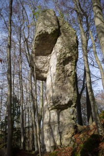    |
1.3.12.3. Rabenstein 20 routes in Crag
- Summary:
-
Mostly Sport climbing
Lat / Long: 49.597198, 11.374953
approach
You can park your car at the electricity tower building at (49.594098, 11.374651). From there it is a 10-15 minutes walk to the crag.
1.3.12.4. Algersdorfer Schattenwand 7 routes in Crag
- Summary:
-
Mostly Sport climbing
Lat / Long: 49.588009, 11.408685
access issues
This crag is usually closed from January 1 until July 31. An active closure is indicated by a warning and 'closed' tag here on the site; when in doubt, signs put up at the crag have precedence!
Dieser Fels ist üblicherweise von 1. Januar bis 31. Juli gesperrt. Eine aktive Sperrung wird auf dieser Seite durch eine Warnung und ein 'gesperrt'-Tag markiert; im Zweifelsfall haben die örtlich aufgehängten Schilder Vorrang!
approach
GPS: 11.40867, 49.58804
1.3.12.5. Algersdorfer Wand 23 routes in Crag
- Summary:
-
All Sport climbing
Lat / Long: 49.585648, 11.411579
approach
take the A9- Exit Hormersdorf, drive towards Kirchsittenbach, about 500m after Steinensittenbach you can park near the Bus-Stop Obermühle on the right. cross the road and up to the crag in 2 min. GPS: 11.41162, 49.58573
1.3.12.6. Algersdorfer Pfeiler 5 routes in Crag
- Summary:
-
All Sport climbing
Lat / Long: 49.585229, 11.412259
1.3.12.7. Grauer Fels 13 routes in Crag
- Summary:
-
Sport climbing and Trad climbing
Lat / Long: 49.555636, 11.442016
summary
Tower with tall west face in the forest that had long been forgotten and was revived at the end of the 70s.
access issues
This crag is usually closed from January 1 until July 31. An active closure is indicated by a warning and 'closed' tag here on the site; when in doubt, signs put up at the crag have precedence!
Dieser Fels ist üblicherweise von 1. Januar bis 31. Juli gesperrt. Eine aktive Sperrung wird auf dieser Seite durch eine Warnung und ein 'gesperrt'-Tag markiert; im Zweifelsfall haben die örtlich aufgehängten Schilder Vorrang!
approach
1.3.12.8. Illafelder Wand 12 routes in Crag
- Summary:
-
Mostly Sport climbing
Lat / Long: 49.618144, 11.427352
description
A small cave with steep routes
approach
Park 100m after Illafeld in direction Homersdorf on the left side. Take the dirt road to the forest and 50 m after the beginning use the second dirt road to the right and follow it 150 m to the crag
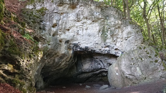 |
1.3.12.9. Geierstein 10 routes in Crag
- Summary:
-
All Sport climbing
Lat / Long: 49.617849, 11.433318
approach
Park at road to Illafeld . Follow forest road to east. Pass a forest glade and walk up the hill.
⛰️ (49.61785, 11.43335)
  |
1.3.12.10. Stöppacher Wand 13 routes in Area
- Summary:
-
All Sport climbing
Lat / Long: 49.571531, 11.440695
summary
Gerade Wandkletterei vom 5 bis 8ten Grad.
description
Fester, griffiger Fels an Löchern und Leisten im meist senkrechten Gelände.
/cb/e5/cbe5da76f2d89ccd1a366bf06f690d5e8548149c) /68/93/68933fea44bbc7d2e05146caab52aab9416ad977) /12/ba/12ba7f1efff9acab79efd847043c8da36c4d3fb4) /59/95/59954948e37d5c92a5c5177ef6f2fe71b8d4b80d) /7c/aa/7caaaba461d12a52fae66dda3a9b41b7044250e0) |
1.3.13. Schnaittach 50 routes in Area
- Summary:
-
Mostly Sport climbing
Lat / Long: 49.557404, 11.367457
1.3.13.1. Enzenstein 14 routes in Crag
- Summary:
-
Sport climbing and Aid climbing
Lat / Long: 49.562955, 11.366459
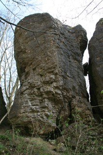 |
1.3.13.2. Glatzenstein 34 routes in Crag
- Summary:
-
Mostly Sport climbing
Lat / Long: 49.544006, 11.372562
summary
Glatzenstein offers long, vertical routes with a nice view from the top.
description
Take your 80m rope to enjoy the full potential of this crag. Long routes on good quality rock.
When you get to the top of Glatzenstein, you might have an audience watching you. The view from the top of Glatzenstein is also a popular hiking destination on weekends as people can reach the top from the backside.
This also means, that you could install a top rope just by going around the rock. But beware not to leave any gear on top unguarded, as it has already happened that hikers had taken lonely looking carabiners from the top anchor.
To avoid any such situation, you can also use the lower offs 5 metres below the top.
The base of the crag is in the shade due to the surrounding trees. This is not a kid friendly crag.
approach
Pass through the village of Weißenbach and park round about here: (49.540729, 11.374009).
Follow the forest road the forks off the main road in north westerly direction. Don't miss the small foot path after a few hundred meters that keeps right and leads you to the base of the crag.
1.3.13.3. Kersbacher Turm 2 routes in Crag
- Summary:
-
All Sport climbing
Lat / Long: 49.544210, 11.372837
summary
Little tower above the left end of "Glatzenstein".
1.3.14. Förrenbachtal 133 routes in Area
- Summary:
-
Mostly Sport climbing
Lat / Long: 49.463930, 11.524530
description
Valley til incl. Thalheim
1.3.14.1. Hohler Fels 23 routes in Crag
- Summary:
-
Mostly Sport climbing
Lat / Long: 49.484607, 11.492218
access issues
Parts of this crag are usually closed from January 1 until July 31. An active closure is indicated by a warning and 'closed' tag here on the site; when in doubt, signs put up at the crag have precedence!
Teile dieses Felsens sind üblicherweise von 1. Januar bis 31. Juli gesperrt. Eine aktive Sperrung wird auf dieser Seite durch eine Warnung und ein 'gesperrt'-Tag markiert; im Zweifelsfall haben die örtlich aufgehängten Schilder Vorrang!
/b7/9c/b79c591b9488b23ca23293ba27e660d38e395f61) 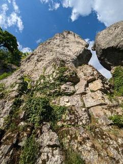 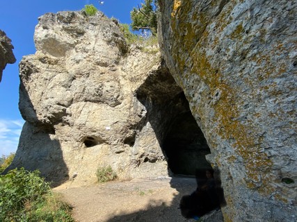 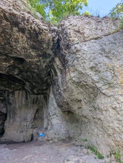 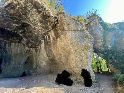 |
1.3.14.2. Gmabrocken 14 routes in Crag
- Summary:
-
Mostly Sport climbing
Lat / Long: 49.484585, 11.492112
/39/eb/39ebdf69aa2f2711a73e0c0eade9c0a36c29a5d3) /19/33/1933c37ceca567992b3d745d1a63b40622290ba8) /ab/8c/ab8c487e0da0d2312aeac66941c19c3eb17d0f0d)  /62/c9/62c913f385de729cd6b265d67ff6fc5415e16ce3) |
1.3.14.3. Happurger Wand 15 routes in Crag
- Summary:
-
Sport climbing and Trad climbing
Lat / Long: 49.484874, 11.491710
approach
GPS: 11.49207, 49.48467
  |
1.3.14.4. Kanzelfels 9 routes in Crag
- Summary:
-
All Sport climbing
Lat / Long: 49.468168, 11.505684
approach
GPS: 11.50567, 49.46823
/ec/91/ec91dae87041295d479663006fe01fa28035b740) |
1.3.14.5. Gotzenberger Wand und Turm 35 routes in Crag
- Summary:
-
Mostly Sport climbing
Lat / Long: 49.446268, 11.534694
1.3.14.6. Kirchtalwände 37 routes in Crag
- Summary:
-
Mostly Sport climbing
Lat / Long: 49.451734, 11.568774
approach
Parking at Kirchthalmühle isn't allowed anymore!
(49.4533287, 11.5619093) - cross bridge to north, than walk to east and follow the right road to Kirchthalmühle. Follow path uphill, which starts few meters in front to the building.
1.3.15. Lehenhammertal 176 routes in Area
- Summary:
-
Mostly Sport climbing
Lat / Long: 49.522877, 11.573640
1.3.15.1. Sieben Brüder 20 routes in Crag
- Summary:
-
Mostly Sport climbing
Lat / Long: 49.533614, 11.579349
summary
Schattige Wand mit vielen eher senkrechten und kurzen, boulderlastigen Routen.
approach
In Etzelwang turn into the Schulstraße, turn left into "Am Hardt" and park there. Follow the road uphill to the end, where the forest starts. Several hiking paths (3/4/5) go right past the Sieben Brüder, which will be on the right side then.
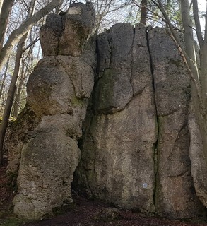 /57/de/57de5f33fd7ad2e3231057820e504a3d38eae5a4) 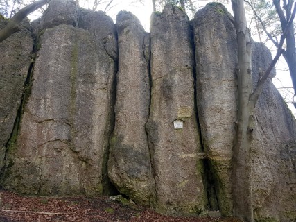   |
1.3.15.2. Etzelwanger Wand 20 routes in Crag
- Summary:
-
Mostly Sport climbing
Lat / Long: 49.529187, 11.581567
approach
For ecopoint, take the train to Etzelwang (36min from Nürnberg) then walk 10 min to the crag.
By Car: Parking in village Etzelwang in main street at schwimming pool. Walk on main street in direction north-west. After 280 meter (before a small bridge) go right on forest street. Few meters after a gate follow a track on right side.
where to stay
Camping in Etzelwang
      |
1.3.15.3. Lehenhammerwände 18 routes in Crag
- Summary:
-
Mostly Sport climbing
Lat / Long: 49.516241, 11.560288
approach
GPS: 11.56036, 49.51619
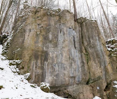  |
1.3.15.4. Neidstallwand 9 routes in Crag
- Summary:
-
All Sport climbing
Lat / Long: 49.515429, 11.558661
approach
GPS: 11.55868, 49.51546
1.3.15.5. Hammertalwand 28 routes in Crag
- Summary:
-
Mostly Sport climbing
Lat / Long: 49.514379, 11.558935
approach
GPS: 11.55900, 49.51442
1.3.15.6. Riesturm 13 routes in Crag
- Summary:
-
All Sport climbing
Lat / Long: 49.515006, 11.561116
summary
Alleinstehender Turm mit Gipfelbuch.
description
Noch rauhe Löcher und gut abgesicherte Touren vom 4ten bis 7ten Grad.
approach
GPS: 11.56116, 49.51500
/82/3f/823fd34d0b5db3f12e65aad48767b3dc099707a9) /94/1b/941b27270fa2594afe740db1704f811132d4f26f) /1a/55/1a55c8f300c1b61cc1c555ffe493f56bd377cd6b) /eb/25/eb25f1ea165d310a038b23032799dbf9e1af9891) |
1.3.15.7. Lehenstein 5 routes in Crag
- Summary:
-
All Sport climbing
Lat / Long: 49.512190, 11.558572
description
save yourself the effort, its overgrown and not worth going to unless its gets reboltet and cleaned.
approach
GPS: 11.55880, 49.51213
1.3.15.8. Oeder Fels 3 routes in Crag
- Summary:
-
All Sport climbing
Lat / Long: 49.511363, 11.561256
approach
20m north of Oeder Wand
1.3.15.9. Oeder Wand 11 routes in Crag
- Summary:
-
Mostly Sport climbing
Lat / Long: 49.511202, 11.561475
summary
Bulky tower next to "Brosinnadel".
approach
GPS: 11.56146, 49.51122
1.3.15.10. Brosinnadel 6 routes in Crag
- Summary:
-
Trad climbing and Sport climbing
Lat / Long: 49.511066, 11.561583
summary
The tallest tower in the valley, and one of the first summit in the Frankenjura that has been climbed for the sake of the sport.
description
The first ascent of the Brosinnadel by Fritz Brosin, together with students from Erlangen in around 1890 is one of the earliest known sport climbs (in the broader sense) in the Frankenjura. Brosin chose the short uphill side, the easiest route up. Later in 1914, the famous duo Toni Rockstroh and Georg Vollrath found a way through the impressive south west face, the "Alte Talseite", which is still the most climbed route here today.
approach
GPS: 11.56146, 49.51122
1.3.15.11. Oeder Schlucht 17 routes in Crag
- Summary:
-
All Sport climbing
Lat / Long: 49.510441, 11.562135
approach
GPS: 11.56210, 49.51045
1.3.15.12. Rupprechtstein 6 routes in Crag
- Summary:
-
All Sport climbing
Lat / Long: 49.537391, 11.585548
1.3.15.13. Dohlenwand 20 routes in Crag
- Summary:
-
Mostly Sport climbing
Lat / Long: 49.506018, 11.571509
approach
GPS: 11.57159, 49.50610
1.3.15.14. Sulzbacher Wand 0 routes in Crag
- Schräger Tod 6 A0 (Erwin Weich)
- Direkter Tod 6 A0 (Rudolf Buchner)
- Sargdeckel 4 A0
description
maybe closed - historical routes:
1.3.16. Haunritz 83 routes in Area
- Summary:
-
Mostly Sport climbing
Lat / Long: 49.490359, 11.599188
1.3.16.1. Haunritzer Wirtsfelsen 6 routes in Crag
- Summary:
-
Mostly Sport climbing
Lat / Long: 49.487734, 11.584631
approach
GPS: 11.58651, 49.49055
1.3.16.2. Alter Fritz 19 routes in Crag
- Summary:
-
Mostly Sport climbing
Lat / Long: 49.490490, 11.586821
1.3.16.3. Haunritzer Wand 22 routes in Crag
- Summary:
-
All Sport climbing
Lat / Long: 49.488989, 11.588275
1.3.16.4. Märchenland 11 routes in Crag
- Summary:
-
All Sport climbing
Lat / Long: 49.489072, 11.588908
1.3.16.5. Kuhfels 5 routes in Crag
- Summary:
-
All Sport climbing
Lat / Long: 49.482472, 11.651011
approach
GPS: 11.65097, 49.48245
1.3.16.6. Naturfreundefels 13 routes in Crag
- Summary:
-
All Sport climbing
Lat / Long: 49.487433, 11.612752
1.3.16.7. Junger Fritz 7 routes in Crag
- Summary:
-
All Sport climbing
Lat / Long: 49.490696, 11.586671
1.3.17. Lichtenegg 123 routes in Area
- Summary:
-
Mostly Sport climbing
Lat / Long: 49.471628, 11.619493
1.3.17.1. Lichtenegger Wand 14 routes in Crag
- Summary:
-
Mostly Sport climbing
Lat / Long: 49.476756, 11.597693
approach
GPS: 11.59770, 49.47675
1.3.17.2. Steinerne Krone 13 routes in Crag
- Summary:
-
Mostly Sport climbing
Lat / Long: 49.474130, 11.596584
 |
1.3.17.3. Hoher Fels 10 routes in Crag
- Summary:
-
Sport climbing and Trad climbing
Lat / Long: 49.474185, 11.596810
 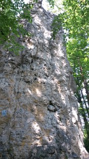 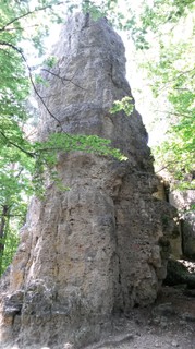 |
1.3.17.4. Türkenfels 38 routes in Crag
- Summary:
-
All Sport climbing
Lat / Long: 49.471450, 11.596311
1.3.17.5. Nonnhofer Hochfels 10 routes in Crag
- Summary:
-
All Sport climbing
Lat / Long: 49.463549, 11.633190
approach
GPS: 11.63318, 49.46358
1.3.17.6. Nonnhofer Höhlenwand 3 routes in Crag
- Summary:
-
All Sport climbing
1.3.17.7. Birkenfels 9 routes in Crag
- Summary:
-
All Sport climbing
Lat / Long: 49.471233, 11.602189
1.3.17.8. Ammerrieder Fels 10 routes in Crag
- Summary:
-
All Sport climbing
Lat / Long: 49.470594, 11.603092
approach
Parking place near Ammerried. Follow forrest street 200m to west. Then follow tzrack into forrest for 100m. Crag could seen on lelft 60m far away from way.
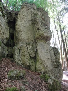  |
1.3.17.9. Kalbsfels 3 routes in Crag
- Summary:
-
All Sport climbing
Lat / Long: 49.480217, 11.653855
approach
near Bachetsfeld
1.3.17.10. Siebenschläferwand 13 routes in Area
- Summary:
-
All Sport climbing
1.3.18. Neukirchen 130 routes in Area
- Summary:
-
Mostly Sport climbing
Lat / Long: 49.538173, 11.625464
1.3.18.1. Hartenfels 41 routes in Crag
- Summary:
-
Mostly Sport climbing
Lat / Long: 49.531105, 11.637657
approach
GPS: 11.63754, 49.53113
1.3.18.2. Grundfels 19 routes in Crag
- Summary:
-
Mostly Sport climbing
Lat / Long: 49.554205, 11.613519
approach
GPS: 11.61365, 49.55418
1.3.18.3. Buchenstein 25 routes in Crag
- Summary:
-
All Sport climbing
Lat / Long: 49.513928, 11.614400
approach
GPS: 11.61439, 49.51394
/a2/b0/a2b0d3656ae31dfc51450e631d1a5009754670e2)  /19/08/19084cc813166787a883d2cbdd1759b2baf4b93f) |
1.3.18.4. Flinzbergwand 10 routes in Crag
- Summary:
-
All Sport climbing
Lat / Long: 49.542580, 11.615417
approach
GPS: 11.61545, 49.54257
1.3.18.5. Gaisheimer Wand 14 routes in Crag
- Summary:
-
All Sport climbing
Lat / Long: 49.555267, 11.616478
approach
GPS: 11.61648, 49.55530
1.3.18.6. Gockelfels 3 routes in Crag
- Summary:
-
All Sport climbing
Lat / Long: 49.524180, 11.666324
approach
GPS: 11.66678, 49.52419
1.3.18.7. Henastoa 18 routes in Crag
- Summary:
-
All Sport climbing
Lat / Long: 49.524181, 11.666808
approach
GPS: 11.66678, 49.52419
1.4. Indoor 48 routes in Artificial
- Summary:
-
All Sport climbing
Lat / Long: 49.686931, 11.274440
description
Kletter- und Boulderhallen
1.4.1. Kletterkatakomben Eckersdorf 0 routes in Gym
1.4.2. Boulderhalle Zugzwang Auerbach 0 routes in Gym
description
approach
Neuhauser Strasse 1, 91275 Auerbach
1.4.3. Fight Club (Betzenstein) 0 routes in Gym
summary
Next to a great Climbing Store, in the heart of the Frankenjura
description
approach
Drive from Nürnberg towards Bayreuth, exit Plech. turn right towards Betzenstein, Pottenstein. In Beetzenstein right, and opposite the post office left.
1.4.4. Magnesia Forchheim 29 routes in Gym
- Summary:
-
Lat / Long: 49.714059, 11.094038
description
https://www.magnesia-klettern.de/
climbing and small boulder gym
1.4.4.1. Frankenjura 0 routes in Sector
1.4.4.2. Kalymnos 2 routes in Sector
- Summary:
-
All Sport climbing
1.4.4.3. Fontainebleau 0 routes in Sector
1.4.4.4. Margalet 5 routes in Sector
- Summary:
-
All Sport climbing
1.4.4.5. Ceüse 6 routes in Sector
- Summary:
-
All Sport climbing
1.4.4.6. Arco 7 routes in Sector
- Summary:
-
All Sport climbing
1.4.4.7. Finale 6 routes in Sector
- Summary:
-
All Sport climbing
1.4.4.8. Yosemite 1 route in Sector
- Summary:
-
All Sport climbing
1.4.4.9. Eldorado 2 routes in Sector
- Summary:
-
All Sport climbing
1.4.5. Kletterhalle Hersbruck 19 routes in Gym
- Summary:
-
Lat / Long: 49.505227, 11.439216
description
| Route | Grade | Style | Selected ascents | |||
|---|---|---|---|---|---|---|
| 41 |
HR 02 - blau
Set: 2023 | 7- | ||||
| 42 |
HR 06 - grau
Set: 2023 | 8- | ||||
| 43 |
HR 08 - rot
Set: 2023 | 8- | ||||
| 44 |
HR 09 - blau
Set: 2023 | 7 | ||||
| 45 |
HR 10 - schwarz
Set: 2023 | 7 | ||||
| 46 |
HR 11 - rot
Set: 2023 | 7- | ||||
| 47 |
HR 13 - gelb
Set: 2023 | 7+ | ||||
| 48 |
HR 14 - orange
Set: 2023 | 7- | ||||
| 49 |
HR 15 - grün
Set: 2023 | 7- | ||||
| 50 |
HR 16 - rot
Set: 2023 | 6+ | ||||
| 51 |
HR 17 - gelb
Set: 2023 | 7- | ||||
| 52 |
HR 21 - gelb
Set: 2023 | 6+ | ||||
| 53 |
HR 26 - gelb
Set: 2023 | 7+ | ||||
| 54 |
HR 30 - rot
Set: 2023 | 6+ | ||||
| 55 |
HR 31 - weiß
Set: 2023 | 6+ | ||||
| 56 |
HR 31 - pink
Set: 2023 | 7 | ||||
| 57 |
HR 33 - blau
Set: 2023 | 6+ | ||||
| 58 |
HR 34 - gelb
Set: 2023 | 7- | ||||
| 59 |
HR 34 - grün
Set: 2023 | 6 | ||||
1.4.6. Blockhelden - Boulderhalle Bamberg 0 routes in Gym
summary
description
1000 m²
approach
1.4.7. Blockhelden Erlangen 0 routes in Gym
summary
https://blockhelden.de/boulderhalle-erlangen/
boulder gym
1.4.8. Steinbock Fürth/Zirndorf 0 routes in Gym
1.4.9. DAV Amberg 0 routes in Gym
description
approach
Dekan-Hirtreiter-Str. 5, 92224 Amberg
1.4.10. DAV Neumarkt 0 routes in Gym
1.4.11. DAV Sulzbach-Rosenberg 0 routes in Gym
1.5. Amberger Gebiet 388 routes in Area
- Summary:
-
Mostly Sport climbing
Lat / Long: 49.386993, 11.777700
ethic
see Mittlere Fränkische Alb / Oberpfälzer Alb / Mittlerer Frankenjura for info.
1.5.1. Schwend 151 routes in Crag
- Summary:
-
Mostly Sport climbing
Lat / Long: 49.426719, 11.666709
1.5.1.1. Bettelmannsfels 20 routes in Crag
- Summary:
-
All Sport climbing
Lat / Long: 49.397291, 11.683317
1.5.1.2. Gumpenwand 10 routes in Crag
- Summary:
-
All Sport climbing
Lat / Long: 49.412376, 11.653345
1.5.1.3. Hagfels 15 routes in Crag
- Summary:
-
All Sport climbing
Lat / Long: 49.423320, 11.625979
1.5.1.4. Kalmusfels 41 routes in Crag
- Summary:
-
All Sport climbing
Lat / Long: 49.443309, 11.694255
description
1.5.1.5. Osterlochwände 35 routes in Crag
- Summary:
-
All Sport climbing
Lat / Long: 49.440724, 11.699598
1.5.1.6. Kalvarienwand 11 routes in Crag
- Summary:
-
All Sport climbing
Lat / Long: 49.407529, 11.684401
description
8 routes from 5 til 7 UIAA
1.5.1.7. Schwender Wand 16 routes in Crag
- Summary:
-
Mostly Sport climbing
Lat / Long: 49.417893, 11.630142
1.5.1.8. Buschenberg 3 routes in Crag
- Summary:
-
All Sport climbing
Lat / Long: 49.449235, 11.647594
1.5.2. Breitenbrunner Wände 53 routes in Crag
- Summary:
-
Mostly Sport climbing
Lat / Long: 49.486530, 11.758179
1.5.2.1. Torbogenwand 4 routes in Sector
- Summary:
-
All Sport climbing
1.5.2.2. Bouldereck 2 routes in Sector
- Summary:
-
All Bouldering
1.5.2.3. Bauchwand 6 routes in Sector
- Summary:
-
All Sport climbing
1.5.2.4. Krakenwand 11 routes in Sector
- Summary:
-
All Sport climbing
Lat / Long: 49.486507, 11.758558
 /e8/e9/e8e91eb3bee6f3eb52bdc13a38452b5effdd41d3) |
1.5.2.5. Rotwand 8 routes in Sector
- Summary:
-
All Sport climbing
Lat / Long: 49.486453, 11.757703
 /ee/95/ee95adba0dbe020359c5c03914585214485b0fcd) |
1.5.2.6. Schildwand 8 routes in Sector
- Summary:
-
All Sport climbing
Lat / Long: 49.486434, 11.757332
/b7/91/b7914e2d960494cf7ed312ad5fbb7c1741a09ac6) |
1.5.2.7. Boulderwand 0 routes in Sector
1.5.2.8. Rudi Hoch Gedenkwand 5 routes in Sector
- Summary:
-
All Sport climbing
 |
1.5.2.9. Endwand 9 routes in Sector
- Summary:
-
All Sport climbing
1.5.3. Ammerthaler Wand 26 routes in Crag
- Summary:
-
All Sport climbing
Lat / Long: 49.445571, 11.748521
- The crag had been temporarily closed due to failure of a glue-in anchor, see news entry of IG Klettern (German)
- closure lifted after investigations and serious re-equipment measures, read more (in German) in a news entry of IG Klettern
summary
South-west face at the edge of a forest with a good range of grades.
access issues
Please do not drive into the valley! Park at the sports field instead.
approach
Park at the sports field of Ammerthal. Follow "Pürschläger Weg" north past two football pitches into a little valley. After about 1 km, you should see some boulders on the opposite side of the valley. Walk over on the path between the fields and into the forest to the foot of the crag.
history
| Route | Grade | Style | Selected ascents | |||
|---|---|---|---|---|---|---|
| 1 | Fingers Fool | 7- | 8m | |||
| 2 | Fresh and Funky | 6+ | 8m | |||
| 3 | Asahi super dry | 8+ | ||||
| 4 | ★★ Desperados | 8- | 16m | |||
| 5 | Touchdown | 8+ | 16m, 5 | |||
| 6 | ★★ Kombination | 8 | 16m | |||
| 7 | ★★ Last Highway | 9+ | ||||
| 8 | ★★ Endspiel | 9 | ||||
| 9 | ★ Undertaker | 9- | 16m | |||
| 10 | ★ J’s pleasure | 7 | 16m | |||
| 11 | ★ Keine Ahnung | 7- | 16m | |||
| 12 | Big in Japan '01 | 7 | 16m | |||
| 13 | ★★ Senkrechtstarter | 7+ | 16m, 5 | |||
| 14 | ★★ Normalweg | 6 | 16m | |||
| 15 | ★ Warm Up | 7- | 16m, 5 | |||
| 16 | ★ STUKA | 7+ | 14m, 5 | |||
| 17 | ★★ Doppelficker | 8- | 14m | |||
| 18 |
★★ Káck Attáck
FA: Peter Haubner, 2002 | 7+ | 14m | |||
| 19 | ★★ Hey Ho Let’s Go | 5- | 15m | |||
| 20 | ★★ Crazy | 6- | 15m | |||
| 21 | ★ Mr. Clean | 5- | 15m | |||
| 22 | ★ Can't touch this '02 | 5- | ||||
| 23 | ★ Fat boy rolling on | 5 | 13m | |||
| 24 | ★ Gipfelgrün | 3+ | 8m, 3 | |||
| 25 | ★ Sternchenweg | 4+ | 8m | |||
| 26 | ★ Prototype | 5 | 8m | |||
1.5.4. Schlampenland 32 routes in Crag
- Summary:
-
All Sport climbing
Lat / Long: 49.431432, 11.766430
| Route | Grade | Style | Selected ascents | |||
|---|---|---|---|---|---|---|
| 1 | Kölsche Jungs | 7- | ||||
| 2 | Projekt 1 | |||||
| 3 | Zappelphilipp | 9- | ||||
| 4 | Querulant | 9+ | ||||
| 5 | Antreten zum Verrecken | 9+ | ||||
| 6 | Hinterstoisserquergang | 9 | ||||
| 7 | Abschlussbreze direkt | 9+ | ||||
| 8 | Abschlussbreze | 9 | ||||
| 9 | HAC-Piaz | 6- | ||||
| 10 | Kassandra | 6- | ||||
| 11 | Tast-a-Tour | 8- | ||||
| 12 | 7 rot GY | 7 | ||||
| 13 | Techno Tom | 7- | ||||
| 14 | Kurz beihalten, Klaus | 9 | ||||
| 15 | unnamed | |||||
| 16 | ★★ The climbing Wildsau | 8- | ||||
| 17 | Täuschungsmanöver | 7+ | ||||
| 18 | Projekt 2 | |||||
| 19 | ★★★ Deutsche Muskelschwundhilfe | 10 | ||||
| 20 | Projekt 3 | |||||
| 21 | Projekt 4 | |||||
| 22 | Wellensalat | 9 | ||||
| 23 | Schnäppchenjagd | 8+ | ||||
| 24 | Signor Rossi | 6 | ||||
| 25 | Weiße Spinne | 7 | ||||
| 26 | offenes Projekt | |||||
| 27 | Projekt 5 | |||||
| 28 | Projekt 6 | |||||
| 29 | Big Holds Coming Up | 10- | ||||
| 30 | Short Cut | 10-/10 | ||||
| 31 | Schlafende Hunde | 8+ | ||||
| 32 | ★★ Schlafes Bruder | 8+ | ||||
1.5.5. Lauterachtal 126 routes in Crag
- Summary:
-
Mostly Sport climbing
Lat / Long: 49.336503, 11.742070
where to stay
1.5.5.1. Lauterachfelsen 20 routes in Crag
- Summary:
-
Mostly Sport climbing
Lat / Long: 49.362592, 11.710507
approach
GPS: 11.71049, 49.36256
/f0/5a/f05a6e7d0f3449b291edb608c20e79b246581ee8) /9c/5c/9c5cce1b066c11d18b8be819840dd0a9d314f53e) /0d/0e/0d0ee4484d4ed8c00a4c00cd1354653dc8e45f91) |
1.5.5.2. Brennesselwand 13 routes in Crag
- Summary:
-
All Sport climbing
Lat / Long: 49.350979, 11.715290
approach
GPS: 11.71532, 49.35092
1.5.5.3. Rote Wand 5 routes in Crag
- Summary:
-
All Sport climbing
Lat / Long: 49.349580, 11.716144
1.5.5.4. Happy-Hippo-Wand 8 routes in Crag
- Summary:
-
Mostly Sport climbing
Lat / Long: 49.350118, 11.718922
summary
Guter Fels und kurzes Zustieg; leider sehr nah an der Straße und bei Motorradverkehr laut
description
Gut mit dem Rad zu erreichen. Bewertungen vergleichweise hart.
approach
Parken an Wanderparkplatz im Lauterachtal - 5 Min. die Straße in südlicher Richtung folgen und links hoch zu den sichtbaren Felsen
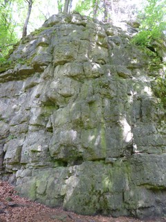   |
1.5.5.5. Dachlwand 13 routes in Crag
- Summary:
-
All Sport climbing
Lat / Long: 49.349925, 11.719139
approach
GPS: 11.71916, 49.34992
1.5.5.6. Welzenbach Gedenkwand 12 routes in Crag
- Summary:
-
All Sport climbing
Lat / Long: 49.348457, 11.720808
access issues
This crag is usually temporally closed from January 1 until July 31. An active closure is indicated by a warning and 'closed' tag here on the site; when in doubt, signs put up at the crag have precedence!
Dieser Fels ist üblicherweise von 1. Januar bis 31. Juli gesperrt. Eine aktive Sperrung wird auf dieser Seite durch eine Warnung und ein 'gesperrt'-Tag markiert; im Zweifelsfall haben die örtlich aufgehängten Schilder Vorrang!
approach
GPS: 11.72081, 49.34847
1.5.5.7. Kleine Wand 8 routes in Crag
- Summary:
-
All Sport climbing
Lat / Long: 49.348291, 11.720922
access issues
This crag is usually temporally closed from January 1 until July 31. An active closure is indicated by a warning and 'closed' tag here on the site; when in doubt, signs put up at the crag have precedence!
Dieser Fels ist üblicherweise von 1. Januar bis 31. Juli gesperrt. Eine aktive Sperrung wird auf dieser Seite durch eine Warnung und ein 'gesperrt'-Tag markiert; im Zweifelsfall haben die örtlich aufgehängten Schilder Vorrang!
approach
GPS:
1.5.5.8. Ransbacher Block 11 routes in Crag
- Summary:
-
All Sport climbing
Lat / Long: 49.343078, 11.728660
access issues
This crag is usually temporally closed from January 1 until July 31. An active closure is indicated by a warning and 'closed' tag here on the site; when in doubt, signs put up at the crag have precedence!
Dieser Fels ist üblicherweise von 1. Januar bis 31. Juli gesperrt. Eine aktive Sperrung wird auf dieser Seite durch eine Warnung und ein 'gesperrt'-Tag markiert; im Zweifelsfall haben die örtlich aufgehängten Schilder Vorrang!
approach
GPS: 11.72863, 49.34313
1.5.5.9. Lauterachstube 12 routes in Crag
- Summary:
-
All Sport climbing
Lat / Long: 49.342412, 11.728966
1.5.5.10. Flügelwand 9 routes in Crag
- Summary:
-
All Sport climbing
Lat / Long: 49.339863, 11.727137
1.5.5.11. Hummellöcher 15 routes in Crag
- Summary:
-
All Sport climbing
Lat / Long: 49.331955, 11.695749
access issues
In the past the land owner did not allow climbing and there had been problems reported. So please be reasonable and respectful in that area to avoid conflicts : )
approach
GPS: 11.69594, 49.33200
1.5.5.12. "Kastl Dorfwand" 0 routes in Crag
description
in Kastl
access issues
The current state of access is unknown
1.6. Neumarkter Gebiet 90 routes in Area
- Summary:
-
All Sport climbing
Lat / Long: 49.288730, 11.533206
1.6.1. Krähentischwand 9 routes in Crag
- Summary:
-
Lat / Long: 49.292174, 11.491061
summary
Südseitiges Kletteregebiet von lokaler Bedeutung. Fels leider etwas brüchig. Helm dringend anzuraten. Dafür eine wunderschöne Aussicht über das Neumarkter Land und man ist dort meist alleine.
description
Ein Gebiet von lokalem Interesse. Felsqualität kann leider mit den restlichen Felsen des Frankenjura nicht mithalten. Trotzdem lohnt es sich hier paar Routen zu klettern, wenn man eh in der Gegend ist oder dort wohnt. Super für sonnige Wintertage, da die Wand südseitig ausgerichtet ist. Sehr schade, dass Menschen von oben ihren Müll herunterschmeißen und der Wandfuss daher entsprechend aussieht. Die lokalen Kletterer entfernen diesen zwar regelmäßig, aber es kommt immer wieder neuer nach.
access issues
Bitte Helm tragen!
approach
Zustieg mit den öffentlichen Verkehrsmitteln leider schwierig. Die Buslinien 564 und 565 fahren bis knapp unter den Fels. Die Rufbuslinie 575 bis direkt zur Burgruine. Linie 564 mit Ausstieg Schafhof: https://www.vgn.de/ib/site/publication/ttb/vgn:63564:H:j22:1-1640659962.pdf Linie 565 mit Ausstieg Hl. Kreuz: https://www.vgn.de/ib/site/publication/ttb/vgn:63565:H:j22:1-1640659967.pdf Rufbuslinie 575 Ausstieg Burgruine: https://www.vgn.de/ib/site/publication/ttb/vgn:65575:H:j22:1-1640660005.pdf
Mit dem Rad ab Neumarkt Bhf in ca. 25 min hoch zur Burgruine.
where to stay
Etliche Übernachtungsmöglichkeiten in Neumarkt.
history
Das Gebiet ist bereits in den 70ern von der Bundeswehr zu Übungszwecken genutzt worden. Daher die alten Haken am Felskopf und die zwei alten Haken in der Wand. Ab 2005 von Ludwig Simek modern mit Klebehaken eingerichtet und von Schmutz und losem Gestein befreit. Der Wandfuss war völlig vermüllt, da Besucher*innen von oben alles mögliche an Müll herunterschmeißen. Kurz darauf wurde im linken Sektor von Stefan Mösel eine Route eingerichtet. Zuletzt (ca. 2008) kam im mittleren Wandbereich die Route "Krisperla" hinzu.
| Route | Grade | Style | Selected ascents | |||
|---|---|---|---|---|---|---|
| 1 |
R1
Überhängende und kräftige Route, Bewertung klassisch hart. Im linken Sektor einzige Route. FA: Stefan Mösel | 9- | ||||
| 2 |
★★ Krisperla
Kurze Route im mittleren Sektor. Fels relativ fest. Plattig. FA: Ludwig Simek, 2008 | 7- | 8m | |||
| 3 |
★★★ Energiewende
Über zwei Haken zum Umlenker (Sauschwanz). Am ersten Haken Schlüsselstelle. Plattig. Einstieg recht brüchig, oben fest. FA: Ludwig Simek, 2008 | 7 | 10m, 2 | |||
| 4 |
★★ Deutsch-tschechischer Freundschaftsweg
Über Haken in Platte unter den Überhang. Links rausqueren und zu Riss. Umlenken an zwei Haken. FA: Ludwig Simek, 2005 | 7 | 10m, 3 | |||
| 5 |
★★ Papa Lui
Längste Route im Gebiet. Großgriffig. Oben links raus zum Umlenker an großen Griffen. FFA: Ludwig Simek, 2005 | 6+ | 13m | |||
| 6 |
★★ Sex and the City
Schwerste Route im rechten Sektor. Direkt über die Haken klettern und nicht in linken Riss ausqueren. Sehr gut gesichert. FA: Ludwig Simek, 2005 | 7+ | 12m | |||
| 7 |
★★★ Tango mit dem Tod
Oben schöner fester Fels. Zwei Griffe wurden mit Mörtel verstärkt. Unten brüchig und rechts querend auf Band. FA: Natalie Haas | 6 | 12m | |||
| 8 |
★★ Ohne Pep(ka) geht nichts!
Gemeinsamer Einstieg mit Ü-Ei und auf Band links über kleinen Überhang zum Umlenker. Sehr gut gesichert. FA: Ludwig Simek, 2005 | 7- | 8m | |||
| 9 |
★★ Ü-Ei
Unten leichter Einstieg oben kurze Plattenstelle zum Umlenker. FA: Ludwig Simek, 2005 | 6- | 8m | |||
1.6.2. Oberrieder Turm 6 routes in Crag
- Summary:
-
Lat / Long: 49.369866, 11.517342
access issues
This crag is usually temporally closed from January 1 until July 31. An active closure is indicated by a warning and 'closed' tag here on the site; when in doubt, signs put up at the crag have precedence!
Dieser Fels ist üblicherweise von 1. Januar bis 31. Juli gesperrt. Eine aktive Sperrung wird auf dieser Seite durch eine Warnung und ein 'gesperrt'-Tag markiert; im Zweifelsfall haben die örtlich aufgehängten Schilder Vorrang!
| Route | Grade | Style | Selected ascents | |||
|---|---|---|---|---|---|---|
| 1 | Lust auf Meer | 8+ | ||||
| 2 | Kissenstimme | 8 | ||||
| 3 | ? | 7 | ||||
| 4 |
Lonely Pussies
FFA: Reinhold Hutzler | |||||
| 5 | Alter Weg | 7 | 12m | |||
| 6 | Overstolz | 7 | ||||
1.6.3. Hackenhofen 5 routes in Crag
- Summary:
-
Lat / Long: 49.172974, 11.722879
description
10 m Wandhöhe, südseitig, schnelltrocknend
access issues
Für dieses Gebiet wurde mit der Regierung von der Oberpfalz eine Vereinbarung getroffen, das es hierzu keine Veröffentlichung geben soll.
approach
Parken im Hammermühlweg, Feldweg zur Laber, dann leicht rechts durch Sträucher den Hang abwärts
| Route | Grade | Style | Selected ascents | |||
|---|---|---|---|---|---|---|
| 1 | Tritschler | 5+ | 3 | |||
| 2 | Freibierlätschn | 6- | 4 | |||
| 3 | Bixlmadam | 6- | 4 | |||
| 4 | Ruamzuzla | 5 | 4 | |||
| 5 | Bauernfümfa | 5+ | 5 | |||
1.6.4. Rudenshofen 11 routes in Area
- Summary:
-
description
Relativ niedrige Blöcke im schönen Laubwald nahe Parsberg in der Oberpfalz
1.6.4.1. Grasberg 11 routes in Area
- Summary:
-
All Sport climbing
 /29/3b/293b7db6477c444b58ca86061d63fb1c9f30989d)  /82/8f/828f39639728ceef23dc2c5e45abdc688a9aa7b3)  /d2/d6/d2d63dbc277a2b338bf0c565da0f450b72c63b06) |
1.6.5. Buchenberg 26 routes in Cliff
- Summary:
-
Lat / Long: 49.173591, 11.713598
approach
5 min
| Route | Grade | Style | Selected ascents | |||
|---|---|---|---|---|---|---|
| 1 |
★ Zwangsräumung
FA: 2017 | 7- | 10m, 4 | |||
| 2 |
★★ Jag das Eichhörnchen
FA: 2017 | 7-/7 | 11m, 5 | |||
| 3 | ★★★ Schneckenrennen | 6- | 11m, 3 | |||
| 4 |
Statisch-dynamisch
FA: 2017 | 7+ | 11m, 5 | |||
| 5 |
Hannibunny
FA: 2017 | 7 | ||||
| 6 |
Anders als gedacht
FA: 2017 | 6- | 8m | |||
| 7 |
Arschklemmer
FA: 2017 | 4+ | 8m | |||
| 8 | Weinbergschnecke | 6 | 10m, 3 | |||
| 9 | Schneck-Pfeiler | 6 | 8m, 3 | |||
| 10 | ★★ Schneckenhaus | 5+ | 11m, 4 | |||
| 11 |
Blejdgstudiert
FA: 2017 | 5+ | 11m | |||
| 12 |
★★ Luderritze
FA: 2017 | 5- | 12m, 5 | |||
| 13 |
★ Geputzt wird später
FA: 15 Oct 2016 | 5- | 11m, 5 | |||
| 14 |
★ Feig?!
FA: 2017 | 5+ | 11m, 5 | |||
| 15 | ★★ Zuckerschnecke | 7- | 12m, 5 | |||
| 16 |
Rache des Eichhörnchens
FA: 2017 | 7- | 11m, 5 | |||
| 17 | Schleimspur | 8m | ||||
| 18 | ★★ Hörschnecke | 6- | 8m, 3 | |||
| 19 |
Hasenmaus
FA: 2017 | 6+ | 9m, 3 | |||
| 20 |
★ Leseschwäche
FA: 2017 | 7- | 10m, 4 | |||
| 21 |
★ Butterbrot
FA: 2016 | 7- | 8m, 4 | |||
| 22 |
★★ Nachtrag
FA: 2017 | 5+ | 9m, 4 | |||
| 23 |
Tim und Struppi
FA: 2014 | 3 | 10m, 3 | |||
| 24 |
★ Spätlese
FA: 2017 | 6- | 8m, 3 | |||
| 25 |
★ Käptn Haddock
FA: 2014 | 4 | 7m, 3 | |||
| 26 |
★ Shorty
FA: 2017 | 5+ | 7m, 3 | |||
1.6.6. Schwammerlwände 23 routes in Crag
- Summary:
-
1.6.6.1. Linke Wand 13 routes in Sector
- Summary:
-
All Sport climbing
    |
1.6.6.2. Mittlere Wand 5 routes in Sector
- Summary:
-
All Sport climbing
 |
1.6.6.3. Rechte Wand 5 routes in Sector
- Summary:
-
All Sport climbing
 |
1.6.7. Grenzstein 10 routes in Crag
- Summary:
-
description
| Route | Grade | Style | Selected ascents | |||
|---|---|---|---|---|---|---|
| 1 | Frontex | 6 | 15m | |||
| 2 | Grenzenlos | 6- | 15m | |||
| 3 | Limes | 7 | 13m | |||
| 4 | Fluchthelfer | 5+ | 13m | |||
| 5 | Ostblock | 4+ | 13m | |||
| 6 | Fall des Ostblocks | 7+ | 13m | |||
| 7 | Turmtänzer | 6 | 13m | |||
| 8 | Grenzwächter | 7 | 13m | |||
| 9 | Krallenkante | 5+ | 13m | |||
| 10 | Schmugglerspalt | 4+ | 10m | |||