Seasonality
Description
One of the most popular easy sport crags in the 'Grampians'. A secret lush valley hidden away behind the olive plantation and only discovered with the help of Google Earth! This place is made for summer. There are two sides to the crag, the south facing shady vertical face and the north facing steep cave. The vertical face is in shade until 4pm in summer, the sport cave gets a little morning sun but is steep enough not to greatly affect the climbing. This is not a great place in winter as it doesn't get any sun at all.
The North Vertical Wall looks and climbs like a mix of Kentucky's Red River Gorge and the Blue Mountains. Because of the shady aspect there is quite a bit of lichen and moss on this wall, but the good routes climb the clean lines between these curtains of vegetation. Hopefully with a few more repeats these routes will become totally clean. The routes on the left side climb very nicely on polished orange rock with remarkable jugs, the right side routes are gritty and a little crumbly underfoot.
If it all gets too hot, there are several waist deep swimming holes 200m further up the ravine and some more minor ones downstream about 200m. They tend to be a bit stagnant in late summer.
There has been some complaints from local bush walkers about the Ravine climbing area. Try and keep to these self-imposed rules when climbing here.
limit the numbers of climbers in your group (no more than 5?) No uni clubs, VCC trips etc.
no new routes
no toilet activities anywhere near the crag or the creek (and bury your paper!)
leave your cars parked at Stapylton camp if you have more than 1
Park your car at the gate (open or closed) and walk in
be courteous to any non-climbers in the area
take out any rubbish you find (even if it isn't yours)
Access issues inherited from Grampians
Designated
Climbing restrictions apply to many crags in Gariwerd/Grampians. Some of these restrictions are likely to change over time as assessments are completed. Tags are being applied to most crags to reflect their current status. Additional access-notes are provided to clarify restrictions where required (and will over-ride this notice). Current and further Parks Victoria advice can be found at https://www.parks.vic.gov.au/places-to-see/parks/grampians-national-park/rock-climbing-in-gariwerd
Approach
20-30 min
From Stapylton Campground drive west along Olive Plantation Road towards 'Grampians' Road. Park at the first left turn after about a kilometre at a sandy hump with a gate, which may be locked in which case you'll need to walk. At the 2nd distinct sharp 90 degree bend you will see a small cliff in front of you, walk 50-100m PAST this final corner and look for a cairn on the left of the road marking the climbers track. Cairns mark the direction of the gully to scramble up. Once at the top of the small cliff line head approximately due east (cairns should mark the way, as all tape markers have been incinerated). While direction is relatively well marked by cairns some of the previous heavily wooded areas are not marked as well. Just keep heading east (gently heading uphill) until you reach the flat rocky ridge line which has cairns marking the final direction. Once looking down into the valley the Ravine is the large canyon approximately due east. Follow cairns down and try to stay to rocky ground to avoid erosion.
Total walking time - 40 minutes including the easy road - a mountain bike would reduce the walk time in half. Mosquitoes lurk in the water holes - bring repellent.
© (aca_admin)Ethic
Tags
Plan your Trip
Some content has been provided under license from: © Australian Climbing Association Queensland (Creative Commons, Attribution, Share-Alike 2.5 AU)
Hello!
First time here?
theCrag.com is a free guide for rock climbing areas all over the world, collaboratively edited by keen rock climbers, boulderers and other nice folks.You can log all your routes, connect and chat with other climbers and much more...» go exploring, » learn more or » ask us a question


Selected Guidebooks more Hide
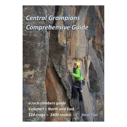
Author(s): Steve Toal
Date: 2019
The Central Grampians Comprehensive Guide books are the most extensive climbing guide to the Grampians. With two volumes they cover the popular areas but also many of which have never been in print before.
Volume 1 of the Central Grampians guide covers the North and East regions and features over 1400 routes spread over 124 crags. Painstakingly put together by Steve Toal, his guides have now become the go-to for climbers for the area.
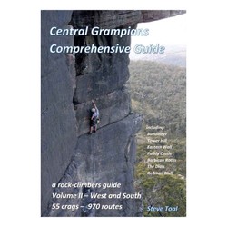
Author(s): Steve Toal
Date: 2019
The Central Grampians Comprehensive Guide books are the most extensive climbing guide to the Grampians. With two volumes they cover the popular areas but also many of which have never been in print before.
Volume 2 of the Central Grampians guide covers the West and South regions and features over 970 routes spread over 55 crags. Painstakingly put together by Steve Toal, his guides have now become the go-to for climbers for the area.
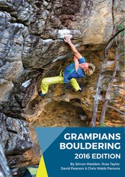
Author(s): Simon Madden, Ross Taylor, David Peason and Taylor Parsons
Date: 2016
ISBN: 9780646955544
"Australia's premier bouldering destination! The new 2016 Edition Grampians Boulder guide authored by Simon Madden, Ross Taylor, David Peason and Taylor Parsons. It contains more than 1300 problems which is double the original guide. Heaps of new information on established areas as well as the inclusion of plenty of boulders and crags not published before. It also features update idiot proof layout and expanded history and culture notes. Get one and start cranking!"
ⓘ
Accommodations nearby more Hide
Share this
Nearby Icons
| 18 | ★ Hey Youse | ||
| 19 | ★★ Pains Ford | ||
| 20 | ★★ Try Land | ||
| 23 | ★★ Pain Criminals Link-up | ||
| 24 | ★ Hung Low Bay | ||
| 26 | ★★ Ravinous |
Photos Browse all photos

Josh Ellis on ★★ Ravinous 26 - 263526370_299684332066678_6515155535040322406_n.jpg

★★ Ravinous 26 - Gramps2611-1940.jpg

★★ Ravinous 26 - ravinous.jpg

Captain Ruin at The Ravine - Glue Mountains.jpg
Thu 8 Jun
Check out what is happening in The Ravine.
Get a detailed insight with a timeline showing
- Ticks by climbers like you
- Discussions of the community
- Updates to the index by our users
- and many more things.
Login to see the timeline!