
Seasonality
Summary
Sandstone
Two big walls of spectacular single pitch climbing and epic views.
Description
The majority of the sectors at this area face southwest, so only get sun after 3pm. The belay ledges are wide and comfy, with minimal dirt and muck. Because of the exposed position wind can howl onto these routes and make winters icy cold. Helmets are recommended due to the featured nature of this wall - and the fact you are a long way from an easy rescue if you cop a rock on your scone.
When you visit this area you may bump into an old bearded character sunning himself on the rocks at the top, or sleeping in one of the caves. He is a friendly chap and loves carrots, but if surprised may butt heads with you. He has famously thrown bolting gear off the top of the cliff and pooed on stashed ropes. He, of course, is a goat and is an escaped pet that appeared after the mid 2010s bushfires and has taken up residence.
Access issues
It's within the National Park, act appropriately. No dogs.
*There are several vulnerable plants (Isopogon fletcheri) growing along the undercut ledge system between the access gully and Banksy Wall. Please don't walk across this ferny ledge as a shortcut - ever. Continued access to future climbing in the Blues depends on it. Be careful of all vegetation on the walk in and at the crag itself. Isopogon fletcheri is only located at a handful of locations in the upper Blue Mountains, and the Oronga Crags contain the 2nd largest number of these plants ever recorded. National Parks is monitoring this site. *
Approach
20-30 min
UPDATE Sept 2018 - Due to the recent discovery of vulnerable plants (Isopogon fletcheri) on a ledge system originally used to approach this crag, the access has changed. The revised access is via an exposed via ferrata, and is only suitable for reasonably experienced climbers. Do not under any circumstance use the old track along the ferny undercut - continued access to the crag depends on it. Be careful of all vegetation on the walk in and at the crag itself.
Park at small dirt pull off on south side of Bells Line Road (-33.5721, 150.3567). This is 250m west of Mt Banks Rd, or 1.3km east of Pierces Pass Rd. It takes about 25 minutes to drive here from Blackheath. There is room for about 4 cars. If the carpark is full park at the Mt Banks turn-off instead.
The approach is not suitable for kids, non-climbers or those with a fear of big exposure. The via ferrata is not recommended in the rain. All up it takes about 30 minutes from car to the first route at Banksy Wall.
From carpark, step over the wire fence to join the old 4WD track. Follow this for 250m until it fades out on the ridge. Continue along top of ridge on a foot track for 900m to the point where the track drops steeply down the hill in the direction of the Grose Valley. After 170m the trees disappear and the track flattens onto a rocky pagoda. Skirt the right side of rock pagoda (-33.5829, 150.3587), then follow track left around pagoda and down the side of the ridge and into a major gully. Follow this until it funnels down into a small canyon. Scramble down fixed rope and a short section of metal rungs down a wet chimney to emerge into large cave.
Walk right from cave entrance along ledge for 20m, down short fixed rope to lower larger ledge. Along this for 50m until it ends at fixed ropes leading along narrow slot cave above huge dropoff. Harness up here, clip into the fixed rope, and traverse across ledge and up via metal rungs to arrive at right end of Banksy Wall below the route Philosophers Zone. Check the condition of the fixed ropes and clip in always, ideally with two slings.
To exit at end of day descend the via ferrata and exit the way you came in.
It's also possible to access the crag by abseiling into the crag from above "Spoke to the Mountain, Listened to the sea" via a cluster of trees.
Where to stay
No nearby official camping.
Ethic
If bolting new routes please avoid squeeze jobs, linkups or variant starts/finishes. There is enough rock for heaps of independent lines. Go for a walk! If your proposed line comes within 3m of an established route, please ask the person whose route it is so as not to devalue their original vision. Avoid damaging any vegetation in this area.
History
Discovered by Monty in early 2017
Tags
Plan your Trip
Did you know?
Did you know that you can create an account to record, track and share your climbing ascents? Thousands of climbers are already doing this.


Selected Guidebooks more Hide
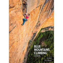
Author(s): Simon Carter
Date: 2019
ISBN: 9780958079082
The latest comprehensive, latest and greatest Blue Mountains Climbing Guide is here and it has more routes than you can poke a clip stick at! 3421 to be exact. You are not going to get bored.
ⓘ
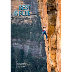
Author(s): Simon Carter
Date: 2019
ISBN: 9780958079075
Simon Carter's "Best of the Blue" is the latest selected climbing guide book for the Blue Mountains and covers 1000 routes and 19 different climbing areas. For all the sport climbers out there, the travellers, or just anyone who doesn't want to lug around the big guide that's more than 3 times the size - cut out the riff-raff and get to the good stuff! This will pretty much cover everything you need!
ⓘ
Accommodations nearby more Hide
Share this
Nearby Icons
| 18 | ★★ The Polar Opposite | ||
| 22 | ★★ Sanction of the Victim | ||
| 24 | ★★★ Sanction of the Victim Extension | ||
| 26 | ★★★ Sarlacc |
Photos Browse all photos

Jason McCarthy on ★★★ Sanctum Emptor (Linkup) 26 - 057c427c40da4f2be2934151769640eb7f64cb44.jpg


Anzhela Malysheva on ★★ The Block 22 - 173A8489.jpg

Jason McCarthy on ★★★ Caveat Emptor Extension 26 - 21765687_10154763954696174_2432294601548753730_o.jpg
Fri 2 Jun
Check out what is happening in Oronga Crags.
Get a detailed insight with a timeline showing
- Ticks by climbers like you
- Discussions of the community
- Updates to the index by our users
- and many more things.
Login to see the timeline!