Seasonality
Summary
Coastal area with a stunning beach, perfect for both climbing and swimming, with the rock providing shade.
Description
The routes are in shade in the afternoon. There is cellphone reception but no amenities or drinking water facilities. Bolting Antalya replaced rusted bolts and anchors and installed new routes.
Approach
Park the car at Büyük Calticak Picnic Area (payed) and go east, then take the path up through the forest navigating via cairns, passing near a cell tower, until reaching up an old asphalt road. Continue up the road for about 100m, then take a left down the scree to reach Akyarlar beach (also marked with cairns) There could be an optional route on sea, via canoe, SUP board, or similar. Trailhead coordinates: (36.7832449N, 30.5733102E)
Tags
Plan your Trip
Did you know?
Did you know that you can create an account to record, track and share your climbing ascents? Thousands of climbers are already doing this.
Selected Guidebooks more Hide
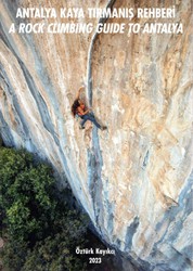
Author(s): Öztürk Kayikci
Date: 2023
ISBN: 9786259930107
A definitive rock climbing guidebook for Antalya describing all the sport climbing to be found at Geyikbayiri, Olympos, Yarasali, Citdibi, Beycik, and Kaputas.
Accommodations nearby more Hide
Share this
Photos Browse all photos

Leanda on ★★ Mister Lova Lova 6c - 65177751_10157461391888057_7070080613818040320_n.jpg
Get a detailed insight with a timeline showing
- Ticks by climbers like you
- Discussions of the community
- Updates to the index by our users
- and many more things.
Login to see the timeline!

