Use this Region Guide to easily find and compare Crags.
Table of contents
- 1.
Nagano / Toyama / 長野・富山
338 in Region
- 1.1. Bokodake Iwa / 坊抱岩 6 routes in Crag
-
1.2.
Ogawayama / 小川山 251 routes in Crag
- 1.2.1. Mawarime Daira Shuhen / 廻り目平周辺 78 routes in Area
- 1.2.2. Kinpō Keikoku / 金峰渓谷 33 routes in Area
- 1.2.3. Hachimansawa Shuuhen / 八幡沢周辺 16 routes in Area
- 1.2.4. Nishimatazawa Taigan / 西股沢対岸 45 routes in Area
- 1.2.5. Karesawa / 涸沢 40 routes in Area
- 1.2.6. Yane Iwa / 屋根岩 39 routes in Area
- 1.3. Yukawa / 湯川 30 routes in Crag
-
1.4.
Yatsugatake / 八ヶ岳 15 routes in Area
- 1.4.1. Amida dake / 阿弥陀岳 2 routes in Area
- 1.4.2. Yatsugatake west faces / 八ヶ岳西面 10 routes in Area
- 1.4.3. Yatsugatake East Faces / 八ヶ岳東面 3 routes in Area
-
1.5.
Hotaka / Yari areas / 穂高岳・槍ヶ岳 2 routes in Area
- 1.5.1. Byoubu-iwa / 屏風岩 0 routes in Crag
- 1.5.2. Karasawa access routes (Hotaka East side) / 涸沢 カールからアクセス (穂高岳東面) 1 routes in Area
- 1.5.3. Myoujin routes / 明神岳ルート 0 routes in Area
- 1.5.4. Hotaka south faces ridges / 穂高岳 南面/尾根 0 routes in Area
- 1.5.5. Hotaka west face and ridges / 穂高岳 西面/尾根 0 routes in Area
- 1.5.6. Yarisawa/ Yokoo-One / 槍沢/ 横尾尾根 1 routes in Area
- 1.6. Shakujou Dake / 錫杖岳 3 routes in Crag
-
1.7.
Tateyama / Tsurugi Areas / 立山・剣岳 3 routes in Area
- 1.7.1. Tsurugi dake / 剣岳 3 routes in Unknown
- 1.8. Todai / 戸台 18 routes in Crag
-
1.9.
Ōyafudō / 大谷不動 8 routes in Crag
- 1.9.1. Left wall Saganpeki area / 左岩壁 3 routes in Area
- 1.9.2. Honryū falls (本流) / 本流 3 routes in Unknown
- 1.10. Arafuneyama 1 routes in Unknown
- 1.11. Shōmyō Falls / 称名滝 0 routes in Crag
-
1.12.
Chuou Alps /中央アルプス 1 routes in Area
- 1.12.1. Mt.Houken /宝剣岳 1 routes in Area
1. Nagano / Toyama
- Summary:
-
Escalada esportiva, Escalada trad e outros estilos
Lat / Long: 36.180334, 137.998017
questões de acesso
Some spots have access issues as many spots near crowded places elsewhere. So please ensure you follow the recommendations of local climbers and behave responsibly.
ética
There`s not a lot of information about climbing in Japan in English. Much of the information is only available in Japanese - or of course here on theCrag!
The Japan Free Climbing Association (http://freeclimb.jp/seibi/seibi.htm) is a good point of contact and there is a set of 5 guidebooks (all in Japanese) and an alpine guide book in English available covering all of Japan and its thousands of sport and trad routes and boulders.
http://www.yamakei.co.jp/products/2811180810.html
https://www.amazon.com/Classic-Alpine-Climbs-Japan-Climb-ebook/dp/B01ARU5KR0
1.1. Bokodake Iwa
- Summary:
-
All Escalada esportiva
Lat / Long: 36.470190, 138.108148
descrição
Located in Kamuriki Mountain. 冠着山の指の様な石のでっぱり
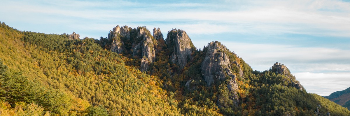
1.2. Ogawayama
- Summary:
-
Escalada esportiva, Escalada trad e Boulder
Lat / Long: 35.904227, 138.632609
sumário
Ogawayama is one of Japan's premier rock climbing areas offering lots of climbing and bouldering in many sectors dispersed in a beautiful valley.
descrição
Ogawayama - granite blocks and mountains dispersed over a wide area in a beautiful setting. It offers mostly granite slab climbing, some cracks, some faces and even some roofs. There is plenty for boulderes and climbers of all abilities. Some of the sectors are not that easy to find and might also require the crossing of small rivers - we at theCrag try to help you with our maps to locate what you want to find. Most climbs are single pitch but there are also some multi-pitch routes. You can find sectors with all orientations, so there is something to climb most of the time. Be aware that the camp is at about 1600m above sea level and that it can get really cold from mid October to May. The best season is definitely from July to mid October.
acesso
You can drive your car up to the camp-site. There is also a parking a little further down that belongs to the village and is free of charge.
onde ficar
There is a large camp ground with good facilities, including laundry. You can also rent simple rooms there and get lunch.
1.2.1. Mawarime Daira Shuhen
- Summary:
-
78 routes in Area
Escalada esportiva, Escalada trad e BoulderLat / Long: 35.909511, 138.638403
1.2.2. Kinpō Keikoku
- Summary:
-
33 routes in Area
Mostly Escalada tradLat / Long: 35.911366, 138.631301
1.2.3. Hachimansawa Shuuhen
- Summary:
-
16 routes in Area
Escalada esportiva, Escalada trad e BoulderLat / Long: 35.905296, 138.634458
1.2.4. Nishimatazawa Taigan
- Summary:
-
45 routes in Area
Mostly Escalada esportivaLat / Long: 35.904364, 138.644021
1.2.5. Karesawa
- Summary:
-
40 routes in Area
Mostly Escalada esportivaLat / Long: 35.901077, 138.627643
1.2.6. Yane Iwa
- Summary:
-
39 routes in Area
Escalada esportiva e Escalada tradLat / Long: 35.915514, 138.637189
1.3. Yukawa
- Summary:
-
Escalada trad, Escalada em top rope e Escalada esportiva
Lat / Long: 36.016240, 138.445724
sumário
More famous for some nice CRACK!
acesso
From Highway 141 take the small road west near Umijiri Station 海尻駅. There are a few small parking areas on the sides of the road. 4x4 vehilces will be able to get closer than reglar cars.
Either way the approach is 5-15min
1.4. Yatsugatake
- Summary:
-
Escalada alpina e Escalada em gelo
Lat / Long: 35.981104, 138.363486
descrição
Yatsugatake is one of Japans prime ice climbing areas due to its cold weather and convenient access from Tokyo.
It receives snow (as expected) but not as much as other areas closer to the Japan Sea. The mid winter temperatures can get down to -30C and the wind on the main ridge line (2500-3000m) often is 25m/s or above. The valleys and ice routes usually stay a lot more protected… generally.
From November until May there is a large range of routes from snow shoeing, to alpine/mixed climbing, to steep waterfall ice, to climbing the artificial ice wall “Ice Candy” at Akadake Kosen.
During summer time people generally (not always, there are some summer routes or canyoning/sawanobori) stick to regular hiking as the rock (being volcanic) is a bit loose and chossy. Many of the loose dirt/ vegetated/loose routes are covered in snow or ice in winter so climbing becomes possible and more enjoyable.
questões de acesso
There`s not a lot of information about in English on climbing in Japan. Much of the information is kept in personal blogs or is accessed through joining a climbing organization.
There are many many ice and apline routes in this area, many are docmented in guide books and well recognised, there are aslo many other routes not docmented well.
It would be best to speak to a local about other routes.
acesso
Most areas are accessed from Minotoguchi美濃戸口. There is car parking and a mountain hut at the trail head. A 3 hour walk brings you to Gyosha Koya行者小屋 in the south branch or Akadake kosen 赤岳鉱泉 in the north branch.
there are mountain huts and or camping at both places.
onde ficar
Minotoguchi美濃戸口 Gyosha Koya行者小屋 (camp OK) Akadake kosen 赤岳鉱泉 (camp OK)
The summit huts are open in summer and sometimes in winter. It`s best to inquire directly to the hut.
1.4.1. Amida dake
- Summary:
-
2 routes in Area
All Escalada alpinaLat / Long: 35.969316, 138.352015
descrição
Mostly winter alpine. Rock can be loose and not idea for summer.
1.4.2. Yatsugatake west faces
- Summary:
-
10 routes in Area
Escalada alpina e Escalada em geloLat / Long: 35.985063, 138.367681
1.4.3. Yatsugatake East Faces
- Summary:
-
3 routes in Area
Escalada alpina e Escalada em geloLat / Long: 35.953425, 138.378729
1.5. Hotaka / Yari areas
- Summary:
-
All Escalada alpina
Lat / Long: 36.315705, 137.637943
1.5.1. Byoubu-iwa
descrição
The equivalent of Yosemite in Japan......Some say.
1.5.2. Karasawa access routes (Hotaka East side)
- Summary:
-
1 route in Area
Lat / Long: 36.300657, 137.660835
acesso
6 hours hike from Kamikochi (上高地) Bus Terminal to Karasawa Curl (涸沢カール)
onde ficar
Karasawa (涸沢) camping or huts
1.5.3. Myoujin routes
1.5.4. Hotaka south faces ridges
1.5.5. Hotaka west face and ridges
1.5.6. Yarisawa/ Yokoo-One
- Summary:
-
1 route in Area
Lat / Long: 36.340862, 137.668392
1.6. Shakujou Dake
- Summary:
-
Escalada alpina e Escalada trad
Lat / Long: 36.281314, 137.550466
sumário
Alpine Multi Pitch
1.7. Tateyama / Tsurugi Areas
- Summary:
-
All Escalada alpina
Lat / Long: 36.612082, 137.631146
acesso
Private vehicles are prohibited, so public transport access to Murodo (室堂) will be required. Depending on the exact climb, from Murodo (室堂) a 2 - 8 hour approach is required.
Some of the few perminant snow fields in Japan are in this area. In summer some approaches may still reqiure crampons and ice axe.
onde ficar
Camp / Monutain huts
1.7.1. Tsurugi dake
- Summary:
-
3 routes in Unknown
Lat / Long: 36.623299, 137.618565
1.8. Todai
- Summary:
-
18 routes in Crag
Mostly Escalada em rochaLat / Long: 35.780061, 138.159148
1.9. Ōyafudō
- Summary:
-
All Escalada em gelo
Lat / Long: 36.562984, 138.374444
sumário
Ōyafudō (大谷不動) is without doubt one of the most spectacular areas for steep ice-climbing Located Ōyafudō (大谷不動) valley near the Sugadaira ski resort (菅平のスキー場) in the Nagano (長野) prefecture
questões de acesso
Due to problems with landowners this area is closed at the moment.
onde ficar
walk into the Oyafudo via the approach and camp in tent near the unmanned hut
ética
Be polite and do not leave litter.
1.9.1. Left wall Saganpeki area
- Summary:
-
3 routes in Area
Lat / Long: 36.564843, 138.375020
descrição
Left wall Saganpeki area (左岩壁)
1.9.2. Honryū falls (本流)
- Summary:
-
3 routes in Unknown
Lat / Long: 36.564048, 138.377547
descrição
Honryū falls (本流)
1.10. Arafuneyama
- Summary:
-
All Escalada em gelo
Lat / Long: 36.205240, 138.623677
descrição
荒船山_カブコロン
1.11. Shōmyō Falls
1.12. Chuou Alps /中央アルプス
- Summary:
-
All Escalada alpina
Lat / Long: 35.741006, 137.819402
1.12.1. Mt.Houken /宝剣岳
- Summary:
-
1 route in Area
Lat / Long: 35.780340, 137.808901