Use this Region Guide to easily find and compare Crags.
Table of contents
- 1.
Ardèche
2448 in Region
- 1.1. Saint Sauveur de Cruzières / Champer 17 in Crag
-
1.2.
Gorges du Chassezac / Berrias et Casteljau 672 in Area
- 1.2.1. Endieu 0 in Crag
- 1.2.2. Le Jardin d'Endieu 31 in Crag
- 1.2.3. Mazet 181 in Crag
- 1.2.4. Casteljau 166 in Crag
- 1.2.5. Les Actinidias 59 in Crag
- 1.2.6. Chaulet 188 in Crag
- 1.2.7. Baume Escure 47 in Area
-
1.3.
Gorges de l'Ardèche 168 in Area
- 1.3.1. Vallon-Pont-d'Arc 11 in Crag
- 1.3.2. Ebbou / Pas du Mousse 15 in Cliff
- 1.3.3. Le Grand Charmasson 89 in Crag
- 1.3.4. Autridge 7 in Cliff
- 1.3.5. La Rouvière 12 in Cliff
- 1.3.6. Saint Marcel 11 in Cliff
- 1.3.7. Cayrebelou 5 in Crag
- 1.3.8. Templiers 6 in Crag
- 1.3.9. Ranc pointu 7 in Crag
- 1.3.10. Les Abeillères 1 in Crag
- 1.3.11. Richemale 4 in Crag
-
1.4.
Saint Montan - La Sainte Beaume 52 in Crag
- 1.4.1. Le Jardin 6 in Sector
- 1.4.2. Grande Dalle Centrale 19 in Sector
- 1.4.3. Grand Pilier 7 in Sector
- 1.4.4. Grande Dalle de Gauche 10 in Sector
- 1.4.5. Petite Dalle de Gauche 10 in Sector
- 1.5. Cirque de Chauzon / Cirque des Gens 315 in Crag
-
1.6.
Balazuc 130 in Crag
- 1.6.1. Le Viel Audon 59 in Crag
- 1.6.2. Les Barasses 71 in Crag
- 1.7. Lanas / Chamtaduc 1 in Crag
- 1.8. Vogüé 30 in Crag
-
1.9.
Chabanne / Lussas 153 in Crag
- 1.9.1. Primaire 15 in Sector
- 1.9.2. Les travées 28 in Sector
- 1.9.3. La conque 13 in Sector
- 1.9.4. Que Dalle 19 in Sector
- 1.9.5. Dalle Décollée 19 in Sector
- 1.9.6. Dalle couchée 18 in Sector
- 1.9.7. Le bouc 29 in Sector
- 1.9.8. Horizon nouveau 12 in Sector
-
1.10.
Courpatas / Saint Laurent / Louyre 63 in Crag
- 1.10.1. Donjon 19 in Sector
- 1.10.2. Le Long 10 in Sector
- 1.10.3. La proue 7 in Sector
- 1.10.4. L'arbre mort 6 in Sector
- 1.10.5. Le gourou 6 in Area
- 1.10.6. Corridor sud 9 in Sector
- 1.10.7. Lierre 6 in Sector
- 1.11. Saint Michel de Boulogne 42 in Crag
-
1.12.
Chomerac / La Vialatte 76 in Crag
- 1.12.1. La Vialatte 0 in Sector
- 1.12.2. Les Carrieres 63 in Sector
-
1.13.
La Payre 99 in Crag
- 1.13.1. L'exil 7 in Sector
- 1.13.2. Demi siècle 15 in Sector
- 1.13.3. Kiné 11 in Sector
- 1.13.4. Le Zoo 8 in Sector
- 1.13.5. Le perchoir 0 in Sector
- 1.13.6. Les trappeurs 11 in Sector
- 1.13.7. Le jardin d'Eden 47 in Sector
-
1.14.
Rompon / Le Chat Gourmand 162 in Crag
- 1.14.1. L'ours 30 in Sector
- 1.14.2. La Grotte 36 in Sector
- 1.14.3. La Chambre 30 in Sector
- 1.14.4. Le Chat 19 in Sector
- 1.14.5. Face Ouest 35 in Sector
- 1.14.6. Face Sud 10 in Sector
- 1.14.7. Monolithe 2 in Sector
- 1.15. Top Secret 29 in Crag
- 1.16. La Goule / Cornas / Châteaubourg 26 in Crag
- 1.17. La Dame du Lac / Lac d'Issarlès 28 in Crag
- 1.18. Les Combes / Le Cros de Géorand 15 in Crag
-
1.19.
Suc des Coux / Sagnes-et-Goudoulet 24 in Crag
- 1.19.1. Le paradis 9 in Sector
- 1.19.2. Les grêlons 15 in Sector
- 1.20. Les Chambons / Borne 14 in Crag
-
1.21.
Chamiers / Montselgues / Rocher de Conchette 5 in Crag
- 1.21.1. Le noyer 0 in Sector
- 1.21.2. L'éboulis 0 in Sector
- 1.21.3. Le châtaignier 3 in Sector
- 1.21.4. Les chèvres à Raoul 0 in Sector
- 1.21.5. La dalle inclinée 0 in Sector
- 1.21.6. Le nez 0 in Sector
- 1.22. Mas de l'Ayre 21 in Crag
- 1.23. Tras les baumes / Jaujac 22 in Crag
-
1.24.
Signal de Coucoulude / Valgorge 29 in Crag
- 1.24.1. Secteur Nord-ouest 9 in Sector
- 1.24.2. Secteur Est 10 in Sector
- 1.24.3. Secteur Sud 10 in Sector
-
1.25.
Salavas 158 in Area
- 1.25.1. Font Garnide 106 in Crag
- 1.25.2. Jeau 1 in Crag
- 1.25.3. Les Branches 51 in Crag
- 1.26. L'horloge / Burzet 10 in Area
-
1.27.
Vallée de l'Eyrieux 87 in Crag
- 1.27.1. Dunière-sur-Eyrieux / La Tour 6 in Crag
- 1.27.2. Les Cabannes / Saint Maurice en Chalencon 49 in Crag
- 1.27.3. Beauvène / Le Tournay 1 in Crag
- 1.27.4. Mariac / Le pont de Fromentière 31 in Crag
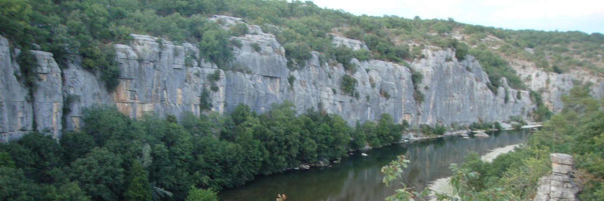
1. Ardèche 2,448 routes in Region
- Summary:
-
Sport climbing, Rock climbing and other styles
Lat / Long: 44.649095, 4.413819
access issues
Some privately owned climbing areas may have restricted access. Check with https://www.ffme.fr/
ethic
Park where indicated, take care of the environment, buy the local guidebook when possible (this is one of the ways you can help local route setters), clean up your shoes before climbing, don't spray beta, be polite.
1.1. Saint Sauveur de Cruzières 17 routes in Crag
- Summary:
-
All Sport climbing
Lat / Long: 44.299514, 4.248807
description
Equipement sur broches bis 2 (déclarées non conformes selon tests ENSA en 2001 car résistance à l’arrachement indéterminé).
approach
Parking devant l’accès au camping de la Claysse. Longer le camping et la rive de la Claysse sur 300 mètres jusqu’à un pont enjambant le ruisseau et une route permettant d’accéder à sa rive opposée au niveau du camping. Atteindre la falaise par une sente ascendante à gauche dans la garrigue. 10 minutes du parking.
where to stay
Camping à 3 minutes de marche de la falaise.
1.2. Gorges du Chassezac 672 routes in Area
- Summary:
-
Sport climbing, Bouldering and Aid climbing
Lat / Long: 44.401756, 4.207233
- Plan Escalade Chassezac Overview
- Plan Escalade Chassezac Details
- For recent informations and updates visit https://www.ct07ffme.fr
- Respect the closing times
- Do not leave rubbish lying around
- Take excrement with you
- Be quiet
- Take care of animals and plants
- Use your own material to lower off
access issues
The Chassezac Gorges have a sensitive ecosystem that is protected. In order to protect flora and fauna, there are sectors where climbing is not allowed at certain times. Each climber is responsible for ensuring that climbing on the rocks of the gorges remains permitted. Please respect these closing times without exception.
ethic
1.2.1. Endieu 0 routes in Crag
1.2.2. Le Jardin d'Endieu 31 routes in Crag
- Summary:
-
All Sport climbing
Lat / Long: 44.402113, 4.193162
access issues
Climbing allowed from 30 April to 1 November.
1.2.3. Mazet 181 routes in Crag
- Summary:
-
Sport climbing and Bouldering
Lat / Long: 44.399318, 4.196266
 With kids: very suitable for crag-kids!
description
Mazet features Ardèche climbing at its finest: sunny limestone of excellent quality, short access, a river nearby and a great selection of beautiful and well-bolted routes. It is a very popular spot and due to the two campsites nearby there are always people on the rock. Unluckily, this has left a fair amount of polish on some of the, mostly easier, routes. Having this in mind, Mazet is still an excellent place to climb, very family friendly and well worth a visit.
approach
From the Mazet's bridge, just walk down to the beach and follow the wall. Secor Jardin d'Endieu can also be accessed by descending from the holiday village on the plateau.
where to stay
The campsites Mazet Plage and Actinidas are just around the corner and in walking distance.
1.2.4. Casteljau 166 routes in Crag
- Summary:
-
All Bouldering
Lat / Long: 44.403666, 4.196704
description
Various nice boulder parcours can be found on the forested plateau over the Chassezac. The numbers of the problems are painted on the blocs (often faded), partly together with boundarys for allowed gripping. However, orientation and even just finding the parcours can be a challenge on its own.
A detailed topo can be found here: http://castelbloc.blogspot.com/p/topo.html
1.2.5. Les Actinidias 59 routes in Crag
- Summary:
-
All Sport climbing
Lat / Long: 44.402824, 4.199201
- With kids: if you are staying at the campground Les Actinidias you can get to this crag in just a few minutes by foot. The base is flat with lots of sand. There is shade in the afternoon and thanks to the near-by river you can comfortably climb there even if it‘s a very hot day. Because of the water very close to the climbs you have to be careful when coming here with smaller kids. It is a perfect place to combine swimming with climbing.
description
approach
Parking at the campground Les Actinidias, in front of the reception, or at the parkingground where the crag Mazet is signed out. Go through the camping ground Les Actinidias and follow the river to the crag.
where to stay
The campground Les Actinidias is near to the crag. There is also the campground Mazet nearby.
1.2.6. Chaulet 188 routes in Crag
- Summary:
-
Mostly Sport climbing
Lat / Long: 44.407538, 4.210686
- With kids: You climb very close to the water which the kids like a lot but you have to be careful, especially with smaller children (risk of drowning).
description
approach
Du parking, 20m après le virage à angle droit faisant face au Chassezac, descendre un sentier peu marqué vers la rivière et la longer rive gauche.
1.2.7. Baume Escure 47 routes in Area
- Summary:
-
All Sport climbing
Lat / Long: 44.406770, 4.208406
description
A small crag followed by two caves.
approach
5 to 15 minutes walk, relatively flat, on a forest path, not far away from the river bank.
1.3. Gorges de l'Ardèche 168 routes in Area
- Summary:
-
Mostly Sport climbing
Lat / Long: 44.352024, 4.482349
1.3.1. Vallon-Pont-d'Arc 11 routes in Crag
- Summary:
-
All Deep water soloing
Lat / Long: 44.381827, 4.416102
summary
Deep Water Soloing spot in the Ardeche, famous for the line "The King" liberated by Chris Sharma.
description
Topos and route descriptions provided by Antoine Aubert.
1.3.2. Ebbou 15 routes in Cliff
- Summary:
-
All Sport climbing
Lat / Long: 44.373403, 4.421477
1.3.3. Le Grand Charmasson 89 routes in Crag
- Summary:
-
All Sport climbing
Lat / Long: 44.382072, 4.446160
1.3.4. Autridge 7 routes in Cliff
- Summary:
-
Mostly Sport climbing
Lat / Long: 44.362487, 4.466620
1.3.5. La Rouvière 12 routes in Cliff
- Summary:
-
All Sport climbing
Lat / Long: 44.332677, 4.513985
1.3.6. Saint Marcel 11 routes in Cliff
- Summary:
-
Mostly Sport climbing
Lat / Long: 44.325456, 4.543132
1.3.7. Cayrebelou 5 routes in Crag
- Summary:
-
All Trad climbing
Lat / Long: 44.335218, 4.482515
1.3.8. Templiers 6 routes in Crag
- Summary:
-
All Sport climbing
Lat / Long: 44.342304, 4.509013
1.3.9. Ranc pointu 7 routes in Crag
- Summary:
-
All Aid climbing
Lat / Long: 44.322360, 4.548037
1.3.10. Les Abeillères 1 route in Crag
- Summary:
-
All Trad climbing
Lat / Long: 44.352196, 4.457199
1.3.11. Richemale 4 routes in Crag
- Summary:
-
Sport climbing and Trad climbing
Lat / Long: 44.339383, 4.479016
1.4. Saint Montan - La Sainte Beaume 52 routes in Crag
- Summary:
-
All Sport climbing
Lat / Long: 44.442825, 4.620423
summary
Nice rock with good routes (mostly for beginners). Style is foremost slab climbing, but with some very sculptured, sometimes vertical, passages in between.
description
Routes from 15 to 25 meters. Even the easy routes are nice. The crag is mostly used for beginners, sometimes also used as a training spot for caving. Very close protection with new pitons and chains.
approach
Use the designated parking place at the eastern end of the small village. Walk back down to the village center, cross the small river and follow the street to the western end of the village. Right behind l'Église San Samonta, turn to the right following signs to la Grotte de l'ermite. After some steep 30 meters the crag is to the right side (10-15 minutes from the parking).
ethic
As always, don't be to noisy, don't leave no trash at the rock.
1.4.1. Le Jardin 6 routes in Sector
- Summary:
-
1.4.2. Grande Dalle Centrale 19 routes in Sector
- Summary:
-
1.4.3. Grand Pilier 7 routes in Sector
- Summary:
-
1.4.4. Grande Dalle de Gauche 10 routes in Sector
- Summary:
-
1.4.5. Petite Dalle de Gauche 10 routes in Sector
- Summary:
-
1.5. Cirque de Chauzon 315 routes in Crag
- Summary:
-
Rock climbing, Sport climbing and Bouldering
Lat / Long: 44.478307, 4.342457
1.5.1. Left 100 routes in Sector
- Summary:
-
Mostly Rock climbing
1.5.2. Middle 125 routes in Sector
- Summary:
-
All Rock climbing
1.5.3. Right 90 routes in Sector
- Summary:
-
Mostly Sport climbing
description
There is a great need in this area for rebolting now as the old steel rings are pretty much not worth trusting. Some routes have been rebolted with stainless steel U bolts. Recommendation** Buy the guide book and read the information in it. It could save your butt.
approach
Walk up the track from the car park until you reach the stairs on the left descending into the gorge. About half way day the trail forks. Take the right and head up to the first sector.
1.6. Balazuc 130 routes in Crag
- Summary:
-
Sport climbing, Rock climbing and Trad climbing
Lat / Long: 44.507983, 4.371684
1.6.1. Le Viel Audon 59 routes in Crag
- Summary:
-
Rock climbing and Sport climbing
Lat / Long: 44.507382, 4.363244
description
While there are new routes being put up and rebolting is in progress beware of the 1970's steel bolts, they are not safe and you should avoid them at all times. Buy the guide book and read it. Its in French but google translate will help you understand why you shouldn't climb on these bolts. While none have failed, don't become the first to find out about them not being good.
The site of the Viel Audon (and not Vieil Audon), pockets the hamlet farm being restored and is shaded in the afternoon from about 1:30pm. Parking is available in the parking lot below the village of Balazuc where you can access the crag within ten minutes by foot.
approach
Park below the village of Balazuc and walk down left and across the bridge spanning the Ardeche river. Turn left and continue to veer left onto the well trodden trail. The crag is above the village of Viel Audon. Note** Please be respectful of local residents and move discreetly through.
1.6.2. Les Barasses 71 routes in Crag
- Summary:
-
Mostly Sport climbing
Lat / Long: 44.512112, 4.368371
approach
From Balazuc bottom car park (located about 80 metres from the bridge crossing the Ardeche river) walk across the bridge and turn left heading towards the ancient tower on the buttress above you. Keeping right up the road. About 140 metres up the road there is a trail on the right that heads up to the main wall.
1.7. Lanas 1 route in Crag
- Summary:
-
All Sport climbing
Lat / Long: 44.523059, 4.391467
1.8. Vogüé 30 routes in Crag
- Summary:
-
All Sport climbing
Lat / Long: 44.549851, 4.409160
description
Short bouldery sports climbing on good rock (not great). Check anchors as they are a little old. Climbing is good and there are some nice fun routes to try.
approach
Driving from Aubenas....as you approach the outskirts of the village there is a small car park on th right hand side of the road. You can see the cliff line on your right. Park here and walk up and to the left trail. It takes you up to the old railway tunnel in the distance. There is a trail to the right about 250 metres along the main trail. Follow this up to the crag. First routes are on a small bulging buttress.
where to stay
Vogüé is 15 minutes from the village of Uzer and 20 minutes from Aubenas. There is plenty of accom in the area and the distances to the crags are short (Drive time maximum of 40 minutes)
1.8.1. La Roche 20 routes in Sector
- Summary:
-
description
small limestone sector with moderates that a well bolted and a little polished. Its more a locals crag. It has a nice vista over the village of Vogüé.
1.8.2. Le Tunnel 10 routes in Sector
- Summary:
-
Lat / Long: 44.549861, 4.409952
description
This secondary sector is located just around the corner from La Roche. It contains 10 routes ranging from 3b to 5c. Well bolted and fun for kids. No names are available as from what I understand none were given. Enjoyable for family days.
1.9. Chabanne 153 routes in Crag
- Summary:
-
All Sport climbing
Lat / Long: 44.625524, 4.460280
summary
Site d'escalade formateur, idéalement praticable les après-midi au printemps/automne/hiver et le matin en été
approach
Depuis le parking prendre la piste qui descend légèrement, au bout de 50m dans le virage prendre le petit chemin qui nous amène au pied des voies
ethic
Pas de nom de voie mais des numéros
1.9.1. Primaire 15 routes in Sector
- Summary:
-
1.9.2. Les travées 28 routes in Sector
- Summary:
-
1.9.3. La conque 13 routes in Sector
- Summary:
-
1.9.4. Que Dalle 19 routes in Sector
- Summary:
-
1.9.5. Dalle Décollée 19 routes in Sector
- Summary:
-
1.9.6. Dalle couchée 18 routes in Sector
- Summary:
-
1.9.7. Le bouc 29 routes in Sector
- Summary:
-
1.9.8. Horizon nouveau 12 routes in Sector
- Summary:
-
1.10. Courpatas 63 routes in Crag
- Summary:
-
All Sport climbing
Lat / Long: 44.675268, 4.477659
1.10.1. Donjon 19 routes in Sector
- Summary:
-
1.10.2. Le Long 10 routes in Sector
- Summary:
-
1.10.3. La proue 7 routes in Sector
- Summary:
-
1.10.4. L'arbre mort 6 routes in Sector
- Summary:
-
1.10.5. Le gourou 6 routes in Area
- Summary:
-
1.10.6. Corridor sud 9 routes in Sector
- Summary:
-
1.10.7. Lierre 6 routes in Sector
- Summary:
-
1.11. Saint Michel de Boulogne 42 routes in Crag
- Summary:
-
All Sport climbing
Lat / Long: 44.688329, 4.439663
1.12. Chomerac 76 routes in Crag
- Summary:
-
All Sport climbing
Lat / Long: 44.709982, 4.655291
1.12.1. La Vialatte 0 routes in Sector
1.12.2. Les Carrieres 63 routes in Sector
- Summary:
-
1.13. La Payre 99 routes in Crag
- Summary:
-
Mostly Sport climbing
Lat / Long: 44.731616, 4.735836
description
1.13.1. L'exil 7 routes in Sector
- Summary:
-
Mostly Sport climbing
1.13.2. Demi siècle 15 routes in Sector
- Summary:
-
All Sport climbing
1.13.3. Kiné 11 routes in Sector
- Summary:
-
All Sport climbing
1.13.4. Le Zoo 8 routes in Sector
- Summary:
-
All Sport climbing
1.13.5. Le perchoir 0 routes in Sector
1.13.6. Les trappeurs 11 routes in Sector
- Summary:
-
All Sport climbing
1.13.7. Le jardin d'Eden 47 routes in Sector
- Summary:
-
All Sport climbing
1.14. Rompon 162 routes in Crag
- Summary:
-
Mostly Sport climbing
Lat / Long: 44.763491, 4.736496
1.14.1. L'ours 30 routes in Sector
- Summary:
-
All Sport climbing
Lat / Long: 44.765505, 4.729707
description
First sector when you come from the parking
approach
You'd need about 20 minutes walk (relatively steep at some point) to reach this first sector
1.14.2. La Grotte 36 routes in Sector
- Summary:
-
All Sport climbing
Lat / Long: 44.765398, 4.730227
1.14.3. La Chambre 30 routes in Sector
- Summary:
-
All Sport climbing
Lat / Long: 44.765354, 4.730866
1.14.4. Le Chat 19 routes in Sector
- Summary:
-
All Sport climbing
Lat / Long: 44.765299, 4.731597
1.14.5. Face Ouest 35 routes in Sector
- Summary:
-
All Sport climbing
Lat / Long: 44.763484, 4.735897
1.14.6. Face Sud 10 routes in Sector
- Summary:
-
All Sport climbing
1.14.7. Monolithe 2 routes in Sector
- Summary:
-
Trad climbing and Sport climbing
Lat / Long: 44.762246, 4.741847
1.15. Top Secret 29 routes in Crag
- Summary:
-
All Sport climbing
Lat / Long: 44.935808, 4.848430
1.16. La Goule 26 routes in Crag
- Summary:
-
Mostly Sport climbing
Lat / Long: 44.982074, 4.842162
1.17. La Dame du Lac 28 routes in Crag
- Summary:
-
All Sport climbing
Lat / Long: 44.818823, 4.077256
1.18. Les Combes 15 routes in Crag
- Summary:
-
All Sport climbing
Lat / Long: 44.791119, 4.087769
1.19. Suc des Coux 24 routes in Crag
- Summary:
-
Mostly Sport climbing
Lat / Long: 44.816946, 4.217657
summary
Site se trouvant à 1300m d'altitude, très agréable en été
1.19.1. Le paradis 9 routes in Sector
- Summary:
-
Mostly Sport climbing
1.19.2. Les grêlons 15 routes in Sector
- Summary:
-
All Sport climbing
1.20. Les Chambons 14 routes in Crag
- Summary:
-
All Sport climbing
Lat / Long: 44.623103, 4.048263
summary
Beautiful granite. Multipitch. Abseil access or walk.
description
Petite falaise surplombant le Canyon de la Borne. Bon secteur d'initiation pour les voies en plusieurs longueurs.
Little cliff above Canyon de la Borne. Ideal for beginning multipitch climb.
access issues
Accès en rappel or par sentier forestier.
Abseil access or walk.
approach
D19 de la Croix de Bauzon. D24 few kms after the col. Route de Chazalette (GR72) 1km Park on the obvious spot in the turn. Walk to the crag.
1.21. Chamiers 5 routes in Crag
- Summary:
-
Sport climbing and Trad climbing
Lat / Long: 44.525392, 3.981085
1.21.1. Le noyer 0 routes in Sector
1.21.2. L'éboulis 0 routes in Sector
1.21.3. Le châtaignier 3 routes in Sector
- Summary:
-
All Sport climbing
1.21.4. Les chèvres à Raoul 0 routes in Sector
1.21.5. La dalle inclinée 0 routes in Sector
1.21.6. Le nez 0 routes in Sector
1.22. Mas de l'Ayre 21 routes in Crag
- Summary:
-
All Bouldering
Lat / Long: 44.436860, 3.996455
1.22.1. Nectar de grès 0 routes in Sector
1.22.2. Ruisseau 0 routes in Sector
1.22.3. Père Noël 21 routes in Sector
- Summary:
-
Lat / Long: 44.436714, 3.995995
1.22.4. Snow park 0 routes in Sector
1.22.5. Robinson 0 routes in Sector
1.22.6. Bambou 0 routes in Sector
1.23. Tras les baumes 22 routes in Crag
- Summary:
-
All Sport climbing
Lat / Long: 44.620696, 4.224635
summary
Very good crag with a good beginner sector, extremely well bolted. The beginner area is ideal for learning multipitching.
The cave area has some gem climbs between 6c+ and 7c.
1.23.1. Dalles 13 routes in Sector
- Summary:
-
Lat / Long: 44.620923, 4.224281
description
Beginner area with multipitch climbs. 50-60m tall from 3c to 5c. Excellent bolting.
descent notes
Lower off.
1.23.2. La Grotte 9 routes in Sector
- Summary:
-
Lat / Long: 44.620655, 4.224575
description
Beautiful sector. Nice 6c+ and 7th grade climbs. Edges, sloppers and crimps. 20m climbs
descent notes
Lower off.
1.24. Signal de Coucoulude 29 routes in Crag
- Summary:
-
All Sport climbing
Lat / Long: 44.609072, 4.097726
summary
Nice place to climb. Amazing view. Can be chilly (1370m).
description
The granite is quite rounded, full of lychen but still very good to climb. Balancy moves, lots of sloppers or tiny crimps.
Lots of climb could be trad climbed instead of using the bolts.
approach
Park at Col de Meyrand and walk to the ONF gate via the gravel road going NE from the carpark.
1.24.1. Secteur Nord-ouest 9 routes in Sector
- Summary:
-
1.24.2. Secteur Est 10 routes in Sector
- Summary:
-
description
8 routes between 3a and 5a
1.24.3. Secteur Sud 10 routes in Sector
- Summary:
-
1.25. Salavas 158 routes in Area
- Summary:
-
Mostly Sport climbing
Lat / Long: 44.394520, 4.374400
1.25.1. Font Garnide 106 routes in Crag
- Summary:
-
Mostly Sport climbing
Lat / Long: 44.394415, 4.366834
summary
De Vallon-Pont-d’Arc, prendre la D579 vers Salavas et la quitter 500m après le pont sur l’Ardèche (suivre Font Garnide à droite). Parking de 50 places après 1,5 km.
description
Très intéressante falaise de calcaire, en particulier en été (à l’ombre jusqu’à 15 heures), avec une centaine de voies de 20 à 40 mètres en 1 ou 2 longueurs avec rééquipement récent. Peu de longueurs inférieures au 5ème degré.
access issues
Un arrêté municipal interdit la circulation motorisée sur le chemin forestier en contrebas de la falaise en période sèche (danger d’incendie - situation août 2022).
approach
Prendre le large chemin forestier qui surplombe le parking et le quitter après 500m par un bon sentier en ascendance sur la gauche. Quitter ce sentier après 250m par une raide sente secondaire à gauche montant droit dans la pente pour le secteur 2 (face à Imagine action) ou poursuivre et déboucher sur une barre déversante pour le secteur 4, à une dizaine de mètres à droite de Miam Miam Zoulou. 15 minutes du parking.
1.25.2. Jeau 1 route in Crag
- Summary:
-
All Sport climbing
Lat / Long: 44.392663, 4.386406
1.25.3. Les Branches 51 routes in Crag
- Summary:
-
All Sport climbing
Lat / Long: 44.383376, 4.407996
1.26. L'horloge 10 routes in Area
- Summary:
-
All Sport climbing
Lat / Long: 44.740640, 4.244932
summary
Site d'escalade au cœur du village de Burzet,idéal pour débuter. Possibilité de grimper en nocturne.
description
Prévoir 50m de corde
approach
Parking sur la "Place du Temple",puis prendre la rue (à gauche de la place)qui monte en direction de l'horloge
1.27. Vallée de l'Eyrieux 87 routes in Crag
- Summary:
-
All Sport climbing
Lat / Long: 44.874381, 4.537180
1.27.1. Dunière-sur-Eyrieux 6 routes in Crag
- Summary:
-
Lat / Long: 44.829936, 4.652321
1.27.2. Les Cabannes 49 routes in Crag
- Summary:
-
Lat / Long: 44.839159, 4.579427
1.27.3. Beauvène 1 route in Crag
- Summary:
-
Lat / Long: 44.878060, 4.529413
1.27.4. Mariac 31 routes in Crag
- Summary:
-
Lat / Long: 44.877105, 4.368722