
Estacionalidad
Descripción
South of the Border starts just to the right of the 'T & L' Area
Restricciones heredado de Massacre Rocks State Park
Massacre Rocks is part of the much larger “American Falls Archaeological District” (AFAD). There are multiple land jurisdictions in both the AFAD and where climbing takes place (see BLM Map). Extensive and well documented studies of the AFAD near and around the Snake River show many cultural resources and evidence of human habitation for at least the last 13,000 years. This area is considered sacred to the local Shoshone- Bannock tribes. Be respectful and minimize your footprint and impact in the area. Keep your staging area small and contained. Pick up and pack out your trash including tape, orange or banana peels, cigarette butts, etc. Prevent your dog from digging. Don’t start or make any fires, especially near the base of cliffs.
Also, please, only park in one of the designated parking areas and respect all road closures. Sandy soils in the AFAD are prone to wind erosion. Motorized vehicles and even foot traffic can damage the fragile ecology and could destroy rare, irreplaceable evidence of 13,000 years of human habitation. When hiking to the crags use established trails and don’t short cut or braid existing trails. Use the following graphic from the BLM to understand which areas are closed to motorized travel.
Ética heredado de Massacre Rocks State Park
The absic infor provided here is from Massacre Rocks Climbing Guide, Updated By: © 2016 Mike Engle, Engle Portal Productions
Updates available at http://www.seiclimbing.com New Route Info: contact Mike Engle @ mike.w.engle@gmail.com
Etiquetas
Planifica tu viaje
¡Hola!
¿Es tu primera visita al sitio?
theCrag.com es una guía gratis de zonas de escalada de todo el mundo, editada de manera colaborativa por escaladores, bloqueros y otros amables entusiastas.Puedes registrar todas tus vías, ponerte en contacto y charlar con otros escaladores y mucho más...» descubre más, » más información or » haz una pregunta


Selected Guidebooks more Ocultar
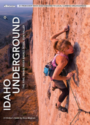
Autor(es): Dave Bingham
Fecha: 2019
número ISBN: 9781938393358
- Wolverine Publishing:
- Whatever style of climbing you prefer, Idaho Underground highlights over 1,500 well-known and lesser-know routes, from the spectacular limestone walls of the Fins to truly underground lava tubes.
- Full-color 2nd edition includes over 1,500 routes and problems for sport climbing, trad climbing and bouldering at the Fins, Snake River Basalt, Boise and Sun Valley
- Author Dave Bingham, an Idaho climbing legend, also spotlights lesser known areas, including the Black Cliffs, Teddy Bear Cove, Dierkes Lake, Leslie Gulch and more
- Wolverine Publishing will donate $1 from every book sold to local climbing organizations
ⓘ
Alojamientos cercanos more Ocultar
Compartir contenido
Sáb 1 Jul
Echa un vistazo a lo que está ocurriendo en South.
Get a detailed insight with a timeline showing
- Ticks by climbers like you
- Discussions of the community
- Updates to the index by our users
- and many more things.
Login to see the timeline!